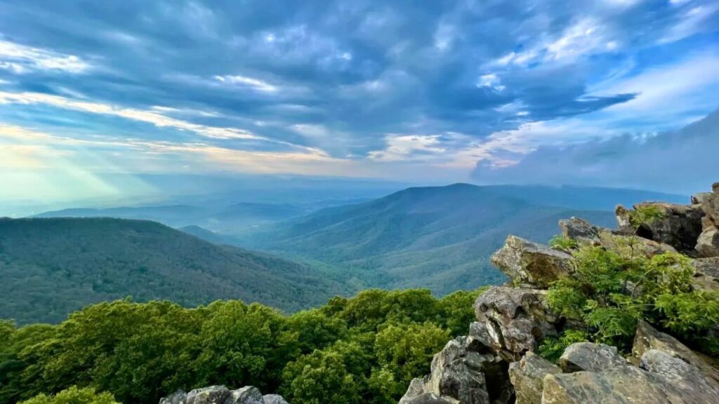
Welcome, fellow wanderers, to the majestic beauty of Shenandoah National Park! Nestled in the Blue Ridge Mountains of Virginia, this park is a haven for nature lovers, offering breathtaking vistas, cascading waterfalls, and miles upon miles of incredible hiking trails. Whether you’re a seasoned trekker looking for a challenge or a family seeking a gentle stroll through the woods, Shenandoah has a path waiting for you.
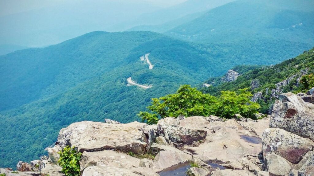
I remember my first time driving Skyline Drive, the park’s iconic scenic byway. The anticipation built with every curve, revealing yet another stunning overlook. But the true magic of Shenandoah? It unfolds when you leave the car behind and step onto the trails. Putting boots to dirt here connects you to something ancient and wild. Over several visits, I’ve explored numerous trails, from easy leg-stretchers to heart-pumping climbs, and I’m thrilled to share some absolute favorites – the hikes that linger in your memory long after you’ve left.
So, grab your water bottle, lace up your boots, and let’s explore some of the best hiking experiences Shenandoah National Park has to offer!
Easy Hikes: Gentle Trails with Grand Rewards
Don’t let the term “easy” fool you – these trails offer incredible scenery without requiring an epic level of exertion. They are perfect for families, beginners, or those days when you want a beautiful walk without an intense climb.
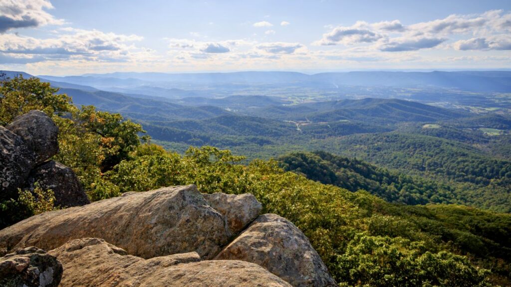
Stony Man Trail
- Distance: 1.5 – 1.6 miles (Loop/Round-trip)
- Elevation Gain: ~320-340 feet
- Difficulty: Easy
- Highlights: Stunning panoramic views, spectacular sunsets, accessible portion of the Appalachian Trail.
Stony Man is often hailed as one of the best viewpoints in the park for minimal effort, and I wholeheartedly agree! The relatively short loop leads you to a rocky outcrop offering sweeping vistas of the Shenandoah Valley. I’ll never forget catching my first sunset here – the sky ablaze with color, painting the rolling hills below. It was so magical, I just had to come back for another! It’s part of the famous Appalachian Trail, giving you a little taste of that iconic long-distance path. In spring and summer, keep an eye out for vibrant wildflowers lining the trail.
- Pro Tip: Parking can fill up, especially for sunset. Consider arriving a bit early. Remember, dogs aren’t permitted on this particular trail section. It can get slippery in winter, so consider microspikes if hiking in colder months.
Limberlost Trail
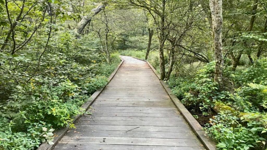
- Distance: 1.3 miles (Loop)
- Elevation Gain: ~98 feet
- Difficulty: Easy (ADA Accessible)
- Highlights: Fully accessible paved trail, lush forest environment, great for strollers and wheelchairs, wildflowers.
Limberlost is a gem, offering a truly immersive forest experience on a trail designed for everyone. It’s one of the few fully ADA-accessible trails in the park, making it perfect for strollers and wheelchairs (though some find assistance helpful for wheelchairs due to slight grades). The path meanders through a beautiful section of woods, often damp and cool, with towering trees and abundant ferns. It’s a fantastic spot for birdwatching and enjoying the tranquility of the forest. While it lacks grand mountain views, its serene beauty is captivating.
- Good to Know: Because it’s accessible and relatively flat, the parking lot fills quickly. Arrive early, especially on weekends. No dogs are allowed on this trail to protect the unique habitat. There are no restroom facilities at the trailhead.
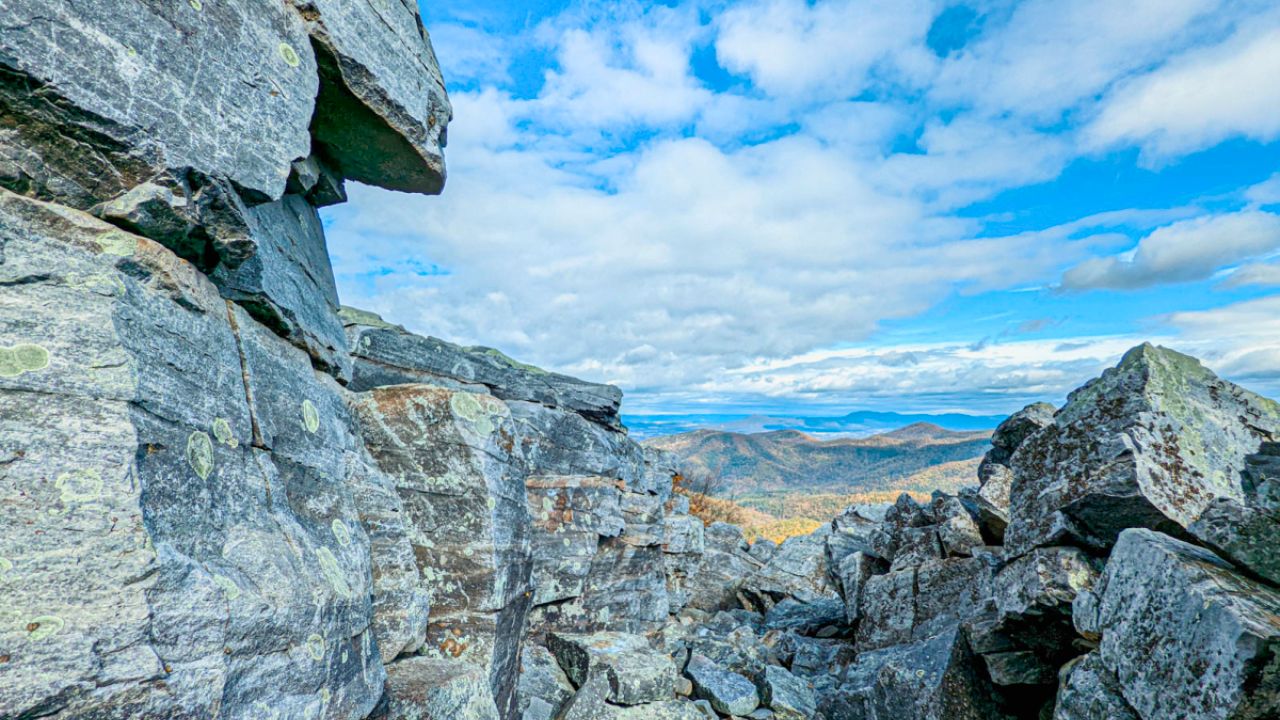
Blackrock Summit

- Distance: 1.1 miles (Loop)
- Elevation Gain: ~180 feet
- Difficulty: Easy
- Highlights: Unique rock jumble (talus slope), panoramic views, wildlife spotting potential.
This short hike leads to a fascinating geological feature – a field of boulders tumbling down the mountainside. It’s quite a sight! The trail circles the base and offers access to climb onto the rocks (carefully!) for fantastic 360-degree views. It’s a different kind of summit experience compared to others in the park. I’ve heard it’s a great spot for wildlife sightings, though I haven’t been lucky enough myself yet! It’s best hiked from spring through fall.
- Heads Up: Bring bug spray during warmer months. The rocks can be slippery when wet or icy. Dogs are welcome on leash.
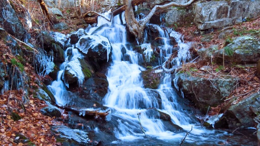
Lands Run Falls Trail
- Distance: ~1.3 miles (Out & back to falls viewpoint, longer options available)
- Elevation Gain: ~300 feet (to falls viewpoint)
- Difficulty: Easy
- Highlights: Gentle waterfall (more of a cascade), easy access from Skyline Drive.
If you’re looking for a quick and easy waterfall fix, Lands Run Falls is a great option. The trail descends gently to a small cascade tumbling over rocks. The water flow varies significantly depending on recent rainfall – it’s most impressive after a good rain. The “falls” themselves are quite close to the road, making it a very accessible hike. Be aware, this area is known for bear sightings, so keep alert and dogs leashed!
- Note: The trail continues much further down, becoming steeper, but the main viewpoint is easily reached.
Millers Head Trail
- Distance: 1.6 miles (Out & back)
- Elevation Gain: ~360 feet
- Difficulty: Easy
- Highlights: Historic stone observation tower, pleasant woodland walk, good views.
This trail leads to a cool stone tower offering elevated views. The path itself is a pleasant walk through the woods. It can be a bit rocky and covered in leaves depending on the season, so wear sturdy shoes. It’s a less-crowded option compared to some of the more famous viewpoints, offering a bit more solitude. Dogs are welcome here too!
Moderate Hikes: Stepping Up the Adventure
Ready for a bit more of a challenge? These moderate hikes often involve more elevation gain, longer distances, or trickier terrain, but reward your efforts with incredible waterfalls, stunning overlooks, and a deeper sense of immersion in the park’s beauty.
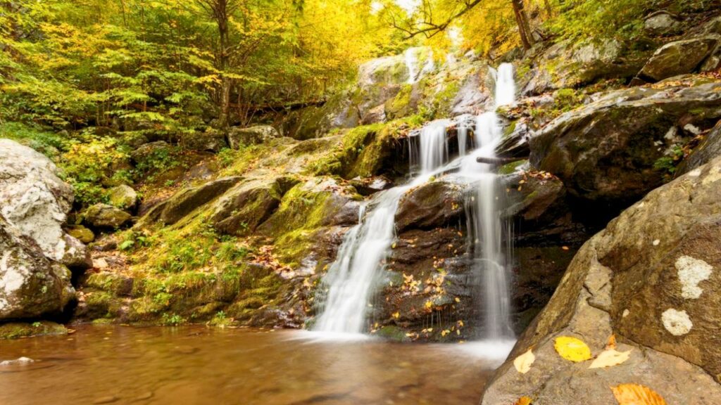
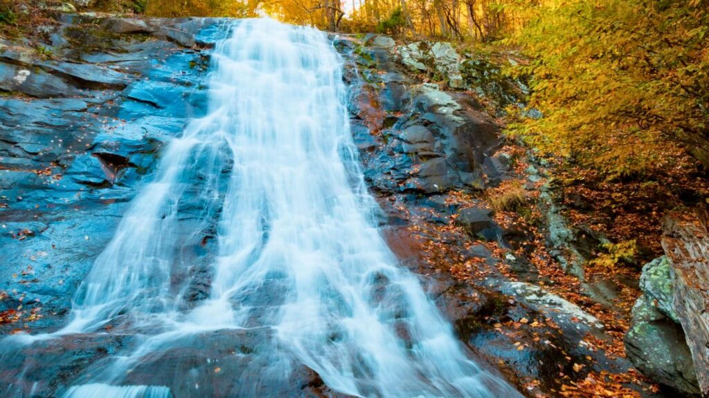
Dark Hollow Falls Trail
- Distance: 1.4 – 1.6 miles (Round-trip/Out & back)
- Elevation Gain: ~440 – 580 feet
- Difficulty: Moderate (due to steepness on return)
- Highlights: Gorgeous multi-tiered 70-foot waterfall, lush scenery, close proximity to Skyline Drive.
Dark Hollow Falls is arguably one of the most popular waterfall hikes in Shenandoah, and for good reason! The trail descends fairly steeply (remember, what goes down must come up!) alongside a stream, leading to the base of a stunning, cascading waterfall. The sound of the water, the cool spray, and the lush green surroundings make it feel almost tropical. I loved dipping my feet in the cool water at the base on a warm day. The hike back up is the challenging part – it’s short but steep!
- Insider Tip: This trail is incredibly popular. Go early in the morning or on a weekday to avoid the biggest crowds. Dogs are not permitted on this trail. You can connect this hike with others, like the Rose River Loop, for a longer adventure.
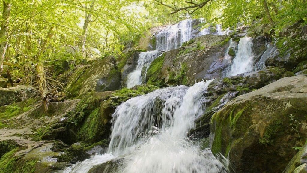
Rose River Falls Loop
- Distance: ~2.4 – 4 miles (Loop options vary)
- Elevation Gain: ~650 – 900 feet
- Difficulty: Moderate
- Highlights: Multiple waterfalls and cascades, stream crossings, beautiful forest setting, potential connection to Dark Hollow Falls.
If you love waterfalls, the Rose River Loop is fantastic. Instead of just one main fall, this trail follows the Rose River, showcasing numerous smaller cascades and pools along the way, culminating in the impressive Rose River Falls itself. The loop involves some stream crossings which can be fun but require sturdy, waterproof footwear, especially after rain. I hiked this in the fall, and the foliage was absolutely breathtaking, complementing the rushing water beautifully.
- Planning Note: You can make this a longer loop (around 4 miles) by incorporating Dark Hollow Falls, creating a truly epic waterfall adventure. Check trail maps for loop variations.
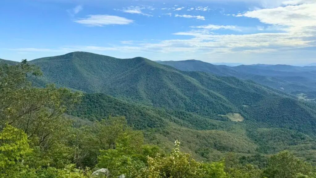
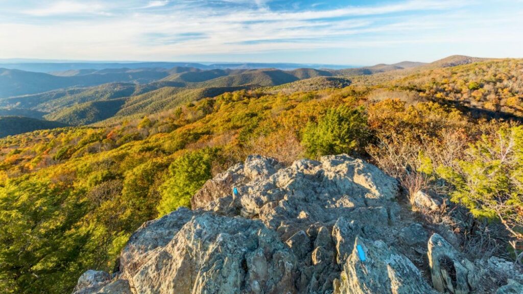
Mary’s Rock Summit
- Distance: ~3.4 miles (Round-trip, via Southern Appalachian Trail access)
- Elevation Gain: ~1,210 feet
- Difficulty: Moderate
- Highlights: Expansive panoramic views, rocky summit perfect for scrambling, beautiful in fall foliage season.
Mary’s Rock delivers some seriously epic views. There are a couple of ways to reach the summit, but the route starting from the Panorama Comfort Station parking area via the Appalachian Trail is popular. It involves a steady, sometimes steep, climb through the woods before opening up onto a large, rocky summit area. The 360-degree views are incredible! I made a point to hike this in October, and the vibrant fall colors blanketing the mountains below were simply jaw-dropping. The rocky top is fun to explore (carefully!).
- Good to Know: There’s also a shorter, steeper route from the Meadow Spring parking area. Choose based on your preferred distance and challenge level.
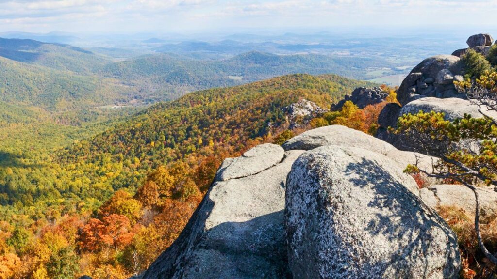
Hawksbill Mountain Summit (Highest Peak!)
- Distance: ~1.7 – 2.9 miles (Round-trip, depending on route)
- Elevation Gain: ~700 – 850 feet
- Difficulty: Moderate (some routes easier than others)
- Highlights: Highest peak in Shenandoah (4,051 ft), 360-degree views, Byrd’s Nest Shelter, excellent sunset spot.
Standing on the highest peak in Shenandoah is a special feeling! Hawksbill Mountain offers several routes to the top. The shortest and steepest leaves from the Upper Hawksbill parking lot, while a slightly longer, more gradual path starts from the Hawksbill Gap parking area. Whichever you choose, the payoff is immense. The summit features a stone viewing platform and the historic Byrd’s Nest No. 2 shelter. I hiked up late one afternoon, and the golden hour light hitting the mountains was unforgettable – definitely my favorite sunset spot in the park so far!
- Trail Choice: For an easier climb, take the loop trail from Hawksbill Gap. For a quicker, steeper ascent, use the Upper Hawksbill trailhead.
Bearfence Mountain Trail (Rock Scramble Option)
- Distance: ~1.1 – 1.4 miles (Loop)
- Elevation Gain: ~310 feet
- Difficulty: Moderate (due to rock scramble) / Easy (viewpoint trail without scramble)
- Highlights: Exciting and fun rock scramble (optional), 360-degree summit views, great sunrise/sunset potential.
Bearfence offers a unique adventure: a short but thrilling rock scramble! This isn’t technical climbing, but it involves using your hands and feet to navigate over, around, and sometimes through boulders. It’s genuinely fun and rewarding, leading to fantastic 360-degree views from the summit rocks. I found the scramble to be challenging but manageable and a total blast! If scrambling isn’t your thing, there’s an alternative viewpoint trail that bypasses the trickiest sections.
- Important: The rock scramble section is not suitable for pets or those uncomfortable with heights or tight spaces. Wear sturdy shoes with good grip.
Strenuous Hikes: The Ultimate Challenge
For those seeking a serious physical challenge and unparalleled rewards, Shenandoah’s strenuous hikes deliver. These trails demand endurance, preparation, and respect, often involving significant mileage, steep elevation gains, and rugged terrain.
Old Rag Mountain Loop
- Distance: ~9.4 miles (Loop, standard route)
- Elevation Gain: ~2,500 – 2,600 feet
- Difficulty: Very Strenuous
- Highlights: Famous and challenging rock scramble, incredible summit views, demanding physical test.
Old Rag isn’t just a hike; it’s a Shenandoah rite of passage. This legendary trail is known for its mile-long rock scramble – a physically demanding section requiring you to pull yourself up, squeeze through crevices, and navigate challenging boulder fields. It’s tough, requires upper body strength, and isn’t for the faint of heart or those afraid of heights. My first time tackling it, my arms were burning, but the sense of accomplishment at the summit, with those panoramic views unfolding below, was immense! The hike down via the fire road feels long but offers a needed respite.
- Crucial Info: A specific Old Rag day-use ticket is now required (in addition to park entrance fees) for part of the year, purchased in advance online. Check the NPS website! Arrive VERY early, especially on weekends, as parking is limited and fills extremely fast. Allow 6-10 hours. Bring plenty of water and snacks. Dogs are NOT allowed. Pay close attention to the blue blazes during the scramble.
Whiteoak Canyon Trail
- Distance: ~4.6 miles (to Upper Falls and back) / ~9.5 miles (Full canyon loop including Cedar Run)
- Elevation Gain: ~1,000 feet (to Upper Falls) / ~2,400 – 2,800 feet (Full loop)
- Difficulty: Moderate (to Upper Falls) / Strenuous (Full loop)
- Highlights: Series of six stunning waterfalls, beautiful gorge environment, swimming holes (use caution!).
Whiteoak Canyon is a waterfall lover’s paradise. The trail descends steeply into a deep gorge, revealing one spectacular waterfall after another. You can hike down as far as you like and return the way you came. Reaching the Upper Falls viewpoint is a rewarding moderate hike. However, completing the full loop, which often involves connecting with the equally steep Cedar Run Trail, is a very strenuous undertaking with significant elevation change. Spring is fantastic for water flow, but be prepared for a tough climb back out!
- Safety: The rocks around the waterfalls are extremely slippery. Be very cautious, especially if venturing near the water or swimming holes. The climb out of the canyon is demanding.
Tips for Hiking in Shenandoah National Park
- Entrance Fees & Passes: You’ll need to pay an entrance fee or use a valid National Park Pass (like the America the Beautiful Pass) to enter Shenandoah National Park via Skyline Drive.
- Check Conditions: Always check the weather forecast and trail conditions before heading out. Conditions can change rapidly in the mountains. Check the official NPS Shenandoah website for alerts, closures, or specific requirements (like the Old Rag ticket system).
- Wear Appropriate Footwear: Sturdy hiking boots or trail shoes with good traction are essential, especially for rocky or steep trails.
- Bring Plenty of Water: Even on cooler days, hydration is key. Carry more water than you think you’ll need, especially for longer or more strenuous hikes.
- Pack Snacks: Fuel your adventure! Energy bars, trail mix, fruit, and sandwiches are great options.
- Navigation: While many trails are well-marked, carrying a map (and knowing how to read it) and/or using a GPS device or app is always a good idea. Cell service can be very spotty.
- Leave No Trace: Pack out everything you pack in, including trash and food scraps. Stay on marked trails to protect fragile vegetation. Respect wildlife from a distance – never feed animals.
- Wildlife Awareness: Shenandoah is home to black bears. Know what to do if you encounter one (make noise, stand your ground, don’t run). Store food properly. Be aware of ticks and snakes as well.
- Timing is Everything: Popular trails and parking areas (especially Old Rag, Dark Hollow Falls, Stony Man) can get extremely crowded, particularly on weekends and during peak fall foliage season. Start early!
- Layer Clothing: Mountain weather changes. Dress in layers you can add or remove as needed. A waterproof outer layer is always recommended.
- Skyline Drive Mile Markers: Trailheads are often referenced by their nearest milepost on Skyline Drive. This is crucial for navigation. Note that mile markers start at 0 at the northern entrance (Front Royal) and increase heading south.
Shenandoah National Park is a treasure, a place where rugged beauty meets accessible adventure. Each trail tells a story, offers a unique perspective, and leaves you with memories etched against a backdrop of rolling mountains and endless sky. Whether you choose an easy stroll to a waterfall or embark on the demanding journey up Old Rag, the magic of Shenandoah awaits. Happy hiking!
Leave a Reply