The smell of woodsmoke and damp leaves hits you before you see the color—maples burning orange against a cloudless sky, birches glowing gold in afternoon light. This is what autumn road trips feel like when you actually plan them right, not when you guess and arrive to bare branches.
The East Coast peaks earlier and more predictably than anywhere else in the country, which means you can plan with confidence instead of hoping. But the Midwest delivers the same color without the gridlock, the Rockies offer drama in concentrated doses, and the West Coast gives you waterfalls alongside foliage—each region rewards a different kind of traveler.
This guide cuts through the noise and tells you exactly which route matches your trip length, timing, and tolerance for crowds. Budget ranges: a long weekend on a single route runs $400–800 for gas and modest lodging; a week-long multi-state itinerary costs $1,200–2,000; a two-week chase from New England to Texas runs $2,500–4,000 depending on lodging choices and how many meals you cook versus eat out.
Five Routes That Actually Deliver Peak Autumn Colors
East Coast routes peak earliest and most reliably—Acadia, Maine (late September–early October) for coastal mountain views; Green Mountain Byway, Vermont (early–mid October) for compact accessibility; Mohawk Trail, Massachusetts (early–mid October) as a natural connector; Blue Ridge Parkway, Virginia to North Carolina (mid-October–early November) for the longest, slowest, most scenic drive.
Midwest routes offer solitude without crowds—Door County, Wisconsin (mid-September–mid-October) for water plus forest; Upper Peninsula, Michigan (late September–early October) for remote wilderness; Hocking Hills, Ohio (late September–mid-October) for waterfalls and gorges.
Mountain routes deliver drama in different ways—Million Dollar Highway, Colorado (mid-to-late September) for 25 miles of hairpin-turn intensity; Rocky Mountain National Park to Santa Fe (September) for 499 miles of multiple ecosystems.
Multi-state itineraries chase color across regions—New England to the Smokies (1,519 miles, October throughout) for maximum East Coast variety; Lake Superior to St. Louis (935 miles, October throughout) for waterfalls plus foliage; St. Louis to Lost Maples, Texas (1,000+ miles, late October–early November) to extend fall into November.
Peak timing rule: Colors peak earlier in the north and at high elevations, later in the south and at lower elevations—use the US Forest Service fall foliage forecast 2–3 weeks before your trip to nail your dates.
Which East Coast Routes Deliver the Best Autumn Colors?
The East Coast peaks earlier and more reliably than anywhere else in the country, which means you can actually plan a road trip with confidence instead of guessing. These five routes stack the most dramatic color transitions, scenic overlooks, and walkable towns in sequence—so you’re not just driving past trees, you’re stopping, eating, and staying somewhere worth the detour.
Route 1 to Acadia National Park, Maine
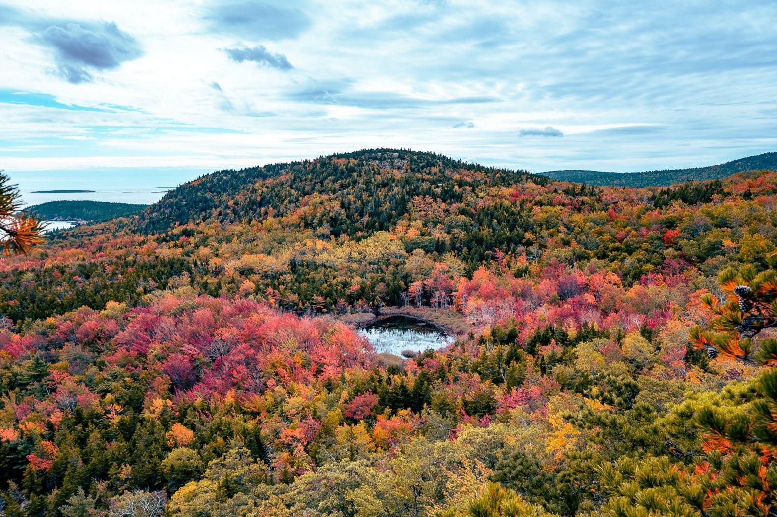
Acadia delivers the most dramatic coastal backdrop for autumn color in the Northeast. The park’s carriage roads and Jordan Pond Path offer close-up views of maples reflected in still water, while the Park Loop Road climbs to overlooks where you see color layered across mountains down to the Atlantic.
This is the northernmost route on this list, so peak color arrives earliest—late September into early October.
- Best for: Photographers and anyone who wants mountains plus ocean in the same view.
- Drive time: Roughly 6–8 hours from Boston; plan 2–3 days minimum to justify the distance.
- Stay strategy: Base yourself in Bar Harbor, the gateway town on the park’s eastern edge. It has restaurants, shops, and lodging within walking distance of the Park Loop Road entrance.
- Insider detail: Arrive at Jordan Pond parking before 9 a.m. in peak season, or you’ll circle for 20 minutes. The reflection shot is worth the early start.
Green Mountain Byway, Vermont

Vermont’s Green Mountain Byway is the most accessible peak-foliage road trip for East Coast travelers—it’s compact, the colors are predictable, and the towns (Stowe, Waterbury, Montpelier) have real character instead of tourist trap sameness. The drive winds through the spine of the state, and you get a mix of hardwood forests, pastoral valleys, and mountain vistas without long highway stretches.
- Best for: First-time fall road trippers and anyone avoiding crowds (compared to Acadia or the Blue Ridge).
- Peak timing: Early to mid-October; Vermont’s color window is narrow and fast.
- Stay strategy: Stowe is the most walkable base, with restaurants and inns clustered around the village center. Waterbury (home to Ben & Jerry’s Factory) works as a quieter alternative 20 minutes south.
- Insider detail: The byway’s best overlooks are unmarked pullouts—slow down around milemarker 100 and look for cars already parked on the shoulder.
The Mohawk Trail, Massachusetts
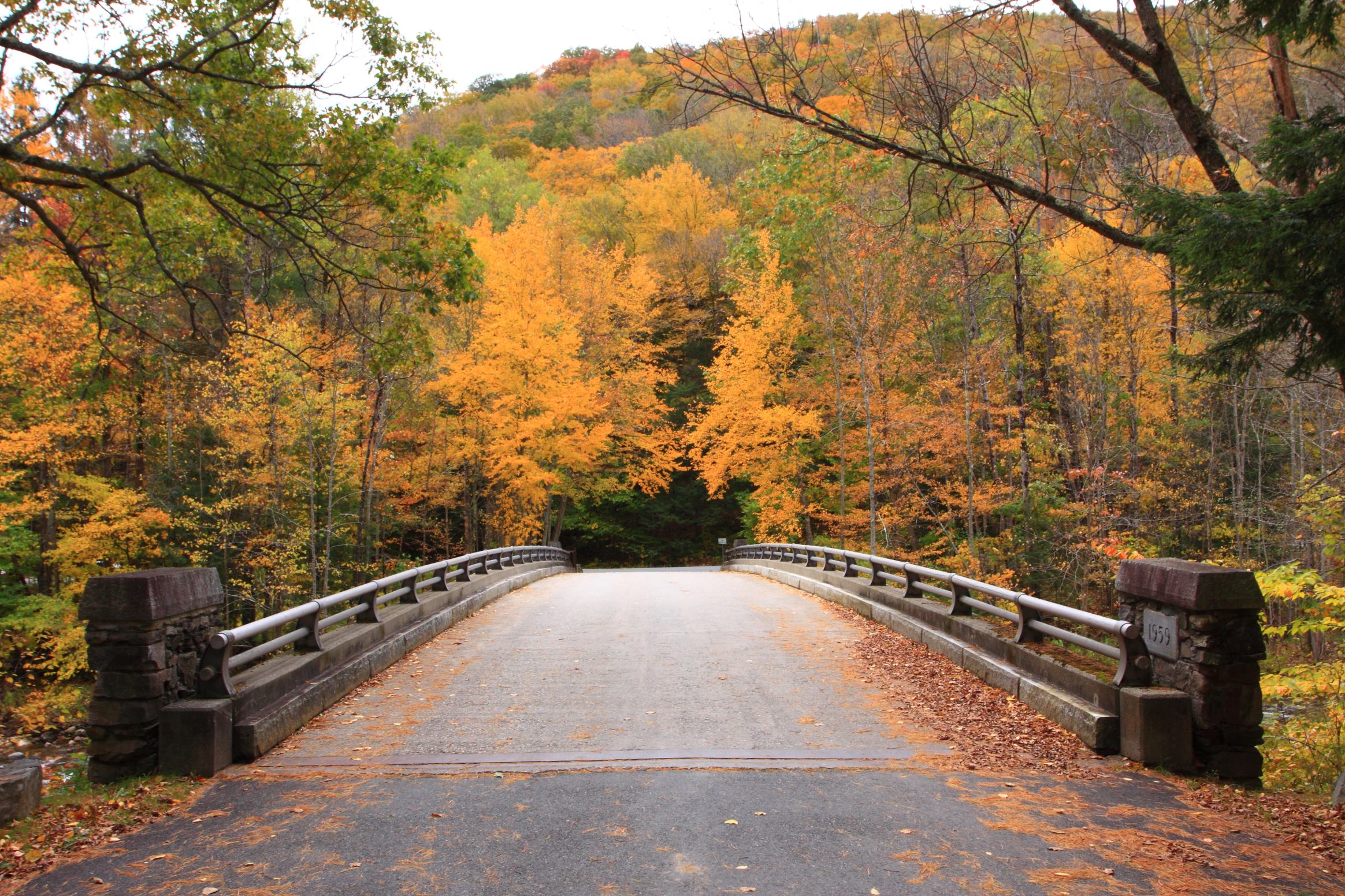
The Mohawk Trail (Route 2) cuts through the Berkshires and is the shortest, most efficient way to see peak New England color without driving to Maine. It connects to the Green Mountains in Vermont to the north and feeds directly into the Shawangunk Mountains Scenic Byway in New York to the south, making it a natural connector for longer East Coast itineraries.
The drive is tight and winding—expect 30–40 mph average speeds—but that’s the point: you’re not rushing.
- Best for: Road trippers building a multi-state itinerary; the trail links seamlessly to Vermont and New York routes.
- Peak timing: Early to mid-October, slightly after Vermont’s peak.
- Stay strategy: Williamstown (home to Williams College) anchors the western end with inns and restaurants. Shelburne Falls, a smaller village midway, has charm and fewer tourists.
- Scenic highlight: The Hairpin Turn near North Adams offers one of the most photographed vistas on the route.
The Adirondacks, New York
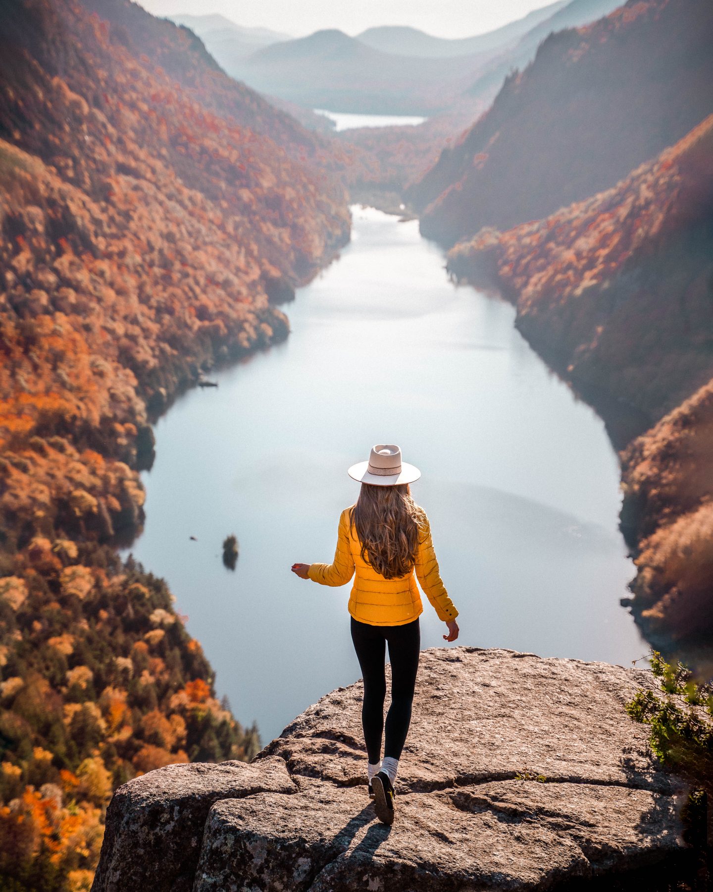
The Adirondacks deliver a different kind of fall drive: higher elevation, cooler temperatures, and a mix of hardwoods and evergreens that creates a more textured color palette than pure deciduous forests. The region is larger and less linear than the other routes on this list, so you’ll need to pick a specific loop (Scenic Byway 28N between Inlet and Newcomb is a solid choice) rather than following one main road.
This works best as a 2–3 day detour if you’re already in upstate New York, not as a standalone destination from the coast.
- Best for: Hikers and anyone who wants to combine driving with trail time; the Adirondacks have 46 peaks and hundreds of miles of marked trails.
- Peak timing: Late September into early October; higher elevation means earlier color.
- Stay strategy: Lake Placid is the most developed base with lodging and restaurants. Saranac Lake, 30 minutes north, is quieter and closer to some of the best scenic drives.
- Insider detail: Many Adirondack overlooks require short hikes (15–45 minutes). Wear layers—elevation and water proximity mean temperature swings of 20+ degrees between morning and afternoon.
Blue Ridge Parkway, Virginia to North Carolina
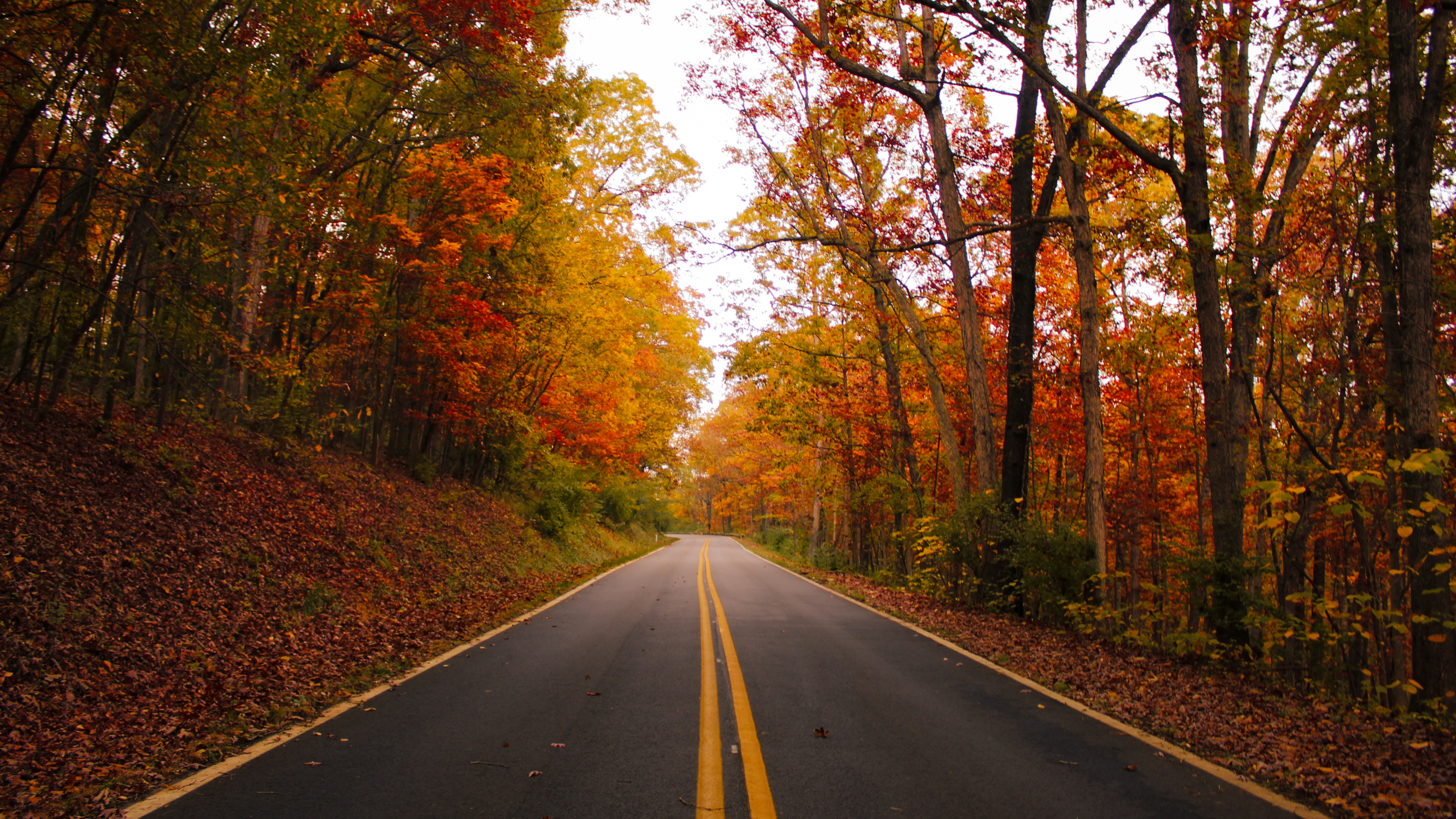
The Blue Ridge Parkway is the longest and most famous route on this list—469 miles of winding mountain road that runs from Roanoke, Virginia, to Asheville, North Carolina. It’s the closest thing the East Coast has to a western scenic drive, with overlooks every few miles and no commercial traffic allowed.
The color window is longer here than in New England (mid-October through early November), and the drive itself is the destination, not a connector to somewhere else.
- Best for: Anyone with 4–5 days to spare and a tolerance for slow, deliberate driving. This is not a sprint.
- Why it wins: No other East Coast route offers this much uninterrupted mountain scenery, and the Linn Cove Viaduct (milemarker 304.4) is genuinely one of the most photographed autumn spots in the country.
- Peak timing: Mid-October (northern section) through early November (southern section near Asheville). You can chase color by driving south as the season progresses.
- Stay strategy: Drive the parkway in sections rather than end-to-end in one trip. Base yourself in Asheville (southern end) for brewery culture and walkable downtown, or Roanoke (northern end) for easier access from the Northeast.
- Insider detail: The parkway closes unpredictably during winter. Confirm road conditions before you leave—sections can shut down for fog, ice, or maintenance with little notice.
- Driving reality: Average speed is 35–45 mph due to curves and overlook stops. Budget roughly 10–12 hours of actual driving time for the full 469 miles, spread across multiple days.
Quick Comparison: Which Route Fits Your Trip?
| Route | Distance | Peak Timing | Best For | Minimum Days |
|---|---|---|---|---|
| Acadia, Maine | ~400 miles round-trip from Boston | Late Sept–early Oct | Coastal views + mountains | 3 |
| Green Mountain Byway, VT | ~150 miles | Early–mid Oct | Compact, accessible, reliable | 2 |
| Mohawk Trail, MA | ~70 miles | Early–mid Oct | Connector route, tight curves | 1–2 |
| Adirondacks, NY | Variable (50–100 miles per loop) | Late Sept–early Oct | Hiking + driving combo | 2–3 |
| Blue Ridge Parkway, VA–NC | 469 miles | Mid-Oct–early Nov | Longest, slowest, most scenic | 4–5 |
How These Routes Connect
If you have 10+ days, stack them: start in New Hampshire or Vermont in early October, work your way down through Massachusetts and New York, then push south to the Blue Ridge Parkway to extend your color window into November. The research data calls this the “New England to the Smokies” itinerary—it’s 1,519 miles total and hits peak foliage at multiple elevations as you move south, essentially chasing autumn down the spine of the Appalachians.
This is the move if you want to maximize color without repeating terrain.
How Does the Midwest Compare for Leaf Peeping Road Trips?
The Midwest delivers autumn color without the East Coast gridlock—and with a completely different landscape personality. While New England gets the hype, Door County, the Upper Peninsula, and Hocking Hills offer denser foliage, fewer tourists, and the kind of quiet, contemplative drives that actually feel like a road trip instead of a traffic jam.
The trade-off: peak color windows are narrower and less predictable than the Northeast, so timing matters more.
Door County, Wisconsin
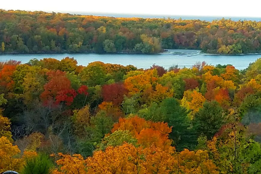
Door County wins for anyone who wants dramatic water views mixed with forest color—this 80-mile peninsula juts into Lake Michigan and delivers both simultaneously. Mid-September through mid-October is peak, though the window is tighter here than in New England.
The real advantage: 3 million summer visitors vanish by fall, so you’ll drive an open road lined with maples and birches instead of bumper-to-bumper leaf-peeping traffic.
Start in Sturgeon Bay (the peninsula’s largest town at 9,000 people—still tiny) and drive north. Five state parks punctuate the route, trading forest views for sea cliffs, sand dunes, rocky ridges, and Lake Michigan vistas that feel oceanic.
The drive itself is the point here; there’s no single “peak” destination, just 80 miles of color and water.
- Best for: Couples and solo travelers who prioritize solitude over crowds.
- Timing reality: Mid-September to mid-October, but confirm peak dates closer to your travel window—Midwest foliage swings wildly year to year.
- Insider move: Drive the peninsula in the early morning when light hits the water and trees together; afternoon glare flattens the color.
Upper Peninsula, Michigan
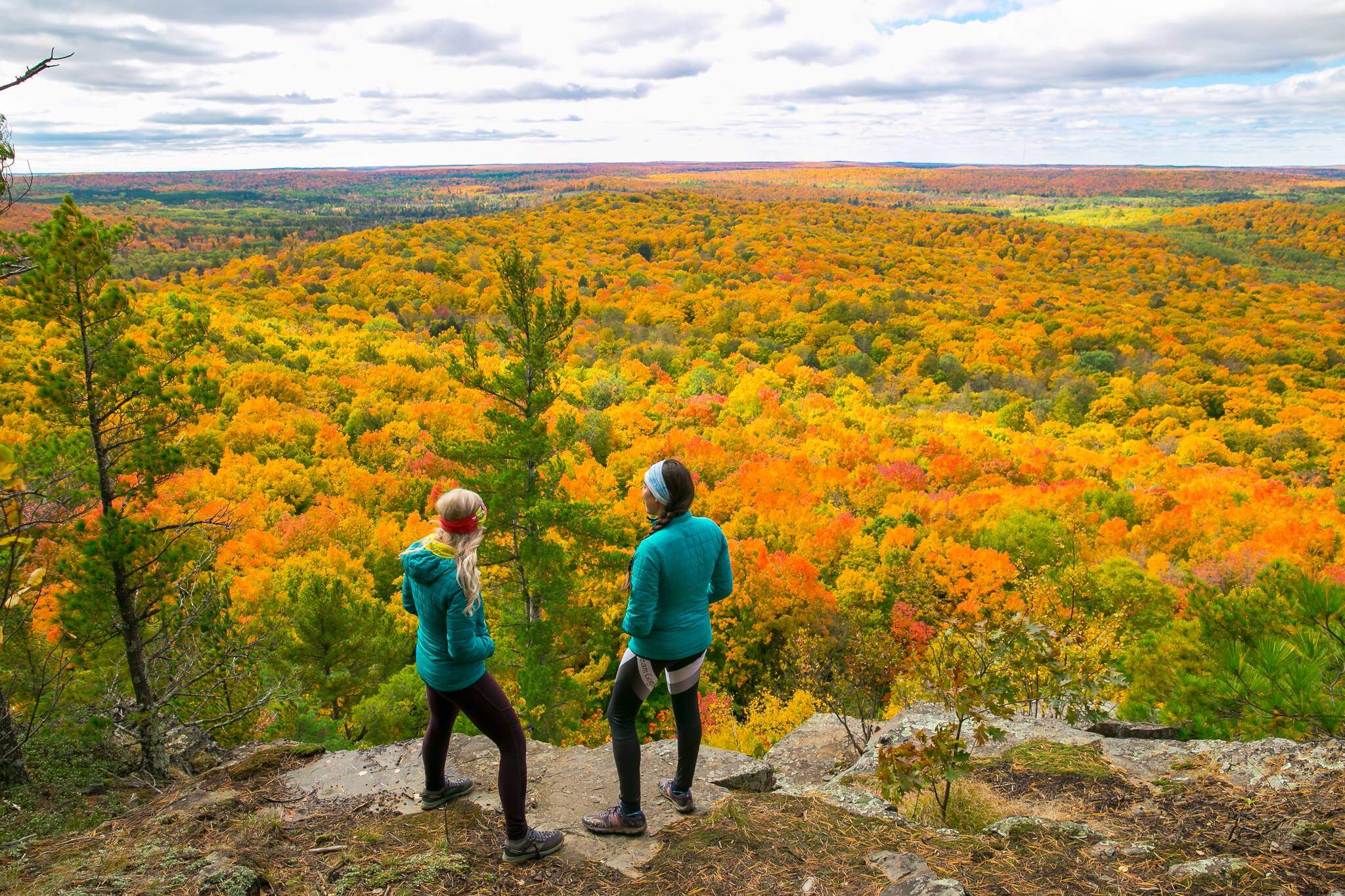
The Upper Peninsula is the Midwest’s secret—fewer people know it exists as a fall destination, which means you get dense, uninterrupted forest color without the infrastructure strain. The landscape is wilder and less manicured than Door County: dense hardwood forests, rocky shorelines, and a genuine sense of remoteness.
This is the move if you want to feel like you’ve discovered something, not followed a guidebook.
Peak timing typically falls in late September through early October, though this varies significantly by year and elevation. The U.P. is larger and less linear than Door County, so plan a base town rather than a straight drive—Marquette or Munising work well for accessing multiple scenic routes without constant relocation.
- Best for: Photographers and travelers who value landscape drama over tourist infrastructure.
- Reality check: Fewer restaurants and services than Door County; stock up in larger towns before heading into scenic areas.
- Timing note: Confirm peak foliage dates with local tourism boards closer to your trip—Upper Peninsula color timing shifts more than other regions.
Hocking Hills Scenic Byway, Ohio
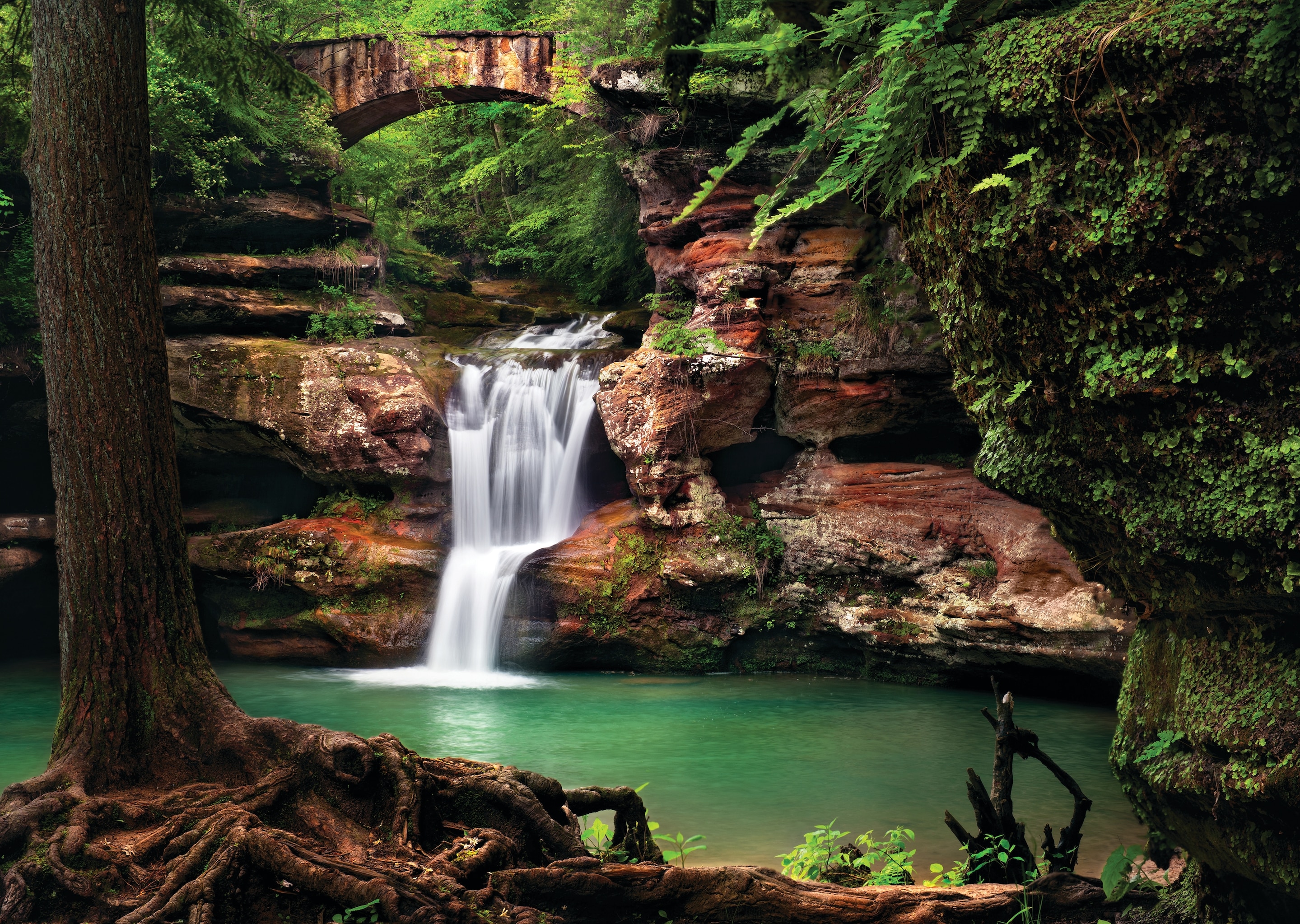
Hocking Hills is the southernmost option here and peaks earlier—usually late September through mid-October—making it ideal if you want to catch color before heading north, or if you’re timing a multi-state loop. The byway cuts through state parks with waterfalls, gorges, and hemlock-shaded ravines that stay green even as surrounding maples turn, creating striking color contrast.
This route is more compact and accessible than the U.P., with better lodging and dining options. It’s the best choice if you’re combining fall foliage with waterfall photography or hiking, since the landscape naturally pairs both.
Base yourself in or near Logan (the main town) for access to multiple scenic drives and trailheads without constant moving.
- Best for: Families, hikers, and photographers who want color plus waterfalls and gorges.
- Timing advantage: Peaks earlier than northern Midwest options, so it works as a starting point for a longer road trip moving north.
- Stay strategy: Logan and nearby villages offer cabins and small inns within walking distance of trailheads—book early for October weekends.
Midwest Foliage Comparison
| Location | Peak Timing | Crowd Level | Best For |
|---|---|---|---|
| Door County, Wisconsin | Mid-Sept to mid-Oct | Very low | Water views + forest; solitude seekers |
| Upper Peninsula, Michigan | Late Sept to early Oct | Very low | Remote wilderness; photographers |
| Hocking Hills, Ohio | Late Sept to mid-Oct | Low to moderate | Waterfalls + color; families and hikers |
The honest take: All three beat the Northeast for crowds and cost, but none guarantees the dense, uniform color saturation of New England or the Blue Ridge. Midwest foliage is patchier—you’ll see brilliant trees next to green ones—but that’s also what makes it feel less crowded and more real.
If you’re flexible on timing and prioritize quiet over peak-color guarantees, the Midwest is the smarter play.
What Mountain Drives Offer Stunning Fall Vibes in the Rockies?
The Rockies deliver autumn color in two completely different ways: one is a white-knuckle 25-mile adrenaline rush through hairpin turns and thousand-foot drops; the other is a 499-mile slow burn through aspen groves and high-altitude valleys that actually lets you breathe between stops. Both peak in September, both demand respect for mountain weather, and both reward early planning.
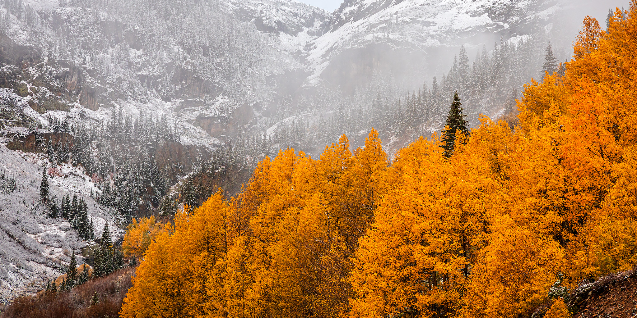
The Million Dollar Highway, Colorado
This 25-mile stretch between Ouray and Silverton in the San Juan Mountains is the move if you want drama—Switzerland-level mountain views, hairpin turns that hug sheer cliffs, and golden aspen forests compressed into a single afternoon drive. You will stop constantly for photos.
The road earns its name partly from the cost to build it and partly from the views that make every mile feel like a splurge.
- Why it wins: Highest concentration of alpine fall color in Colorado; the drive itself is the destination, not just the route to one.
- Best for: Photographers, experienced mountain drivers, and travelers who want maximum scenery in minimum time.
- Reality check: Narrow road with no guardrails on some sections; not for nervous drivers or RVs. Weather can close the highway in late September or early October, so confirm road status before you go.
- Timing: Peak foliage typically hits mid-to-late September; the window is short before snow arrives.
- Insider detail: Stop in Ouray first—the town sits in a box canyon and fills with leaf-peepers on weekends, so arrive early morning or base yourself nearby and drive the highway at dawn.
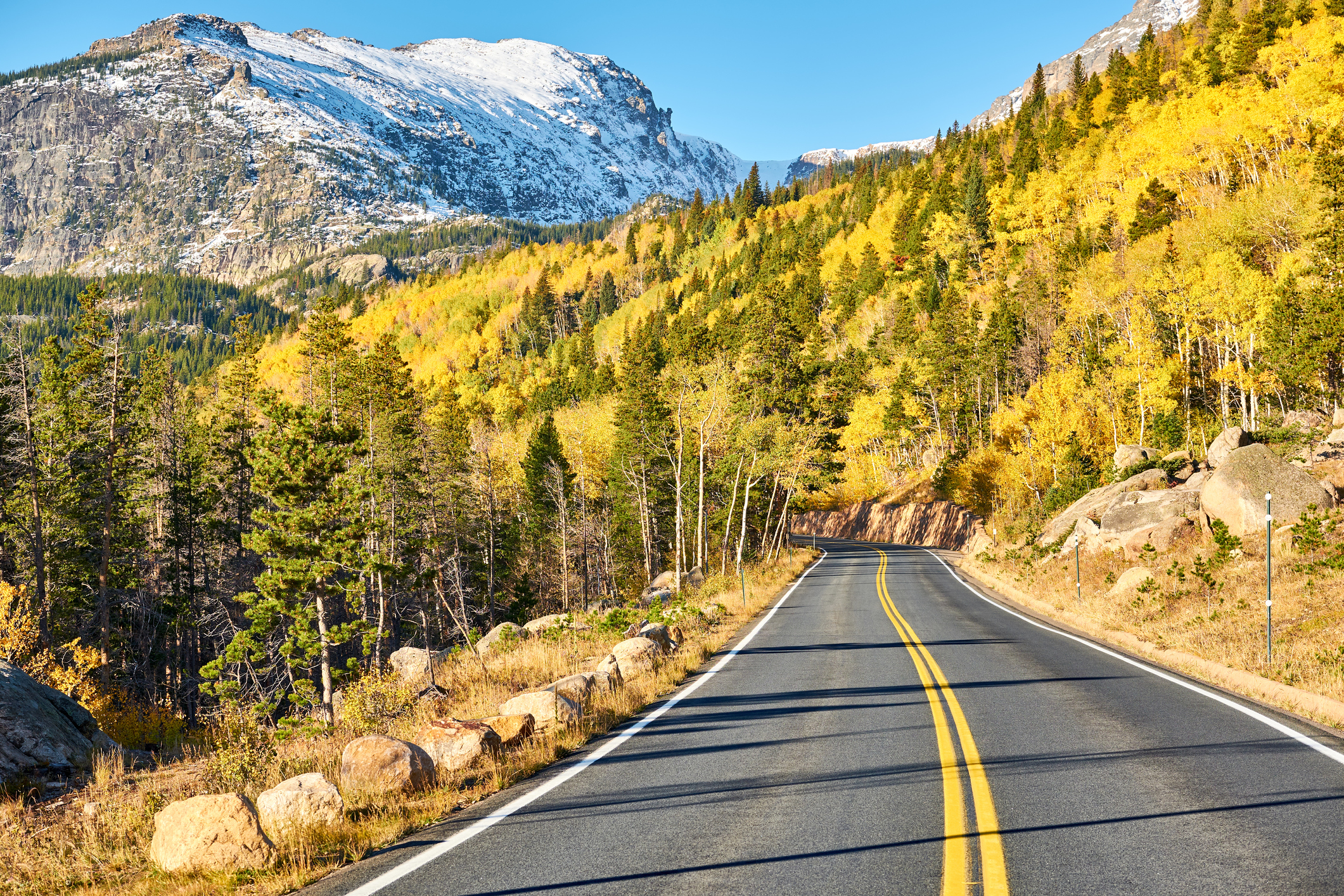
Rocky Mountain National Park to Santa Fe, New Mexico Route
This 499-mile route is the best choice if you want to actually experience fall in the Rockies rather than just drive through it. You start in Rocky Mountain National Park, drop through Colorado’s high country on two scenic byways, pass Great Sand Dunes National Park, and end in Santa Fe’s high-desert light—all in one trip that unfolds like a slow reveal of different mountain ecosystems.
- Route flow: Rocky Mountain National Park → Peak to Peak Scenic and Historic Byway → Nederland (stop for pizza) → Top of the Rockies & Collegiate Peaks Byway → Salida (stop for food) → Great Sand Dunes National Park & Preserve → Santa Fe.
- Why it works: You see aspen color in the high peaks, then transition to piñon and juniper in the southern mountains—two completely different fall palettes on one drive. The byways are built for scenery, not speed.
- Best for: Road-trip planners who want multiple stops, hikers, and travelers comfortable with 6-8 hours of driving spread across 3-4 days.
- Timing: September is ideal; peak aspen color typically hits mid-September at higher elevations, then moves south as the month progresses.
- Where to stay: Base yourself in Nederland or Salida for overnight stops—both are mountain towns with local character and easy access to the next leg of the drive. Salida sits on the Arkansas River and offers more restaurant options if you’re planning a longer pause.
- Insider detail: The I-70 stretch between Nederland and the Top of the Rockies Byway is unavoidable and brief—don’t skip it trying to avoid the interstate; it saves 45 minutes and the byway payoff is worth the short highway section.
| Route | Distance | Drive Time | Peak Season | Best For |
|---|---|---|---|---|
| Million Dollar Highway | 25 miles | 1–2 hours (with stops) | Mid-to-late September | Scenic intensity, photographers, half-day trips |
| Rocky Mountain to Santa Fe | 499 miles | 3–4 days | September | Multi-day road trips, multiple ecosystems, hikers |
Mountain weather reality: Both routes sit above 9,000 feet for stretches. September weather can shift fast—bring layers, check road conditions before you leave, and have a backup plan if snow or storms hit early.
The Million Dollar Highway closes seasonally; confirm it’s open before driving from Ouray.
Are There Worthwhile West Coast Options for Autumn Road Trips?
The West Coast delivers autumn road trips that rival the East—but with a completely different character. Instead of dense foliage crowds, you get high-altitude color, volcanic drama, and the kind of driving that makes you forget efficiency exists.
Peak timing runs early October, and the payoff is worth the longer distances.
Columbia River Gorge Scenic Byway, Oregon
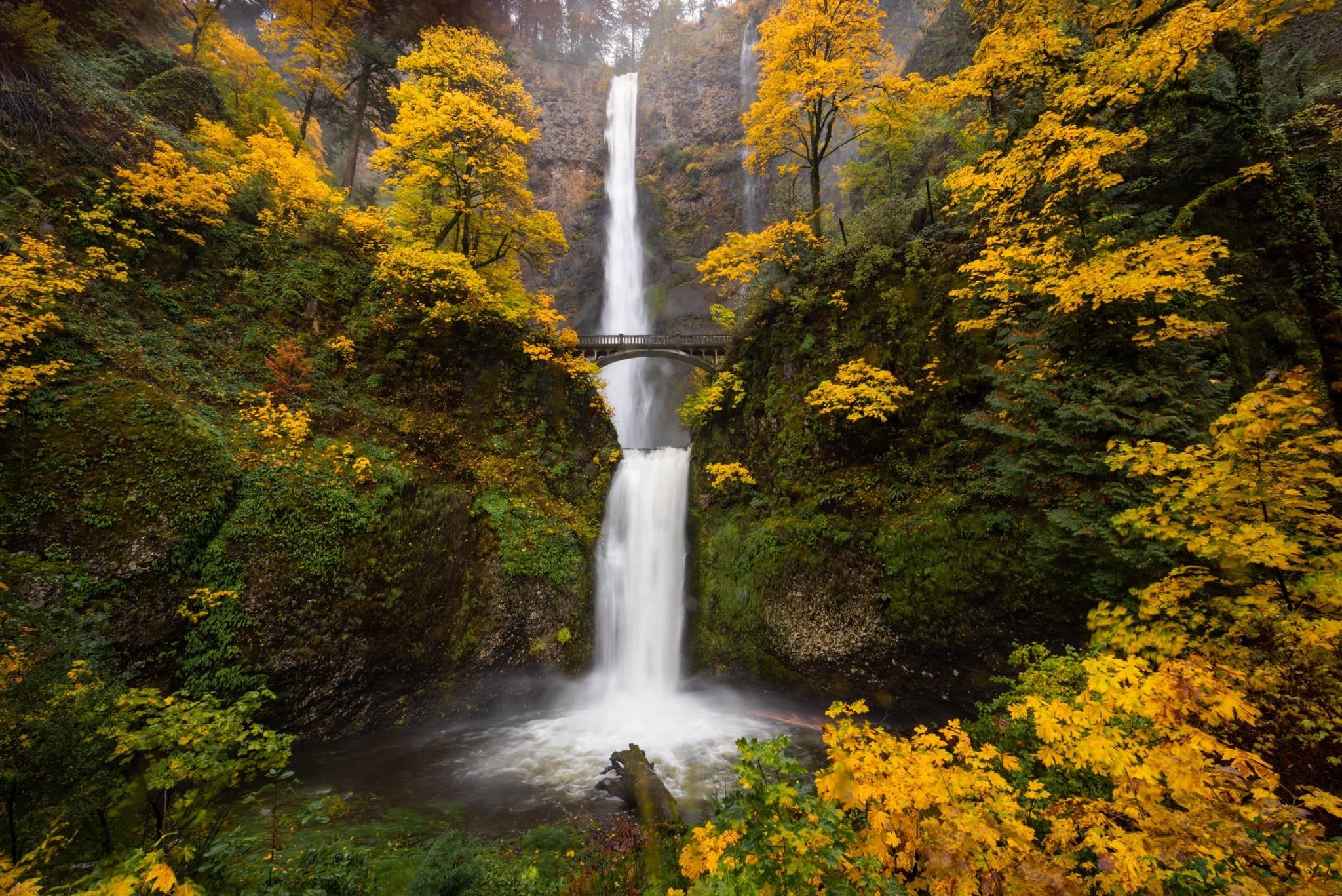
This 70-mile stretch east of Portland is America’s first scenic highway, and it earns that title. Ninety waterfalls cascade down basalt cliffs as the Columbia River carves through the gorge—Multnomah Falls alone drops 620 feet and dominates the drive.
The real win here is that you get dramatic water and canyon color without fighting East Coast crowds, and the route connects directly to other scenic byways heading south into California.
- Best for: Photographers and anyone who wants waterfall drama mixed with fall color—this isn’t pure foliage, but the combination is unbeatable.
- Drive time from Portland: The scenic byway itself takes 2–3 hours without stops; budget a full day if you’re hitting multiple waterfalls.
- Insider detail: Arrive at Multnomah Falls before 9 a.m. or after 4 p.m. to avoid tour bus crowds; the light is better anyway.
- Parking: Main pullouts fill quickly on weekends—arrive early or use smaller, less-known falls like Latourell and Bridal Veil as equally stunning alternatives.
Bellingham to Mammoth Lakes Route
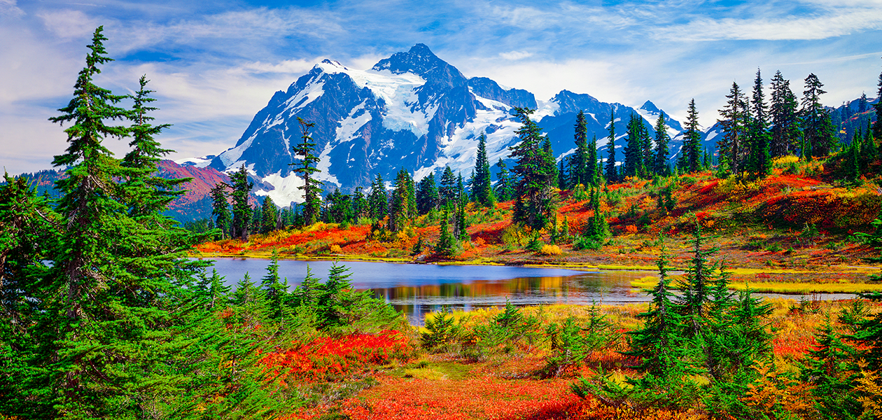
This 1,636-mile loop from Washington to California is designed for travelers who want to chase autumn across multiple states and ecosystems without backtracking. You’re not optimizing for speed—you’re threading together six scenic byways and two national parks into one continuous fall-color experience.
Start early October in Bellingham, Washington, and work south through the North Cascades Scenic Highway, the Yakima River Canyon, the Columbia River Gorge, Mount Hood Scenic Byway, and eventually into California’s high country via the Yuba-Donner Scenic Byway and Ebbetts Pass before finishing through Yosemite’s Tioga Road to Mammoth Lakes.
- Best for: Road-trip enthusiasts who want to see how autumn changes across elevation and geography—this is a 10–14 day commitment, not a weekend.
- Peak timing: Late September through early October; Tioga Road (the final stretch through Yosemite) can close by late October due to snow, so don’t delay.
- Critical planning note: Tioga Road’s closure date varies yearly—confirm it’s open before committing to the final leg. Early October is safest.
- Where to base overnight: Break the drive into 3–4 overnight stops: consider Bend, Oregon (central hub with good lodging), the Lake Tahoe area (gateway to Yosemite), and Mammoth Lakes as your final destination. This keeps driving days manageable (6–8 hours max) and lets you explore each region.
- Insider advantage: This route avoids the East Coast’s peak foliage crush entirely—you’ll see color but with a fraction of the traffic, and the mountain scenery beats pure deciduous forest.
Which Multi-State Itineraries Maximize Endless Autumn Vibes?
These three routes stretch across 1,500+ miles each, designed to chase peak foliage from north to south as the season progresses—meaning you can hit color in multiple regions without doubling back or arriving too early or too late.
New England to the Smokies
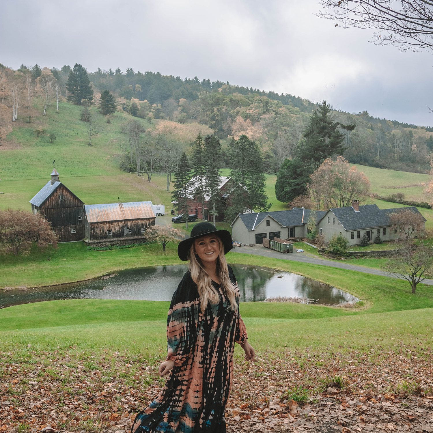
This 1,519-mile route is the gold standard for East Coast leaf peepers who want maximum color variety and zero wasted driving. Start in early October near the Canadian border in northern New Hampshire, where the first hard frosts trigger peak color, then work your way south as the season progresses through lower elevations.
The route flows naturally: Connecticut River Byway through Vermont (with stops in Stowe and the Green Mountains), into the Berkshires of Massachusetts, then the Shawangunk Mountains Scenic Byway in New York. From there, cut through Pennsylvania and hit Shenandoah National Park’s Skyline Drive in Virginia, which connects directly to the Blue Ridge Parkway—the route’s grand finale where you’ll catch peak foliage in mid-to-late October as you descend toward the Smokies.
- Best for: Road trippers who want the full East Coast experience without flying back and forth or backtracking.
- Timing: Early October start in New Hampshire; peak foliage hits the Smokies by late October.
- Insider move: Don’t rush the Blue Ridge Parkway—it’s the payoff. Plan 2–3 days minimum on this section alone, stopping at overlooks rather than driving straight through.
- Base yourself: Use small mountain towns along the Blue Ridge (like Asheville, North Carolina) as your anchor for the final leg; they’re walkable, have good restaurants, and put you close to multiple parkway entrances for early-morning drives.
North Shore of Lake Superior to St. Louis

This 935-mile route captures two distinct fall personalities: the dramatic, waterfall-studded boreal forests of Minnesota’s North Shore, then transitions into the rolling Midwest hardwoods as you head south. It’s the move if you want waterfalls AND foliage—a combo most other routes skip.
Begin in October at Grand Portage State Forest and Superior National Forest in northeastern Minnesota, where the North Shore Scenic Drive hugs Lake Superior’s shoreline. The massive conifers mixed with birch and aspen create a fiery-meets-evergreen palette you won’t see elsewhere.
From there, head south toward St. Louis, where the route transitions into classic Midwest oak and maple country with softer, more muted tones than New England.
- Best for: Travelers who want fewer crowds than the East Coast, dramatic water views, and a slower pace through smaller towns.
- Timing: October throughout; peak color on the North Shore hits early-to-mid October, while southern sections peak later in the month.
- Why it works: You’re chasing the color wave south, so timing is forgiving—start whenever works for your schedule and you’ll hit peak somewhere along the route.
- Base yourself: Use Duluth, Minnesota (where Lake Superior meets the city) as your North Shore anchor; it’s walkable, has good lodging and restaurants, and puts you minutes from the scenic drive. For the southern leg, small towns along the Mississippi River offer quieter overnight stops.
St. Louis to Lost Maples, Texas
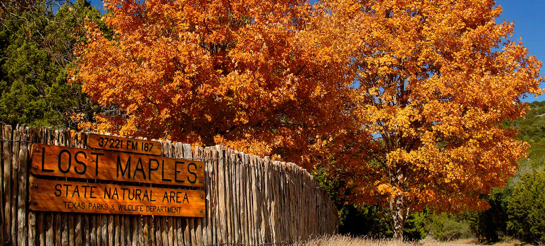
This route is the wildcard—it’s the only multi-state itinerary that extends fall foliage season into late October and early November by dropping south into Texas hill country. At 1,000+ miles, it’s the longest of the three, but it rewards patience with a completely different landscape and fewer tourists than the northern routes.
Leave St. Louis in mid-to-late October and drive south through the Ozarks, where oak and hickory create a warm, golden palette. The real payoff is Lost Maples State Natural Area in the Texas Hill Country, where native bigtooth maples (rare in Texas) turn brilliant red and orange in late October through early November—often 2–3 weeks after peak color fades elsewhere in the country.
This is the only place in Texas where you’ll see true New England–style foliage.
- Best for: Travelers with flexible schedules who want to extend fall into November, or anyone based in the South who doesn’t want to drive 20+ hours to New England.
- Timing: Mid-to-late October departure; Lost Maples peaks late October through early November, typically around the second week of November.
- Why it’s underrated: Most road trippers don’t know Lost Maples exists, so you’ll have the trails and scenic overlooks mostly to yourself while New England is mobbed.
- Insider detail: Lost Maples is a state park with limited capacity—arrive early in the day or visit on weekdays to avoid parking lot full signs. The park’s Maple Trail (10.6 miles round-trip) is the best vantage point for color; start before 9 a.m.
- Base yourself: Bandera or Vanderpool (tiny towns near Lost Maples) offer cabin rentals and small inns within 20–30 minutes of the park. These towns are quiet and rural—perfect for a slower-paced finale to a long road trip.
Quick Comparison: Which Route Wins for Your Trip?
| Route | Distance | Best Timing | Peak Foliage Window | Best For |
|---|---|---|---|---|
| New England to Smokies | 1,519 miles | Early October start | October throughout | Maximum variety, East Coast classics, crowds accepted |
| Lake Superior to St. Louis | 935 miles | October anytime | October throughout | Waterfalls + foliage, fewer crowds, Midwest charm |
| St. Louis to Lost Maples | 1,000+ miles | Mid-October start | Late October–early November | Extended fall season, solitude, unique Texas foliage |
The honest take: New England to the Smokies is the most scenic and most crowded. Lake Superior to St. Louis offers the best balance of beauty and breathing room.
St. Louis to Lost Maples is the move if you want to avoid peak-season traffic and extend fall into November—but only if you’re willing to drive longer for a more subtle payoff.
When Is the Best Time to Visit for Peak Foliage?
Peak foliage timing shifts dramatically across the country—start too late in New England and you’ll find bare branches; start too early in the Southwest and you’ll miss color entirely. The rule is simple: colors peak earlier in the north and at high elevations, later in the south and at lower elevations.
This means your road trip timing depends entirely on which region you’re driving, not just which week sounds convenient.
Timing for New England and Appalachians
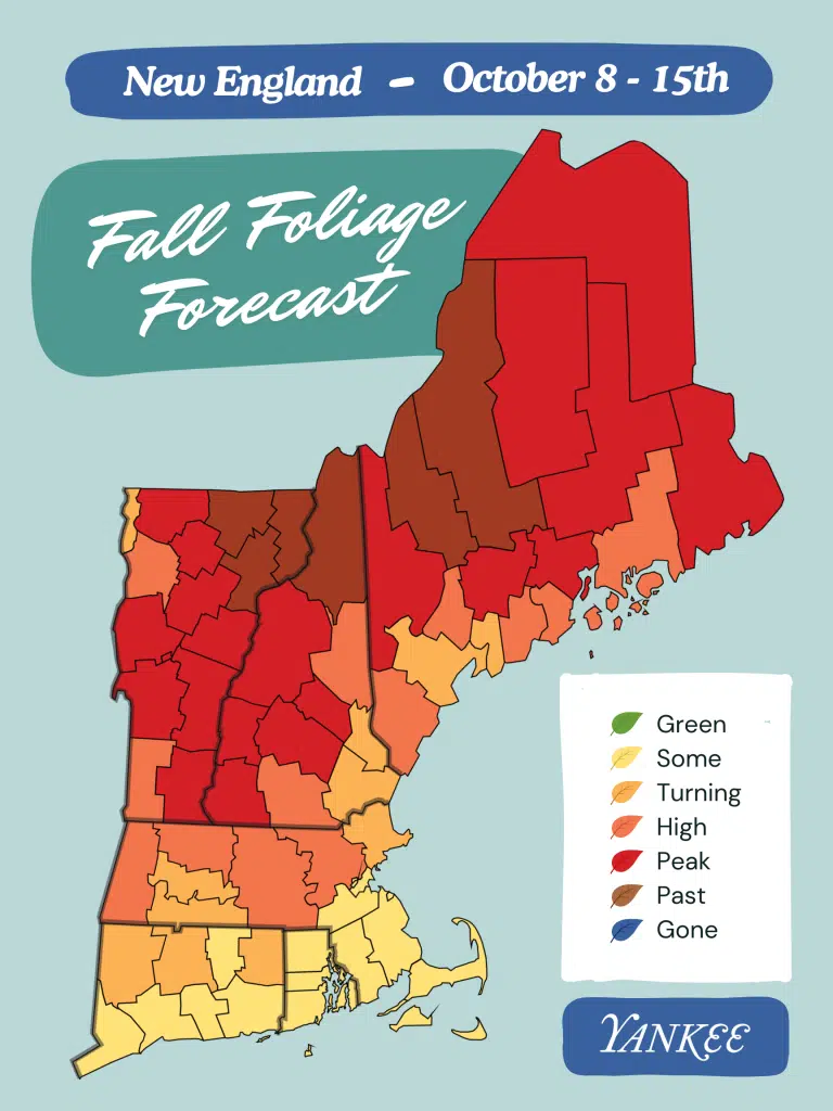
Early October is peak leaf-peeping time for New England—specifically the second week of October, when Hipcamp community photos and reviews cluster most heavily. Start your New England to the Smokies route in early October near the New Hampshire-Canada border, then work your way south through Vermont’s Green Mountain Byway (mid-September through mid-October delivers the best views here), Massachusetts, and into the Berkshires.
By the time you reach Shenandoah National Park’s Skyline Drive and the Blue Ridge Parkway in Virginia and North Carolina, you’ll catch mid-to-late October color as the foliage wave moves south.
- New Hampshire and Vermont: Early October—colors peak first at high elevations and northern latitudes.
- Massachusetts (Mohawk Trail, Berkshires): Mid-October—the 69-mile Mohawk Trail from Athol to the Atlantic coast hits peak color roughly one week after Vermont.
- Blue Ridge Parkway (Virginia to North Carolina): Late October through early November—lower elevations and southern latitude mean color arrives last; this is your final stop on an East Coast road trip.
Base yourself in small mountain towns along these routes—Stowe, Vermont and Asheville, North Carolina are natural overnight stops that position you for early-morning drives and evening hikes without fighting resort crowds.
Timing for Midwest and Great Lakes
Mid-September through mid-October is the window for Door County and the Upper Peninsula, with peak color arriving earlier than you’d expect. Door County’s 80-mile peninsula sees its best foliage mid-September through mid-October—earlier than New England because of its northern latitude and Great Lakes influence.
The Upper Peninsula of Michigan follows a similar timeline, typically peaking in late September through early October. The North Shore of Lake Superior to St. Louis route works best if you start in late September in Minnesota and Wisconsin, then drift south through Ohio’s Hocking Hills Scenic Byway (typically peaking in mid-to-late October) before reaching Missouri.
- Door County, Wisconsin: Mid-September through mid-October—the earliest peak in the Midwest; avoid summer crowds entirely by going in fall.
- Upper Peninsula, Michigan: Late September through early October—slightly later than Door County but still earlier than southern routes.
- Hocking Hills, Ohio: Mid-to-late October—lower elevation means color arrives after northern Michigan and Wisconsin.
Sturgeon Bay, Wisconsin (Door County’s largest town at 9,000 people) and small lakeside villages make logical overnight bases; they’re quiet in fall and position you for the next day’s drive south.
Timing for Rockies and Southwest
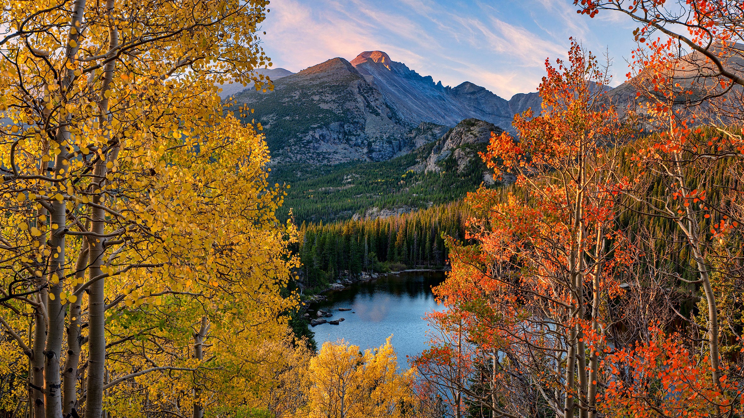
Late September through early October for high-elevation Rockies; mid-to-late October for lower-elevation desert routes. The Rocky Mountain National Park to Santa Fe route peaks in two distinct windows: late September through early October at high elevations in Colorado, then mid-to-late October as you descend toward New Mexico’s lower elevations and southern latitude.
The St. Louis to Lost Maples, Texas route requires patience—colors don’t peak in Texas until late October or early November, making this a late-season option if you’re chasing foliage across multiple regions.
- Rocky Mountain National Park and Million Dollar Highway, Colorado: Late September through early October—high elevation means early peak.
- Santa Fe and northern New Mexico: Early to mid-October—lower than Colorado peaks but still earlier than southern destinations.
- Lost Maples State Natural Area, Texas: Late October through early November—the latest peak in this article’s routes; bigtooth maples turn brilliant red, but only after frost arrives.
Timing for Pacific Northwest and California
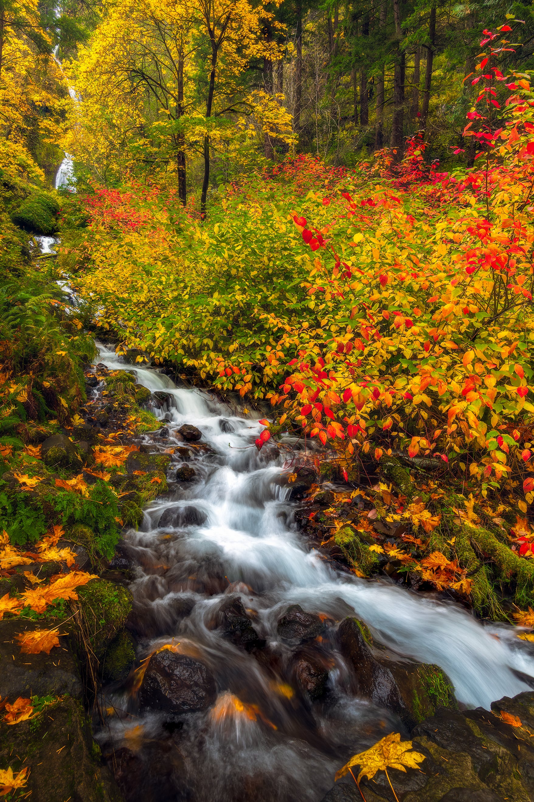
Late September through mid-October for the Columbia River Gorge; October through early November for the Bellingham to Mammoth Lakes route. The Columbia River Gorge Scenic Byway in Oregon peaks in late September through mid-October as temperatures drop and deciduous trees turn gold and red.
The longer Bellingham, Washington to Mammoth Lakes, California route requires a more flexible timeline: start in late September in Washington’s temperate zones, move through Oregon in early October, and reach California’s high-elevation areas (Mammoth Lakes) by mid-to-late October when aspen groves turn gold. This route’s length means you’re chasing color across a month-long window rather than hitting one peak week.
- Columbia River Gorge, Oregon: Late September through mid-October—shorter window but reliable color.
- Bellingham to Mammoth Lakes route: Late September through early November—plan for a 2-3 week drive to catch color at each elevation zone.
Use the Hipcamp fall foliage map as your planning tool—it predicts optimal foliage timing by county using machine learning and community photo data, removing guesswork from your route planning. Fall foliage is notoriously difficult to predict year to year, but this map accounts for weather patterns and historical data to give you the most reliable window for each region you’re driving.
Frequently Asked Questions
When exactly should I leave to catch peak fall colors on these routes?
Peak timing depends entirely on latitude and elevation. New England routes (Mohawk Trail, Green Mountain Byway, Acadia) typically peak in mid-September through mid-October, with northern Maine hitting its best colors first.
The Blue Ridge Parkway follows a south-to-north progression, so starting in Virginia in late September and driving north into North Carolina extends your color window into October. The Midwest (Door County, Upper Peninsula) peaks mid-September through mid-October.
Mountain routes in Colorado and the Rockies peak later—typically late September through early October depending on elevation. Rather than guessing, check the US Forest Service fall foliage forecast 2-3 weeks before your planned dates; it updates weekly and accounts for weather patterns that shift peak timing by days or even weeks year to year.
Do I need reservations for camping or lodging on these routes, or can I wing it?
Winging it in peak fall season is a gamble that usually loses. Popular routes like the Blue Ridge Parkway, Acadia, and Door County draw crowds specifically because the foliage is stunning—campgrounds and roadside lodging fill 4-6 weeks ahead.
Book accommodations at least 4-6 weeks before your trip if traveling in September or early October. For more flexibility and spontaneity, use Hipcamp’s Roadtrip search tool: plug in your starting and ending points, and it shows unique camping and lodging options within 30 minutes of your custom route, letting you find available sites even on shorter notice.
If you’re willing to adjust your route slightly or stay in smaller towns off the main highways, last-minute options exist—but they won’t be on the most famous scenic stretches.
How long should I plan for a full autumn road trip, and which routes work best for different trip lengths?
A meaningful fall foliage road trip needs at least 4-5 days to avoid feeling rushed. A single route like the Mohawk Trail (69 miles) or Door County (80 miles) works perfectly for a long weekend—drive it slowly, stop for hikes and small-town exploration, and base yourself in one or two towns.
For a week-long trip, combine two adjacent routes: New England to the Smokies (covering Acadia, Green Mountain Byway, and Blue Ridge Parkway) or the North Shore of Lake Superior to St. Louis route. Two-week trips allow you to tackle multi-state itineraries like St. Louis to Lost Maples, Texas, which maximizes endless autumn by chasing colors southward as northern routes fade.
Shorter trips (2-3 days) work only if you pick one concentrated route and accept that you’ll see it once rather than linger.
What’s the best way to find camping and unique stays along these routes without losing flexibility?
Hipcamp’s Roadtrip search is built exactly for this: enter your start and end points, and the map connects them while showing all available campsites, cabins, and unique lodging within 30 minutes of your custom route. This approach beats booking a rigid hotel itinerary because you can adjust your route based on where colors are actually peaking, weather, or spontaneous detours.
Arrive a few days before your expected peak foliage date—if an untimely windstorm strips leaves early, you’ll still catch decent color rather than arriving to bare branches. For budget-conscious travelers, camping along these routes costs significantly less than hotels and puts you closer to the scenery; pair it with budget road-trip tips (cooking some meals, skipping paid attractions some days) to extend your trip length without overspending.
Book Your Route and Chase the Color South
Pick your route based on how many days you have and whether you want crowds or solitude: the Blue Ridge Parkway wins for sheer scenic intensity if you have 4–5 days, but Door County delivers equal beauty with a fraction of the traffic if you want a long weekend. Reserve lodging 4–6 weeks ahead for peak season (early October), or use Hipcamp’s Roadtrip search to find flexible camping and cabin options along your custom route.
The real magic of autumn road trips is that you’re not just driving past trees—you’re stopping in small towns, hiking to overlooks, eating dinner where locals eat, and arriving at each overlook when the light is actually good. This is the kind of trip that justifies a week away from home.
Start planning your route today using the timing windows in this guide, check the US Forest Service foliage forecast for your chosen region, and book your first night’s lodging—the rest will unfold as you drive south and watch the color change.
Leave a Reply