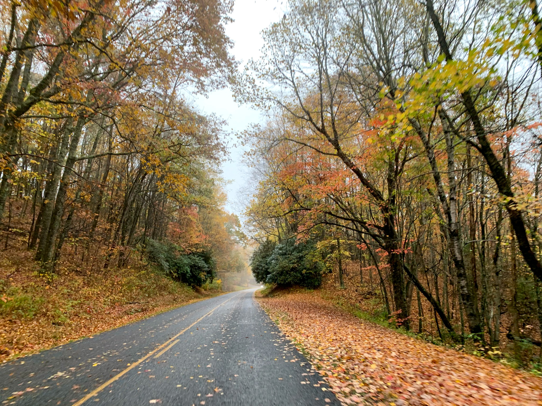
Imagine winding through a tunnel of fiery amber and deep crimson, the crisp mountain air carrying the scent of damp earth and pine. Golden leaves dance across your windshield as the morning mist lifts to reveal endless, layered blue ridges painted in autumn’s best hues.
This isn’t just a road trip; the Blue Ridge Parkway fall colors drive is a 469-mile elevation-dependent spectacle where you can chase the peak foliage for weeks. Unlike standard highways, this slow-paced, federally protected route bans commercial trucks and billboards, keeping your eyes locked entirely on the canopy.
This guide will help you decide exactly when to go, which direction to drive, and which iconic overlooks are actually worth your time. Whether you plan a budget trip using camp spots ($100–$150/day), a mid-range getaway in cozy mountain towns ($200–$350/day), or a splurge-worthy retreat in historic peaks ($500+/day), I have you covered.
The Quick-Read Blueprint for Your Fall Drive
Short on time? Here is the ultimate cheat sheet to help you plan the perfect leaf-peeping road trip without the stress.
- The Winning Route: Drive North to South (Virginia to North Carolina) to follow the natural descent of the foliage.
- The Sweet Spot Timing: Aim for mid-October to catch the most vibrant colors across the majority of the mid-elevation sections.
- Must-Stop Photo Spots: Do not miss the iconic Mabry Mill for rustic charm, or the engineering marvel of the Linn Cove Viaduct.
- Best Quick Hike: Trek the short boardwalk at Rough Ridge for jaw-dropping gorge views, or take the flat walk to Roaring Fork Falls.
- Top Cultural Break: Stop by the Folk Art Center near Asheville to browse authentic mountain crafts.
What is the Blue Ridge Parkway Fall Colors Drive?
The Blue Ridge Parkway is a 469-mile ribbon of asphalt that serves as the premier corridor for experiencing the Appalachian autumn, stretching from the Shenandoah National Park in Virginia to the Great Smoky Mountains in North Carolina. Unlike a standard highway, this federally managed route is designed specifically for leisure, featuring a low speed limit that forces you to slow down and actually see the landscape.
It is not just a drive; it is a multi-week, elevation-dependent phenomenon where the forest canopy shifts from deep greens to brilliant oranges, reds, and golds.
For any traveler planning a trip, the Parkway functions as a massive, vertical laboratory for fall foliage. Because the route climbs from roughly 2,500 feet to over 6,000 feet in elevation, the “peak” does not happen all at once.
Instead, the colors descend from the high-altitude ridges in North Carolina down into the valleys of Virginia over several weeks. I recommend viewing this as a long-form road trip rather than a single-day excursion; attempting to see the entire length in one go is a mistake that leaves you exhausted rather than inspired.
Why This Drive Wins
- Unrivaled Accessibility: You do not need to be a backcountry hiker to see the best views. The most iconic vistas are accessible directly from your car or via short, well-maintained walks from designated overlooks.
- Strategic Elevation Changes: Because the Parkway traverses such a vast range of altitudes, you have a much higher success rate of catching peak color compared to a static location. If you miss the peak at higher elevations, you can simply drive to a lower section to find the color waiting for you.
- The “Slow Road” Experience: With no commercial billboards or heavy truck traffic, the Parkway provides an immersive experience that keeps you focused on the changing forest rather than navigation or speed.
Planning Your Timing and Strategy
If you are serious about catching the peak, you must book your overnight stays months in advance. October is the busiest month on the Parkway, and lodging near popular hubs like Asheville or Blowing Rock fills up rapidly.
I recommend checking the official Parkway webcams and regional fall color reports in the two weeks leading up to your departure to adjust your itinerary based on current weather patterns.
My top recommendation: Prioritize your time in the North Carolina section if you want the most dramatic, high-altitude mountain vistas. While the Virginia section offers a beautiful, rolling pastoral experience, the North Carolina portion—specifically around areas like Black Balsam Knob and Graveyard Fields—provides the rugged, high-elevation scenery that defines the classic Blue Ridge aesthetic.
If you are short on time, focus your efforts between Asheville and the Great Smoky Mountains for the most concentrated “wow” factor.
Practical Action: Download a digital tour guide or map before you lose cell service. The Parkway is notorious for signal dead zones, and you do not want to miss a turn-off for a prime overlook because your GPS failed to load.
When is the Best Time to See the Fall Colors?
Timing your drive along the Blue Ridge Parkway requires balancing elevation shifts with the calendar, as the “peak” is not a single day but a cascading event that moves down the mountains. Because the Parkway spans from roughly 600 feet to over 6,000 feet in elevation, the foliage transformation typically begins in the high-altitude regions of North Carolina in early October and descends into the lower valleys and Virginia sections by mid-to-late October.
Peak Foliage Timing by Elevation and State
To maximize your chances of seeing peak color, prioritize your travel window based on the specific section of the road you plan to explore. If you are targeting the high-elevation zones in North Carolina—such as the areas near Mount Pisgah and Graveyard Fields—plan your trip for the first two weeks of October.
If your itinerary focuses on the lower-elevation stretches in Virginia, aim for the third week of October. Keep in mind that these are planning baselines; the exact timing fluctuates annually based on late-summer temperatures and rainfall.
- Early October: Focus on high-elevation North Carolina segments (above 5,000 feet). This is the best time for photographers looking to capture the first vibrant reds and oranges at spots like Black Balsam Knob.
- Mid-October: This is the “sweet spot” for the majority of the Parkway. The colors are typically at their most brilliant across the middle elevations in both North Carolina and southern Virginia.
- Late October: Ideal for the northern sections of the Parkway in Virginia. If you missed the peak further south, the lower-altitude forests here often provide a final, stunning display as the season concludes.
How Weather Impacts Leaf Color Vibrancy
The intensity of the fall display is highly sensitive to the weather in the months leading up to October. A summer with adequate rainfall followed by a dry, cool September typically produces the most vibrant, long-lasting colors.
Conversely, extreme heat or drought during the late summer can cause leaves to brown and drop prematurely, leading to a muted season. Because conditions change rapidly, I recommend checking the official Blue Ridge Parkway fall color webcams and the weekly Fall Color Update reports provided by the National Park Service or regional mountain life outlets before finalizing your departure date.
Pro Tip: Because October is the most popular month for this drive, lodging fills up months in advance. If you have your heart set on a specific mountain inn or lodge, secure your reservation as soon as your travel dates are set.
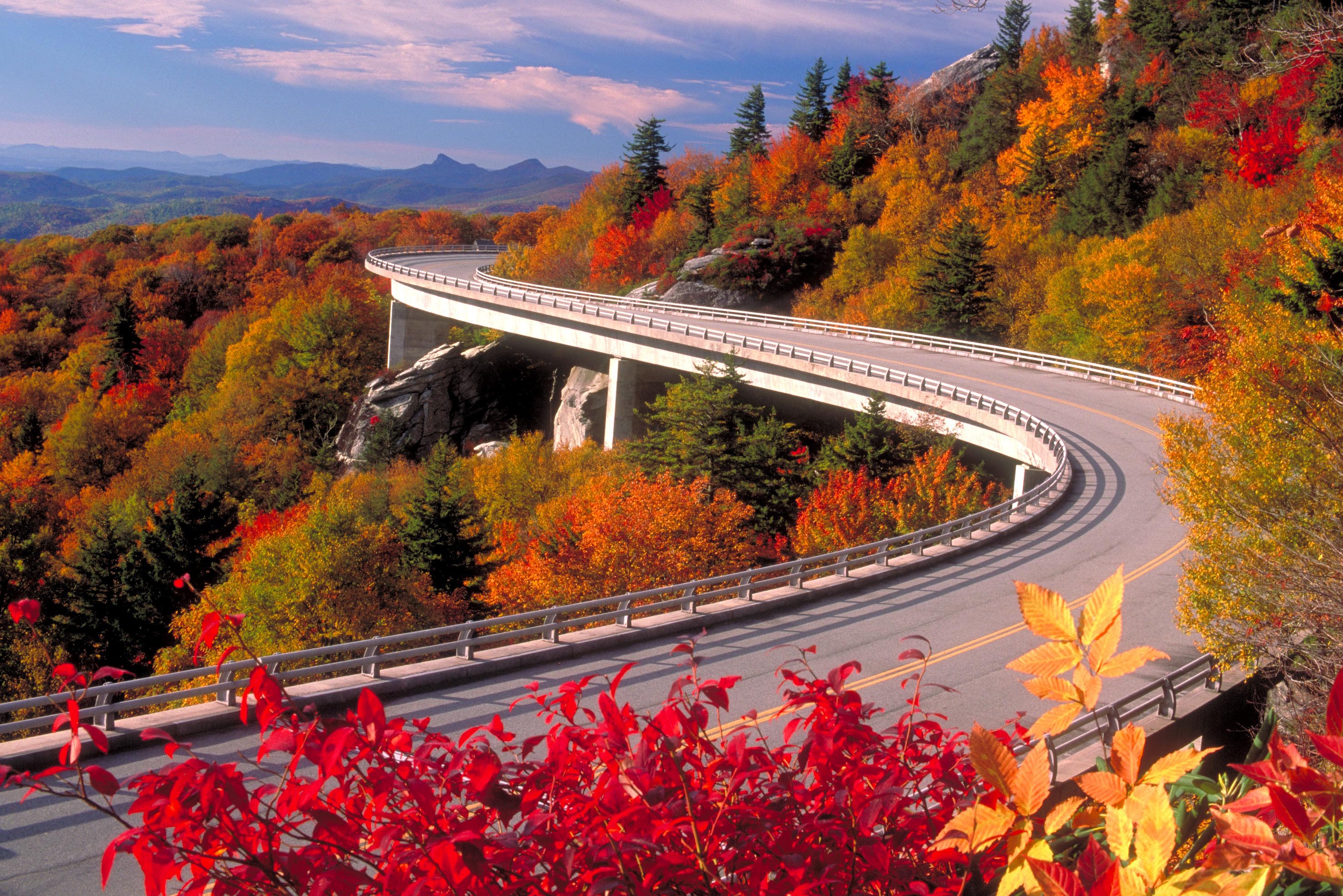
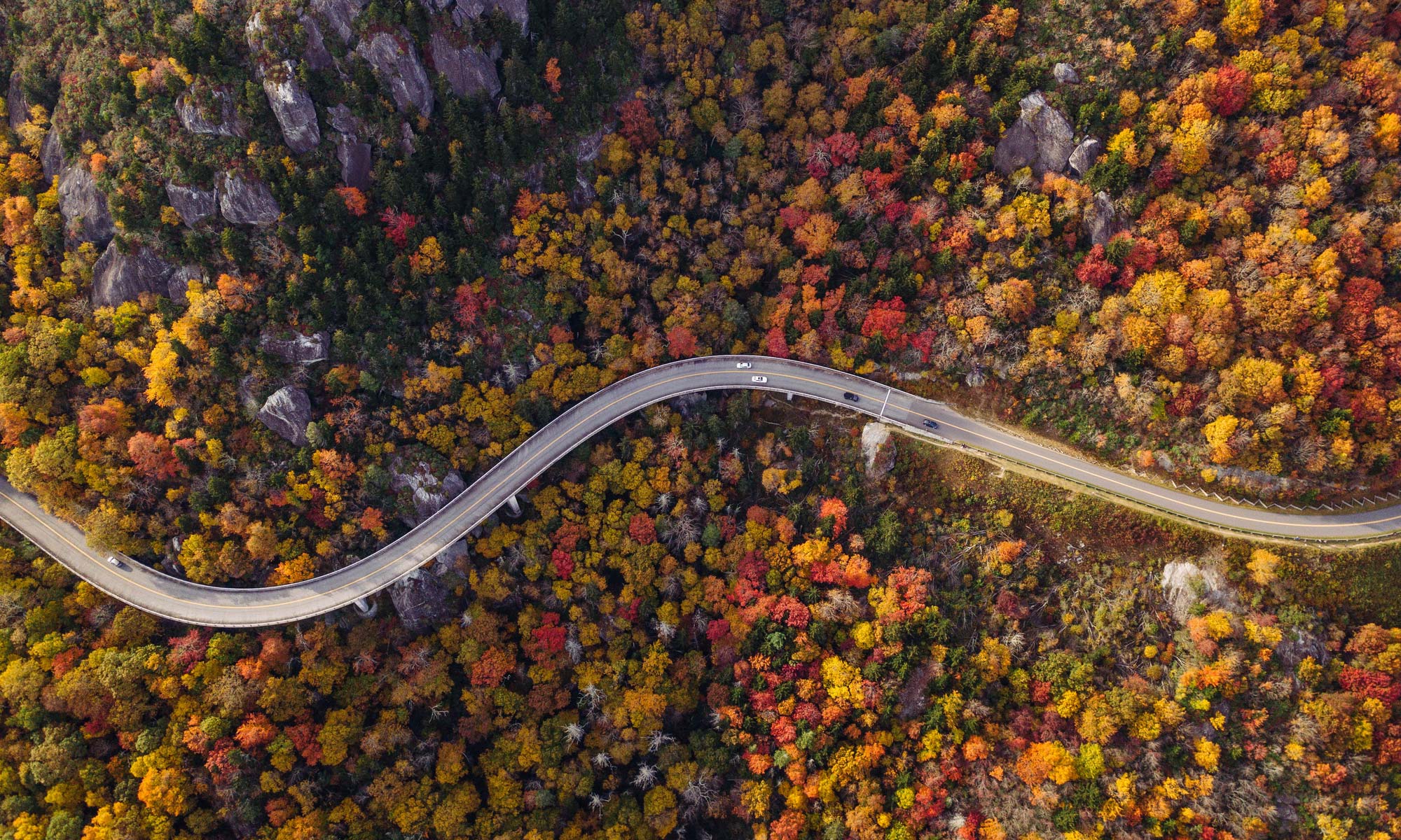
If you are flexible, you can often find better availability by booking a mid-week trip rather than a weekend, which also helps you avoid the heaviest traffic at popular overlooks like the Linn Cove Viaduct.
Which Direction and Route Itinerary Should You Drive?
Driving the Blue Ridge Parkway is not just a commute; it is a deliberate, 469-mile immersion into the changing seasons that demands a strategic approach to avoid backtracking and maximize your time in the golden light. While you can drive in either direction, I recommend a North-to-South route starting in Virginia and ending in the Great Smoky Mountains of North Carolina.
This flow allows you to follow the progression of the foliage as the higher elevations in the south hit their peak later in the season, effectively extending your window for prime leaf-peeping.
Why You Should Drive North to South (Virginia to Tennessee)
Driving North to South is the superior choice for fall travelers because it aligns your journey with the natural descent of the color change. As you move from the rolling, lower-elevation ridges of Virginia into the rugged, high-altitude peaks of North Carolina, you are chasing the peak colors rather than racing against them.
This direction also places the sun at your back for much of the morning, providing better lighting for photography at the iconic overlooks.
The Recommended 5-Day Driving Itinerary
Five days is the sweet spot for this trip. It allows you to maintain a relaxed pace, stopping for hikes and photography without feeling the pressure to rush through the 469-mile stretch.
Use this breakdown to plan your overnight stops in mountain inns or gateway towns.
- Shenandoah to Roanoke (Milepost 0 to 120): Start your journey at the northern terminus. This section is defined by gentle, pastoral landscapes. Spend your first night in the Roanoke area, which offers the most robust selection of downtown hotels and dining.
- Roanoke to Fancy Gap (Milepost 120 to 200): This stretch offers a transition into the more rural, high-plateau sections of Virginia. It is best for travelers who enjoy quiet, rolling vistas. I recommend finding a cabin or mountain lodge near Fancy Gap for a peaceful second evening.
- Fancy Gap to Blowing Rock (Milepost 200 to 291): As you cross into North Carolina, the elevation begins to climb. Blowing Rock is a quintessential mountain town; it is the perfect base for your third night, offering walkable streets and easy access to the high-country trails.
- Blowing Rock to Asheville (Milepost 291 to 382): This is arguably the most dramatic section of the drive, featuring the engineering marvels and high-altitude overlooks. Asheville is a major hub, so book your fourth-night accommodation well in advance if you are visiting during the October peak.
- Asheville to Great Smoky Mountains (Milepost 382 to 469): The final leg takes you through the highest peaks of the entire parkway. This is the most rugged terrain, best suited for those who want to end their trip with high-elevation hiking and misty, layered mountain views before reaching the park entrance.
Practical Action: Always check the official Parkway website for real-time road closures before departing each morning. Mountain weather can force unexpected maintenance or safety closures, and having a flexible route plan is the hallmark of a seasoned Blue Ridge traveler.
Top 10 Scenic Stops and Overlooks for Fall Foliage
The Blue Ridge Parkway spans 469 miles, but these ten specific vantage points offer the most reliable, high-impact views of the autumn canopy. Because elevation dictates the timing of the color change, you will find that these stops provide a staggered experience, allowing you to chase the peak foliage from north to south as the season progresses.
| Stop | Milepost | Best For | Why It Wins |
|---|---|---|---|
| Peaks of Otter | 85.6 | History & Vistas | Classic mountain lake reflection |
| Mabry Mill | 176 | Photography | Iconic rustic watermill setting |
| Wildcat Rocks | 236.6 | Dramatic Views | Unobstructed valley overlooks |
| Rough Ridge | 302.8 | Short Hikes | Boardwalk views over the gorge |
| Linn Cove Viaduct | 304.4 | Engineering Fans | Architectural marvel amid trees |
| Linville Falls | 316 | Waterfall Chasers | Multi-tiered cascades |
| Mount Pisgah | 408.6 | Iconic Peaks | Signature silhouette views |
| Black Balsam Knob | 420.2 | Panoramic Vistas | 360-degree high-altitude views |
| Graveyard Fields | 420.2 | Early Color | High-elevation foliage |
| Waterrock Knob | 451.2 | Sunsets | Highest visitor center elevation |
1. Peaks of Otter (Milepost 85.6)
This stop is the move for those who want a quintessential mountain lake shot without a strenuous hike. I recommend arriving at sunrise to catch the reflection of the surrounding ridges in Abbott Lake.
Skip this if you are looking for rugged, high-altitude terrain, as this is a more tranquil, pastoral setting.
2. Mabry Mill (Milepost 176)
Mabry Mill is the most photographed spot on the entire Parkway for a reason. It is best for travelers who love cultural history and rustic aesthetics.
If you are on a tight schedule, this is a quick win, but expect crowds—arrive before 9:00 a.m. to secure a parking spot.
3. Wildcat Rocks Overlook (Milepost 236.6)
This overlook is the best choice for those seeking a dramatic, sheer-drop view of the valley floor. It is less crowded than the northern stops, making it a perfect place to pull over for a quiet moment.
It wins for its raw, unfiltered perspective of the Blue Ridge escarpment.
4. Rough Ridge (Milepost 302.8)
If you only do one short hike, make it the boardwalk at Rough Ridge. It is the best way to see the Linn Cove Viaduct winding through the colorful canopy below. It is best for active travelers, but skip it if you cannot handle uneven wooden steps.
5. Linn Cove Viaduct (Milepost 304.4)
This is a marvel of modern engineering that hugs the side of Grandfather Mountain. It is best viewed from the visitor center trails rather than from your car, as the perspective from below highlights the scale of the structure against the fall colors.
6. Linville Falls (Milepost 316)
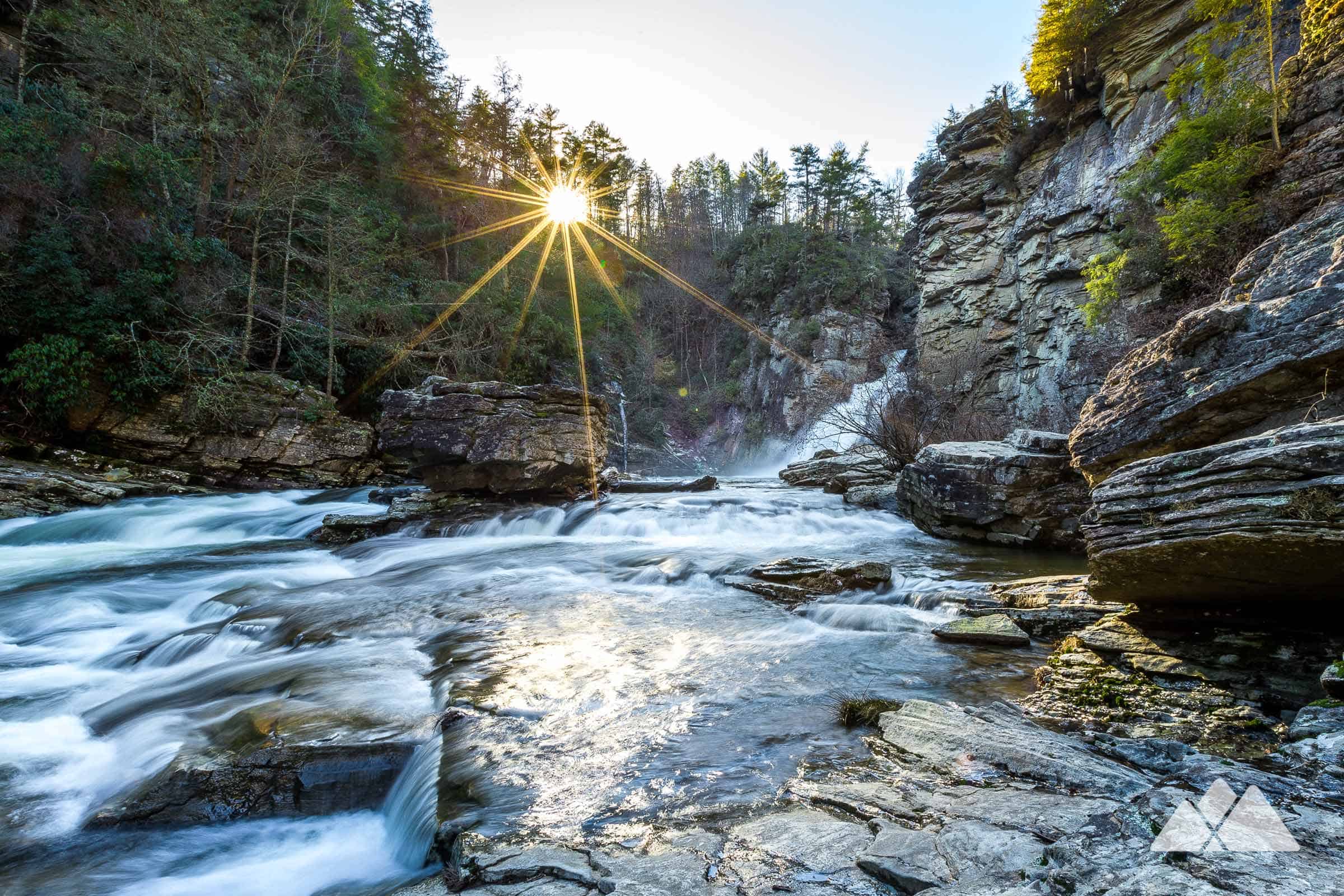
Linville Falls is the premier stop for waterfall enthusiasts. The trails here offer multiple vantage points of the tiered falls framed by vibrant maples and oaks. It is best for those who want a mix of forest immersion and water features.
7. Mount Pisgah and Pisgah Inn (Milepost 408.6)
Mount Pisgah is a landmark that defines the Asheville-area skyline. The inn here is a prime base for travelers who want to stay directly on the Parkway, though you must book months in advance for October dates.
It wins for its proximity to high-elevation hiking trails.
8. Black Balsam Knob and Graveyard Fields (Milepost 420.2)
Because of their high elevation (over 5,000 feet), these two spots are usually the first to show color. Black Balsam Knob offers a rare, treeless, 360-degree view that feels like the Scottish Highlands.
Graveyard Fields is the best spot for an early-season visit, but it is extremely popular—expect limited parking and heavy foot traffic.
9. Devil’s Courthouse (Milepost 420.2)
This stop provides a steep, short climb to a rocky summit with sweeping views. It is best for those who want a high-reward, quick-effort summit experience.
The view is particularly striking during the peak of the season when the valley below is ablaze with color.
10. Waterrock Knob (Milepost 451.2)
As the highest visitor center on the Parkway, Waterrock Knob is my pick for a sunset finale. It is the best place to watch the light fade over the Great Smoky Mountains.
It is a must-stop for photographers, but bring a jacket, as temperatures drop significantly at this altitude.
Summary: To maximize your trip, prioritize the high-elevation stops (Black Balsam and Waterrock) if you are traveling in early October, and focus on the lower-elevation stops (Mabry Mill and Peaks of Otter) if your trip falls later in the month. Always check the official Parkway website for current road closures before departing.
Best Waterfalls and Hikes Along the Autumn Route
The true magic of the Blue Ridge Parkway in autumn lies beyond the overlooks; you must step onto the trails to experience the canopy’s transformation up close. While the drive offers panoramic vistas, these specific hikes provide the intimate, immersive forest experience that defines a mountain fall.
| Hike | Difficulty | Best For |
|---|---|---|
| Crabtree Falls | Moderate/Strenuous | Waterfall chasers |
| Roaring Fork Falls | Easy | Quick, high-reward photo ops |
| Boone Fork Trail | Moderate | Diverse terrain and stream views |
| Log Hollow Falls | Easy/Moderate | Solitude seekers |
Crabtree Falls and Roaring Fork Falls
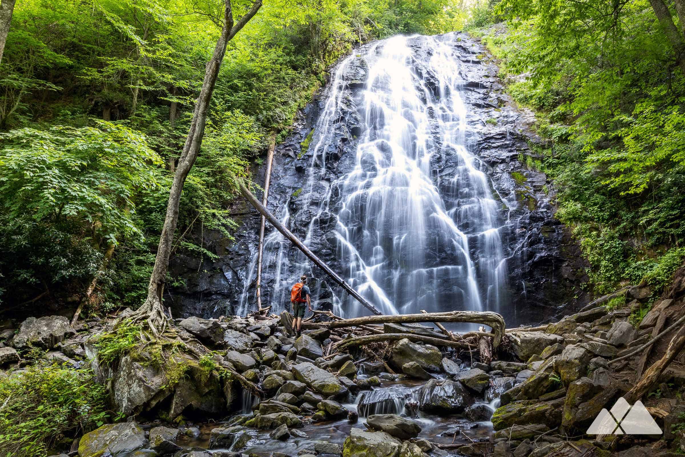
Crabtree Falls is the move if you want a dramatic, multi-tiered waterfall experience, but be prepared for a steep climb on the return trip. It is best for hikers who don’t mind a workout to earn their view; skip this if you have knee issues or limited time.
For a much lower-effort alternative, Roaring Fork Falls is a short, flat walk through a lush forest that feels especially vibrant when the late-October leaves begin to carpet the ground. I recommend Roaring Fork for families or those who just want a quick, beautiful stop without the heavy lifting.
Hebron Falls and Boone Fork Trail
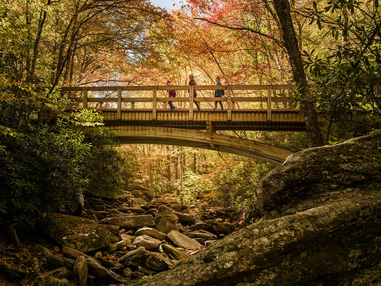
The Boone Fork Trail is my top pick for variety, looping through meadows, dense forest, and along the rocky banks of the stream. Hebron Falls, located along this loop, features massive boulders that make for a perfect, albeit chilly, autumn lunch spot.
This trail is ideal for those who want to spend a half-day immersed in the changing colors. If you are basing yourself in nearby Blowing Rock, this is an essential morning outing before the afternoon crowds arrive at the more famous overlooks.
Log Hollow Falls and Cove Creek Falls

Log Hollow Falls and Cove Creek Falls are the hidden gems of the Pisgah National Forest area. These trails are significantly quieter than the main parkway stops, making them the best choice for travelers who want to escape the leaf-peeping traffic.
Log Hollow is a gentle, shaded walk that feels like a private sanctuary, while Cove Creek offers a more rugged, adventurous feel. I recommend these for anyone who prefers a tranquil, off-the-beaten-path hike over the high-traffic tourist hotspots.
Pro Tip: Always pack layers and sturdy, waterproof boots. Even if the trailhead is sunny, the mist from these waterfalls and the high-elevation mountain air can drop temperatures significantly.
For the best experience, start your hikes before 9:00 AM to secure parking at these popular trailheads and enjoy the soft morning light hitting the foliage.
Essential Visitor Centers and Cultural Stops to Make
The Blue Ridge Parkway is more than just a scenic ribbon of asphalt; it is a living museum of Appalachian heritage that requires strategic stops to truly understand the landscape you are driving through. While the overlooks offer the best photos, the visitor centers provide the necessary context on why these mountains look and feel the way they do.
Major National Park Service Visitor Centers
To navigate the Parkway effectively, prioritize these primary hubs for real-time road status, trail maps, and expert ranger advice on current foliage conditions.
- Humpback Rocks Visitor Center (Milepost 5.8): This is your essential first stop if you are heading south from Virginia. It features a collection of relocated 19th-century farm buildings that illustrate early mountain life. Best for: History buffs and those needing a quick orientation before the climb. Skip if: You are in a rush to reach the higher elevations of North Carolina.
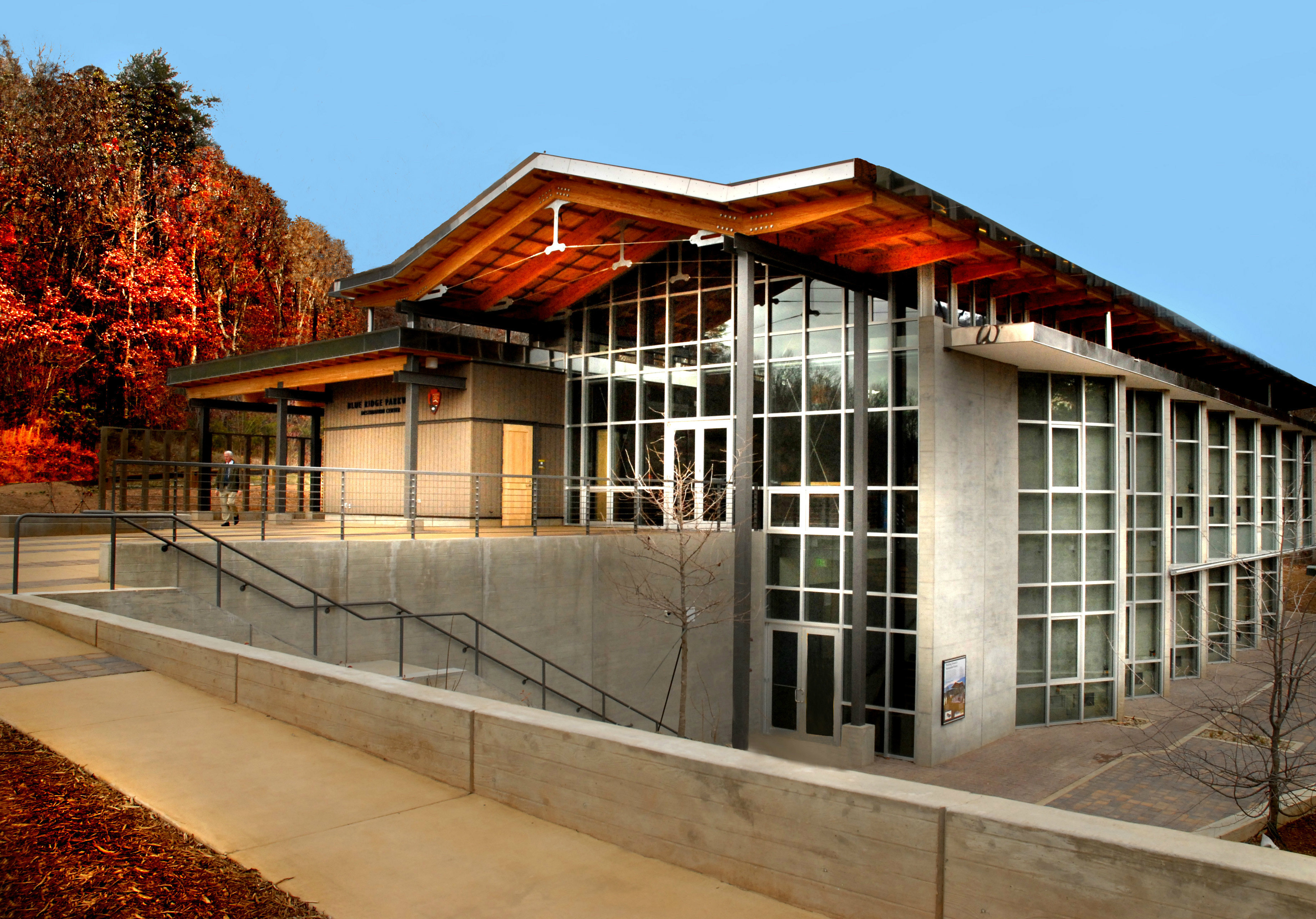
- Blue Ridge Parkway Visitor Center (Milepost 384): Located just outside Asheville, this is the most comprehensive facility on the route. It houses an interactive “Blue Ridge Parkway” map and high-quality exhibits on the natural and cultural history of the region. Best for: Families and travelers who want a deep dive into the Parkway’s construction. Skip if: You prefer smaller, quieter stops.
Museums, Music Centers, and Folk Art Stops
The culture of the Blue Ridge Mountains is defined by its music and craftsmanship; these stops are where you experience the soul of the region.
- Blue Ridge Music Center (Milepost 213): This facility celebrates the roots of American music. During the fall, the outdoor amphitheater often hosts midday performances. Best for: Music lovers and those looking for an authentic cultural experience. Recommendation: Check the schedule online before you leave, as performances are seasonal and weather-dependent.
- Folk Art Center (Milepost 382): Located near the Asheville entrance, this center showcases the finest traditional and contemporary crafts from the Southern Highlands. Best for: Anyone looking for high-quality, authentic souvenirs that support local artisans. Insider Tip: The rotating exhibits are professionally curated and often feature intricate woodworking or weaving that you won’t find in standard gift shops.
Planning Your Stops: When mapping your route, I recommend grouping these stops by their proximity to your overnight base. If you are staying in a mountain inn near Asheville, dedicate a full morning to the Folk Art Center and the nearby Visitor Center at Milepost 384.
For those driving the northern section, Humpback Rocks serves as the perfect mid-morning break. Always confirm operating hours on the National Park Service website, as staffing and seasonal schedules can shift with little notice.
How to Plan and Stay Safe on Your Autumn Road Trip
Planning a successful autumn drive requires more than just picking a date; it demands a strategy for managing the Parkway’s intense October popularity and unpredictable high-altitude weather. The reality of the Blue Ridge Parkway is that you are sharing a narrow, winding road with thousands of other leaf-peepers, so your best defense is an early start and a flexible mindset.
Beating the Heavy October Crowds
The Parkway becomes a bottleneck during peak October weekends, particularly near popular trailheads and overlooks. I recommend hitting the road by 8:00 AM to secure parking at high-traffic spots.
By the time mid-day arrives, the most scenic pull-offs are often completely full, forcing you to skip them entirely. If you plan to stay overnight, book your lodging at least six to nine months in advance, as the best mountain inns and lodges near major hubs sell out quickly for the entire month of October.
Navigating Sketchy Mountain Fog and Weather Changes
Mountain weather is notoriously fickle, and you should be prepared for sudden, dense fog that can reduce visibility to near zero in a matter of minutes. Always keep your headlights on, even during the day, to ensure other drivers can see you through the mist.
Because the Parkway spans elevations from 2,500 to 6,000 feet, temperatures can drop significantly as you climb; what feels like a mild autumn day in the valley can be near-freezing at the higher peaks. Check the official National Park Service webcams and road status reports before you depart each morning to confirm that your intended route is open and clear of weather-related closures.
Packing Essentials: Layers, Navigation, and Food Logistics
Successful navigation of the Parkway requires preparation for the lack of services directly on the road. You will not find gas stations or restaurants every few miles, so plan accordingly.
- Layered Clothing: Pack a windproof jacket and fleece, as the wind chill at high-elevation overlooks is significantly colder than at ground level.
- Offline Navigation: Cell service is spotty to non-existent for large stretches of the drive. Download offline maps and consider a GPS-based audio tour guide to keep you oriented without relying on a data signal.
- Food and Water: Carry a cooler with enough water and snacks for the entire day. Relying on parkway concessions is a gamble due to long lines and limited operating hours during the busy fall season.
- Emergency Kit: Keep a basic roadside emergency kit in your trunk, including a flashlight, extra layers, and a physical map of the Blue Ridge region.
The bottom line: The most successful travelers treat the Parkway as a slow-paced experience rather than a transit route. Prioritize your stops based on the morning’s weather report, keep your gas tank topped off in gateway towns like Roanoke or Asheville, and always carry extra layers for the sudden temperature shifts at higher elevations.
Frequently Asked Questions
Is the Blue Ridge Parkway crowded during the fall?
Expect significant congestion, particularly on weekends in October. The Parkway is a premier destination for leaf-peepers across the country, and popular overlooks and trailheads often reach parking capacity by mid-morning.
If you want to avoid the worst of the traffic, I recommend driving on weekdays and starting your daily segments as early as possible—ideally before 9:00 AM.
Do I need to book my lodging in advance for a fall trip?
Yes, you must book early. Because peak foliage season is a short, high-demand window, mountain inns, lodges, and cabins near major hubs like Asheville and Blowing Rock often sell out months in advance.
If you are planning a trip for October, finalize your accommodation reservations by late spring or early summer to ensure you have a base for your route.
How can I check the current status of the leaves before I drive?
Never rely on a static date for peak color, as weather patterns shift annually. I recommend checking the official National Park Service webcams along the Parkway to see real-time conditions.
Additionally, consult regional fall color reports published by local tourism bureaus, which provide weekly updates on which elevations are currently showing the most vibrant hues.
Are there entrance fees for the Blue Ridge Parkway?
The Blue Ridge Parkway is free to drive. There are no entrance stations or tolls, which makes it one of the most accessible scenic routes in the United States.
While the road itself is free, remember that some nearby state parks or specific attractions may charge their own individual parking or entry fees.
What should I pack for an autumn drive on the Parkway?
Pack for rapidly changing mountain weather. Even if it feels warm at lower elevations, temperatures at higher altitudes—especially at spots like Mount Pisgah—can be significantly colder, particularly in the mornings and evenings.
I suggest dressing in layers, keeping a sturdy rain jacket in the car, and bringing comfortable hiking boots if you plan to get out and explore the trails at places like Graveyard Fields.
Top Decision Factors: For the best experience, prioritize weekday travel to avoid weekend bottlenecks, secure your lodging months ahead of your October departure, and rely on real-time webcams rather than calendar dates to time your arrival with the peak color shift.
How to Make Your Blue Ridge Dream Trip Happen
Before you pack your bags, download your offline maps and secure your lodging in Blowing Rock or Asheville immediately. You should also bookmark the official parkway webcams to track the foliage shifts in real time.
There is truly nothing on earth that compares to the magic of watching these ancient Appalachian peaks catch fire with autumn color.
Map out your five-day route starting from the northern terminus today and get ready for the drive of a lifetime.
Leave a Reply