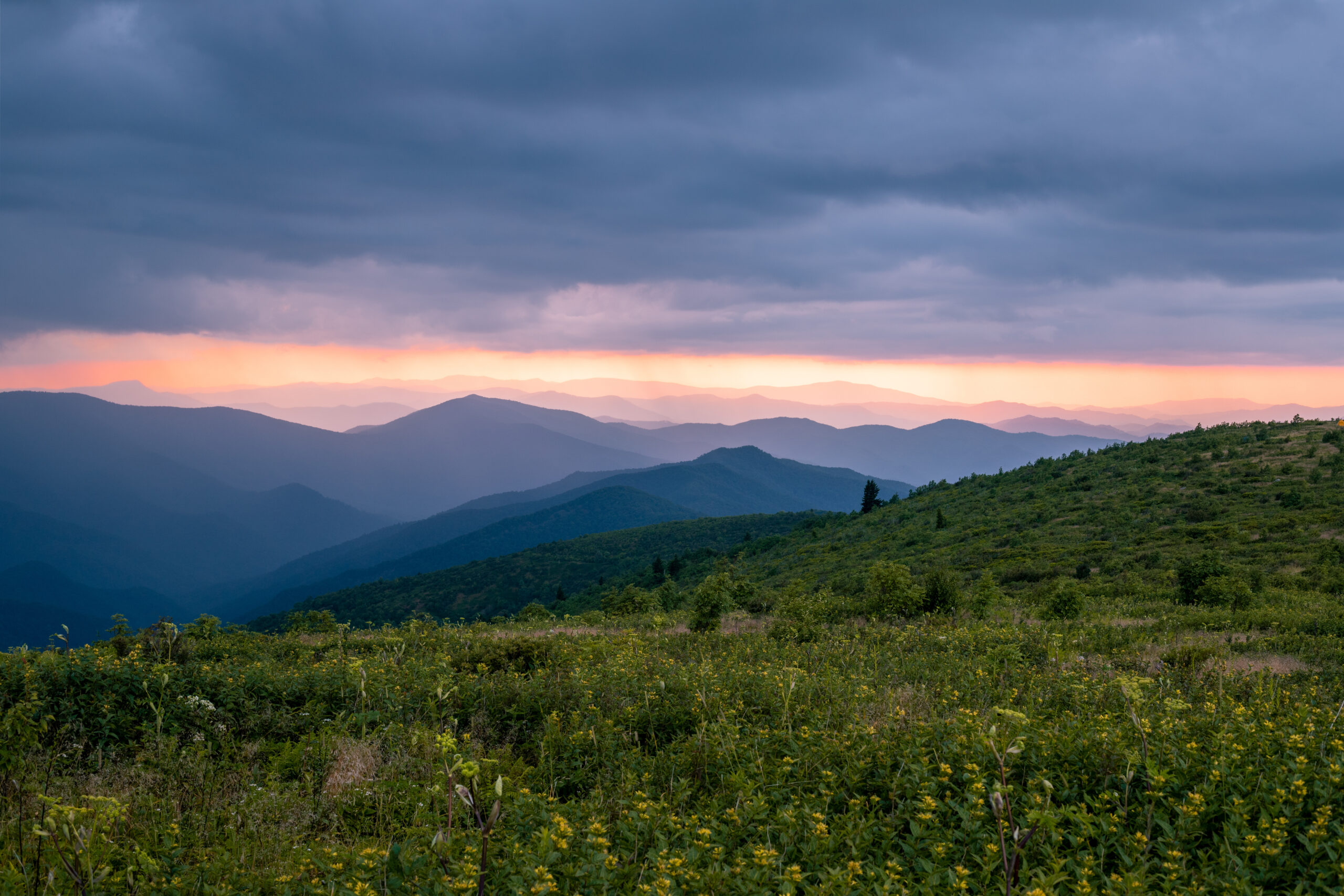
The moment you step onto Rough Ridge in mid-October, the air hits differently—crisp enough to sting your lungs, thick with the smell of wet leaves and distant woodsmoke, and so clear you can see three states from the ridgeline. The Blue Ridge Parkway’s fall show is unlike anywhere else because it doesn’t happen all at once; instead, color cascades down the mountain like a slow-motion waterfall, starting at the highest peaks in early October and trickling into the valleys by month’s end.
This elevation-based timing is what separates a stunning trip from a disappointing one—miss the peak window at your chosen elevation by just one week, and you’re hiking past bare branches instead of blazing maples. I’ve learned the hard way that booking a fixed October date months ahead is a losing strategy; the only way to guarantee peak color is to stay flexible and confirm your exact hiking dates 7–10 days out using the National Park Service foliage tracker.
This guide cuts through the guesswork and tells you exactly which hikes to prioritize, when to hike them based on elevation, and how to time your trip so you’re always chasing color instead of chasing it too late. Budget-wise, plan $30–60 per night for lodging in Asheville or nearby towns, $0 for Parkway access (no entrance fee), and $15–25 per meal at casual mountain restaurants.
Your Quick-Reference Fall Hiking Plan
Peak Foliage Windows by Elevation: Early October peaks above 5,000 feet (Graveyard Fields, Black Balsam Knob); mid-to-late October peaks at mid-elevation zones (Craggy Gardens, Rough Ridge, Linville Falls); late October catches lower valleys and Virginia sections. For every 1,000 feet of elevation, peak foliage shifts roughly one week later—use this to your advantage if your travel dates are fixed.
Best Summit Hikes for Panoramic Views: Rough Ridge (1.5 miles, Milepost 302.8) and Beacon Heights (1 mile, Milepost 305–308.3) stack together in one morning; Craggy Pinnacle and Craggy Gardens (Milepost 364.1–364.4) offer flexibility between steep and gentle; Black Balsam Knob (2 miles, Milepost 420.2) delivers unobstructed balds but requires early arrival to avoid crowds.
Best Waterfall Hikes for Forest Immersion: Linville Falls (1.6 miles, Milepost 316.3) is the signature shot everyone photographs; Graveyard Fields (Milepost 418.8) peaks earliest in October; Crabtree Falls (3 miles, Milepost 339.5) pairs perfectly with Linville for a two-waterfall morning.
Timing Strategy: Check the National Park Service foliage forecast one week before your trip, then refresh it 2–3 days before you drive. Plan your exact dates around the tracker’s current peak-color zones, not a fixed calendar date—this flexibility is the only reliable way to guarantee you’ll hike during peak foliage.
Where to Stay: Base yourself in Asheville (30 minutes from Graveyard Fields and Skinny Dip Falls) or Brevard (20 minutes from Crabtree and Linville Falls) to access all major hikes within 45 minutes of driving.
When is the Best Time to Go for Blue Ridge Parkway Fall Hikes?
Peak foliage on the Blue Ridge Parkway peaks the second and third weeks of October—but the exact timing depends entirely on elevation, and missing that window by a week means watching bare branches instead of color. The autumn leaf show begins early October in the highest elevations above 5,000 feet and gradually descends down into the lowest valleys by the end of the month.
Intensity of color often varies greatly mile-to-mile and will slow down or speed up in response to weather swings. This means your hiking window is narrow, and planning around elevation zones—not just a calendar date—is the difference between a stunning trip and a disappointing one.
Peak Foliage Windows by Elevation and State
The Blue Ridge Parkway’s 469 miles span two states and multiple elevation zones, each with its own foliage timeline. Higher elevations peak first; lower valleys peak last.
Understanding this elevation-based cascade lets you chase color instead of chasing it too late.
Early October (First Week): Highest elevations above 5,000 feet in North Carolina show the earliest and often most brilliant color. Graveyard Fields (Milepost 418.8) typically displays the most vivid fall colors in the first week of October, making it the earliest reliable peak-color stop on the Parkway.
If you’re hiking in the first week of October, focus on the southern NC section and the highest-elevation trailheads.
Mid-to-Late October (Second and Third Weeks): This is the sweet spot for most of the Blue Ridge Parkway in the North Carolina mountains. The majority of the Parkway’s hiking zones—including Craggy Gardens (Milepost 364.4), Rough Ridge (Milepost 302.8), and the mid-elevation overlooks—peak during these two weeks.
Most visitors plan their trips for mid-October specifically because this window catches the broadest range of elevations at or near peak simultaneously.
Late October (Fourth Week and Beyond): Lower valleys and northern sections continue showing color as higher elevations fade. By late October, the highest peaks have already peaked, but lower-elevation hikes and Virginia sections of the Parkway still offer strong color.
This window works if you want to avoid the mid-October crowds, though color intensity will be uneven across the Parkway.
Elevation Rule of Thumb: For every 1,000 feet of elevation gain, peak foliage shifts roughly one week later. This means a hike at 3,000 feet peaks later than one at 5,000 feet on the same date.
Use this to your advantage: if early October looks dull at lower elevations, drive higher. If late October is your only window, stick to lower-elevation trails.
How to Use Interactive Color Trackers for Peak Autumn Leaves
Guessing at peak foliage is a losing game—interactive trackers give you real-time data instead of calendar assumptions. The National Park Service and regional tourism boards update foliage forecasts weekly during fall, tracking color intensity and peak timing by specific milepost and elevation zone.
Official NPS Foliage Forecast: The National Park Service updates a Blue Ridge Parkway fall foliage forecast weekly from late August through November. Check it one week before your planned trip to see which sections are at peak, which are just starting, and which have already peaked.
This forecast breaks down color by region (northern Virginia, central NC, southern NC) so you can adjust your hiking route accordingly.
Regional Tourism Trackers: Asheville-area tourism sites like Romantic Asheville maintain detailed fall foliage forecasts specific to the 170-mile Parkway section in the North Carolina mountains. These trackers update color status by milepost range and include notes on weather impacts—critical because unseasonably warm or cold weeks can accelerate or delay peak by up to two weeks.
Check these trackers 3–5 days before your hike, not weeks in advance.
Real-Time Strategy: Rather than booking a fixed trip date months ahead, plan your Blue Ridge Parkway fall hike for a flexible window (typically mid-October) and confirm your exact dates 7–10 days out using the foliage tracker. If the forecast shows peak color arriving early, move your trip earlier.
If color is delayed, push it back. This flexibility is the only reliable way to guarantee you’ll hike during peak foliage, not before or after it.
Weather Watch: Foliage trackers also note weather impacts—heavy rain, early frost, or warm spells can all shift timing. A tracker that updates weekly accounts for these swings; a static blog post about “October peak” does not.
Refresh your tracker check 2–3 days before you drive, especially if weather has been unusual.
Top Blue Ridge Parkway Fall Hikes for Panoramic Summit Views
The highest-elevation hikes on the Parkway deliver 360-degree vistas that stretch across multiple states when fall color peaks—but only if you time them right and know which ones reward the effort over the crowds.
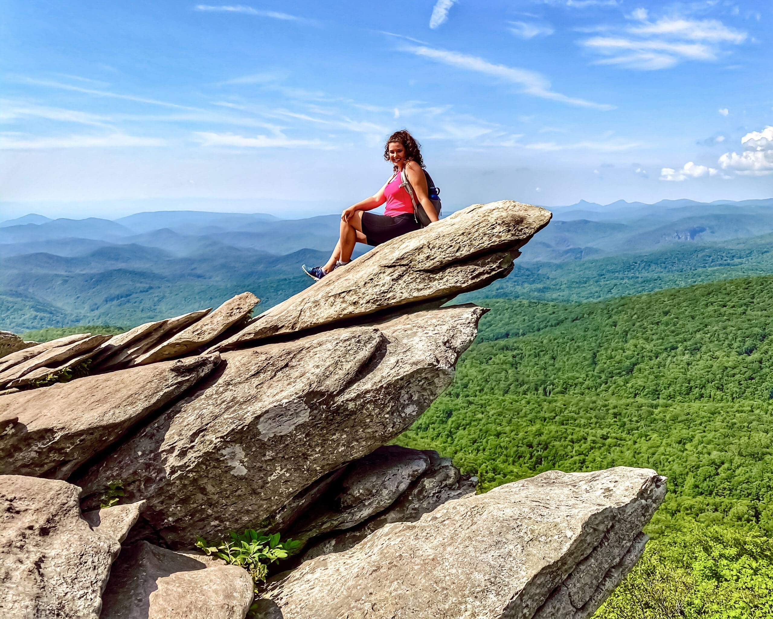
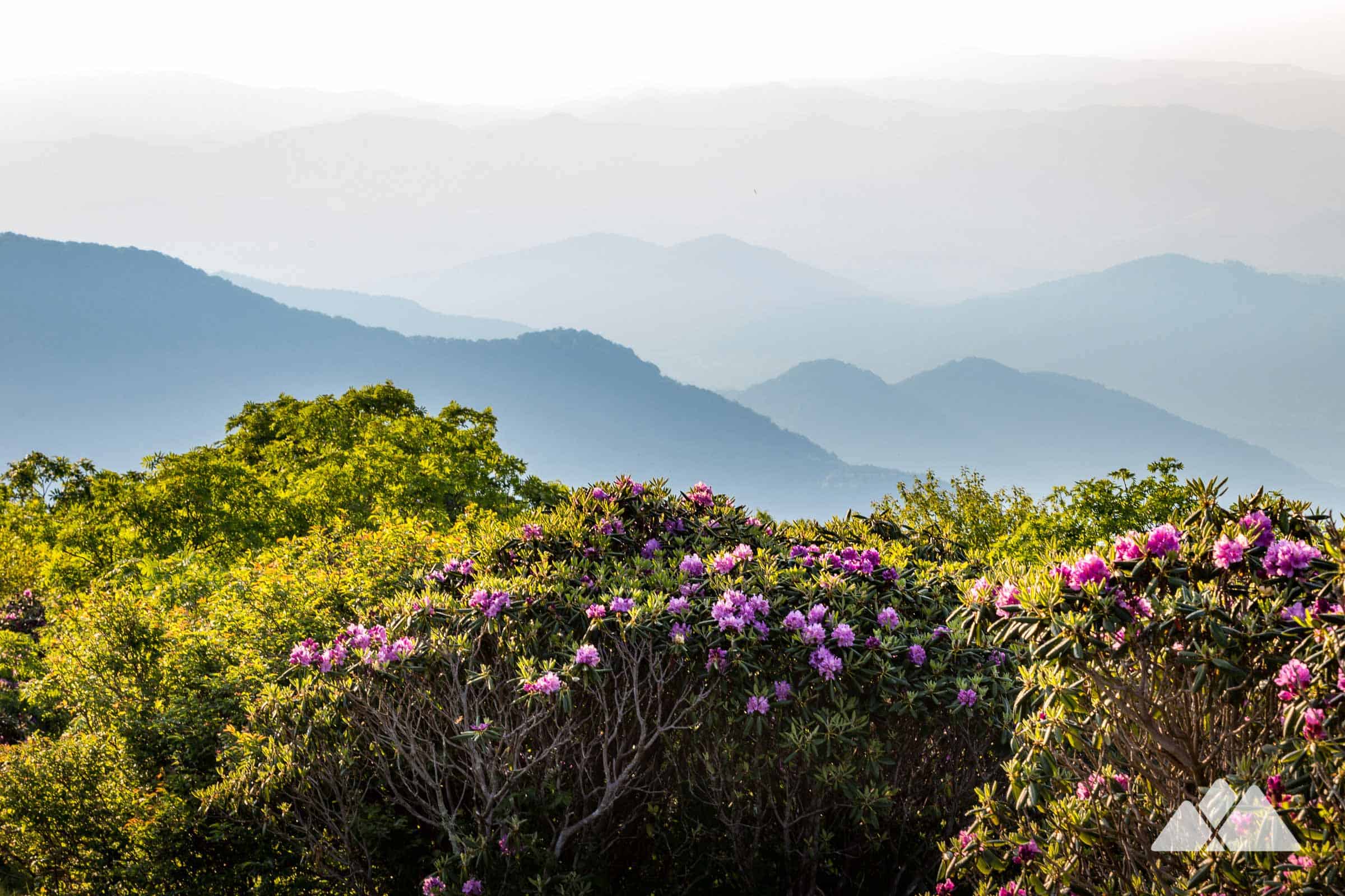
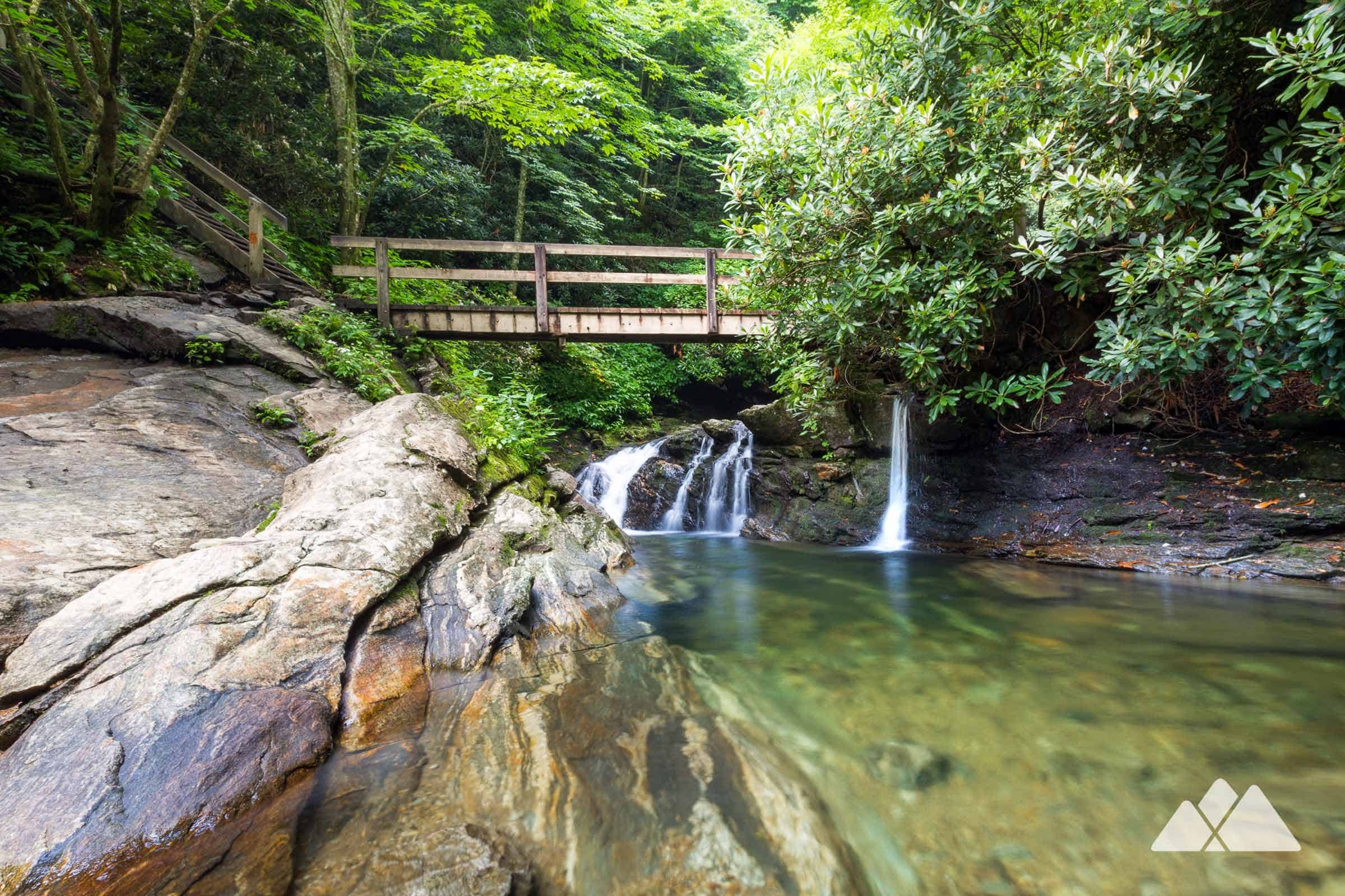
Rough Ridge (Milepost 302.8)
This 1.5-mile round-trip hike is the move for anyone wanting dramatic ridgeline views without committing to a full day of hiking. The trail ranges from moderate to strenuous depending on which loop you choose, but even the easier option delivers sweeping vistas across the northern Parkway section.
Best for: hikers with limited time or families wanting a quick payoff. Wins because: it’s close to Beacon Heights (see below), so you can stack two summit views in one morning without backtracking.
Beacon Heights and Flat Rock Trail (Milepost 305–308.3)
A 1-mile round-trip walk that sits just 2.3 miles north of Rough Ridge, making it perfect for a two-stop morning loop. The trail is genuinely easy—no scrambling, no elevation surprises—and the payoff is a clear vista point ideal for picnics.
Best for: couples, older hikers, or anyone wanting to maximize views with minimal exertion. Wins because: the proximity to Rough Ridge means you get two distinct summit perspectives without driving more than five minutes between them, and the easier grade means you’ll actually have energy for photos instead of just catching your breath.
Craggy Pinnacle and Craggy Gardens (Milepost 364.1–364.4)
Craggy Pinnacle is a short, steep push to a rocky summit with unobstructed 360-degree views; Craggy Gardens (accessed from the visitor center at milepost 364.4) is a gentler 1-mile loop through rhododendron thickets and wildflower meadows with equally stunning panoramas. Best for: hikers who want flexibility—do one or both depending on energy and time.
Wins because: the visitor center provides bathrooms, water, and shelter if weather turns, and the two trails offer completely different terrain experiences within the same stop.
Black Balsam Knob on the Art Loeb Trail (Milepost 420.2)
A 2-mile round-trip across open balds with uninterrupted mountain vistas—this is the local favorite and the most crowded summit hike on the Parkway during peak foliage. Best for: hikers willing to wake up early or visit midweek to avoid the crush.
Wins because: the open balds mean zero tree cover blocking views, and the trail doubles as an epic picnic and camping spot if you want to linger. Arrive before 9 a.m. on weekends or go Tuesday through Thursday to secure parking and avoid the bottleneck at the trailhead.
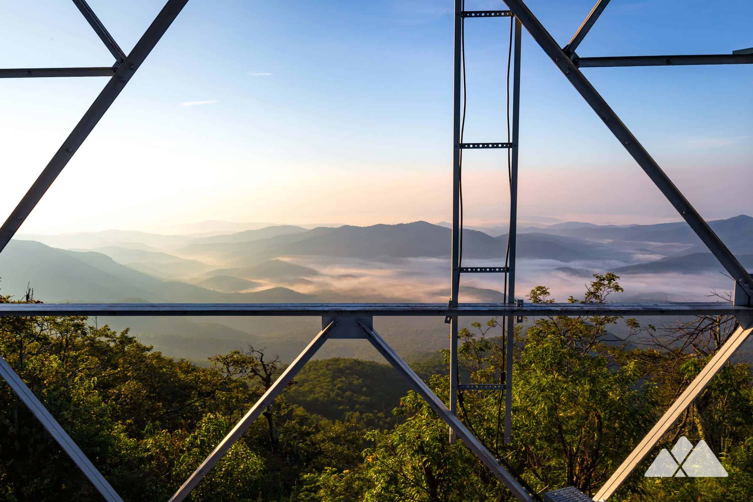
Devil’s Courthouse and Fryingpan Lookout Tower (Milepost 409.6–422.4)
Two distinct summit experiences within 12 miles of driving: Devil’s Courthouse is a steep, rocky scramble to a clifftop vista; Fryingpan Lookout Tower (milepost 409.6) is a historic fire tower offering epic 360-degree views from the top. Best for: hikers comfortable with exposure and scrambling (Devil’s Courthouse) or anyone wanting a tower-top experience without the climb (Fryingpan).
Wins because: you can do both in one afternoon, and the tower requires zero technical skill—just a walk to the structure and a stair climb for the payoff.
Mount Mitchell and Mount Pisgah (Milepost 355.4–407.6)
Mount Mitchell is the highest peak east of the Mississippi (6,684 feet); Mount Pisgah is a shorter, more accessible alternative with equally dramatic vistas. Mount Mitchell requires a drive to the summit parking area and a short walk to the observation tower; Mount Pisgah offers a moderate 1.4-mile round-trip hike with 360-degree views.
Best for: Mount Mitchell if you want the highest-elevation bragging rights with minimal effort; Mount Pisgah if you want a real hike with comparable views and fewer crowds. Wins because: both deliver the sense of standing above the world, but Mount Pisgah’s hike means you’ll actually feel like you earned the view instead of just parking and walking 50 yards.
Stay strategy: Base yourself in Asheville or along the Parkway corridor near mileposts 350–420 to access all six summits within 90 minutes of driving. This section of the Parkway has the densest cluster of high-elevation hikes and the most reliable fall color timing in mid-to-late October.
Best Blue Ridge Parkway Fall Hikes for Waterfalls and Forest Trails
These waterfall hikes deliver the two things fall hikers actually want: water cascading through peak foliage and trails dense enough that you’re surrounded by color, not just viewing it from a pullout. Unlike the panoramic summit hikes covered elsewhere, these routes keep you immersed in the forest canopy where the light hits the leaves differently every few minutes.
All five are accessible from the Parkway itself—no detours to distant trailheads—and most can be done in under two hours, leaving time to explore multiple falls in a single day.
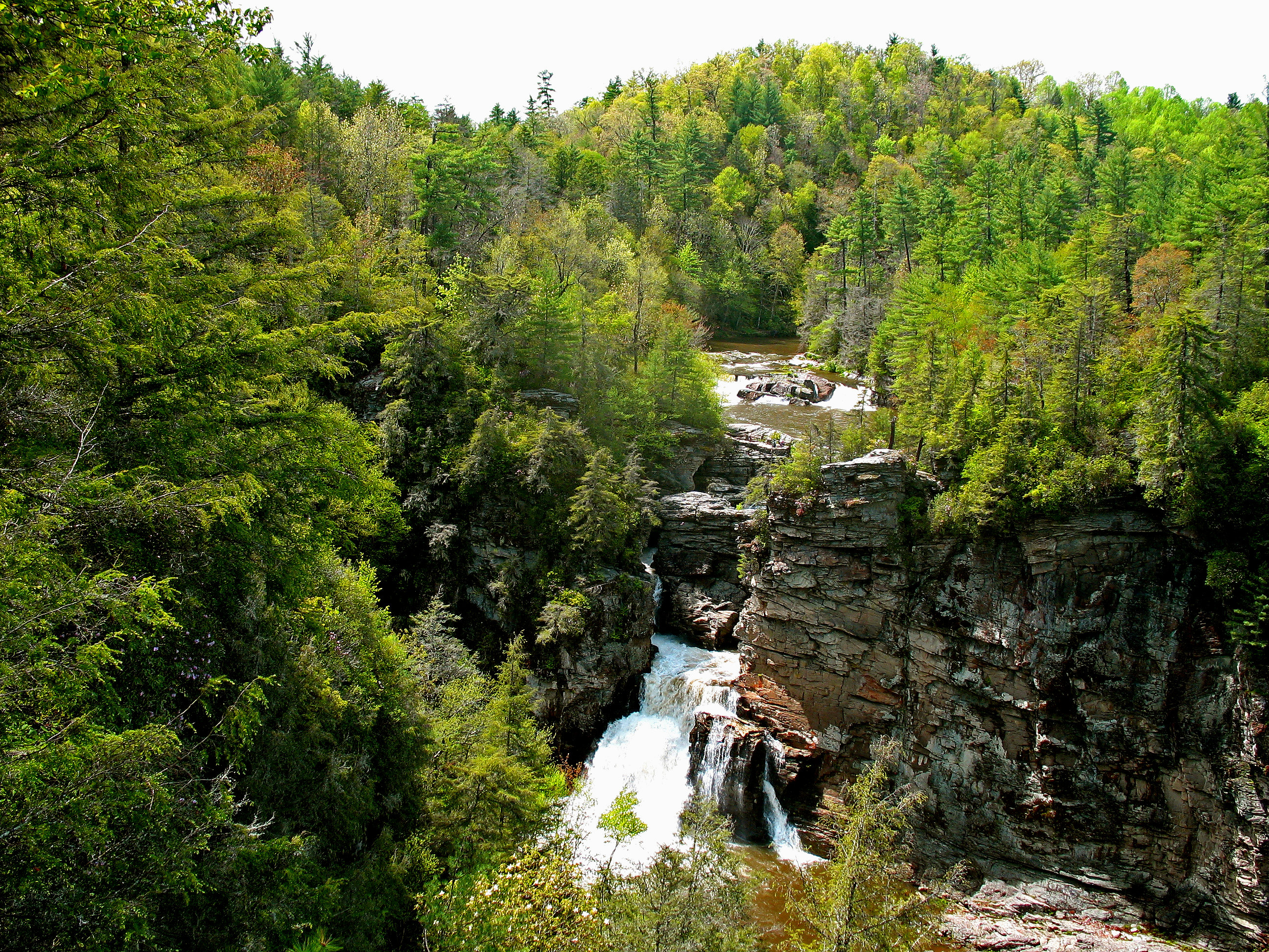
Linville Falls (Milepost 316.3)
This is the waterfall everyone photographs, and it earns the attention—a 90-foot drop framed by sheer cliff walls and surrounded by hardwoods that turn crimson and gold in October. The hike is 1.6 miles round-trip and moderate, which means crowds, but the payoff is a falls that looks different from every angle along the trail.
Best for hikers who want a guaranteed stunning shot and don’t mind company; skip it if you’re seeking solitude. The single reason it wins: nowhere else on the Parkway combines this much vertical drop with this much accessibility and this much fall color density in one frame.
Graveyard Fields (Milepost 418.8)
This is the early-peak specialist—Graveyard Fields typically shows the most brilliant and earliest fall colors anywhere on the Parkway, often by the first week of October when lower elevations are still mostly green. The hike splits into two options: a short walk to Lower Falls (easy, under an hour) or a longer loop through the mile-high meadow (more strenuous, 2.3 miles).
The meadow itself is the draw—open, rolling, and surrounded by forest that turns faster here because of elevation. Best for travelers who want to catch peak color before mid-October or prefer open-sky hiking mixed with waterfall views; skip it if you need dense forest coverage the entire way.
The reason it wins: nowhere else on the Parkway peaks this early or offers this much elevation-driven color advantage.
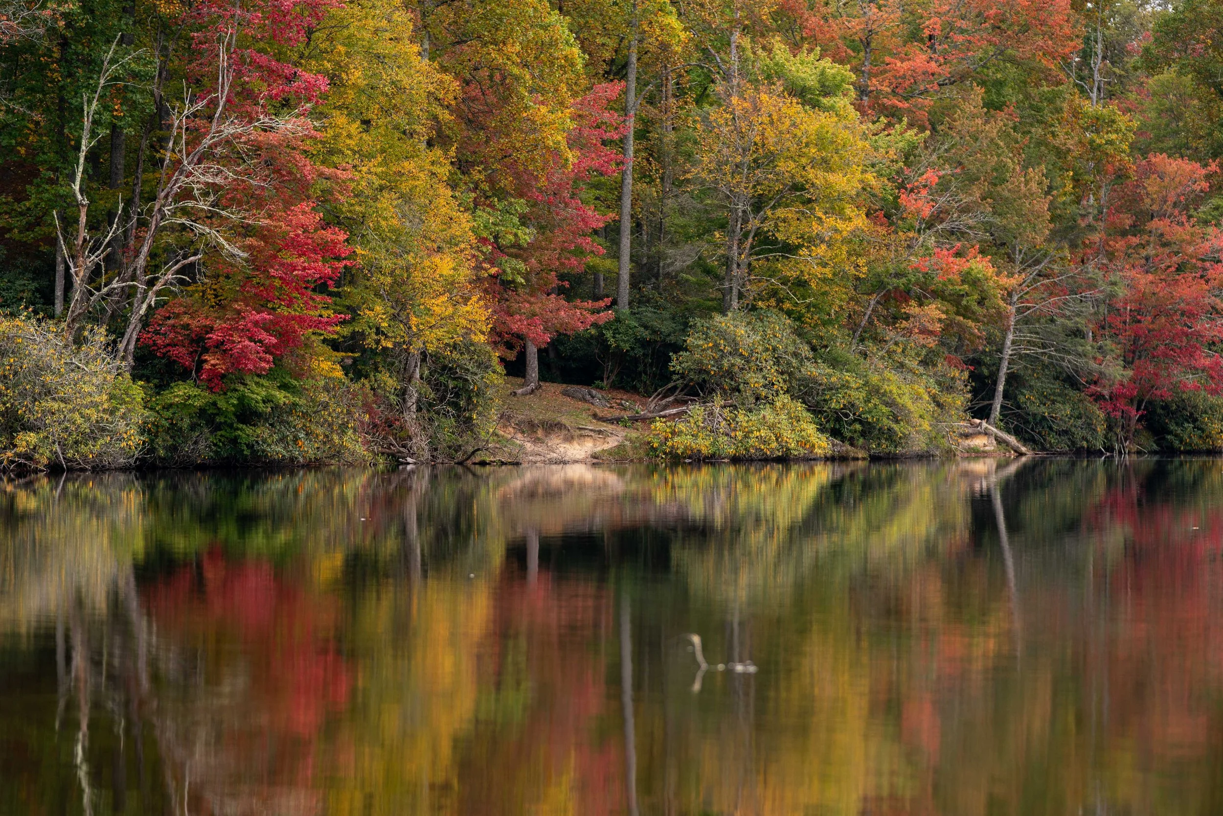
Crabtree Falls (Milepost 339.5)
Three miles round-trip through forest that feels older and less trafficked than Linville, Crabtree Falls sits close enough to Linville that many hikers pair them in a single morning or afternoon. The waterfall is beautiful but less dramatic than Linville—it’s a series of cascades rather than one signature drop—which means the hike is about the journey through the woods as much as the destination.
Best for hikers who want to see two major falls in one outing without backtracking far on the Parkway; skip it if you need a single showstopping waterfall moment. The reason it wins: the proximity to Linville makes it the logical second stop, and the forest density here is higher, meaning more color immersion per mile.
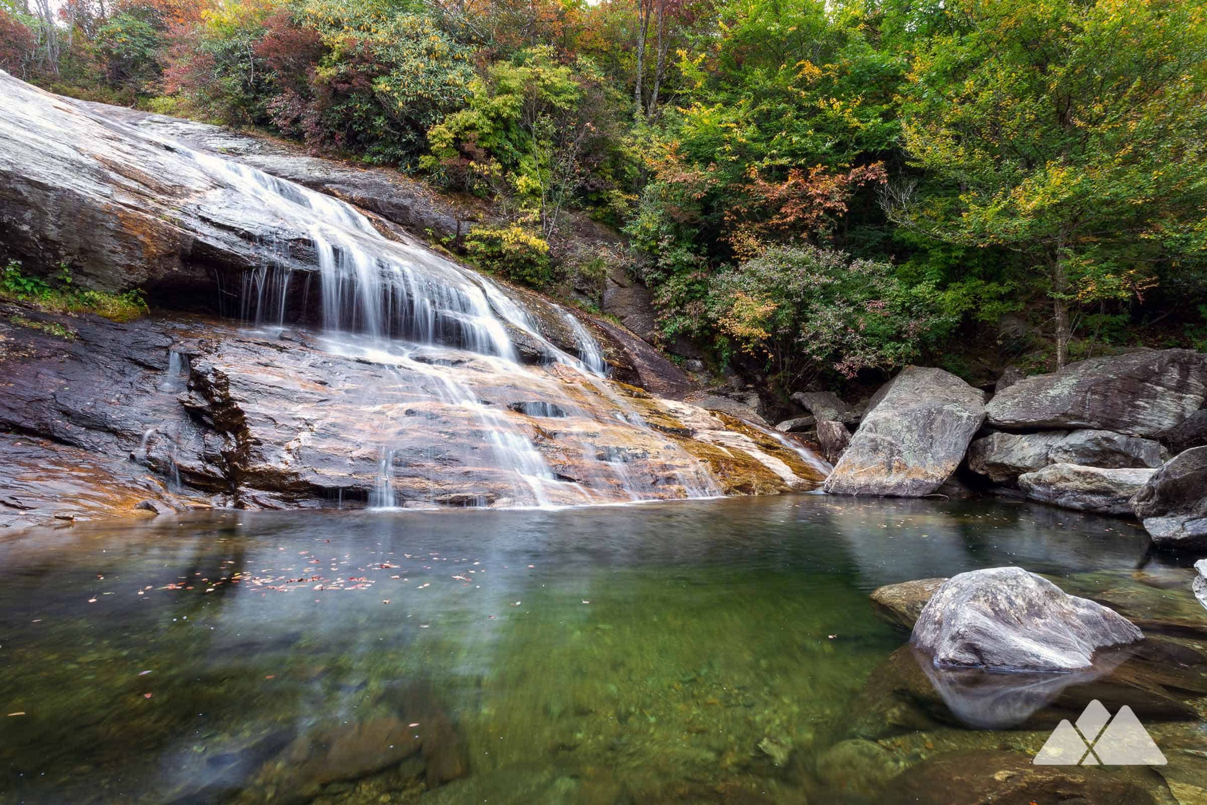
Skinny Dip Falls (Milepost 417)
A half-mile walk from the Looking Glass Rock Overlook leads to an idyllic setting with multiple cascades and a pool—the kind of spot that feels discovered even though it’s right off the Parkway. The hike is easy, the water is cold and clear, and the falls are surrounded by hemlock and rhododendron that frame the cascades beautifully in fall light.
Best for families, photographers, or anyone who wants waterfall access without committing to a long hike; skip it if you need a challenging climb or a dramatic single-drop waterfall. The reason it wins: the combination of ease, intimacy, and multiple cascade angles makes it the most flexible waterfall stop on this list.
Lesser-Known Waterfall Hikes: Roaring Fork, Grassy Creek, and Log Hollow Falls
These three trails exist in the shadow of Linville and Graveyard Fields, which means lighter crowds and a better chance of solitude during peak foliage season. Roaring Fork offers creek-side hiking with consistent water sounds and forest coverage; Grassy Creek provides a gentler walk through mixed hardwoods; Log Hollow Falls delivers a small but elegant cascade in a quiet corner of the Parkway.
None of these are dramatic enough to be Instagram famous, but all three reward hikers who prioritize peace and forest immersion over waterfall size. Best for experienced hikers who know the Parkway well and want to avoid the main attractions; skip them if you need a signature waterfall moment or prefer well-marked, heavily maintained trails.
The reason they win: you’ll likely be alone, the forest canopy is thick enough to slow the season’s color transition (meaning peak foliage lasts longer here), and the water sound is constant enough to mask any Parkway noise.
Stay strategy: Base yourself in Asheville or Brevard for waterfall-focused hiking days. Asheville offers the most lodging variety and sits roughly 30 minutes from Graveyard Fields and Skinny Dip Falls; Brevard is closer to Crabtree and Linville Falls (about 20 minutes) and works better if you want to start early and hike multiple falls before afternoon crowds peak.
Either town gives you access to all five falls within a 45-minute drive, and both have restaurants and cafes where you can grab coffee before sunrise hikes.
Frequently Asked Questions
What’s the best time to drive the Blue Ridge Parkway for fall foliage?
Peak color hits the second and third weeks of October across most of the North Carolina section of the Parkway. The autumn show begins in early October at the highest elevations above 5,000 feet—places like Graveyard Fields (Milepost 418.8) typically blaze with color in the first week of October—and gradually descends into the lower valleys by month’s end.
Weather swings the timeline unpredictably, so confirm current conditions with the National Park Service before driving.
Do I need reservations for Blue Ridge Parkway hikes, and is there a fee to drive the Parkway?
No entrance fee exists for the Blue Ridge Parkway itself, and most trailheads do not require advance reservations. Parking at popular overlooks and trailheads is first-come, first-served, which means arriving before 9 a.m. on peak foliage weekends is non-negotiable if you want a spot.
Some private attractions near the Parkway—like Mount Mitchell State Park—charge modest day-use fees, but the hiking trails themselves are free.
Can I use GPS to navigate the Blue Ridge Parkway and find trailheads?
GPS will fail you on the Parkway because trailheads have no street addresses. Use the official Parkway mileposts instead—they’re clearly marked along the road and correspond to every major overlook, waterfall, and hike.
Download a physical map or use the NPS Blue Ridge Parkway app before you lose cell service in the mountains. This single detail saves hours of frustration.
What should I pack for fall hiking on the Blue Ridge Parkway?
Layer aggressively: mornings at 5,000+ feet elevation hit the 40s°F even in mid-October, and afternoon sun can push temps into the 60s. Bring a moisture-wicking base layer, fleece or wool mid-layer, and a windproof jacket—not a heavy coat.
Waterproof hiking boots are essential because morning fog and overnight dew soak the trails, and the exposed ridges on hikes like Rough Ridge and Craggy Pinnacle are brutally windy. Pack a headlamp; sunset comes at 6 p.m. by late October, and trails darken fast.
Lock In Your Peak Foliage Hike Now
Pull up the National Park Service Blue Ridge Parkway foliage forecast right now and identify which elevation zone peaks during your available travel window—this single step eliminates 90% of the guesswork. If mid-October works for you, book lodging in Asheville and plan to hike the mid-elevation zones (Craggy Gardens, Rough Ridge, Linville Falls); if you’re locked into early October, shift your focus to the highest elevations like Graveyard Fields and Black Balsam Knob.
The Blue Ridge Parkway’s fall show is genuinely the most reliable color display on the East Coast because the elevation cascade means peak foliage lasts longer here than anywhere else—you’re not chasing a two-week window, you’re working with a month-long cascade. Book your trip, confirm your dates one week out, and arrive at your first trailhead before 9 a.m. on weekends to secure parking and catch the morning light hitting the leaves at their most brilliant.
Leave a Reply