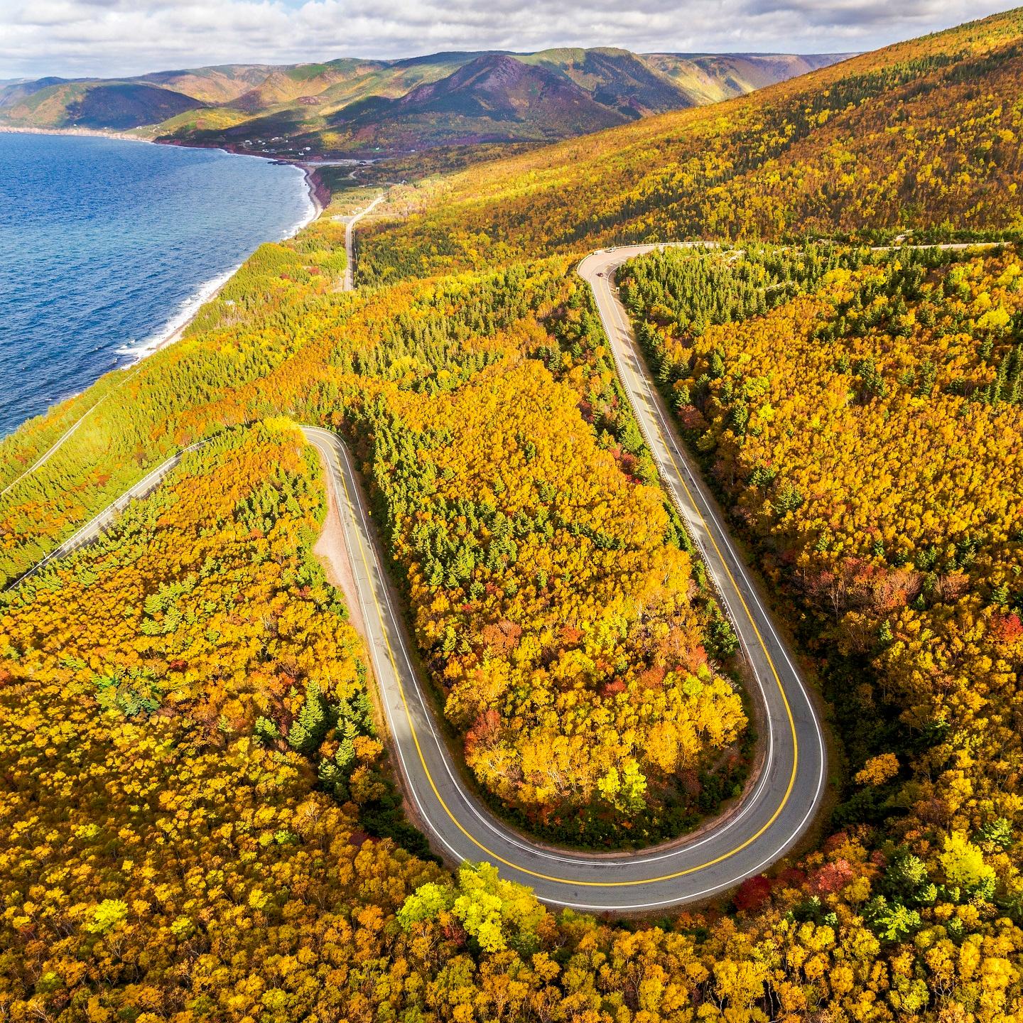
You round a bend on the Cabot Trail and the world drops away—fiery maple reds tumbling into the steel-blue Atlantic, the smell of salt and damp earth sharp in the air. This isn’t just another fall drive; it’s where the Appalachian Mountains meet the sea in a final, spectacular blaze of color before winter.
Unlike New England, here the foliage is woven with Celtic music, Acadian villages, and a wild, untamed coastline. This guide will help you decide exactly when to go, which direction to drive, and which trails are worth your precious time.
Expect to spend around $150 CAD/day for a mid-range trip, covering a rental car, cozy inn, and seafood dinners. Budget travelers can manage closer to $100 CAD by camping and cooking, while a splurge at a lodge like Keltic could run $300+ CAD per night.
Your Cape Breton Fall Road Trip at a Glance
- Best Time to Go: Aim for the middle two weeks of October. This window delivers peak color across the island, though you should track real-time foliage reports from mid-September.
- Ideal Duration: Five days is the sweet spot. This allows for the full Cabot Trail loop, key hikes, and the detour to Meat Cove without rushing.
- Drive Direction: Go counter-clockwise. You’ll get morning sun on the dramatic east coast and sunset over the Gulf of St. Lawrence on the final stretch.
- Must-Do Hike: Skyline Trail. The iconic boardwalk headland view is the postcard shot, but arrive before 10 a.m. to beat crowds. For a tougher climb with fewer people, tackle Franey Trail.
- Lodging Strategy: Base yourself in Ingonish for direct trailhead access or Chéticamp for Acadian culture. Book months in advance if visiting during Celtic Colours (typically mid-October).
Best Time to Visit Cape Breton for Peak Fall Foliage
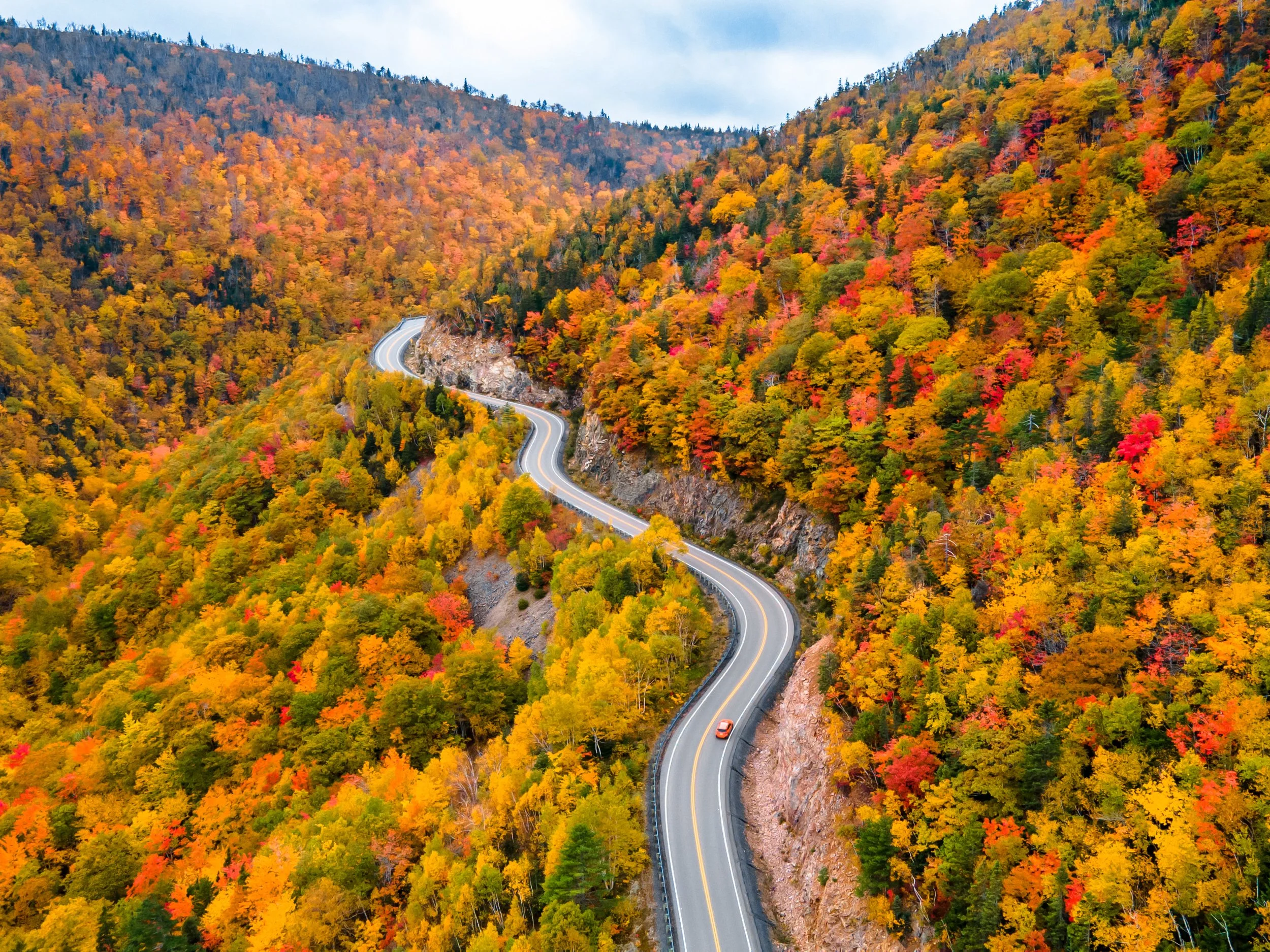
Peak color on Cape Breton doesn’t hit everywhere at once — highland elevations turn first, coastal lowlands hold green longer — so arriving even five days too early or too late can mean driving the Cabot Trail through bare branches on the exact stretch you came to see blazing.
Mid-October Timing and Variability
Target the middle two weeks of October. This window consistently delivers the most color across the widest stretch of the island.
In 2023, peak color landed around October 15–20, though some locals noted it was less vibrant than prior years. That kind of swing is normal — rainfall, early cold snaps, and wind storms can push peak a week in either direction.
The detail most visitors miss: the highlands and inland valleys peak before the coastal sections. If you’re driving the Cabot Trail counter-clockwise, expect vivid color through the interior hills while the western coast may still be transitioning.
Factor this into your starting date — it matters more than most planning guides admit.
How to Track Foliage Reports
Don’t trust generic “Canada in fall” roundups. These sources are actually useful as your trip approaches:
- Cape Breton foliage map: The official Destination Cape Breton tourism site posts updated color-stage maps breaking the island into regions. Start checking weekly from mid-September.
- Parks Canada trail conditions: Useful specifically for Cape Breton Highlands National Park — recent wind or storms can strip exposed highland trails before lower elevations change.
- Real-time visitor photos: Search recent posts tagged #CabotTrail and #CapeBretonFoliage on Instagram and Facebook from the past 48 hours. Honest, unfiltered, and far more reliable than any forecast.
Bottom line: even the best tracker is an educated guess. Lock in the middle two weeks of October, accept some variability, and you’ll still see more color than most destinations in North America can deliver.
Celtic Colours International Festival Dates
If you need a tiebreaker for when to book, aim for the week of Celtic Colours International Festival. This nine-day celebration of Cape Breton’s Celtic heritage — concerts, community dinners, and ceilidhs held in venues from Chéticamp to Baddeck to Sydney — typically runs in mid-October.
Exact dates shift each year; confirm at celtic-colours.com before booking flights.
Fair warning: the festival draws visitors from across Canada and beyond. Accommodations in Baddeck, Chéticamp, and Ingonish book up early.
If Celtic Colours is part of your plan, reserve lodging at least two months out — three is safer. This is the single biggest booking mistake fall visitors make.
How Many Days Do You Need for a Cape Breton Fall Road Trip?
Five days is the sweet spot — enough time to drive the full 298-km Cabot Trail loop without white-knuckling past trailheads, and still squeeze in the detour to Meat Cove that most itineraries skip. Three days works if you accept trade-offs.
Two days is a scenic drive, not a trip.
Here’s the honest breakdown of what each timeframe actually delivers.
| Duration | Best For | What You Get | What You Lose |
|---|---|---|---|
| 5 days | First-timers who want the full experience | Every major trail, Meat Cove, unhurried drives, Celtic Colours events if timed right | Nothing significant |
| 4 days | Most travelers with a tight schedule | Full loop, 2–3 top hikes, some flexibility for weather delays | Meat Cove detour or a second hike on the Highlands |
| 3 days | Long-weekend trips from Halifax or Moncton | The trail loop, Skyline Trail, one base-town evening | Meat Cove, Franey Trail, and any real downtime |
Read the five-day plan first — even if you only have three days, knowing what you’re cutting makes the decision cleaner.
5-Day Itinerary Overview
Day 1 — Arrive and settle into Baddeck or Ingonish. Most visitors reach Cape Breton via the Canso Causeway from mainland Nova Scotia, then drive roughly 1–1.5 hours to Baddeck or continue another hour to Ingonish. Use this day to shake off the drive.
Walk the Baddeck waterfront, grab dinner, and get an early night — the real driving starts tomorrow. If you’re starting the loop counter-clockwise (see the route-planning section for why), Ingonish puts you right at the trail’s northeast entrance.
Day 2 — Ingonish to Meat Cove. This is the day for the Franey Trail — a steep 7.4-km loop that rewards you with a panoramic fall-color overlook most visitors never see. After that, push north to Meat Cove, the northernmost settlement on the island.
The road is unpaved for the final stretch, so check conditions (covered in the road-conditions section). Overnight in Meat Cove or loop back to Ingonish.
Day 3 — Northern Highlands to Pleasant Bay. Drive the dramatic northwestern section of the trail, where the road clings to ocean cliffs and the foliage hits peak intensity in mid-October. This stretch includes the Skyline Trail — the most popular hike on the island, a 6.5-km out-and-back to a headland boardwalk above the Gulf of St. Lawrence.
Plan to arrive by mid-morning; the trailhead parking lot fills fast during fall weekends. Base yourself in Pleasant Bay or Chéticamp for the night.
Day 4 — Chéticamp and the Acadian Coast. Chéticamp is the Acadian heart of Cape Breton — think lobster dinners, hooked-rug studios, and a slower pace. If you have energy, the Acadian Trail starts right from town and offers a less-crowded alternative to Skyline with comparable summit views.
This is also your buffer day: if weather socked in a previous hike, today is your redo.
Day 5 — Margaree Valley and Departure. The drive south through the Margaree Valley is arguably the prettiest stretch of fall color on the entire loop — the river valley flares into gold and amber against the highlands. Stop in Margaree Forks for coffee, then either loop back to Baddeck or head toward the Canso Causeway.
If you’re visiting during the Celtic Colours International Festival (usually mid-October — confirm exact dates annually), you’ll find evening concerts in community halls along this stretch.
Shortening to 3 or 4 Days
Cutting from five to four days means sacrificing one thing: Meat Cove. It’s a 45-minute detour on rough road from the main loop, and while the cliff-top views are spectacular, you’ll still see plenty of coastal drama on the northern section between Ingonish and Pleasant Bay. Skip Meat Cove, combine Days 1 and 2, and you have a tight but complete four-day loop.
For three days, the math gets harder. Here’s what actually works:
- Day 1: Drive to Baddeck in the morning, explore the town, continue to Ingonish by evening. One base, no backtracking.
- Day 2: Ingonish to Chéticamp via the northern route. Pick one hike — Skyline Trail wins for most people because the payoff-to-effort ratio is unbeatable in fall foliage. Overnight in Chéticamp.
- Day 3: Chéticamp through Margaree Valley and out. This version misses Franey, Meat Cove, and the Acadian Trail — but you still complete the full loop and see the highlights.
The insider move for a three-day trip: start the Cabot Trail no later than 8 a.m. on Day 2. You’ll beat the tour buses to Skyline Trail’s parking lot by an hour, which is the difference between a peaceful headland and a crowded boardwalk. The lot holds roughly 40–50 cars and hits capacity by 10:30 a.m. on peak fall weekends.
Whatever length you choose, book accommodations in Baddeck or Ingonish for night one, and Chéticamp for your final night on the trail — these are the two towns with the most lodging options and the best restaurant access. Details on where to stay are covered in the lodging section below.
Which Direction Should You Drive the Cabot Trail?
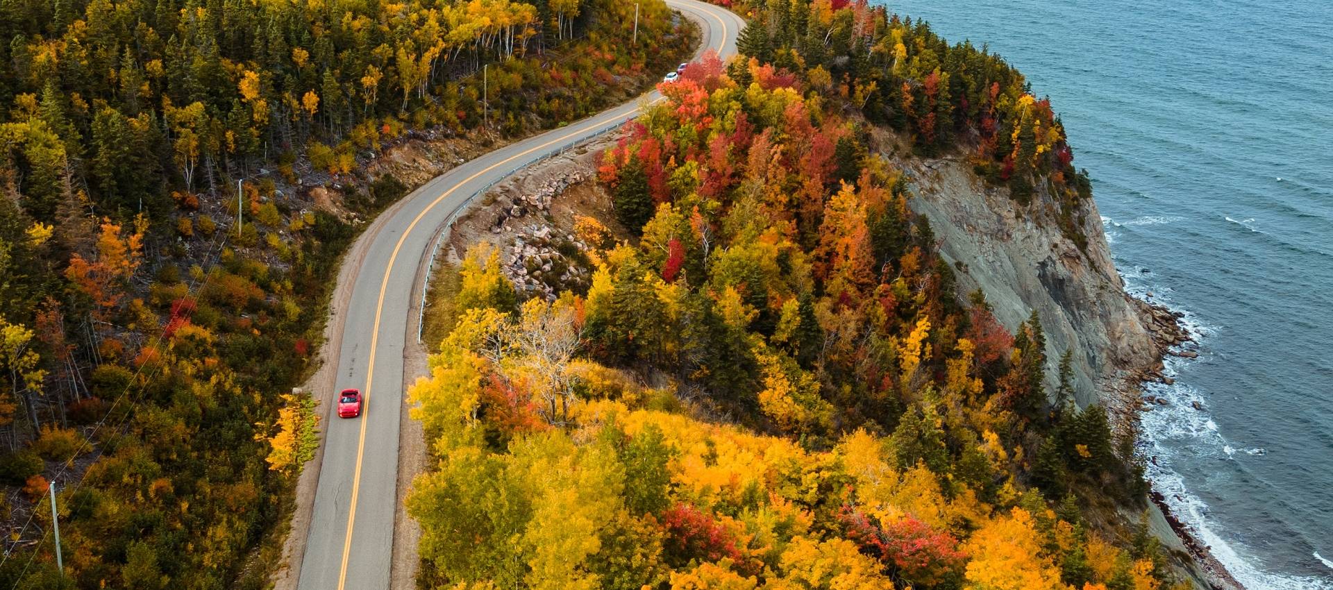
Most visitors instinctively go counter-clockwise, and the morning light on the eastern coastline is the reason — but that popularity comes with a cost that’s worth weighing before you commit.
The Cabot Trail is a roughly 298-kilometer loop, and direction shapes your entire experience: which coast you see in golden hour, how comfortable you feel on the cliff-hugging northern switchbacks, and how many cars are in front of you at every overlook. Both work.
One is better for you depending on your priorities.
Counter-Clockwise Route Benefits
Starting from Baddeck and heading north along the eastern shore, counter-clockwise puts the Atlantic Ocean on your passenger side for the first stretch. Morning light hits the east-facing cliffs and coves, which matters more than you’d think — fall foliage photographs dramatically better in soft morning sun than harsh afternoon glare.
You’ll also catch sunset over the Gulf of St. Lawrence on your final stretch through the western coast near Chéticamp, which is the photo most people want.
- Best for: Photographers and first-timers who want the postcard version of the drive — sunrise on the east, sunset on the west.
- The trade-off: This is the default direction, so expect more traffic at overlooks and trailheads during peak foliage week. Arrive at popular stops like Skyline Trail before 9 a.m. to beat the crowds.
- Driving comfort: On the steep northern section between Pleasant Bay and Cape North, you’ll be on the outside lane hugging the cliff edge. It’s thrilling, but if steep drop-offs make you tense, this is the more nerve-wracking direction.
Clockwise Route Advantages
Heading west from Baddeck first means you tackle the western coast in the morning and loop up through Chéticamp before the eastern-bound traffic hits. The northern switchbacks put you on the inside, mountain-side lane — a noticeably calmer drive if you’re not fond of cliff edges with no guardrails.
You’ll also encounter fewer vehicles in the morning hours, particularly on the quieter western stretch.
- Best for: Drivers who are nervous about heights and anyone who’d rather have a relaxed morning start without jockeying for overlook parking.
- The trade-off: You’ll hit the eastern coastline in the afternoon, when the light flattens out and fall colors look less vibrant in photos. The famous ocean panoramas still stun in person, but your camera roll won’t look as polished.
- Driving comfort: The inside lane on the northern climbs is meaningfully more comfortable. If you’re towing a trailer or driving a large RV, clockwise is strongly recommended.
| Factor | Counter-Clockwise | Clockwise |
|---|---|---|
| Best light | Morning east coast, sunset west | Morning west coast, afternoon east |
| Traffic | Heavier, especially midday | Lighter mornings |
| Driving comfort | Outside lane on cliffs | Inside lane on cliffs |
| Photo quality | Superior for foliage shots | Good, but less dramatic light |
| Best for | First-timers, photographers | Nervous drivers, RVs, trailers |
The insider take: If you’re visiting during Celtic Colours week or Canadian Thanksgiving weekend, go clockwise. The counter-clockwise traffic train during those peak dates is genuinely frustrating — you’ll spend more time waiting at pull-offs than enjoying them.
For any other fall week, counter-clockwise is the better default.
Do You Need a Car for a Cape Breton Fall Road Trip?
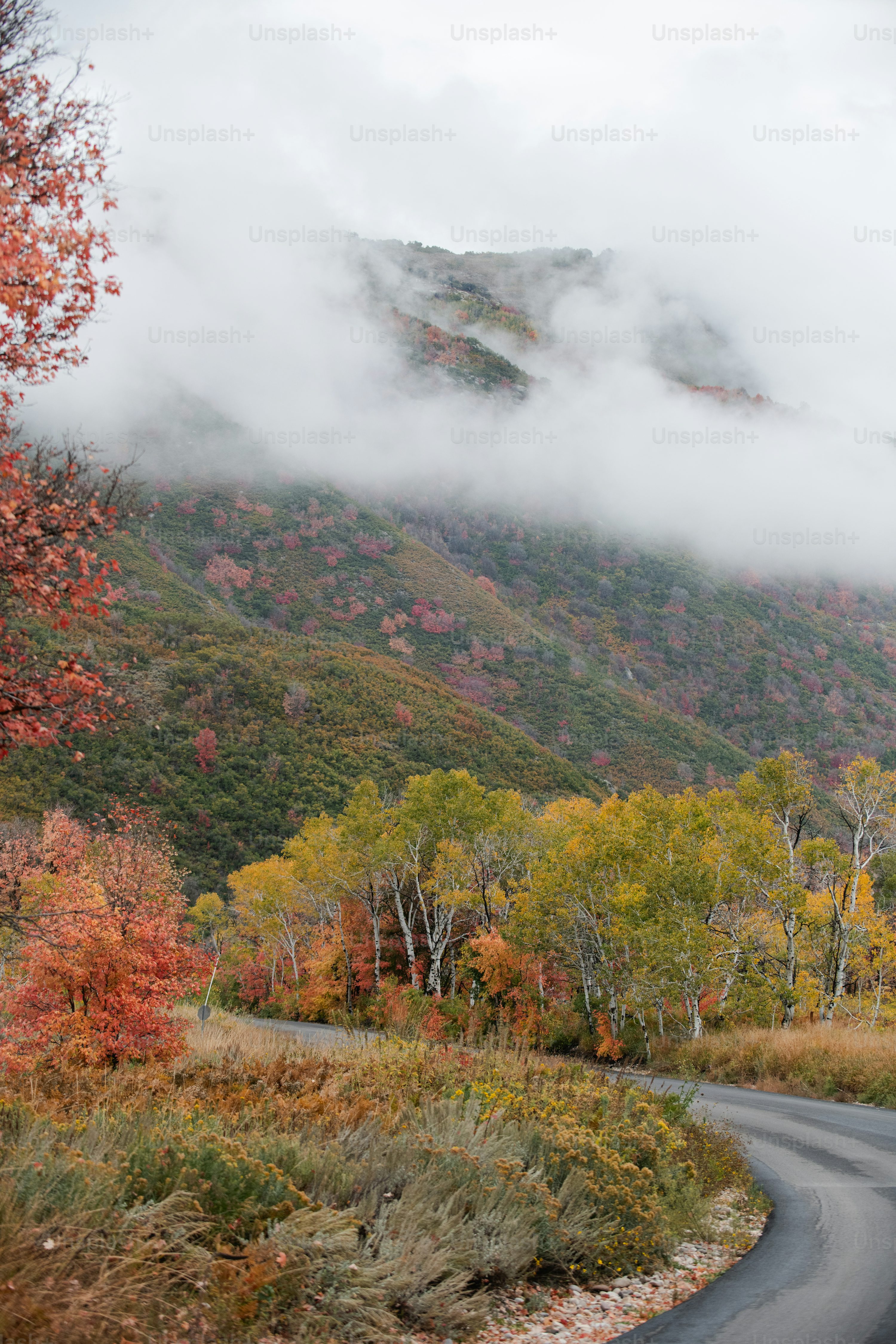
A car isn’t just recommended here—it’s non-negotiable. Cape Breton has no public transit network connecting the Cabot Trail, so your own wheels are the only way to access trailheads, coastal towns, and that famous foliage at your own pace.
Renting and Driving Logistics
Book your rental early, especially for fall. Halifax Stanfield International Airport (YHZ) offers the best rates and selection, but Sydney/J.A.
Douglas McCurdy Airport (YQY) saves you a 3.5-hour drive if you’re starting on the island. For the unpaved road to Meat Cove, you’ll want a vehicle with decent clearance—compact SUVs are the sweet spot.
Avoid tiny city cars if you plan to explore remote areas.
- Best for Peace of Mind: Halifax airport. Larger fleet, competitive pricing, and 24/7 service desks mean fewer pickup hiccups.
- Best for Saving Time: Sydney airport. Immediate island access, but confirm your rental agreement allows unpaved roads.
- What to Book: Compact SUV. Enough clearance for rough roads, better on gas than full-size trucks, and easier to maneuver on narrow coastal turns.
Road Conditions to Meat Cove and Remote Areas
The final 8 kilometers to Meat Cove are a steep, gravel-and-dirt road with sharp turns and limited pull-offs. It’s passable in a standard sedan if you drive slowly, but an SUV makes the ride far less stressful and protects your rental from undercarriage scrapes.
Cell service drops out completely for long stretches, so download offline maps before you leave Chéticamp or Ingonish.
- Meat Cove Road: Unpaved, winding, and steep in sections. Avoid after heavy rain unless you’re comfortable with slippery conditions.
- Other Remote Spots: Roads to White Point and Cape North are paved but narrow. Drive slowly and expect logging trucks.
- Fuel Stops: Gas stations are sparse outside towns like Baddeck, Chéticamp, and Ingonish. Never let your tank drop below half.
Insider Tip: The parking lot at the Meat Cove Overlook trailhead is tiny and fills fast by mid-morning. Arrive before 9:30 a.m. to guarantee a spot and avoid the stress of turning around on that tight road.
Where to Stay on a Cape Breton Fall Road Trip
Booking accommodations for this loop is about securing your launchpad for dawn hikes and your cozy landing after sunset drives—towns fill fast during Celtic Colours and peak foliage.
| Base Area | Vibe & Stay Style | Best For | Proximity to Key Hikes |
|---|---|---|---|
| Baddeck | Lakeside village charm, mix of inns & rentals | Start/End points, pre-Celtic Colours atmosphere | Gateway; ~1-1.5 hrs to Ingonish |
| Ingonish | Park-adjacent lodges and cabins | Direct access to Skyline & Franey Trailheads | Within 5-25 minutes |
| Chéticamp | Acadian cultural hub, motels to B&Bs | Western trail access, shorter drives to Skyline | ~45 minutes to Skyline Trailhead |
| Margaree/Meat Cove | Rugged, remote cabins & campgrounds | Ultimate seclusion, dramatic coastline | Trails are local; driving required to major park hikes |
Options in Baddeck
This village on the Bras d’Or Lakes is the logical first or last night. It’s where Alexander Graham Bell summered, giving it a historic polish rare in Cape Breton. You’ll find more dining options and services here than almost anywhere else on the loop.
- Best for: Travelers wanting a walkable dinner spot and a gentle start to the trip. Ideal if you’re arriving late from Halifax or flying into Sydney.
- Stay style: Classic inns and waterfront rentals. The Inverary Resort is a large, reliable property with lake access and dining, good for families. For more character, seek out a locally owned B&B on the lakefront.
- Insider detail: Book months in advance if your dates align with the Celtic Colours International Festival, as Baddeck hosts key concerts and the entire town sells out.
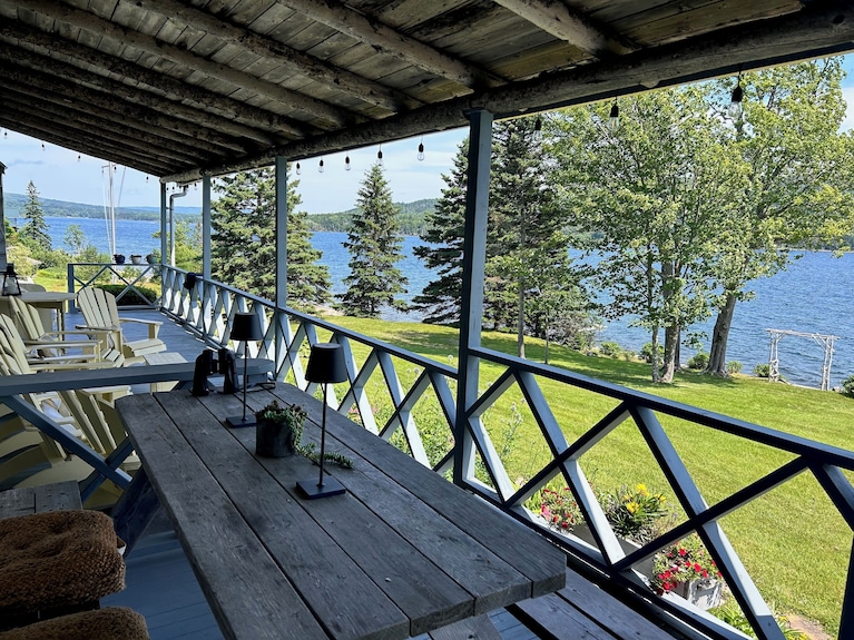
Options in Ingonish
Staying here puts you inside the national park’s emotional core—you’ll be minutes from the Skyline Trail trailhead for a pre-crowd sunrise start.
- Best for: Hikers prioritizing the Franey and Skyline Trails. This is the most convenient base for beating the midday tour bus crowds on the most popular trails.
- Stay style: Park-adjacent lodges and rental cabins. The Keltic Lodge Resort is the iconic, upscale option with a clifftop setting, but its price tag is steep. More affordable motels and cottage clusters line the road into both North and South Ingonish.
- Insider detail: Accommodations here are often dated but functional; you’re paying for location, not luxury. Expect roughly $150-$300 CAD/night for a basic room or cabin in fall, though prices vary widely with foliage timing.
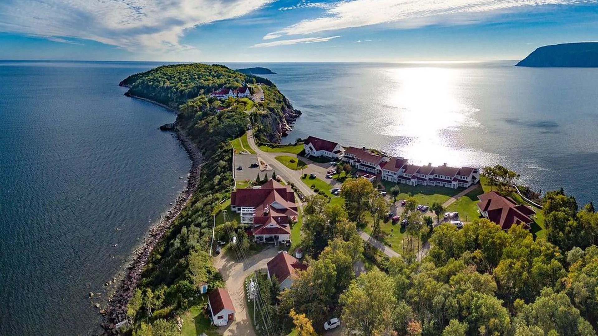
Options in Chéticamp
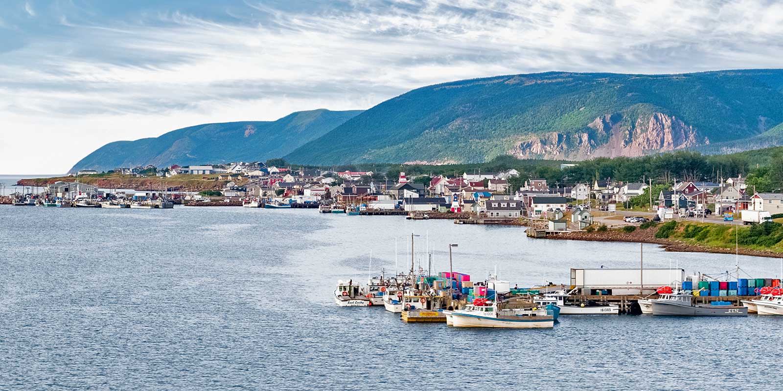
Chéticamp offers a cultural pivot from the wilderness-focused east side. This Acadian fishing village is the western gateway to the park and has a distinct French-Canadian character, vibrant hooked rug artistry, and a solid selection of casual eateries.
- Best for: Those driving the trail counter-clockwise (highly recommended) who want a base with personality and a slightly shorter drive to the Skyline Trail than from Baddeck.
- Stay style: Mainly motels, B&Bs, and vacation rentals along or near the main road (Cabot Trail). It’s less scenic than Ingonish but more practical.
- Insider detail: The drive from Chéticamp to the Skyline Trailhead is about 45 minutes, all on the incredible Cabot Trail. This makes a sunrise start very manageable.
Options in Margaree and Meat Cove
This stretch is for travelers who consider seclusion a feature, not a bug. The Margaree River valley is beautiful salmon country, while Meat Cove—literally the end of the road—has some of the most raw, untamed coastal scenery on the island.
- Best for: Adventurous couples or groups wanting total immersion in the landscape. This isn’t for those needing multiple dining options or reliable cell service.
- Stay style: Rustic cabins, vacation rentals, and a seasonal campground. In the Margaree Valley, you’ll find charming inns and riverside cottages. In Meat Cove, lodging is extremely limited: Meat Cove Campground (sites and a few rustic cabins) and a couple of private rentals are it. The campground’s cliffside sites have staggering ocean views.
- Insider detail: The road into Meat Cove is a steep, winding gravel road. While passable for most vehicles in dry conditions, it’s rough and not for the faint of heart. Book any Meat Cove lodging far in advance—it’s a tiny place with a big reputation.
Is a Cape Breton Highlands National Park Pass Required?
Yes, but only for the roughly one-third of the Cabot Trail that cuts through the national park — and that’s precisely where the most iconic hikes and lookouts are. Driving the scenic trail itself is free, but accessing those key stops requires a valid Parks Canada pass.
Daily vs Annual Pass Pricing
Pricing is straightforward and designed for length of stay, not number of entries. A daily pass covers 24 hours from your first entry, while the annual Discovery Pass is your best value for multi-day itineraries.
| Pass Type | Best For | Typical 2024/2025 Price (per adult) | Key Benefit |
|---|---|---|---|
| Daily Pass | Visitors driving through in one day | Check Parks Canada for current rate; expect ~$10-$11 CAD | Low upfront cost for a single-day park visit. |
| Discovery Pass (Annual) | Anyone spending 2+ days in the park | Check Parks Canada for current rate; often ~$72 CAD for a family/group | Unlimited entry to over 80 Parks Canada sites for a full year — a no-brainer for most fall road trips. |
Where to Purchase and Valid Stops
Purchase online at the Parks Canada website before you go. This lets you bypass the kiosk lines at the park gates — a real time-saver, especially on busy fall weekends. You can also buy passes at the park entrance gates in Ingonish or Chéticamp, or at the Parks Canada Visitor Centre in Chéticamp.
Your pass is required at all major stops within the park boundary, including:
- Skyline Trail* (the most popular trail in the park)
- Franey Trail*
- Warren Lake
- Acadian Trail
- Park campgrounds, like Chéticamp Campground.
Insider Tip: Rangers actively check for passes at trailhead parking lots, not just at entrance gates. Buying online ahead of time means you won’t get turned back from the Franey trailhead after a long drive.
Base yourself in Ingonish or Chéticamp for easiest access to the park’s major trailheads. The pass is your ticket to the heart of the fall foliage experience — don’t skip it.
Top Hikes on the Cabot Trail in Fall
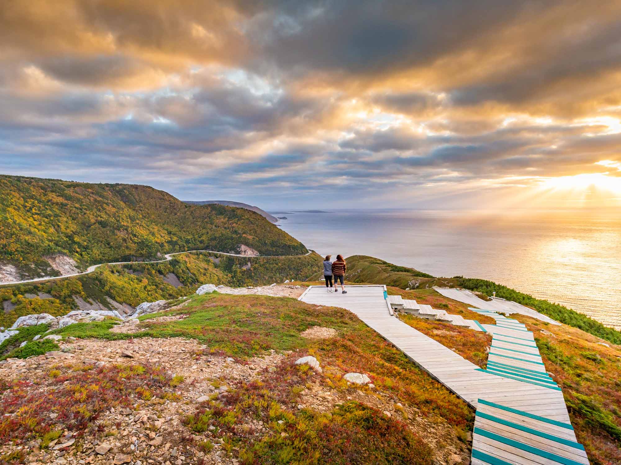
Skyline Trail draws the most visitors for its headland boardwalk, but it’s just one of six hikes that range from a 30-minute coastal scramble to a half-day ridge climb — and the fall color makes every single one worth stepping out of the car for.
At a glance — which trail fits your day:
| Trail | Effort | Best For |
|---|---|---|
| Skyline | Easy | Iconic ocean headland views |
| Franey | Strenuous | Panoramic ridge with fewer crowds |
| Middle Head | Easy | Quick peninsula stroll, whale watching |
| Meat Cove Overlook | Easy | Raw, rugged coastal drama |
| Gypsum Mine Trail | Easy | Turquoise lake in autumn forest |
| Egypt Falls | Easy–Moderate | Hidden waterfall in a forested gorge |
Skyline Trail
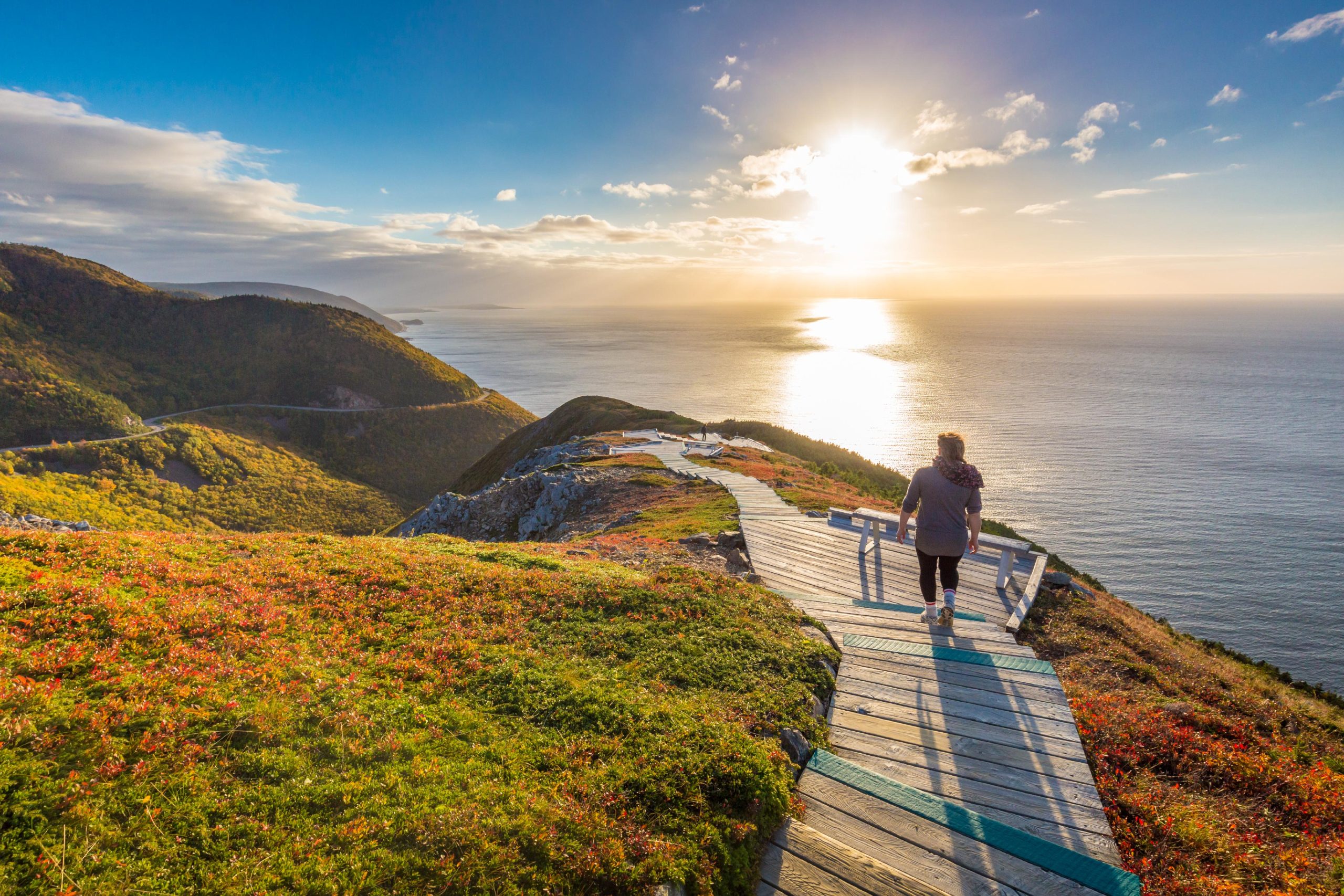
This is the most popular trail in all of Cape Breton — and in fall, when the headland blazes gold and orange against the Gulf of St. Lawrence, you’ll understand why. The mostly flat boardwalk leads to a dramatic headland where ocean cliffs drop hundreds of feet.
Budget two to three hours for the full out-and-back.
- Wind is real. The headland is exposed, and strong gusts can shut down the descent section at the end. Check conditions at the trailhead kiosk before committing to the full loop.
- Park pass required. Skyline sits inside Cape Breton Highlands National Park.
- Arrive before 10 a.m. The parking lot fills fast in peak foliage season. Morning light is also better for photos.
Base yourself in Chéticamp for the closest access — roughly a 20-minute drive to the trailhead.
Franey Trail
If Skyline is the Cabot Trail’s greatest hit, Franey is its deep cut — a steep, relentless climb through boreal forest that opens onto a sweeping panoramic view of the Indian Brook valley and the Atlantic coast. It’s the most physically demanding trail on this list, but the payoff is a ridgeline vista with a fraction of Skyline’s crowds.
Go here when you want a proper workout with your fall foliage.
The trailhead sits near Ingonish on the trail’s eastern side, inside the national park (pass required). It pairs well with Middle Head the same day.
Middle Head Trail
This easy peninsula walk starts from the Keltic Lodge area in Ingonish and juts out between two ocean coves. It’s the best “I only have an hour” hike on the Cabot Trail — flat, scenic the entire way, and a reliable spot for whale and eagle sightings in fall.
The headland views rival some of the longer hikes without any elevation gain.
Meat Cove Overlook and Mountain
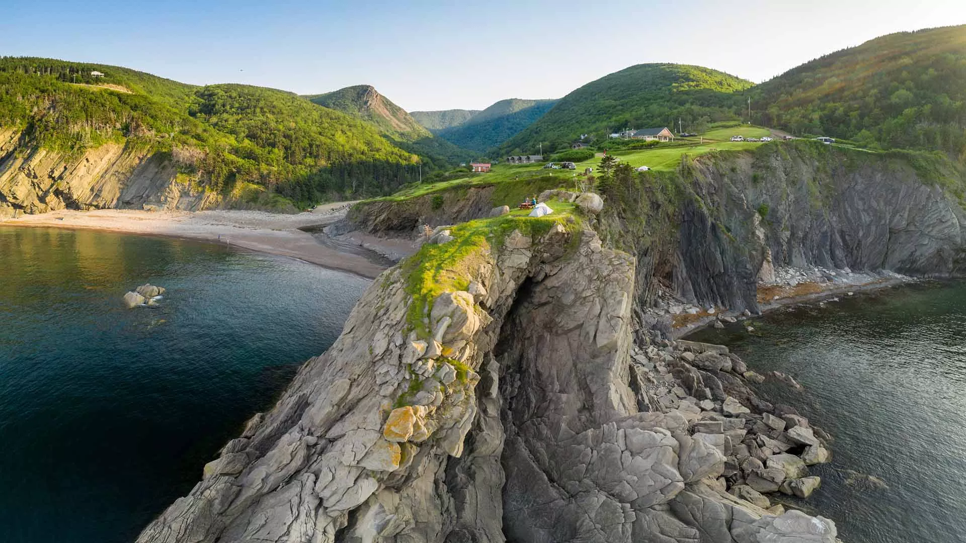
The short scramble up to the Meat Cove Overlook delivers jaw-dropping views of Cape Breton’s most rugged coastline — dark mountains speckled with yellow against crashing surf. It’s one of the most dramatic short hikes on the island and the highlight of the northern detour off the main Cabot Trail loop.
- Not in the national park — no pass needed.
- The road to Meat Cove is narrow and gravel. Allow extra time, and drive with care, especially if you’ve been on pavement all day.
Insider tip: Stay at Meat Cove Campground — the only accommodation in the village — to catch the overlook at sunrise. Almost no one bothers, and the early light on that coastline is unforgettable.
Gypsum Mine Trail
A flat, easy walk to a flooded turquoise gypsum quarry surrounded by autumn forest. The bright blue-green water against golden birch and red maple is the kind of unexpected color you don’t associate with Nova Scotia.
Locals swim here in summer; in fall, you’ll likely have the pool to yourself.
The trailhead is just outside Chéticamp, making it an easy same-day pairing with Skyline Trail — a combination most Cabot Trail itineraries list as one of the best day combos on the entire loop.
Egypt Falls
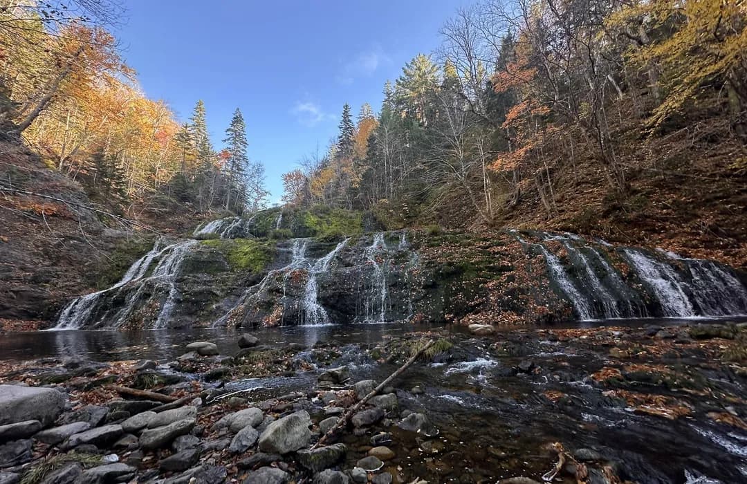
Technically off the Cabot Trail but only a short drive — and one of the best waterfall stops in Cape Breton during fall. The trail descends into a forested gorge to reach a powerful cascade framed by autumn color.
It feels hidden even though it’s well-documented, partly because the short scramble down deters casual visitors.
- No park pass required.
- Best combined with a Margaree Valley base — the falls are a quick detour from the Cabot Trail’s western stretch, and the valley is loaded with Celtic music venues and farm stands during October’s Celtic Colours festival.
Best Viewpoints and Scenic Stops
The Cabot Trail’s best views aren’t at the places with the biggest parking lots — they’re at the unsigned pull-offs between them. These three stops give you structured reasons to pull over, but the real magic happens on the stretches connecting them, especially between Beulach Ban Falls and Chéticamp where the road clings to cliffs painted in red and gold.
| Stop | Time Needed | Effort | Worth It? |
|---|---|---|---|
| North Mountain Look-Off | 10 minutes | None — roadside | Non-negotiable stop |
| McKenzie Mountain Look-Off | 10 minutes | None — roadside | Non-negotiable stop |
| Beulach Ban Falls | 20–30 minutes | Short flat walk | Worth it if passing; skip as a detour |
| Cape Smokey Gondola | 1–2 hours | Ride up, walk around | Best for non-hikers wanting summit views |
North Mountain and McKenzie Mountain Look-Offs
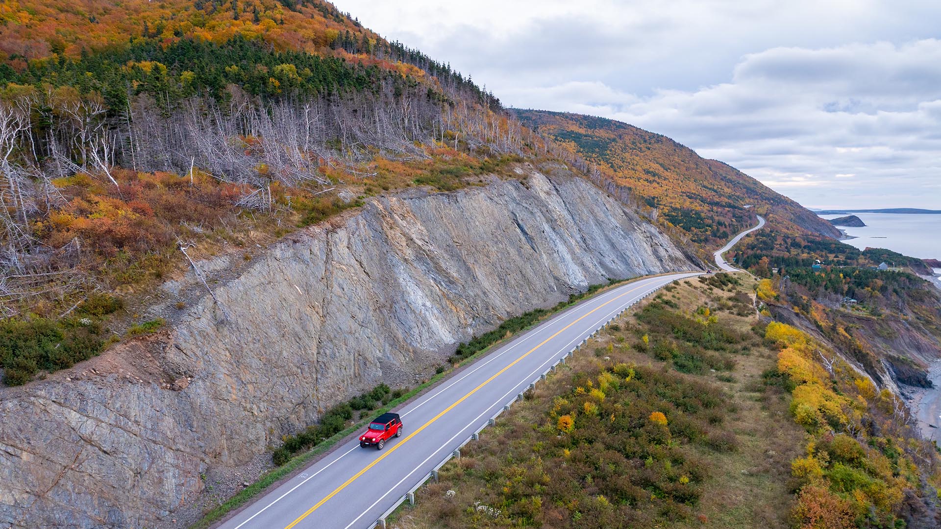
These two pull-offs sit along the highland plateau section of the Cabot Trail and deliver the kind of sweeping, multi-layered views that make you forget you’re still in North America. North Mountain Look-Off gives you a wide-angle shot across the highlands — in mid-October, the foreground burns with burnt orange and crimson while the Gulf of St. Lawrence stretches out behind it.
McKenzie Mountain Look-Off sits nearby and offers a slightly different angle with deeper valley views.
- Best timing: Morning light hits both look-offs well, but late afternoon creates richer color contrast on the foliage. Aim for either — midday washes things out.
- Crowd factor: Expect a handful of cars at any given time in peak season. These are pull-offs, not trailheads, so people cycle through quickly.
- Insider detail: The unmarked pulloffs between these two official look-offs often have better compositions with fewer heads in your frame. Slow down and take what catches your eye.
Base yourself in Ingonish or Chéticamp to reach this section of the trail within an hour’s drive, depending on direction.
Beulach Ban Falls
At 21 meters tall, Beulach Ban Falls is a photogenic cascade framed by yellow hardwoods in fall — and it’s steps from the parking lot, making it one of the easiest stops on the entire trail. The honest call: it’s pretty but not jaw-dropping compared to the coastal scenery surrounding it.
If you’re already driving this stretch, pull over and enjoy it for 15 minutes. Do not add extra driving time to reach it as a standalone destination — you’ll be disappointed relative to the effort.
- Who should stop: Anyone passing through the Pleasant Bay to Chéticamp corridor. Families with kids who need a stretch break. Photographers chasing waterfall-with-foliage compositions.
- Who can skip it: Travelers on a tight schedule who need to prioritize. If you’re choosing between this and the Skyline Trail or a look-off, the others win.
- Practical note: The walk is flat and short — accessible for most mobility levels. No park pass required for this particular stop since it sits just outside the national park boundary.
Cape Smokey Gondola Alternative

For anyone who wants summit-level views without summit-level effort, the Cape Smokey Gondola near Ingonish carries you up the mountainside for panoramic ocean and highland views that otherwise require a strenuous hike. It’s the best option on this list for travelers with limited mobility, families with small kids, or anyone who’d rather save their legs for the trail that matters most to them.
- Cost: Expect roughly $30–40 CAD per adult — confirm current pricing directly with Cape Smokey before your visit, as rates adjust seasonally.
- Timing: The gondola typically operates from late spring through mid-fall, but the exact closing date shifts yearly based on weather. If you’re visiting in the second half of October, call ahead to confirm it’s still running.
- Why it belongs on this list: The summit views rival anything you’ll see from a roadside look-off, and in fall, you’re looking down on a quilt of red and gold treetops with the Atlantic beyond. It compresses what would be a full hiking day into 90 comfortable minutes.
- Insider detail: Go early in the day. Cloud cover tends to roll in by mid-afternoon along this coast, and you want clear sightlines from the top — not fog.
Pair this with a stay in Ingonish, where you’re minutes from the gondola base and can hit the road for look-offs the next morning before day-trippers arrive.
Where to Eat Along the Cabot Trail
The trail has a handful of genuine dining gems — but you’ll also hit long stretches with nothing but gas-station coffee, so plan meals around the spots below rather than hoping something appears around the next blind curve.
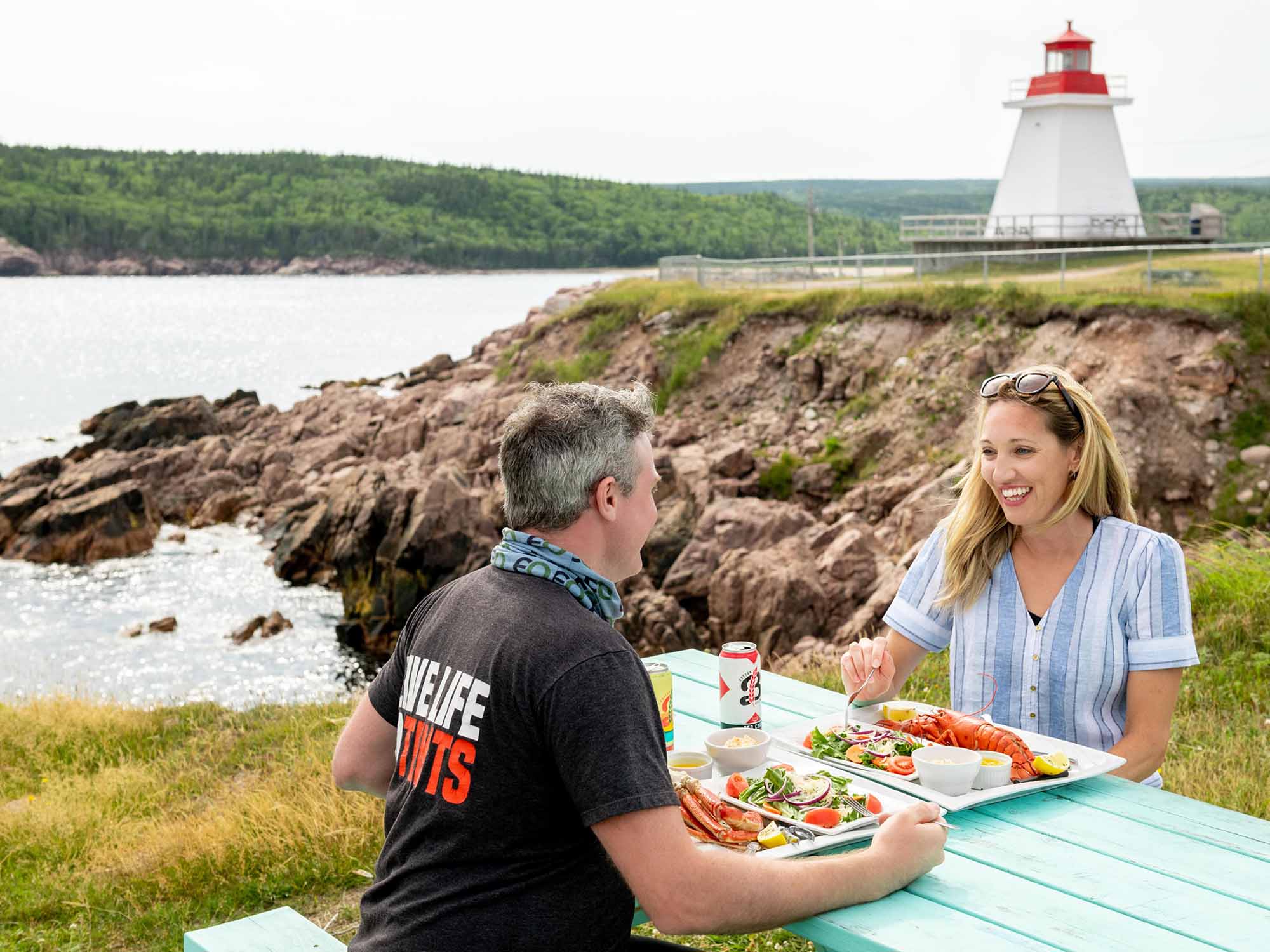
- Baddeck Lobster Suppers: All-inclusive seafood feast, the trail’s biggest splurge.
- Lawless Lobster: Faster, cheaper lobster rolls when you don’t want a full sit-down.
- Local bakeries (Baddeck and Margaree Valley): Morning pastries and bread to fuel early drives.
- Dancing Goat Cafe: The trail’s most popular lunch — arrive before noon or expect a line.
- Chéticamp dinner spots: Acadian-influenced sit-down meals on the western leg.
Baddeck Lobster Suppers and Cafes

At roughly $68 CAD per person, Baddeck Lobster Suppers delivers all-you-can-eat mussels and chowder, your choice of entree, dessert, one non-alcoholic drink, and coffee or tea — communal-table style, white plastic bibs included. It’s the biggest meal deal on the island and the best reason to start or end your loop in Baddeck.
Arrive hungry and arrive early; this place fills up nightly in peak foliage season.
Baddeck also has several casual cafes for lighter meals and breakfast. These pair well with an overnight base in town before hitting the trail first thing in the morning — the lodging options in Baddeck range from waterfront inns to budget motels, all within a short walk of the main strip.
Lawless Lobster and Local Bakeries
If a full lobster supper feels like too much commitment, Lawless Lobster serves lobster rolls in a more casual, counter-service format — the move for a quicker midday stop without losing the seafood mandate. Bakeries scattered through Baddeck and the Margaree Valley are where you grab pastries, fresh bread, and coffee before an early-morning drive leg.
These aren’t destination dining; they’re practical fuel, and they do the job well.
Dancing Goat Cafe and Chéticamp Spots
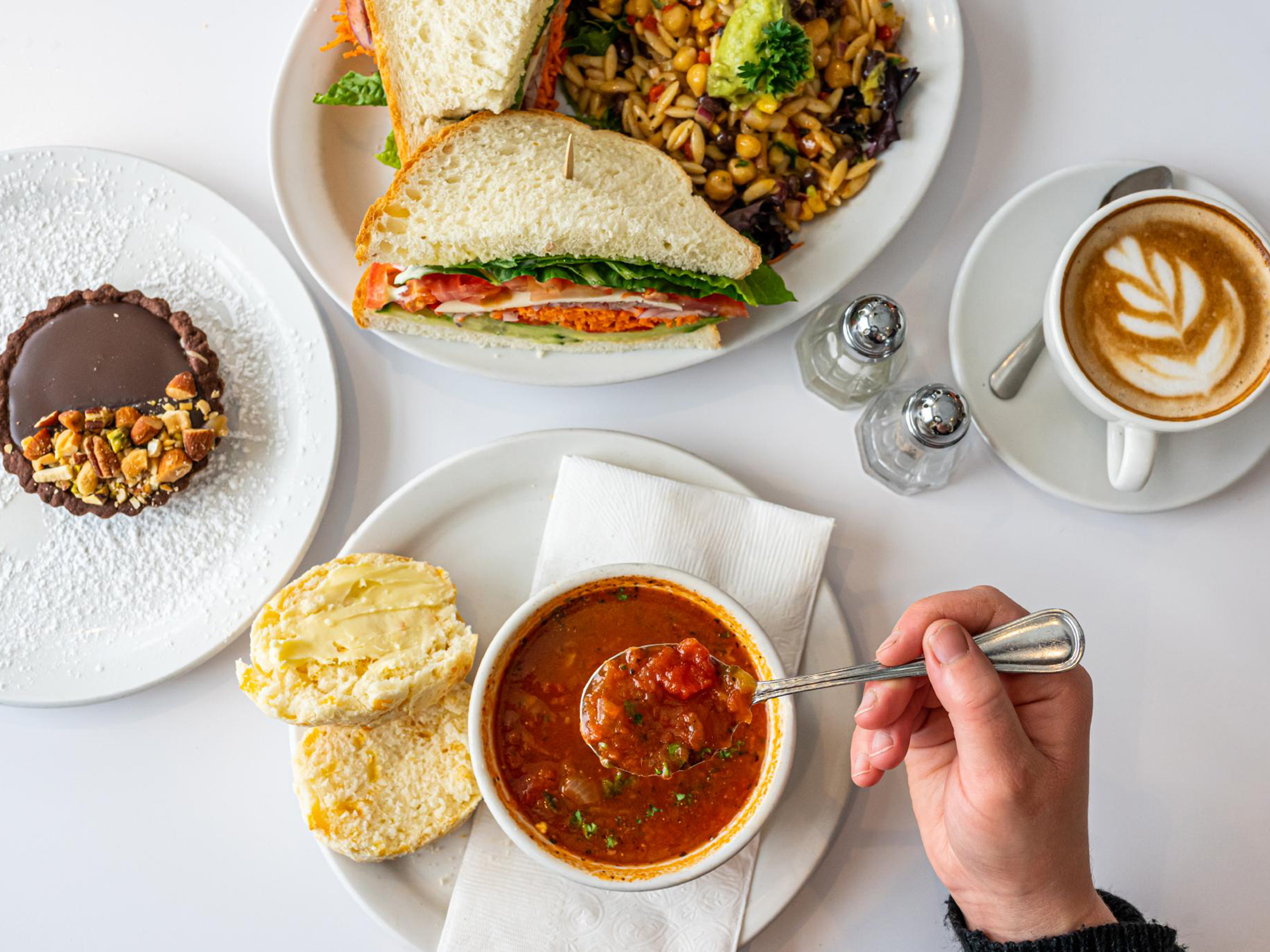
Hands down the most popular restaurant on the Cabot Trail, the Dancing Goat Cafe & Bakery sits in the Margaree area on the trail’s western leg. They bake their own bread daily and build sandwiches on it — simple, excellent, and exactly what you want at midday after winding through the highlands.
In fall, their pumpkin spice lattes are a genuine seasonal highlight, not a chain-store afterthought. Insider tip: arrive before noon.
This place draws a line out the door by 12:30 most autumn days, and they don’t take reservations.
Chéticamp, the largest community on the trail’s western side, is a proudly Acadian town with a handful of sit-down restaurants serving seafood and local fare. The options aren’t plentiful, but they’re the most reliable dinner choice between Margaree and the national park’s western entrance.
If you’re overnighting in Chéticamp — a smart base for exploring the Skyline Trail at sunset — eat here rather than backtracking. Specific menus and hours shift seasonally, so check locally when you arrive.
What to Pack for Fall Weather and Trails
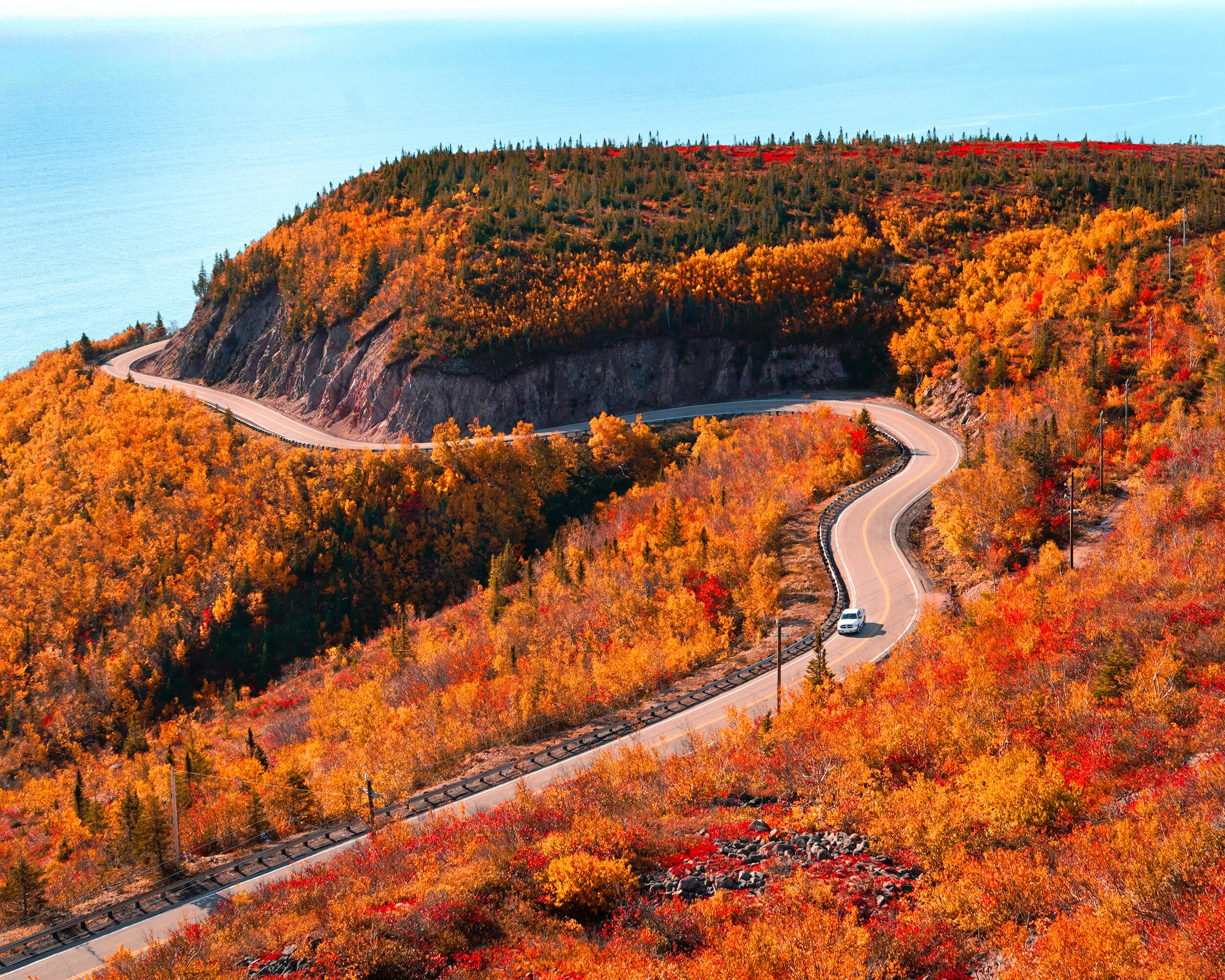
Cape Breton’s fall weather swings from 50°F sun at midday to 38°F windchill on an exposed headland in the same afternoon — and that shift happens fast. The gear you bring directly determines whether the Skyline Trail’s ocean overlook is exhilarating or miserable.
Layers and Rain Gear
Mid-October temperatures along the Cabot Trail typically range from the upper 30s to mid-50s°F (3–14°C), but coastal wind makes exposed sections like French Mountain and the Skyline Trail boardwalk feel significantly colder. The highland interior — where most popular hikes sit — runs 5–8°F cooler than Baddeck or Chéticamp at sea level.
Build your layering system around three pieces:
- Base layer: Merino wool or synthetic moisture-wicking top. Cotton kills comfort here — once damp from sweat or mist, it stays cold all day.
- Insulating mid-layer: A packable down or synthetic puffy jacket. This is non-negotiable. Mornings at trailheads like Franey or Skyline regularly start in the low 40s°F before the sun hits.
- Outer shell: A genuinely waterproof, windproof jacket with a hood — not “water-resistant.” Cape Breton’s coastal rain comes sideways with wind, and drizzle can last for hours. A $30 rain shell from a big-box store won’t cut it on the Skyline Trail’s exposed platform.
Pack a warm hat and lightweight gloves. You’ll use them more than you expect, especially on any trail above 1,000 feet elevation or during early-morning starts. A buff or neck gaiter is worth the zero space it takes up.
Hiking Shoes and AllTrails Maps
Cape Breton trails range from groomed boardwalk (Skyline Trail) to steep, rooty, muddy scrambles (Franey Trail, portions of the Coastal Trail near Meat Cove). After a fall rain — common in October — even “easy” trails get slippery.
Trail running shoes with decent grip work for Skyline’s boardwalk and the Bog Trail, but anything beyond that demands waterproof hiking boots with ankle support.
- Best all-around pick: Mid-height waterproof hiking boots. The Franey Trail drops 1,000+ feet with loose rock and exposed roots — low-cut shoes invite rolled ankles on the descent.
- What to skip: Fashion sneakers and anything non-waterproof. A single stream crossing or muddy patch on the Acadian Trail ruins them for the rest of the trip.
Download your trail maps on AllTrails before leaving your accommodation each morning. Cell service is spotty to nonexistent on most Cabot Trail hikes — especially on the western side between Pleasant Bay and Chéticamp and anywhere in the Cape Breton Highlands National Park interior.
The free AllTrails app lets you download maps offline; the paid version adds wrong-turn alerts, which genuinely help on poorly blazed sections of the Jack Pine and Coastal trails.
Insider detail: AllTrails crowdsource data sometimes lists trail distances and times as shorter than actual experience because hikers often turn around at viewpoints rather than completing full loops. Budget 20–30% more time than the app suggests, especially on Franey and Skyline in fall conditions with wet footing and photo stops.
One more thing most packing lists skip: bring a small dry bag or zip-lock bags for your phone and camera. Cape Breton’s coastal fog rolls in fast, and light drizzle persists for hours without ever becoming a full rainstorm — just enough moisture to slowly soak anything in open pockets.
Frequently Asked Questions
Do I need a park pass to drive the Cabot Trail?
Yes and no. Driving the Cabot Trail itself is completely free.
However, a significant portion—roughly one-third—passes through Cape Breton Highlands National Park. You will need a park pass for any stops, hikes, or activities within the park’s boundaries.
Plan for daily or annual pass fees, as detailed in our pricing section.
Can you drive the entire Cabot Trail in one day?
Technically, yes, but it’s a bad idea. The loop is approximately 298 kilometers (185 miles) and pure driving time is about five hours without stops.
But the entire point is the stops—ocean lookouts, short hikes, lunch in a fishing village. Trying to rush it in one day means you’ll miss everything that makes the trip worthwhile.
Build in at least two days to drive it comfortably, with three or more days being ideal for a proper fall road trip.
What is the weather like on a Cape Breton fall road trip?
Expect variability. October temperatures typically range from 5°C to 15°C (40°F to 60°F), but wind and elevation changes can make it feel much cooler, especially on coastal trails or highland peaks.
The absolute key is to pack layers: a windproof jacket, fleece, and moisture-wicking base layers are non-negotiable. Weather can change rapidly, so be prepared for anything from sunny skies to chilly fog or rain within the same day.
Ready to Hit the Road?
Start by locking in your dates for the middle of October, then immediately book your first and last night’s accommodation in Baddeck or Ingonish. This secures your launchpad and lets you drive the loop without backtracking.
This trip earns its reputation—it’s a concentrated burst of natural drama, culture, and autumn magic you won’t find replicated anywhere else on the continent.
Your next step is to check the official Celtic Colours festival dates for the year you plan to visit, as they’ll dictate your exact booking timeline.
Leave a Reply