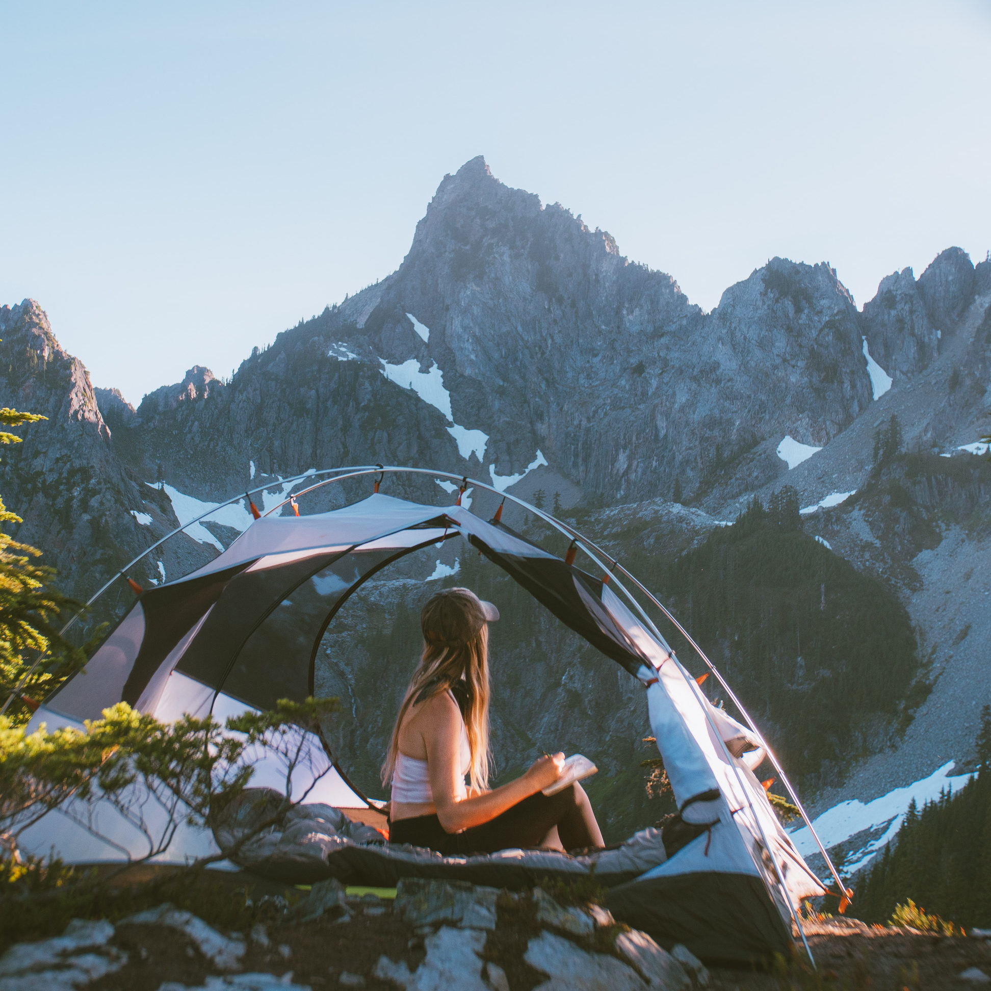
Cool morning air hits your face as golden larch needles catch the first light, turning entire mountainsides into liquid gold against turquoise alpine lakes—this is the Pacific Northwest fall experience, and it lasts exactly three weeks before the color fades and snow closes the passes.
Fall hiking here is fundamentally different from anywhere else: October hunting season overlaps with peak color, weather shifts from 60°F to hail in an hour, and daylight vanishes by 4:30 p.m., compressing your window to hike safely and see the show. The PNW’s maritime climate means you’re chasing a narrow peak—mid-September through mid-October—when golden larches, deep red huckleberries, and alpine meadows align perfectly.
This guide cuts through the noise and tells you exactly which trails deliver the most dramatic fall color, when to go, and how to avoid the mistakes that turn a perfect hike into a cold, dark scramble down a slippery trail.
Budget estimates: Day hikes run $5–$30 for parking passes; mid-range lodging near trailheads (Leavenworth, Concrete, Ashford) costs $120–$200 per night; splurge options with mountain views hit $250+.
Your Fall Hiking Decision Map
Closest to Seattle with guaranteed color: Granite Mountain (2 hours, steep, 3-mile round trip, late September peak) or Snow and Gem Lake (2.5 hours, moderate, 9 miles, early October peak).
Golden larch specialists (the main event): Cutthroat Lake (3.25 hours, 10 miles, mid-October peak) for larch-plus-lake reflections, or Lake Ingalls (2.5 hours, 10 miles, late September peak) for the densest larch forest in the central Cascades.
Most dramatic color show: Cascade Pass and Sahale Arm (3 hours, 14 miles, very crowded, mid-October)—the red and gold intensity here justifies the crowds and effort.
Solitude over crowds: Crater Lakes Trail (long drive, 9 miles, 2,200 feet gain, least crowded larch hike) or Goat Peak Lookout (2.5–3 hours, 3.5 miles, sunset views, low crowds).
Mount Rainier without the epic drive: Skyline Loop counter-clockwise (6.5 miles, 1,800 feet, deep red huckleberries, early October) or Naches Peak Loop (3 miles, 600 feet, easiest Rainier option).
Columbia River Gorge and Mount Hood (Portland base): Catherine Creek Trail for oak-against-blue-sky contrast, or Salmon River Trail for vine maple reds and easy access.
Best Fall Hikes in the Mount Baker and North Cascades Wilderness
The Mount Baker and North Cascades corridor delivers the Pacific Northwest’s most dramatic fall color show — golden larches against jagged peaks and turquoise alpine lakes — but these trails demand serious planning because weather turns fast, snow arrives early at elevation, and the season compresses into a narrow window between late September and mid-October.
This region sits 2–3 hours northeast of Seattle, centered around Highway 20 (the North Cascades Highway), and rewards early starts and flexible dates. Base yourself in Marblemount, Concrete, or Sedro-Woolley for trailhead access; Concrete is closest to most of these hikes and has gas, lodging, and supplies before you head into the wilderness.
The trails here split into two distinct zones: the Mount Baker area (west side, lower elevation, earlier season) and the Highway 20 corridor (central Cascades, higher elevation, peak larch color mid-to-late October). Crowds are real but manageable compared to Rainier or the Enchantments — you’ll see other hikers, but solitude is still possible on weekdays.
Snow can appear above 5,000 feet by late October, so confirm conditions with the ranger station before driving out.
Ptarmigan Ridge Trail
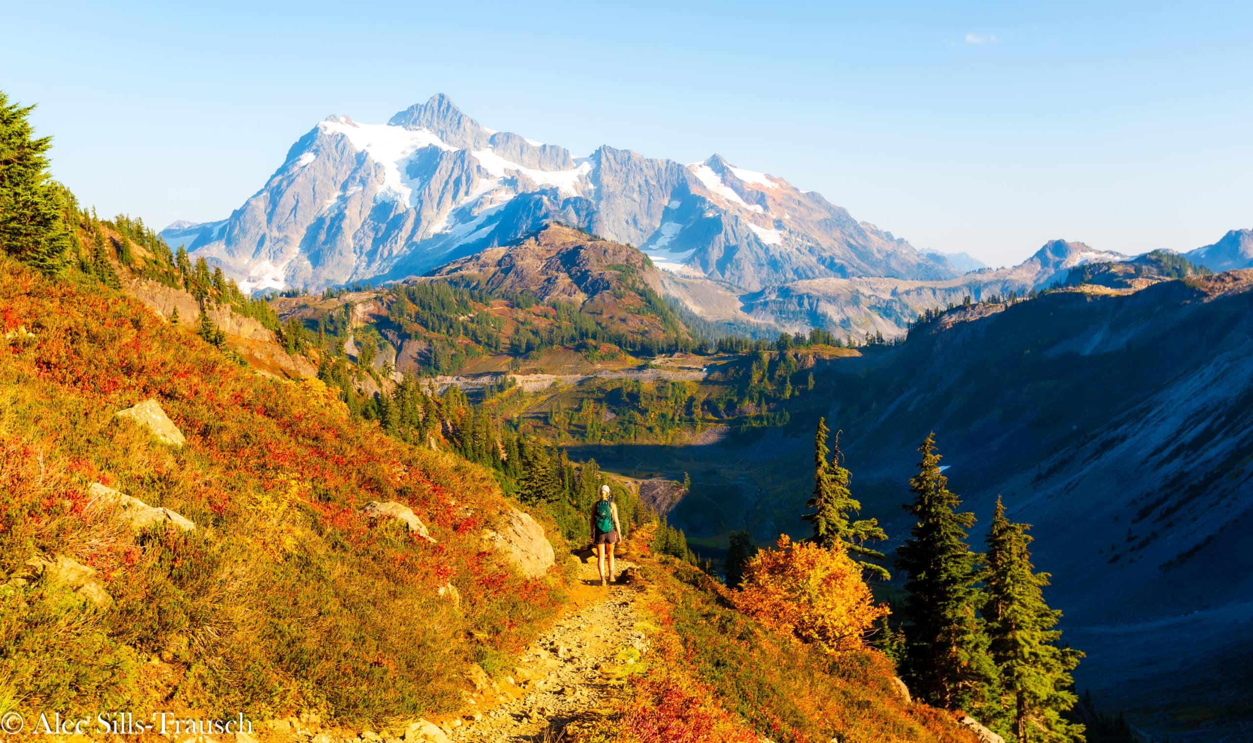
This is the gateway hike to the Mount Baker wilderness and the best choice if you want immediate payoff without a brutal climb. The trail climbs 2,000 feet over 5.5 miles to a ridge with unobstructed views of Mount Baker and Mount Shuksan, and in fall the meadows turn rust and gold while the peaks stay snow-capped.
It’s popular but not suffocating, and the wide-open terrain means you’re never trapped in forest — you see weather coming and can bail if conditions turn. Start early; the parking lot fills by 9 a.m. on weekends.
Drive time from Seattle is roughly 2.5 hours.
Chain Lakes Loop
This 8.8-mile loop shares the first stretch with Ptarmigan Ridge, so you get the same Mount Baker and Shuksan views right from the start, but then it peels off into a more intimate alpine basin with three pristine lakes. Fall transforms the meadows into a patchwork of red huckleberry and golden grass, and the loop format means no backtracking.
It’s slightly less crowded than Ptarmigan Ridge because the extra distance deters casual hikers. Elevation gain is around 2,000 feet, and the loop takes 5–6 hours at a moderate pace.
Same trailhead as Ptarmigan Ridge; arrive early.
Yellow Aster Butte
A shorter, steeper alternative to Ptarmigan Ridge if you want color without the mileage. The 5-mile round trip climbs 2,200 feet to a butte with 360-degree views and a fire lookout structure.
Fall larch and huckleberry color is excellent, and the trail is less crowded than nearby options. This one rewards an early start because afternoon clouds roll in fast at elevation.
Drive time from Seattle is about 2.5 hours.
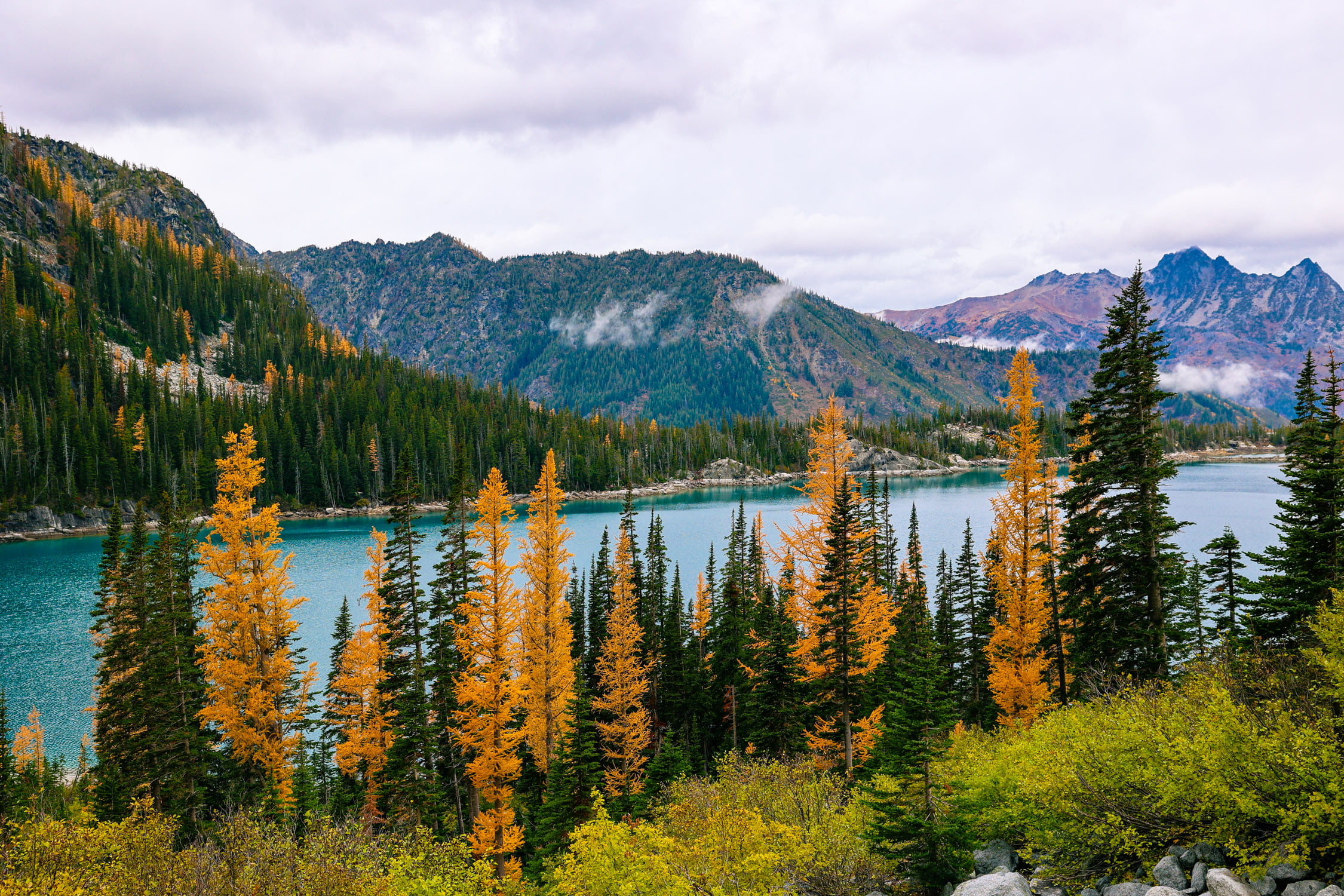
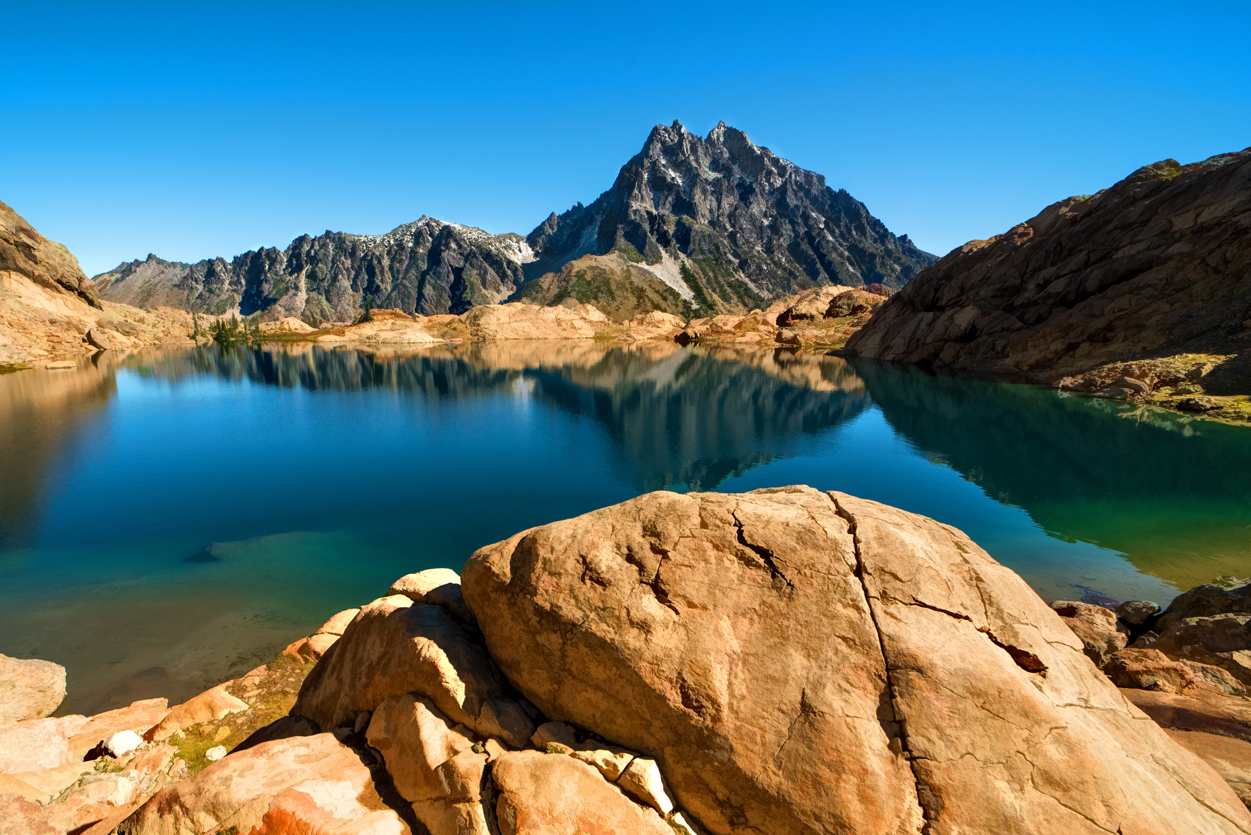
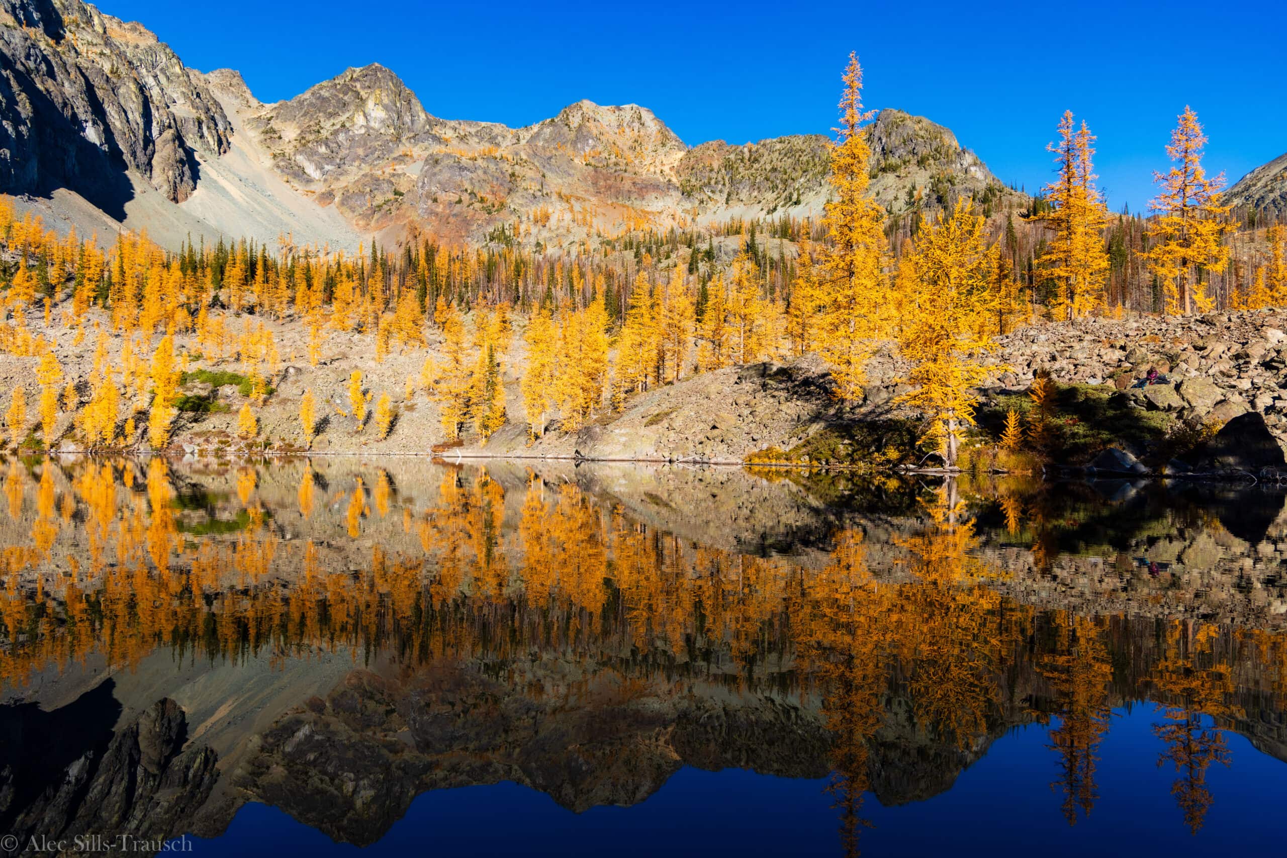
Cutthroat Pass and Cutthroat Lake
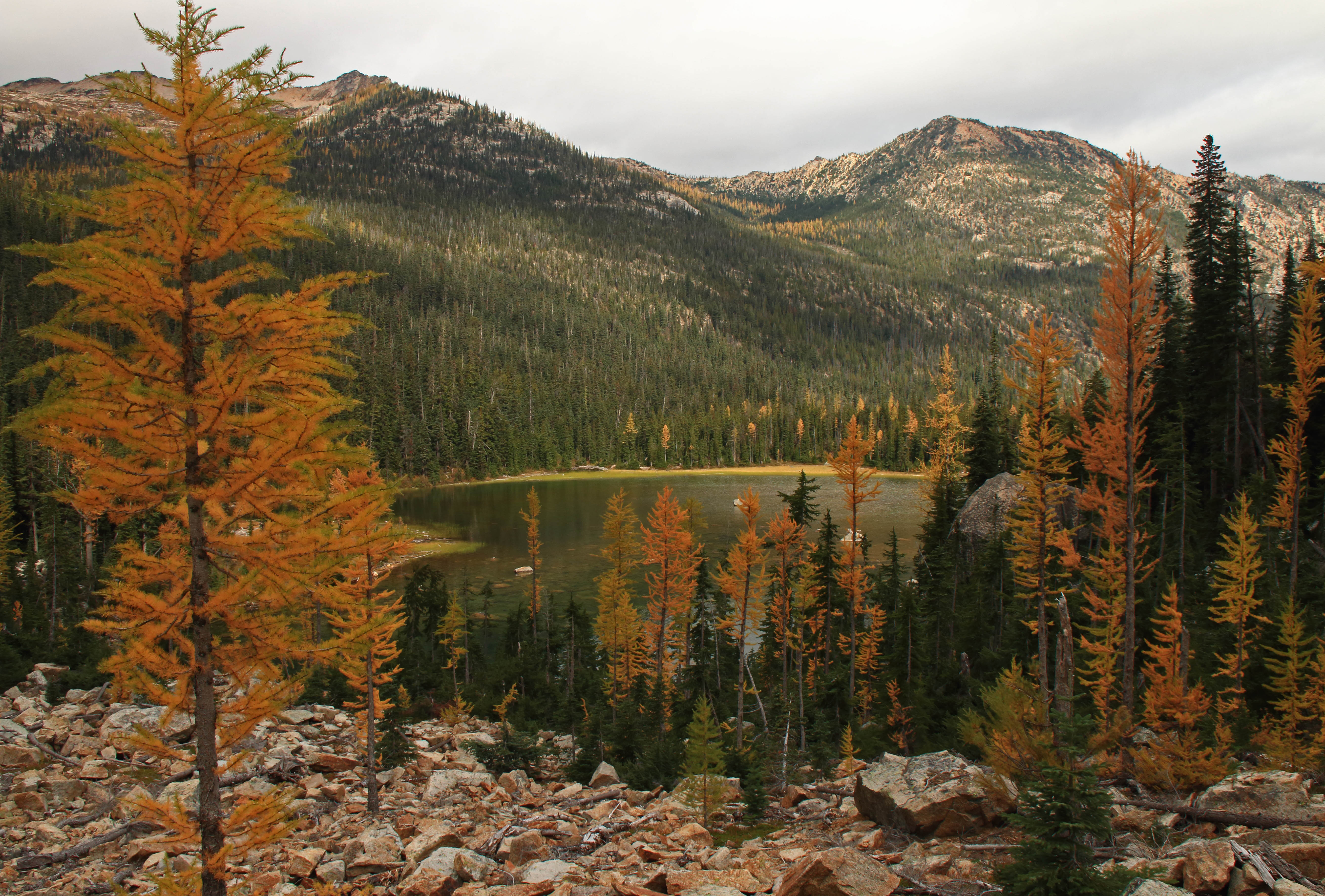
This is the premier larch hike in the North Cascades and the single best choice if your goal is golden larch color reflected in alpine water. The Cutthroat Lake approach (10 miles round trip, 2,500 feet elevation gain) is gentler than the PCT approach and keeps you in the larches longer — the trail doesn’t feel steep even as you rack up miles.
The lake sits in a basin surrounded by golden trees and turquoise water, and in late September through mid-October the color is genuinely stunning. It’s busy but not overwhelming; the length filters out day-trippers.
Drive time from Seattle is 3.25 hours via Highway 20. Park at the Cutthroat Lake trailhead (not the PCT trailhead) to stay in the larch zone.
Maple Pass Loop
A 9-mile loop that climbs 2,200 feet through open meadows and larch forest, with views of Rainy Pass and the surrounding peaks. The loop format and moderate difficulty make it popular, but the length keeps it from feeling crushed.
Best in late September through early October when larches are turning but before heavy snow. Drive time from Seattle is 3 hours via Highway 20.
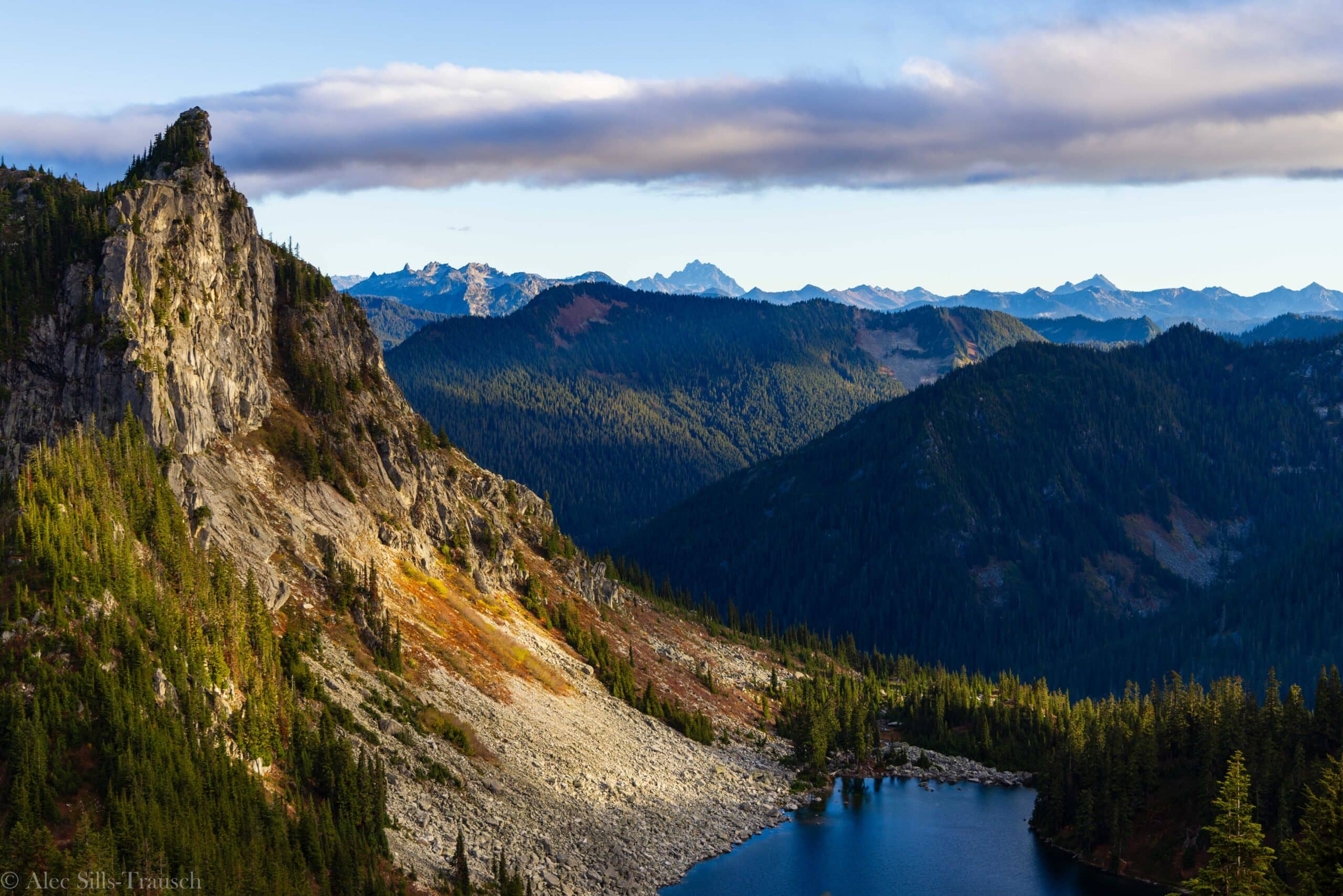
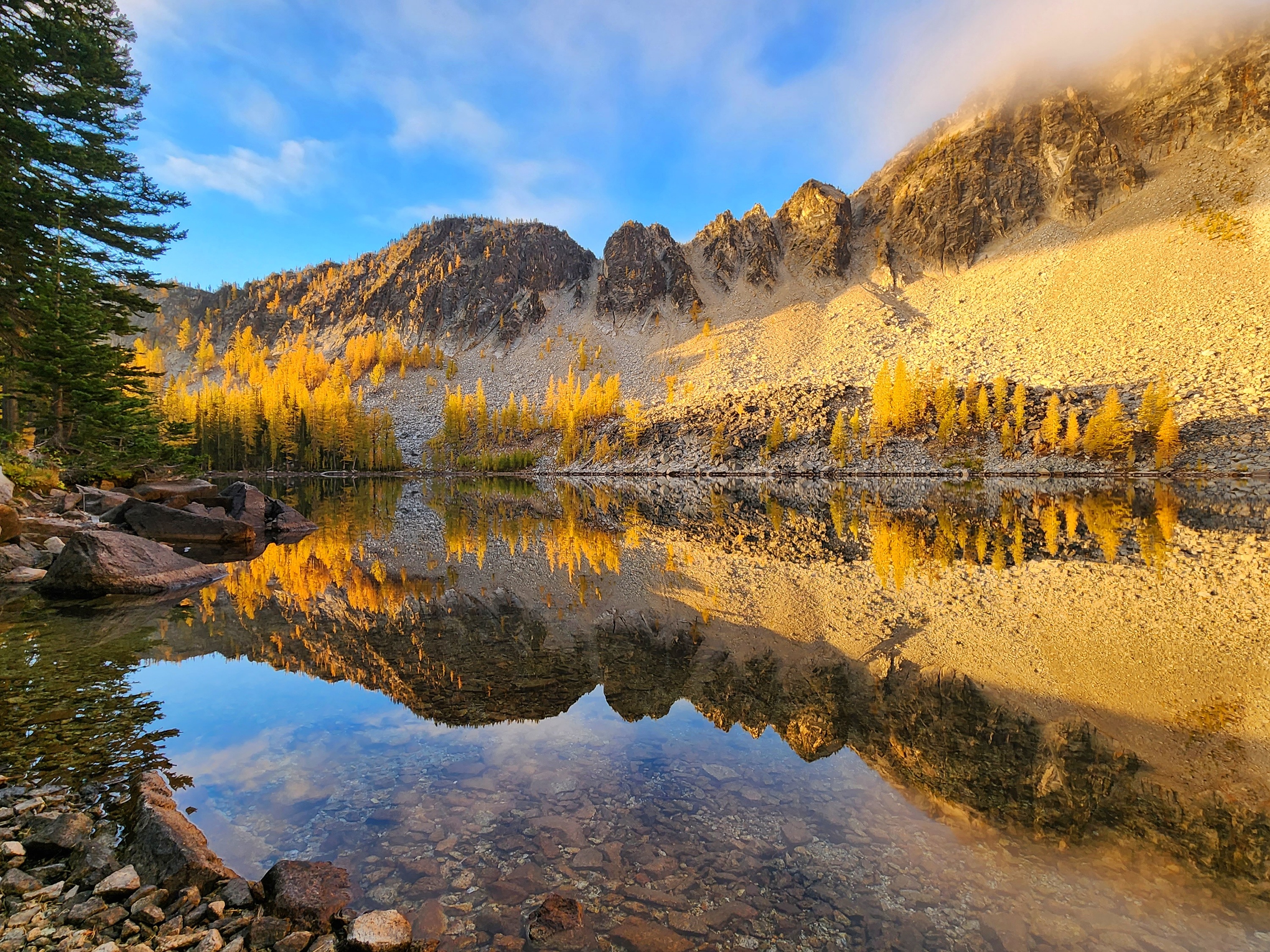
Wing Lake and Lewis Lake
Wing Lake is accessed via the Maple Pass Loop and is the payoff for the effort — late fall golden larches frame a turquoise alpine lake with towering peaks reflected in the water. The full Maple Pass Loop is 9 miles; if you want just Wing Lake, it’s roughly 6 miles round trip with 1,800 feet of gain.
The “infinity pool” effect at the back of the lake is worth the hike. Lewis Lake is a quieter alternative on the same general route if Wing Lake crowds are too heavy.
Both are best in late September through mid-October.
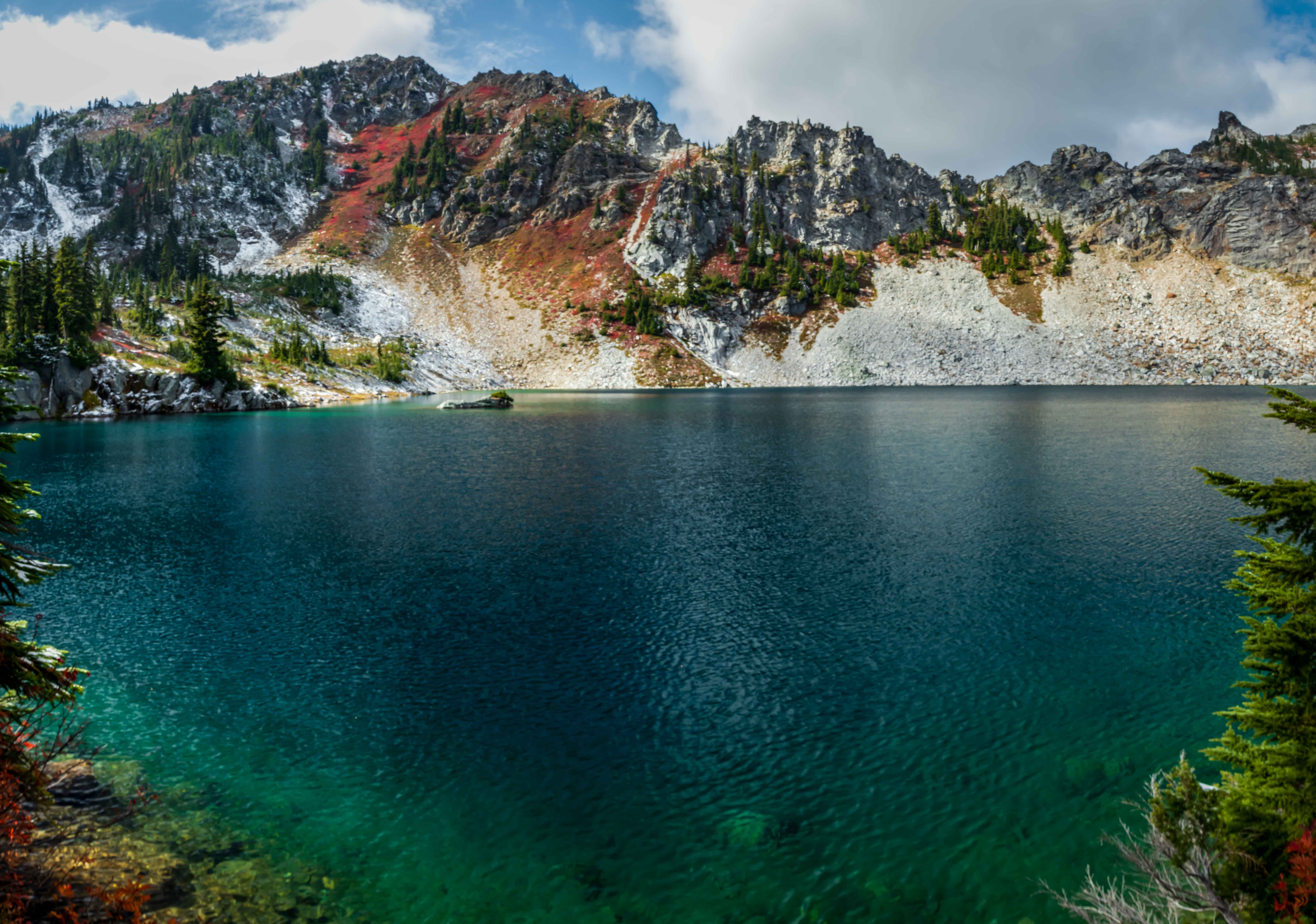
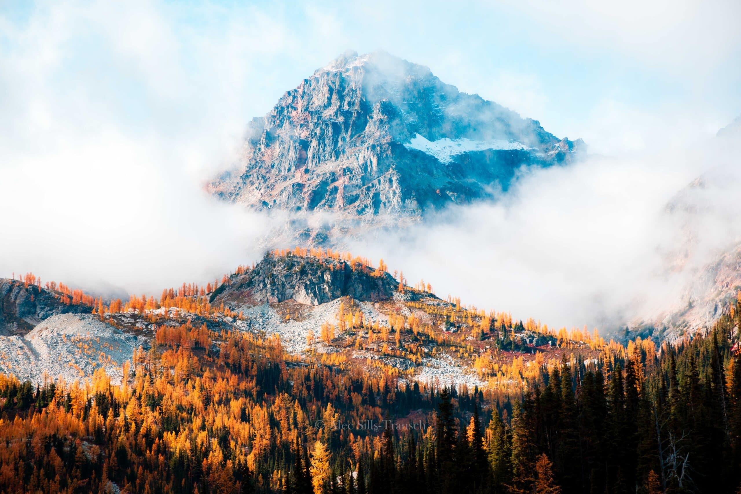
Cascade Pass and Sahale Arm
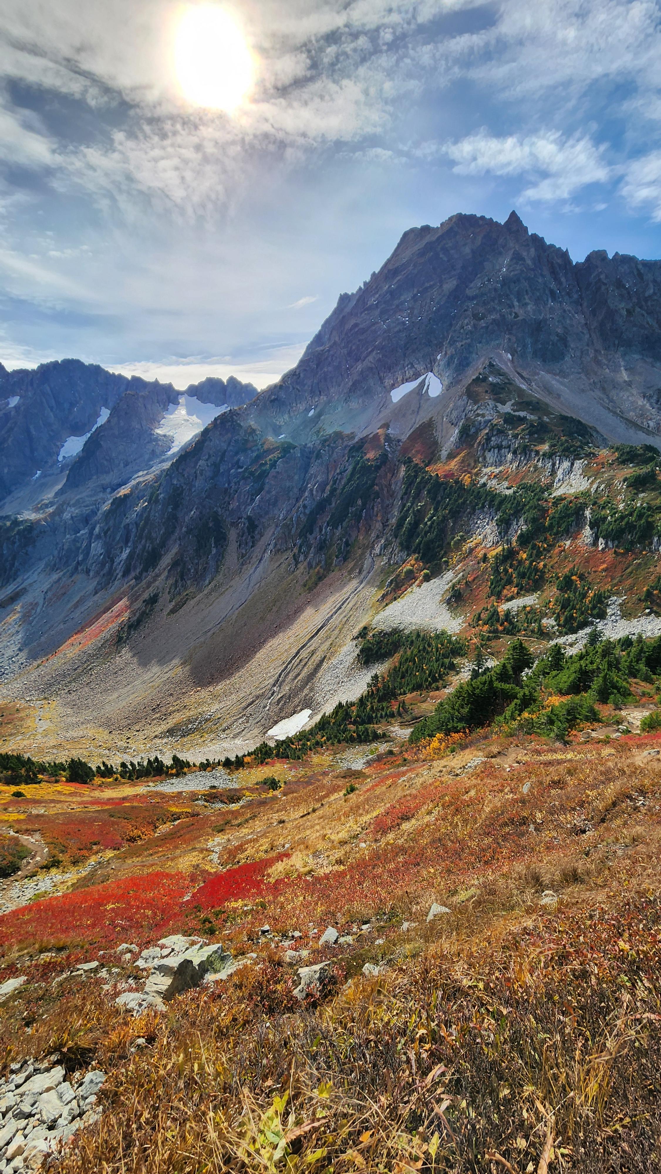
This is the most visually dramatic hike in the region and arguably the best fall color show in Washington — the amount of red and gold on this trail is genuinely bonkers. The 14-mile round trip with 3,800 feet of elevation gain climbs to Cascade Pass (a historic trade route between valleys) and then up to Sahale Arm for views of Glacier Peak and the surrounding wilderness.
It’s very crowded in fall, but the scenery justifies it. The red color comes from alpine blueberry and other low shrubs; the gold from larch.
Start early and expect to share the trail. Drive time from Seattle is 3 hours via Highway 20.
Snow can appear above 6,000 feet by late October, so confirm conditions.
Blue Lake
A shorter, less-crowded option in the Highway 20 corridor. The 9-mile round trip climbs 1,200 feet to a turquoise alpine lake surrounded by larch forest. Best in late September through early October. Drive time from Seattle is about 2.5 hours via Highway 20.
Goat Peak Lookout
For sunset views and solitude, this is the move. The 3.5-mile trail climbs through a larch forest to an active fire lookout with panoramic views of the surrounding mountains.
The short distance and specific sunset timing mean fewer hikers, and the lookout itself is a unique vantage point. Bring a headlamp for the descent if you’re timing it for sunset.
Drive time from Seattle is roughly 2.5–3 hours depending on which trailhead you use.
Cutthroat Pass via the PCT
An alternative approach to Cutthroat Pass using the Pacific Crest Trail. This route is 10–13 miles depending on your exact turnaround point, with 2,000 feet of elevation gain.
It’s less crowded than the Cutthroat Lake approach because it requires more planning and navigation, but the larch color is equally stunning. Best for hikers comfortable with less-maintained trail.
Drive time from Seattle is 3.25 hours.
Grasshopper Pass and Slate Peak Lookout
A remote, high-elevation option for experienced hikers seeking solitude and expansive views. Grasshopper Pass sits at 6,800 feet, and Slate Peak Lookout (the highest point in the North Cascades National Park area) offers 360-degree views.
These trails are less crowded because of the elevation and distance, but snow can arrive early and weather changes fast. Best in early October before snow closes the pass.
Drive time from Seattle is 3–3.5 hours via Highway 20.
Kangaroo Pass
A lesser-known pass hike in the Highway 20 corridor with good larch color and fewer crowds than the main attractions. The exact distance and elevation gain depend on your approach, but expect 8–10 miles and 2,000+ feet of gain.
Best for hikers who want to avoid the Cascade Pass crowds while still getting alpine views.
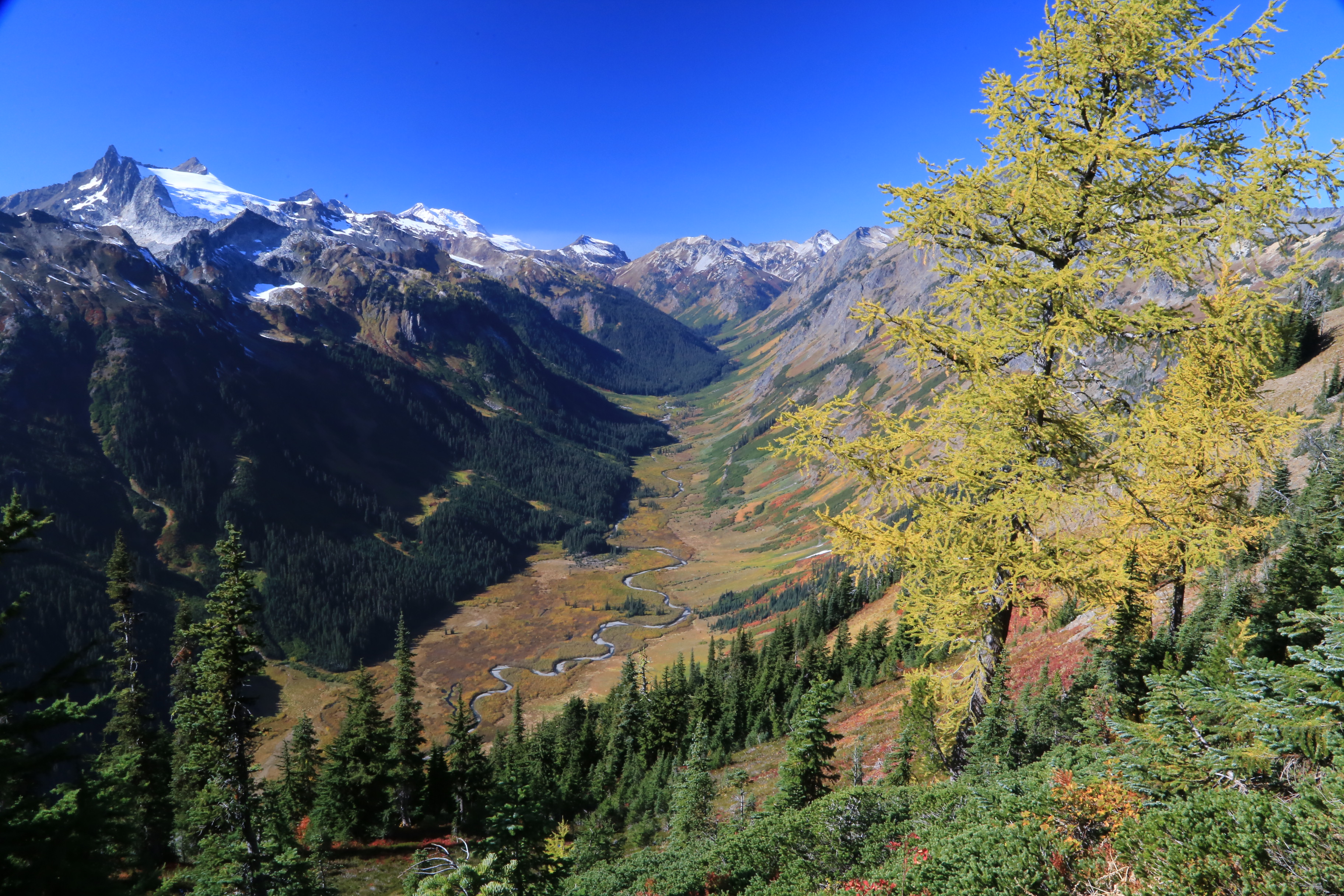
Harts Pass to Windy Pass via the PCT
A high-elevation traverse on the Pacific Crest Trail with expansive views of the North Cascades and the Pasayten Wilderness. This is a serious hike for fit, experienced hikers — the elevation is high (6,000+ feet), weather is unpredictable, and snow can appear by late September.
The payoff is solitude and dramatic mountain scenery. Drive time from Seattle is 3.5+ hours via Highway 20 and Forest Service roads.
Quick Comparison: What Wins for Your Goal
| Trail | Best For | Distance | Elevation Gain | Crowds | Peak Color Timing |
|---|---|---|---|---|---|
| Ptarmigan Ridge | First-time visitors; Mount Baker views | 5.5 mi | 2,000 ft | Moderate–High | Late Sept–Early Oct |
| Cutthroat Lake | Golden larch + alpine lake reflections | 10 mi | 2,500 ft | Moderate | Mid–Late Oct |
| Cascade Pass & Sahale Arm | Most dramatic color show | 14 mi | 3,800 ft | Very High | Mid–Late Oct |
| Maple Pass Loop | Balanced effort + views + larch | 9 mi | 2,200 ft | Moderate–High | Late Sept–Early Oct |
| Goat Peak Lookout | Sunset + solitude + short distance | 3.5 mi | ~1,500 ft | Low | Late Sept–Early Oct |
| Yellow Aster Butte | Color without the mileage | 5 mi | 2,200 ft | Moderate | Late Sept–Early Oct |
| Grasshopper Pass / Slate Peak | Solitude + high elevation views | 8–12 mi | 2,500+ ft | Low | Early–Mid Oct |
Planning Notes: When to Go and What to Confirm
Timing is everything. The Mount Baker area (Ptarmigan Ridge, Yellow Aster Butte, Chain Lakes) peaks in late September through early October. The Highway 20 corridor (Cutthroat Lake, Cascade Pass, Maple Pass) peaks in mid-to-late October when larch color is most intense.
Snow can start appearing above 5,000 feet by late October, and Highway 20 itself can close due to snow by November. Confirm road access and trail conditions with the Mount Baker Ranger District (360-856-5700) or the North Cascades National Park Visitor Center before driving out.
Parking and permits: Most of these trails require Northwest Forest Pass ($5 day pass or $30 annual) or National Park Pass ($30 vehicle pass for North Cascades). Parking lots fill fast on weekends — arrive by 8 a.m. or plan a weekday hike.
No backcountry permits are required for day hikes, but overnight camping requires a permit from the ranger district.
Weather and gear: Fall weather in the Cascades is unpredictable. Expect temperatures in the 40s–50s°F at trailheads and 30s–40s°F at elevation.
Bring layers, a rain shell, and a headlamp even on day hikes — the sun sets by 5:30 p.m. in late October. Trails above 5,000 feet may have snow or ice by late October; microspikes are smart insurance.
Insider tip: If Cascade Pass is too crowded or you want to avoid the Sahale Arm scramble, hike just to Cascade Pass itself (7 miles round trip, 2,000 feet gain) — the views are still excellent, the crowds thin out, and you avoid the technical terrain above the pass.
Golden Larch and Alpine Basin Hikes in the Central Cascades & Chelan
Golden larches turn these high alpine basins into a photographer’s fever dream for exactly three weeks in mid-September through early October — and the window closes fast. This cluster of trails in the central Cascades and around Chelan offers the densest concentration of larch-heavy routes in the Pacific Northwest, with most peaks out by mid-October.
Unlike the crowded North Cascades corridor, many of these hikes stay quieter because they require longer drives from Seattle (2.5 to 5 hours) and demand either serious elevation gain or a full day’s commitment. The payoff: fewer hikers, more golden trees, and alpine lakes that reflect the color like mirrors.
Base yourself in Leavenworth or Snoqualmie Pass for the easiest access to most of these trailheads. Both towns offer lodges, cabins, and mountain inns within 45 minutes to 1.5 hours of the major routes below.
Book accommodations by late August — fall weekends fill fast. Most trailheads require a Northwest Forest Pass ($5 per day or $30 annual); carry cash or buy online before you go.
The Enchantments Thru-Hike
This is the hardest single-day fall hike in Washington at roughly 20 miles, and it demands a pre-dawn start because daylight runs short in autumn. The route threads through one of the most larch-dense alpine basins in the state, with turquoise lakes and granite peaks that justify the brutal effort.
Skip this if you’re not comfortable hiking in near-darkness at the end of the day or if you haven’t done serious elevation gain recently — the risk of injury on descent in low light is real. Pick this only if you’re an experienced hiker with excellent fitness and you can commit to a 5 a.m. trailhead arrival on a clear-weather day.
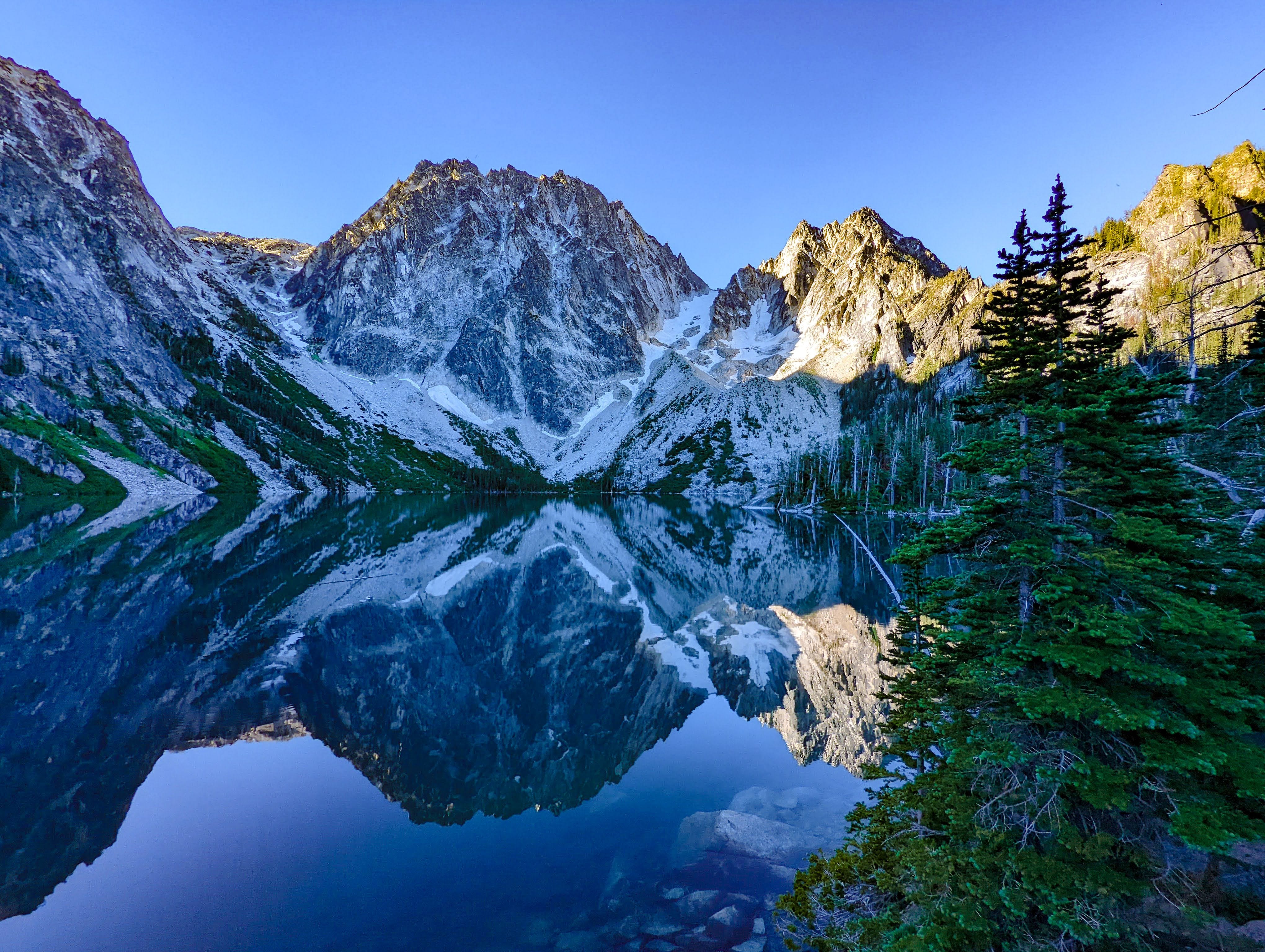
Lake Ingalls
This 10-mile round-trip with 3,000 feet of elevation gain is the most popular larch hike in the central Cascades for good reason: the larches are thick, the lake is stunning, and the surrounding peaks frame the whole scene. The trail splits partway up — stay low to hike through the larch forest, or stay high for photography angles above the trees.
Expect crowds on clear weekends in late September; go on a weekday or wait for the first week of October when most casual hikers have moved on but the color is still peak. Drive time from Seattle is roughly 2.5 hours, making this the most accessible of the longer larch routes.
Alta Mountain and Rampart Lakes

The 9.8-mile route starting at Rachel Lake Trailhead climbs through colorful forest to alpine lakes with calm water that mirrors fall foliage perfectly. The optional summit push to Alta Mountain adds 360-degree views but also serious elevation — only do it if you have energy left and the weather is holding.
This hike wins for hikers who want larch color without the 20-mile commitment of the Enchantments, and the lake itself is a legitimate turnaround point if the weather turns or your legs give out. Rampart Lakes is the quieter reward at the top.
Lake Valhalla and Mount McCausland
The 6.3-mile base hike to Lake Valhalla is one of the gentler routes in this section, winding through lush forest to a serene alpine lake surrounded by golden larches. The optional push up Mount McCausland adds panoramic views of surrounding peaks and valleys but also serious scrambling.
Hike this on a clear day — the lake reflection and larch color are the whole point, and clouds will ruin both. This wins for anyone wanting larch scenery without extreme elevation gain, and it’s short enough for a half-day outing if you start early.
Carne Mountain

Research data on this route is limited, but it appears in the central Cascades larch cluster. Confirm current trailhead access, elevation gain, and distance with the Washington Trails Association or local ranger district before driving out — some Cascades routes experience seasonal closures or maintenance work that isn’t always updated online.
Minotaur Lake
This alpine basin hike offers larch color and high-elevation scenery typical of the central Cascades cluster. Confirm trailhead conditions and distance with the WTA or local ranger district, as detailed route information is limited.
Little Giant Pass
A pass-based route in the central Cascades larch zone. Verify current access and elevation gain with the Washington Trails Association before committing to the drive.
Copper Glance Lake
The 5.5-mile hike with 2,500 feet of elevation gain is worth the nearly 5-hour drive from Seattle specifically for the density of larches surrounding the lake — this is one of the best larch concentrations in the state. The trail stays relatively mild in terms of technical difficulty, but the elevation gain is real and relentless.
Go on a weekday to avoid crowds; this is still one of the less-crowded larch hikes despite its reputation. Start early to maximize daylight and allow time for the long drive home.
Golden Lakes Loop (Eagle Lakes & Cooney Lake)
This loop route combines multiple alpine lakes in one outing, offering variety and multiple photo opportunities as you move through different larch-filled basins. Confirm exact mileage and elevation gain with current sources, as loop routes can vary depending on which direction you hike and which lakes you include.
Crater Lakes Trail
The 9-mile route with 2,200 feet of elevation gain is one of the least crowded larch hikes in the central Cascades, making it a smart choice if you want color without fighting weekend traffic. Tons of larches encircle the lake, and the quieter status means you’ll actually have space to stop and photograph without hikers streaming past.
This wins for anyone prioritizing solitude over convenience — the drive is long and the elevation gain is substantial, which naturally filters out casual hikers.
Timing, Crowds, and Larch Peak
Golden larch season in the central Cascades typically peaks mid-September through early October, with the window narrowing sharply after the first week of October. The exact peak shifts 1-2 weeks depending on elevation and that year’s weather — higher passes peak later.
Check the Washington Trails Association’s fall hiking updates and recent trip reports on AllTrails or WTA before committing to a specific date. Weekday hikes see 50-70% fewer people than weekends; if you can take a day off work, do it.
Expect roughly $5 per vehicle for a Northwest Forest Pass at most trailheads, or buy a $30 annual pass if you’re hiking multiple routes. Parking fills by 8-9 a.m. on clear weekends in late September — arrive by 7 a.m. or plan for a 30-minute hike to an overflow lot.
Top Autumn Hikes Near Seattle: I-90 and Mount Rainier Corridors
The I-90 corridor and Mount Rainier National Park deliver the most accessible fall color shows within 2.5 to 3 hours of Seattle, with trails that shift from huckleberry-red meadows in early September to deep crimson bushes and golden larches by October. These hikes fill fast on weekends—parking becomes the real bottleneck—but arriving before 8 a.m. or hiking on weekdays solves that problem entirely.
The payoff: trails where autumn colors are guaranteed, elevation gains stay moderate to manageable, and you’re back in the city by dinner.
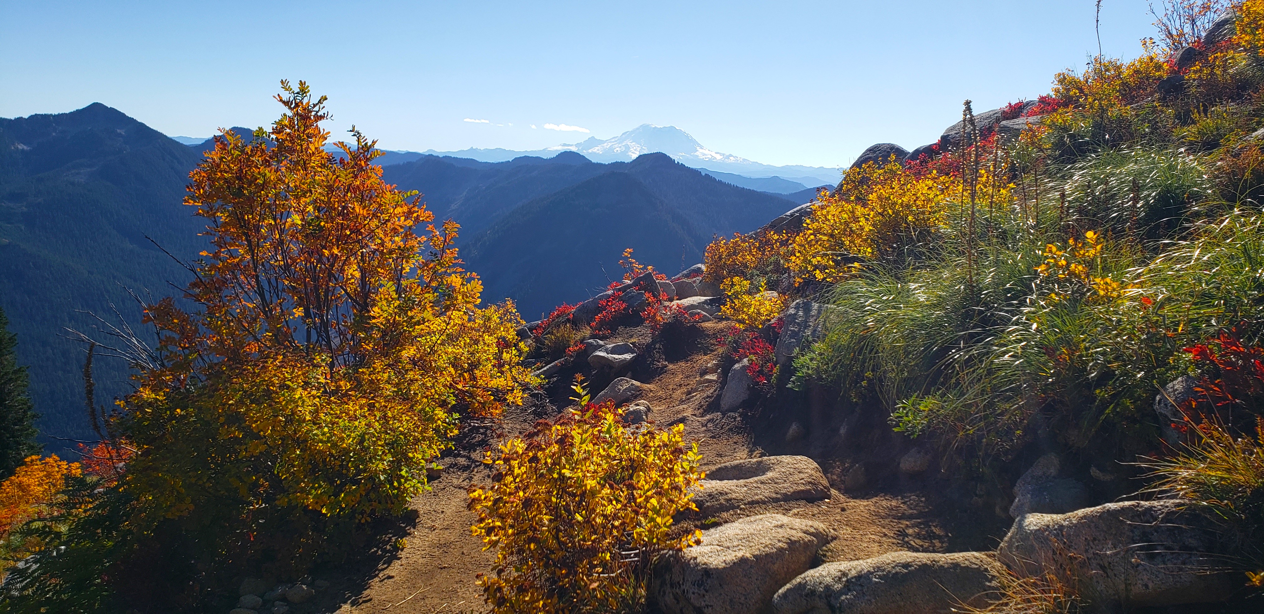
Granite Mountain
Best for: Hikers who want dramatic views without the Mount Rainier crowds, and who don’t mind a steep push to earn them. Why it wins: The payoff-to-effort ratio is unbeatable—a short, intense climb delivers panoramic views of the entire Cascade range and the Snoqualmie Valley below, and fall colors here peak slightly earlier than higher-elevation trails, making it reliable in late September.
This is a no-nonsense hike: steep, direct, and done in under 3 hours round-trip. The trail climbs roughly 2,000 feet in about 3 miles with minimal switchbacks, so expect a quad-burning ascent.
The reward is a fire lookout perch where you can see Mount Rainier, Mount Baker, and the Cascades stretching north and south. In fall, the surrounding slopes turn rust and gold, and the lower-elevation trees begin their color shift earlier than alpine zones, so this hike works well in late September when higher trails are still mostly green.
Arrive by 7:30 a.m. on weekends to secure parking at the Granite Mountain Trailhead off I-90 near Snoqualmie Pass.
Snow and Gem Lake
Best for: Families and hikers seeking a moderate, scenic loop with guaranteed solitude if you push past the first lake. Why it wins: Snow Lake itself gets crowded on sunny weekends, but continuing to Gem Lake cuts the crowds dramatically while adding the best fall color display—brilliant red berry bushes line the trail between the two lakes, and Gem itself sits in a quieter alpine basin.
This is a 9-mile round-trip from the Alpental parking area (near Snoqualmie Pass), gaining roughly 2,000 feet. Snow Lake is the obvious turnaround for most day hikers, which means the trail to Gem Lake stays peaceful and feels like a secret despite being only 1.5 miles further.
The stretch between the two lakes is where autumn really shows: huckleberry bushes turn deep red, and the trail winds through an open alpine meadow with views of surrounding peaks. Gem Lake itself is smaller, colder, and more serene than Snow Lake—a better place to linger and eat lunch.
Plan for a 2.5-hour drive from Seattle, and aim to start by 8 a.m. on weekends; the Alpental lot fills by mid-morning in September and October.
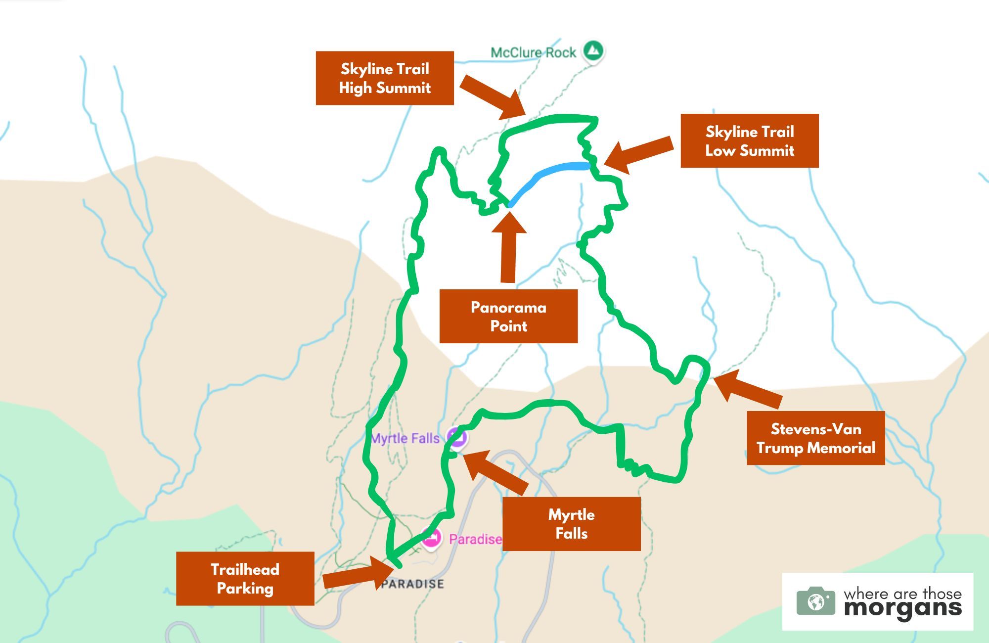
Skyline Loop Trail (Mount Rainier National Park)
Best for: Hikers who want Mount Rainier as a constant backdrop and don’t mind crowds if they time it right. Why it wins: The counter-clockwise direction offers a more gradual ascent and naturally thins out the crowds who follow the standard clockwise route—you’ll see fewer people in the second half of the hike while still getting the same deep-red bush colors and alpine meadow views.
This 6.5-mile loop gains 1,800 feet and is very popular for good reason: you’re hiking around the mountain with views of Mount Rainier’s south face the entire time, and in fall the meadows explode in burgundy and crimson hues. The key move is starting counter-clockwise (heading left from the Paradise trailhead) instead of the standard clockwise route—this spreads out the crowds and gives you a gentler climb early on.
Arrive at Paradise by 7 a.m. on weekends to secure parking; the lot regularly fills by mid-morning in September and October. The hike takes roughly 4 to 5 hours at a moderate pace, and the best color display peaks in late September through early October.
Naches Peak Loop (Mount Rainier National Park)
Best for: Hikers with limited time or less experience who still want authentic Mount Rainier scenery and fall colors. Why it wins: At only 3 miles with 600 feet of elevation gain, this is the shortest and easiest Mount Rainier loop available, yet it delivers the same deep-red fall foliage and views of the mountain that longer trails promise.
This loop sits on the east side of Mount Rainier and is significantly less crowded than Skyline, though it still fills up on sunny weekends. The short distance and modest elevation gain make it perfect for families, older hikers, or anyone who wants a solid autumn hike without committing 4+ hours.
The trail winds through meadows and subalpine forest where huckleberry bushes turn brilliant red in fall, and you get clear views of Mount Rainier and the surrounding Cascade peaks. Parking at the Naches Peak trailhead is more forgiving than at Paradise, but still arrive by 8 a.m. on weekends to be safe.
The drive from Seattle is roughly 2.5 hours via I-90 and Highway 410.
Stay near Mount Rainier: Base yourself in the gateway town of Ashford or Elbe, both 30 to 45 minutes from Paradise and Naches Peak trailheads. These small towns offer cabin lodges and mountain inns with easy access to early-morning starts, and you’ll avoid the chaos of trying to find parking if you’re driving from Seattle the same day.
September and October are peak season here, so book lodging 4 to 6 weeks in advance if possible.
Best Fall Hikes Near Portland, Vancouver, and the Columbia River Gorge
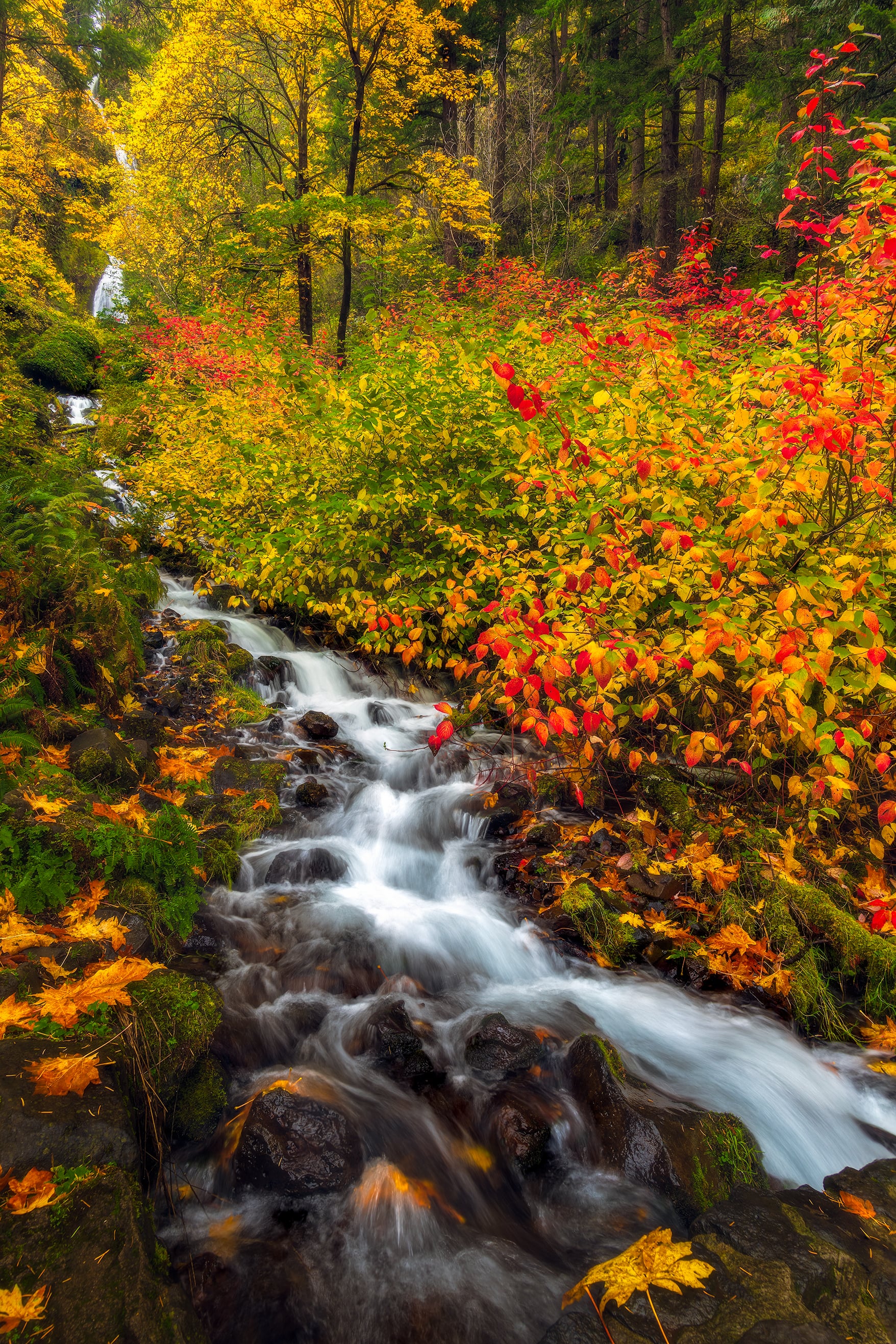
The Columbia River Gorge and Mount Hood region deliver fall color without the alpine scramble — think vine maple reds, white oak browns, and accessible water views that peak in October when summer crowds vanish. These trails work best as day hikes from Portland or Vancouver bases, with most trailheads within 45 minutes to 90 minutes of the city.
Fall here means shorter daylight (plan to start early), occasional rain, and the real bonus: fewer people on the most scenic overlooks.
Columbia River Gorge Waterfalls and Overlooks
The Gorge splits into two distinct fall experiences: the west side floods with big-leaf maple reds, while the east side’s white oaks turn brown and orange against clearer skies. Cape Horn wins for raw color drama — the area is known as one of the best fall viewing spots in the Gorge, but most established trails have serious drop-offs.
The safer option is a 1-mile kid-friendly walk to a walled overlook that still delivers full Gorge views without cliff exposure.
Catherine Creek Trail (east side) is the move for older hikers who want that oak-against-blue-sky contrast and don’t mind elevation gain and exposure. The trail gains significant elevation with drop-offs and rattlesnakes present, so staying on the marked path is essential — October and November are prime for the brown-orange oak display.
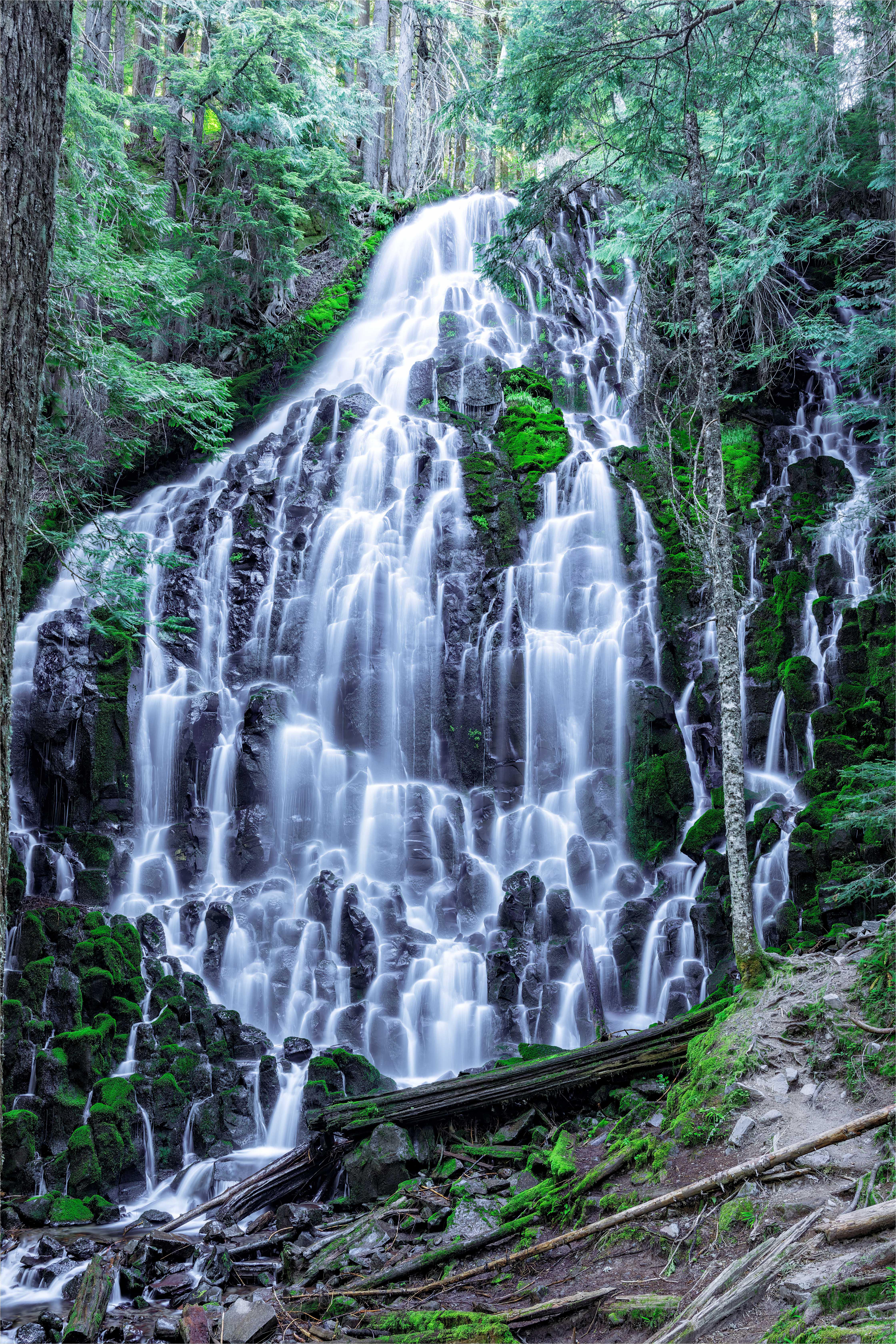
Latourell Falls, Ruckel Creek, Pool of the Winds, and Starvation Creek offer shorter waterfall and creek walks that work year-round but shine in fall when water flow is steady and foliage frames the cascades. These are best for anyone wanting a quick scenic break rather than a full day commitment.
Mount Hood Autumn Escapes
Mount Hood’s south and east sides offer mid-elevation fall hikes that avoid early-season snow while catching peak color. The Salmon River Trail is the standout — a moderate, forested walk along clear water with consistent vine maple color and minimal elevation gain, making it ideal for families or anyone avoiding steep terrain.
Wildwood Recreation Area near Welches has multiple short loop options through old-growth forest, best for a 2-3 hour outing. Lost Lake, a scenic alpine lake on the north side, works for both day hikers and overnight stays, with the lake reflecting surrounding larch and fir.
Lookout Mountain offers higher views but requires more elevation gain. Barlow Wayside is a quick roadside stop rather than a full hike.
Base yourself in Government Camp or the small towns along Highway 26 (Welches, Rhododendron) for easy morning access to these trailheads. Most Mount Hood trails are drivable from Portland in 60-90 minutes, making them perfect for a long weekend or day trip from the city.
Portland Metro and Sauvie Island Day Hikes
For hikers who don’t want to leave the metro area, Hoyt Arboretum in the West Hills delivers curated fall foliage without the drive — it’s essentially a botanical garden with hiking trails, best for anyone prioritizing easy access and guaranteed color. Oxbow Regional Park on the Sandy River offers longer loop options through mixed forest and along the river, winning for anyone wanting a real trail feel without leaving the Portland suburbs.
Springbrook Park and Reed Lake are quieter alternatives with water views and minimal crowds on weekday mornings.
Wapato Access Greenway and Lacamas Park on Sauvie Island (northwest of Portland) are the move for anyone wanting wetland and water-edge scenery — expect waterfowl, open meadows, and a completely different landscape from the forested trails. Sauvie Island is a 20-minute drive from downtown Portland and works as a morning or afternoon outing.
All these trails are best hiked on weekdays in October to avoid weekend crowds.
SW Washington Lowland Trails
Just north of Portland in Clark County, Washington, these lowland trails offer easier elevation gain and reliable fall color without the drive to the mountains. Battle Ground Lake is the standout — a full loop around a pristine lake in a state park with consistent crowds but worth it for the complete forest-and-water experience.
The lake sits in a volcanic crater, giving it unusual depth and clarity. Lucia Falls delivers waterfall scenery in a short walk, best for families or anyone with limited time.
Whipple Creek, Vancouver Lake North, and CASEE Trails are quieter alternatives with marsh and woodland views, ideal for birders or anyone avoiding the main attractions.
Lewisville Park rounds out the region with river access and open meadow hiking. These trails are 30-50 minutes from Portland and work well as a day trip from Vancouver, Washington, or as a stop on the way to Mount St. Helens.
October is ideal — expect cool mornings, afternoon sun, and minimal mud despite the region’s wet reputation.
Mount St. Helens and Gifford Pinchot Wilderness
Mount St. Helens’ volcanic landscape offers a completely different fall experience — lava fields, recovering forest, and unique geology rather than traditional alpine color. Ape Cave Surface Trail is the fall standout.
October is peak season for this hike: vine maple leaves turn vibrant red, mushrooms emerge from the lava field, and crowds thin compared to summer. Timed parking reservations through Recreation.gov are still required, so book ahead.
The trail winds through lava fields and is easy to get scraped on sharp rock or step into hidden holes — it’s not ideal for young children despite being short and relatively flat.
The lower cave section (if you want to combine surface hiking with cave exploration) has smaller crowds in fall than summer. Thomas Lake, Placid Lake, Goat Marsh Lake, Whistle Punk, and Summit Springs offer easier forest and lake walks in the Gifford Pinchot area, best for anyone wanting a gentler experience.
These trails are 90 minutes to 2 hours from Portland and work as a full-day or weekend trip — consider basing yourself in Longview or Centralia for overnight access.
Plan your visit for early-to-mid October for peak vine maple color. By late October, most deciduous trees have dropped their leaves, and weather becomes more unpredictable.
All these trails are lower elevation than the North Cascades, so they’re accessible longer into fall and less likely to have early snow.
How to Prepare Safely for Autumn Trails in the PNW
October and November hunting season turns peaceful trails into shared terrain with rifle hunters—and that’s the single detail that changes everything about how you gear up and move through the forest. Weather shifts from 60°F to hail in an hour, hypothermia creeps in faster than you’d expect, and trail conditions deteriorate quickly as rain and early snow arrive.
This section covers the non-negotiable prep work that keeps you safe, visible, and comfortable on PNW fall trails.
What Gear Should You Pack for Changing Fall Weather
Layer aggressively—cotton is your enemy. The PNW fall formula is deceptive: cool morning temperatures plus afternoon rain plus wind equals hypothermia risk, even on short hikes. Wear a moisture-wicking base layer (merino wool or synthetic), add an insulating mid-layer (fleece or down), and pack a waterproof outer shell that actually fits over everything else.
Cotton holds moisture and kills heat retention, so skip it entirely—this is non-negotiable.
Check the weather the morning of your hike, then pack for worse. Forecasts in the Cascades are educated guesses at best. Bring extra layers even if the morning looks clear—wind, hail, and sudden rain are standard fall surprises.
A lightweight packable rain jacket takes up almost no space and prevents the panic of being caught exposed.
Bring traction and visibility gear. Early season snow, wet leaves, and loose scree make footing treacherous. Microspikes or traction devices become essential as September turns to October, especially on higher elevation trails.
A headlamp or bright light is critical if you’re hiking after 4 p.m.—daylight shrinks fast, and you need to be visible to other hikers and hunters.
Pack a first aid kit with blister supplies and pain relief. Wet conditions and longer hikes mean blisters happen faster. Bring tape, moleskin, and ibuprofen.
Wet socks and cold temperatures also increase sprain risk on slippery terrain, so ankle support or taping supplies are worth the weight.
Staying Safe During Hunting Season and Around Wildlife
October and November demand hunter orange—wear it visibly. Washington’s hunting season runs through November, and many popular fall trails overlap with active hunting zones. Wear a hunter orange hat, vest, or pack cover that’s impossible to miss.
Check trail-specific hunting season impacts before you go—resources like the Washington Trails Association flag which hikes are affected and when. If a trail is in an active hunting area, either avoid it during peak hunting hours (dawn and dusk) or choose a different route entirely.
Make noise and stay on trail. Hunters expect hikers to stay on marked paths. Bushwhacking or moving quietly through the forest puts you at risk of being mistaken for game.
Talk, use a whistle, or play music—predictable human presence keeps everyone safer.
Teach kids (and yourself) to avoid mushrooms. Fall mushroom growth is beautiful but dangerous. Toxic species are impossible to identify by sight alone, and even touching certain mushrooms can cause reactions.
Establish a hard rule: look but don’t touch, and never eat anything foraged from the trail. This applies especially on family hikes where young hikers are curious about everything.
Watch for wildlife and adjust your pace accordingly. Black bears are still active in fall, and elk are in rut during September and October—both are unpredictable. If you see wildlife, back away slowly, don’t run, and give animals space to leave.
Travel in groups when possible; solo hiking during hunting season adds unnecessary risk.
Start early and finish before dark. Daylight at 4:30 p.m. in October means you need to be off the trail well before sunset. Tired hikers make mistakes, and darkness increases the chance of a fall or getting lost.
Plan your mileage around sunset time, not optimistic estimates of how fast you’ll move.
Frequently Asked Questions
Can you hike Mount Rainier in October?
Yes, but with serious caveats. October is the tail end of the hiking season at Mount Rainier National Park—the park stays open, but higher-elevation trails close as snow moves in.
Lower trails like Skyline Loop (6.5 miles, 1,800 feet elevation gain) remain accessible in early October and deliver deep red huckleberry bushes and reliable fall color. By late October, expect snow above 6,000 feet and significantly shorter daylight hours.
Arrive early for parking; this trail is very popular during peak fall color season.
Is Mount Rainier busy in October?
Extremely. October is peak fall-color season in the Cascades, and Skyline Loop draws crowds specifically for its deep red foliage and accessible distance.
Parking fills early—arrive before 8 a.m. if you want a guaranteed spot. The counter-clockwise direction offers a more gradual ascent and thinner crowds than the clockwise route.
What is the most difficult fall hike in Washington?
The Enchantments thru-hike (approximately 20 miles) is the hardest single-day fall hike in the state. It’s a full-day commitment, and because daylight shrinks in autumn, you’ll start and finish in darkness—a serious logistical and safety challenge.
This hike demands strong fitness, navigation skills, and headlamps. Only attempt it if you have extensive alpine experience and can manage a pre-dawn start.
What are the best trails to see fall colors in Olympic National Park?
Head into the rainforest for the most dramatic contrast: yellow, red, and orange leaves against the lush green understory create colors you won’t see anywhere else in the PNW. The rainforest setting makes autumn foliage feel almost surreal compared to typical alpine fall hikes.
Trails like Hoh Rainforest offer accessible access to this unique seasonal display without requiring high elevation or technical skill.
When do the golden larches peak in the Pacific Northwest?
Golden larches peak from mid-September through mid-October, with the most intense color typically hitting in late September and the first two weeks of October. The exact timing shifts year to year depending on early frost and weather patterns—confirm current conditions with ranger stations or local hiking communities before committing to a specific trip date.
Once the first hard freeze hits, the needles drop quickly, so don’t delay if you’re chasing that specific golden-larch window.
Get on the Trail Before the Window Closes
Pick your hike based on your fitness level and how far you’re willing to drive, then commit to a specific date in late September or early October—don’t wait for “perfect weather” because the color window closes fast. Book lodging near your chosen trailhead 4–6 weeks in advance if you want a weekend spot, and arrive at the parking lot by 7–8 a.m. to secure a space before the lot fills.
Fall color in the Pacific Northwest is genuinely worth the early alarm and the drive, and these trails deliver it in ways you won’t find anywhere else in the country—golden larches reflecting in turquoise water, surrounded by peaks dusted with early snow.
Start by picking one trail from the overview above that matches your fitness and time, confirm current conditions with the Mount Baker Ranger District or Washington Trails Association, and book your trip for the next clear weekend in September or early October.
Leave a Reply