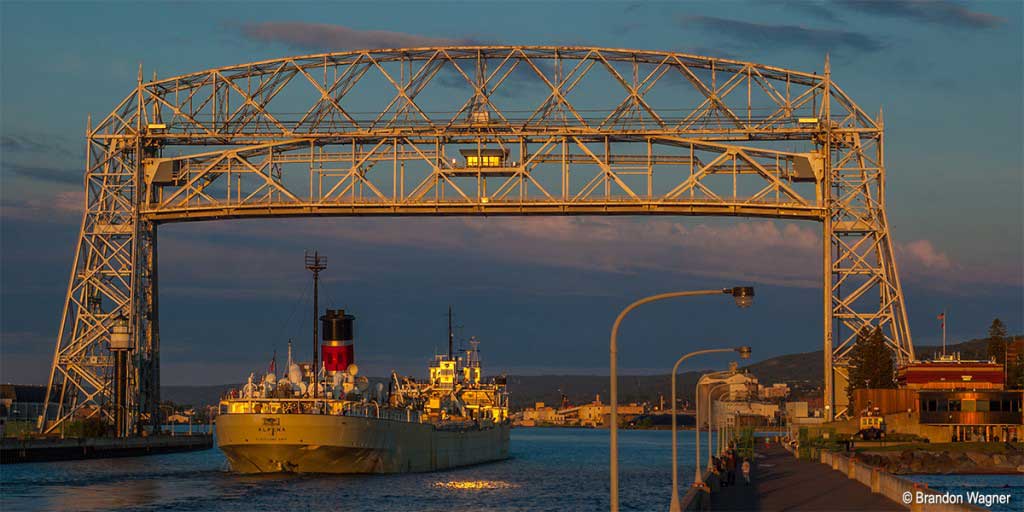
Roll down your windows and inhale the sharp scent of warm pine needles and crisp alpine air at 12,000 feet. Feel the cool ocean mist kiss your skin as you sweep around a dramatic cliffside curve with the Pacific crashing far below.
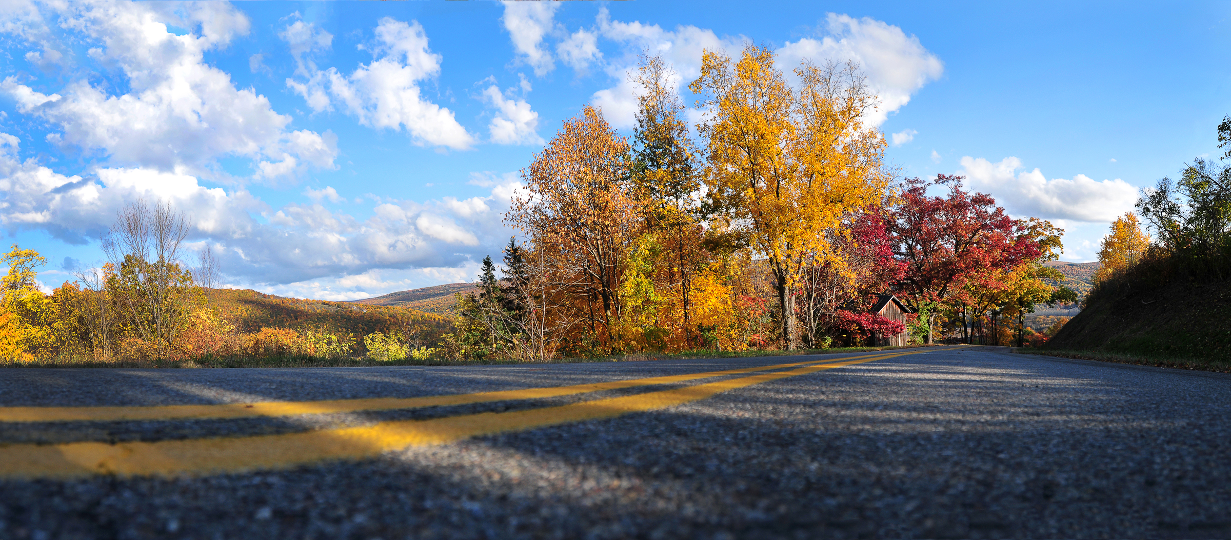
Summer in America unlocks high-altitude mountain passes and wild coastal corridors that are completely buried under snow for the rest of the year. It is the only season where you can drive from sun-baked red deserts to glacial peaks in a single week.
This curated guide will help you choose the absolute best route for your summer vacation, whether you crave rugged wilderness or lazy coastal cruising.
Expect to spend around $50 a day for a budget road trip with camping, $150 to $250 for mid-range hotels, or $500+ for luxury coastal lodges.
To make your planning effortless, I have distilled the absolute best routes from this list based on what you want to experience most.
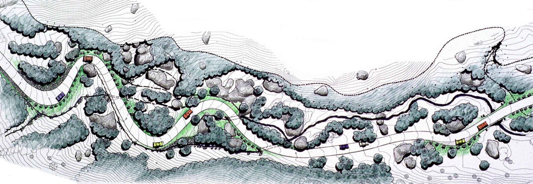
My Top Road Trip Picks for Your Summer Itinerary
- Best for Alpine Views: Going-to-the-Sun Road in Montana offers jaw-dropping glacial vistas, while the Beartooth Highway delivers pure high-altitude thrills.
- Best to Beat the Heat: The Pacific Coast Highway provides iconic California cliff views, while the Oregon Coast Highway 101 offers moody, misty pine-fringed beaches.
- Best for National Parks: Spot bison along Yellowstone’s Grand Loop Road, or marvel at towering red rocks on the Zion Canyon Scenic Drive.
- Best Shaded Escapes: Chase waterfalls along the Columbia River Highway, or enjoy the endless mountain canopies of the Blue Ridge Parkway.
- Best Tropical & Lake Drives: Tackle the winding curves of the Road to Hana in Maui, or cruise past the vineyards on New York’s Road 14.
Which Mountain Passes Are Only Open for Summer Driving?
High-altitude mountain passes in the American West are defined by their short, glorious windows of accessibility, typically clearing snow only between late June and early October. Because these routes climb into alpine zones where winter conditions can persist well into July, checking current road status via National Park Service or state transportation websites is mandatory before you finalize your itinerary.
| Scenic Route | Peak Elevation | Best For | Vehicle Restriction |
|---|---|---|---|
| Going-to-the-Sun Road | 6,646 ft | Glacial views | Under 20 ft length |
| Beartooth Highway | 10,947 ft | High-alpine thrills | None (challenging) |
| Independence Pass | 12,095 ft | Continental Divide | Under 35 ft length |
| Pikes Peak Highway | 14,115 ft | Summit access | None |
| North Cascades Hwy | 5,477 ft | Rugged wilderness | None |
1. Going-to-the-Sun Road (Glacier National Park, Montana)

This 50-mile engineering marvel is the crown jewel of the Rockies, connecting the east and west sides of Glacier National Park. I recommend prioritizing a sunrise start at Logan Pass to secure parking, as the lot fills by dawn during peak summer months.
The route is strictly for smaller vehicles; if your RV or trailer exceeds 20 feet in length, you must skip this drive or use the park’s shuttle system. Key stops include the Weeping Wall and Lake McDonald, but keep your eyes on the road—the drop-offs are significant.
2. Beartooth Highway (Montana & Wyoming)
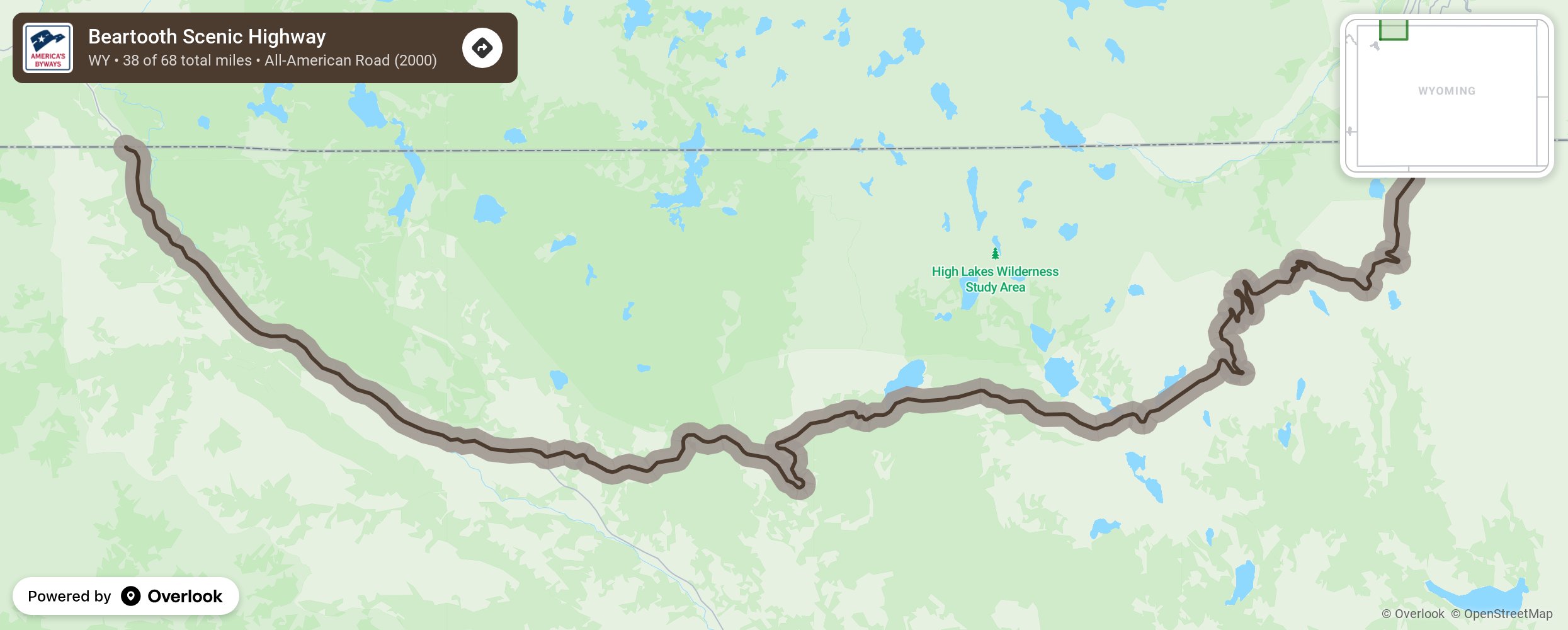
Connecting Red Lodge, Montana, to the northeast entrance of Yellowstone, this 68-mile stretch is the most exhilarating drive in the region. It is best for drivers who enjoy steep, hairpin turns and high-alpine plateaus above the tree line.
If you are nervous about heights or driving without guardrails, choose a different route. I recommend this drive for those who want to experience the raw, snow-capped intensity of the Absaroka-Beartooth Wilderness without the crowds of Yellowstone’s main loops.
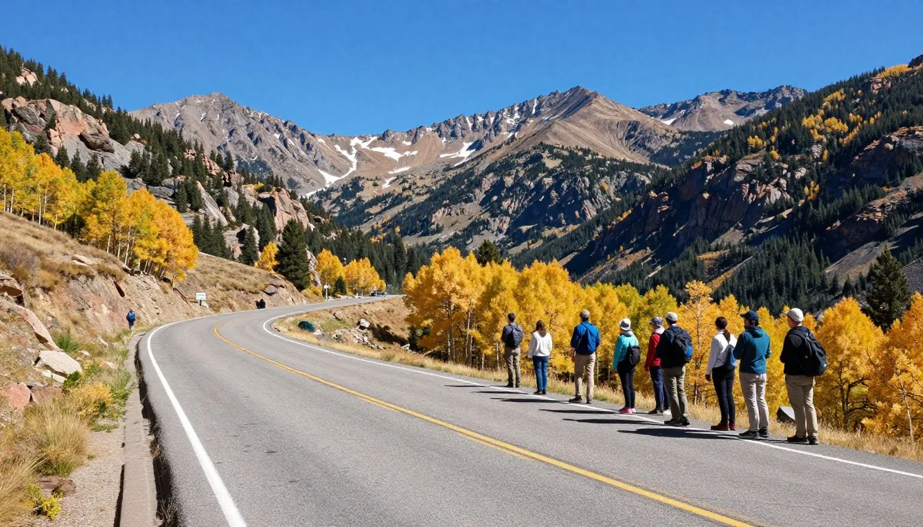
3. Independence Pass (Colorado)
Crossing the Continental Divide at 12,095 feet, this route is the ultimate summer shortcut between Aspen and Twin Lakes. It is best for travelers who want to experience true high-altitude tundra without needing to hike.
Note that the road is narrow and winding; it is strictly prohibited for vehicles over 35 feet. I recommend stopping at the summit overlook for a quick walk to acclimate—the air is thin, and the views of the Sawatch Range are unmatched.
4. Pikes Peak Highway (Colorado)
This 19-mile paved toll road takes you to the summit of one of America’s most famous “fourteeners.” It is best for those who want to reach a high-altitude summit with minimal physical exertion. You must book a timed entry reservation in advance during the summer season.
My pick is to arrive as early as possible to avoid the afternoon thunderstorms that frequently roll in over the summit, which can force temporary closures for safety.
5. North Cascades Scenic Highway (Washington)
State Route 20 offers the most dramatic mountain scenery in Washington, cutting through the jagged, glaciated peaks of North Cascades National Park. It is best for travelers who prefer wild, uncrowded landscapes over manicured tourist stops.
Unlike the other mountain passes, this route is less about hairpins and more about sweeping vistas of deep blue lakes and dense pine forests. I recommend basing yourself in the gateway town of Winthrop for the best access to the eastern approach of the pass.
Summary: For the most dramatic glacial scenery, choose Going-to-the-Sun Road. For pure high-altitude thrills, the Beartooth Highway is the clear winner.
Always confirm current road status before departing, as seasonal snow removal can delay openings into late June or early July.
Best Coastal Drives to Beat the Summer Heat
When the inland temperatures spike, the Pacific coastline offers the ultimate natural air conditioning, with marine layers keeping the air crisp and the scenery dramatic. Whether you are chasing the towering redwoods of Northern California or the misty, blue-hued waters of the Pacific Northwest, these routes provide the best relief from the summer sun.
| Drive | Key Vibe | Best For | Planning Note |
|---|---|---|---|
| Pacific Coast Highway | Iconic Cliffs | First-timers | Book Hearst Castle early |
| Oregon Coast 101 | Rugged Americana | Road trippers | Expect fog in mornings |
| Lake Crescent | Alpine Serenity | Nature lovers | Best in early summer |
| Avenue of the Giants | Ancient Forest | Photography | Keep lights on |
| 17-Mile Drive | Luxury Coastal | Quick excursions | $12.25 entry fee |
6. Pacific Coast Highway & Big Sur (California)
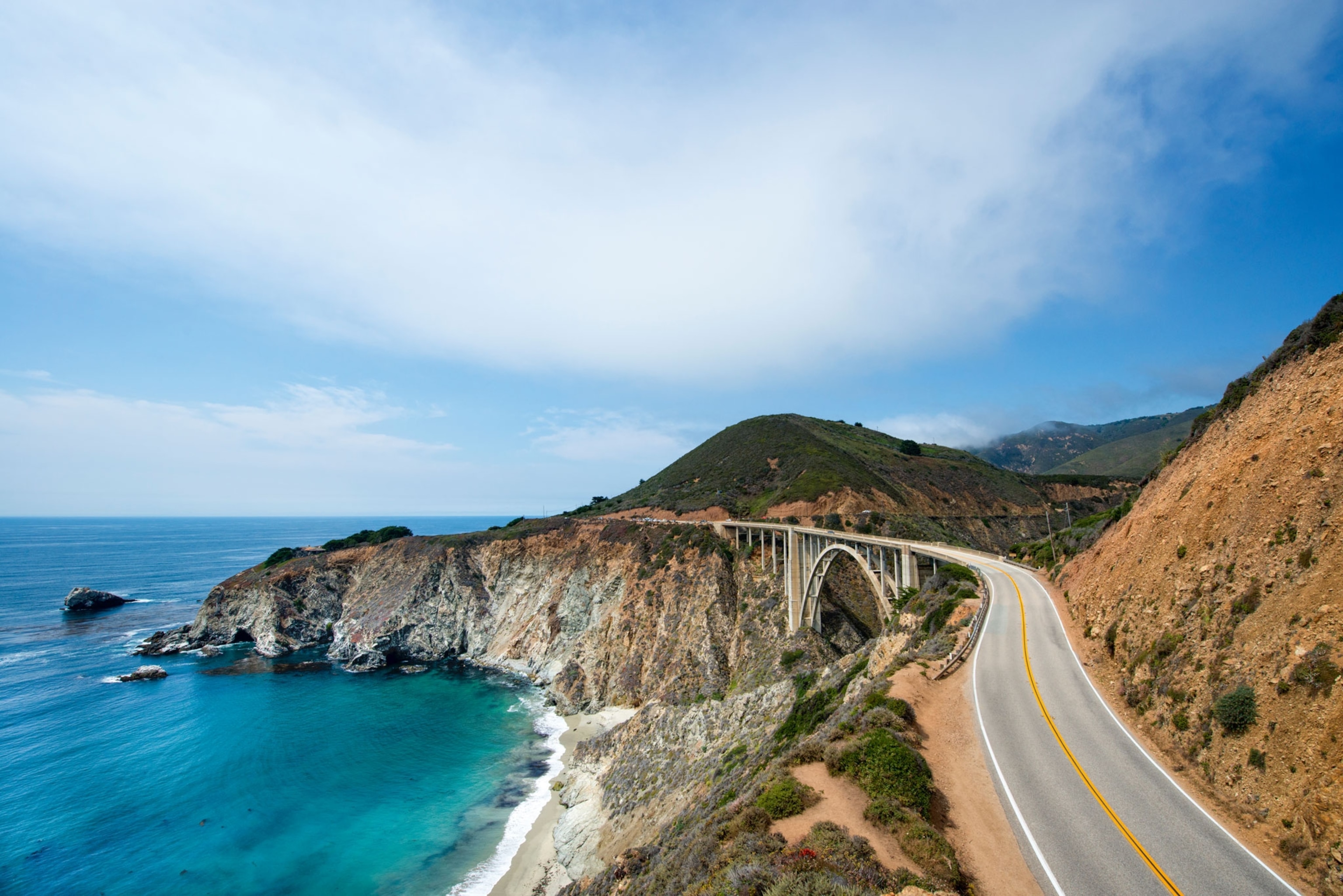
The Pacific Coast Highway (State Route 1) is the quintessential American road trip, stretching over 600 miles from Dana Point to Leggett. For the most dramatic experience, focus on the Big Sur stretch, where the Santa Lucia Mountains drop sharply into the Pacific. My pick: Prioritize a stop at Bixby Creek Bridge for the classic photo, but don’t miss the hidden beauty of McWay Falls at Julia Pfeiffer Burns State Park.
If you need a base, choose a boutique lodge in Carmel-by-the-Sea for easy access to the northern entrance of the Big Sur coast.
7. Oregon Coast Highway 101 (Oregon)
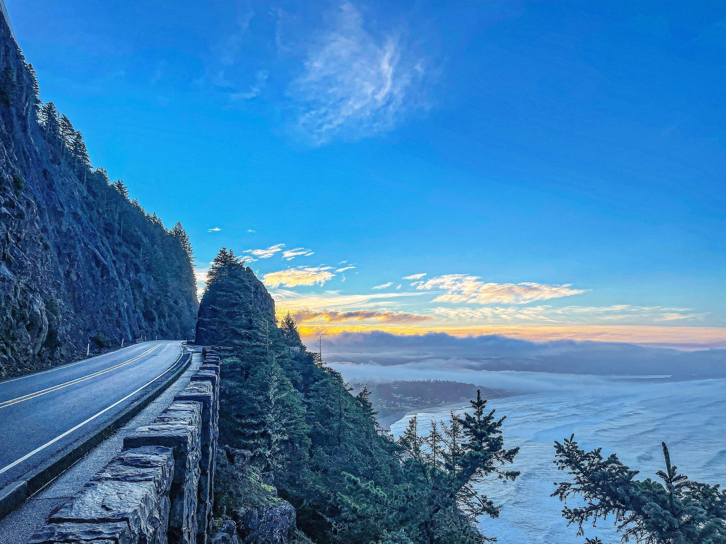
Spanning 363 miles, Oregon’s Highway 101 is an All-American Road that trades California’s steep cliffs for expansive, moody beaches and towering sea stacks. This drive is best for those who prefer cool, misty weather over intense heat. Insider tip: The entire route is stunning, but the stretch near Cannon Beach provides the most iconic views.
Plan for overnight stops in coastal towns like Astoria or Newport to break up the drive and enjoy fresh local seafood.
8. Lake Crescent & Olympic Highway (Washington)
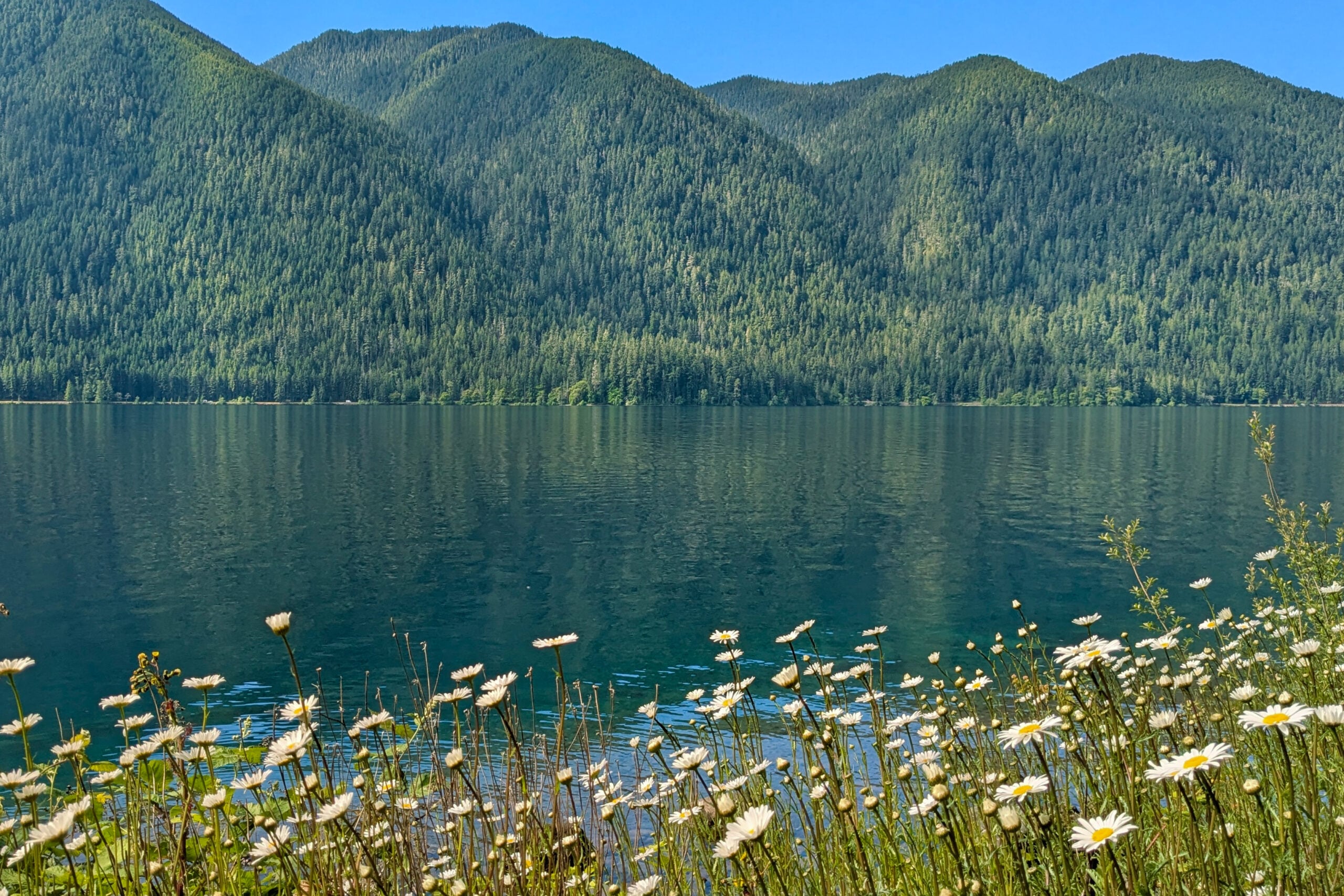
Lake Crescent is a glacial-fed marvel in the Olympic Peninsula that offers a cooling, deep-blue escape from the summer heat. The drive along the Olympic Highway is lush, dense, and feels worlds away from civilization. Recommendation: Drive this route in the early morning to catch the mist rising off the water.
It is the perfect detour for anyone exploring the Washington coast, and I recommend staying in a lakeside cabin to maximize your time near the water.
9. Avenue of the Giants & Lost Coast Loop (California)
For a complete change of pace, head to Northern California’s Avenue of the Giants. This 31-mile stretch of old Highway 101 winds through massive redwood groves that provide a natural canopy, keeping the temperature significantly lower than the surrounding valleys.
It is best for travelers who want to feel small beneath the world’s tallest trees. Practical action: Keep your headlights on as the tree cover is dense enough to create near-twilight conditions even at midday.
10. 17-Mile Drive (Monterey Peninsula, California)
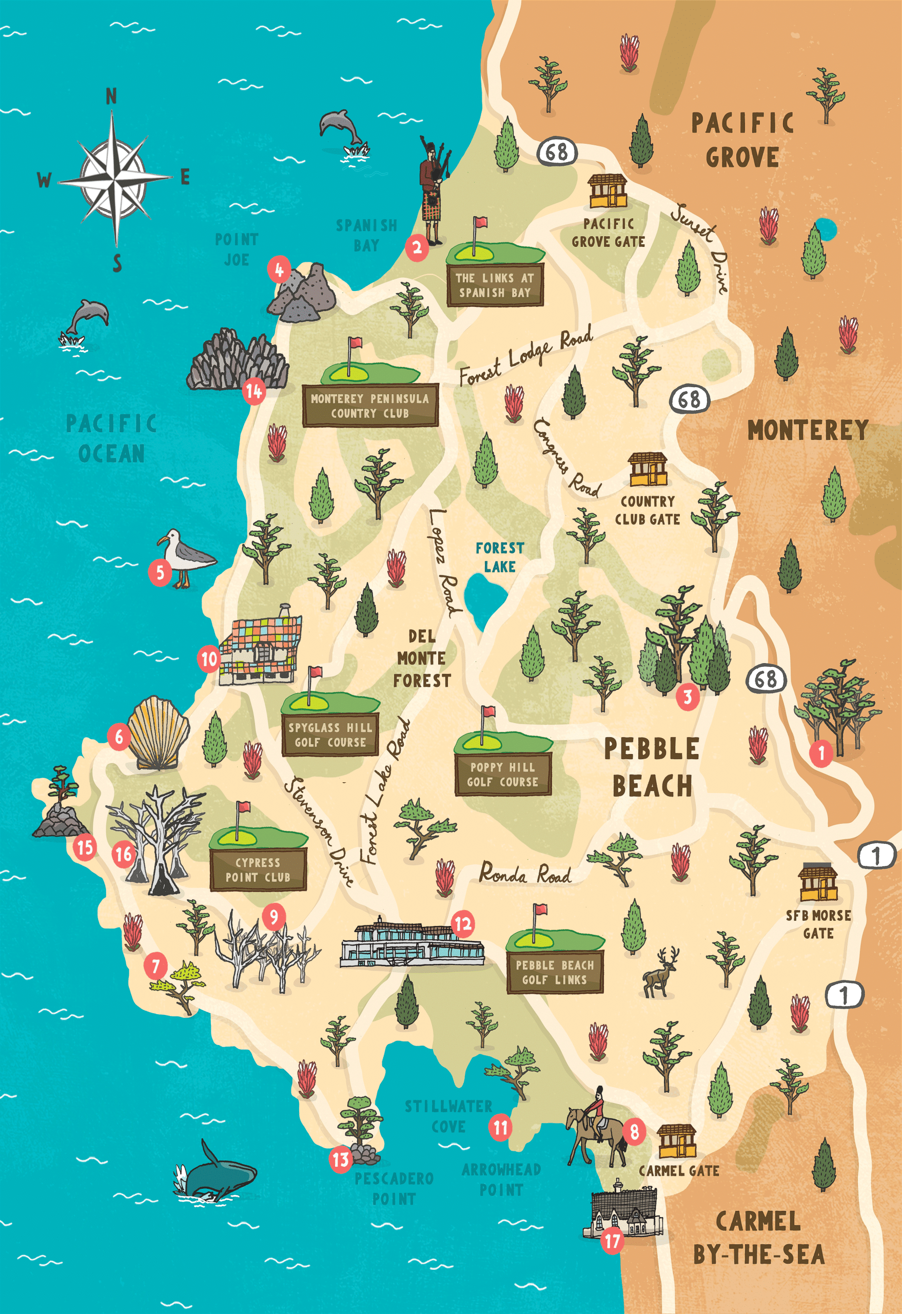
This 17-mile loop between Carmel and Pacific Grove is the gold standard for a short, curated coastal drive. It features iconic stops like the Lone Cypress and the legendary Pebble Beach golf course. Planning note: There is an admission fee of $12.25 per vehicle, which is well worth it for the manicured views.
It is best for those with limited time who want the “best of” the Monterey Peninsula in a single afternoon. If you are staying in Monterey, this makes for an effortless morning loop before heading south toward Big Sur.
Summary: For the ultimate summer drive, choose the Pacific Coast Highway if you want iconic drama, or the Avenue of the Giants if you prefer the cooling shade of ancient forests. Always check for seasonal road conditions, especially when traveling through the rugged terrain of Big Sur or the Olympic Peninsula.
Top National Park Drives for Summer Wildlife and Geology
Traversing these iconic national park corridors requires strategic timing to avoid peak congestion and maximize your chances of spotting native wildlife or catching the perfect light on ancient stone formations. Use the following guide to prioritize your route based on your interest in high-altitude geology or valley-floor wildlife viewing.
| Drive | Primary Draw | Best For | Summer Tip |
|---|---|---|---|
| Grand Loop Road | Wildlife | Families | Start by 7:00 AM |
| Zion Canyon Scenic Drive | Geology | Hikers | Use the park shuttle |
| Skyline Drive | Vistas | Photographers | Mid-week visits |
| Badlands Loop | Geology | Road Trippers | Golden hour light |
| Arches Scenic Drive | Geology | Explorers | Timed entry required |
11. Grand Loop Road (Yellowstone National Park, Wyoming)
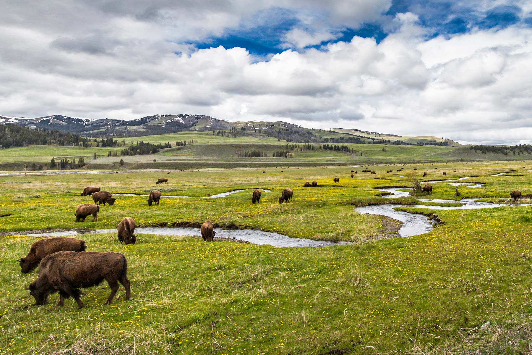
The Grand Loop Road is your gateway to the Lamar Valley, frequently called “America’s Serengeti” for its massive herds of bison and frequent wolf sightings. I recommend basing yourself in the gateway town of Gardiner, Montana, for easy northern entrance access.
This drive is best for wildlife enthusiasts who don’t mind early mornings; skip it if you prefer a quiet, solitary experience, as summer traffic is heavy. For the best experience, drive the Lamar Valley segment at dawn or dusk when animals are most active.
12. Zion Canyon Scenic Drive & Route 9 (Utah)
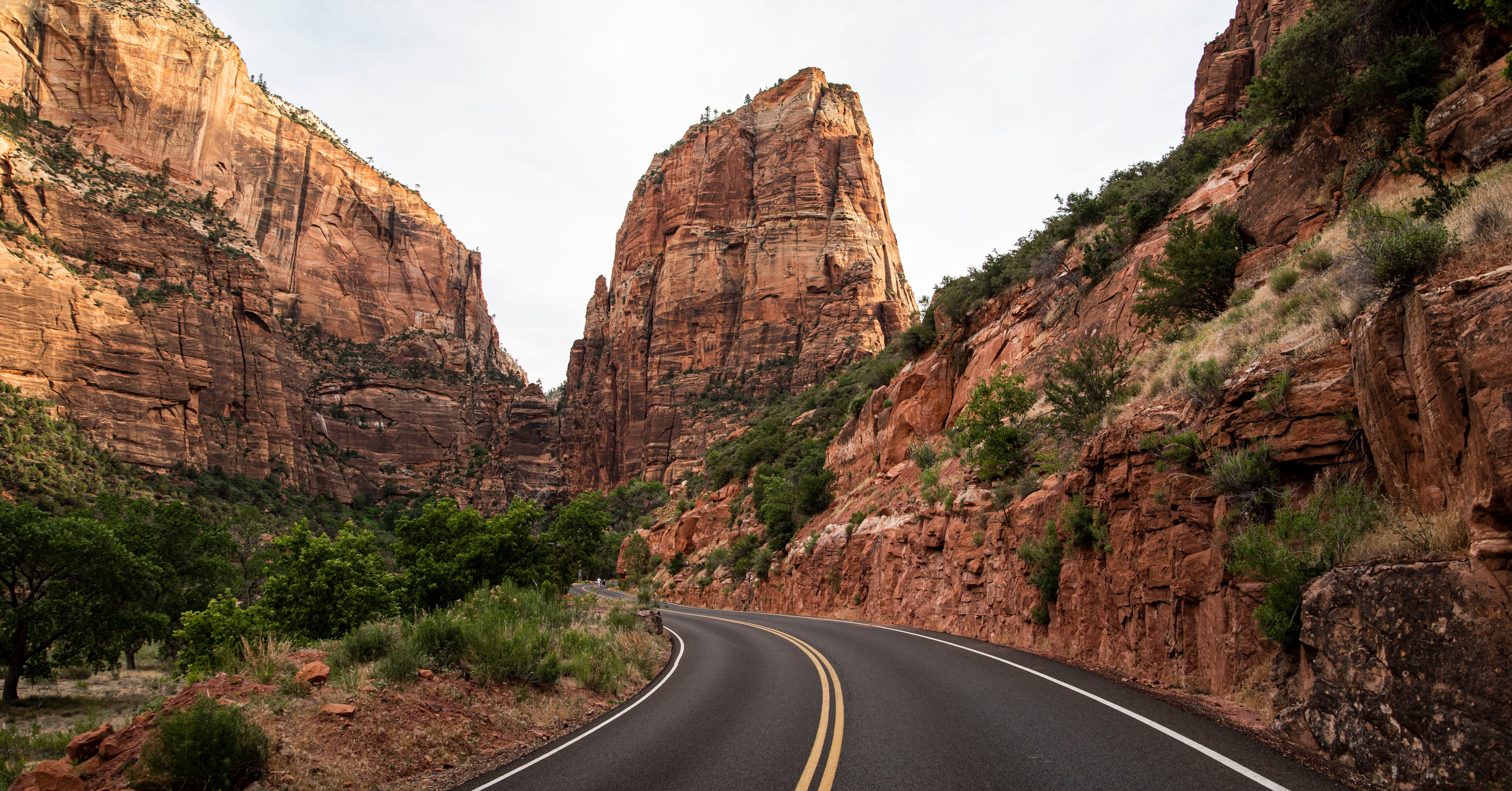
This route offers a masterclass in sheer sandstone cliffs and narrow canyon geology. The Zion Canyon Scenic Drive is restricted to park shuttles for much of the summer, so plan to park in Springdale and use the shuttle system.
Route 9, however, remains open to private vehicles and is the move for those wanting to experience the dramatic tunnel cut through solid rock. I recommend staying in Springdale for immediate access to the park entrance.
13. Skyline Drive (Shenandoah National Park, Virginia)
Skyline Drive runs 105 miles along the crest of the Blue Ridge Mountains, providing endless overlooks of the Shenandoah Valley. It is the move for travelers seeking a slower, more meditative pace compared to the rugged western parks.
It is best for those who enjoy forest canopy drives and frequent short hikes. I suggest basing your stay in Front Royal or Luray for easy access to the northern and central sections of the park.
14. Badlands Loop State Scenic Highway (South Dakota)
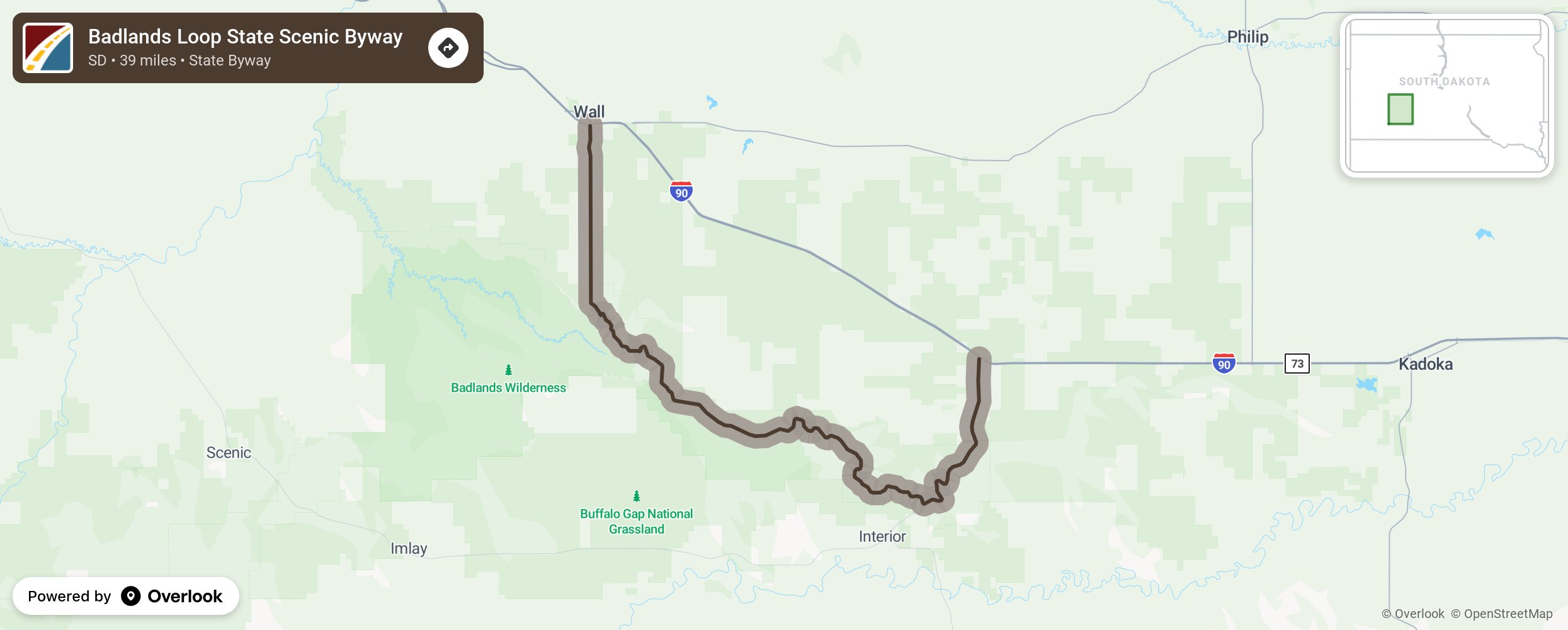
This 39-mile route through Badlands National Park showcases otherworldly spires and deep gullies. It is the move for those who want high-impact geology with minimal hiking effort.
I recommend visiting during the “golden hour” just before sunset; the low light makes the orange and purple hues of the rock formations pop. Stay in Wall, South Dakota, to be within minutes of the park’s northern entrance.
15. Arches National Park Scenic Drive (Utah)
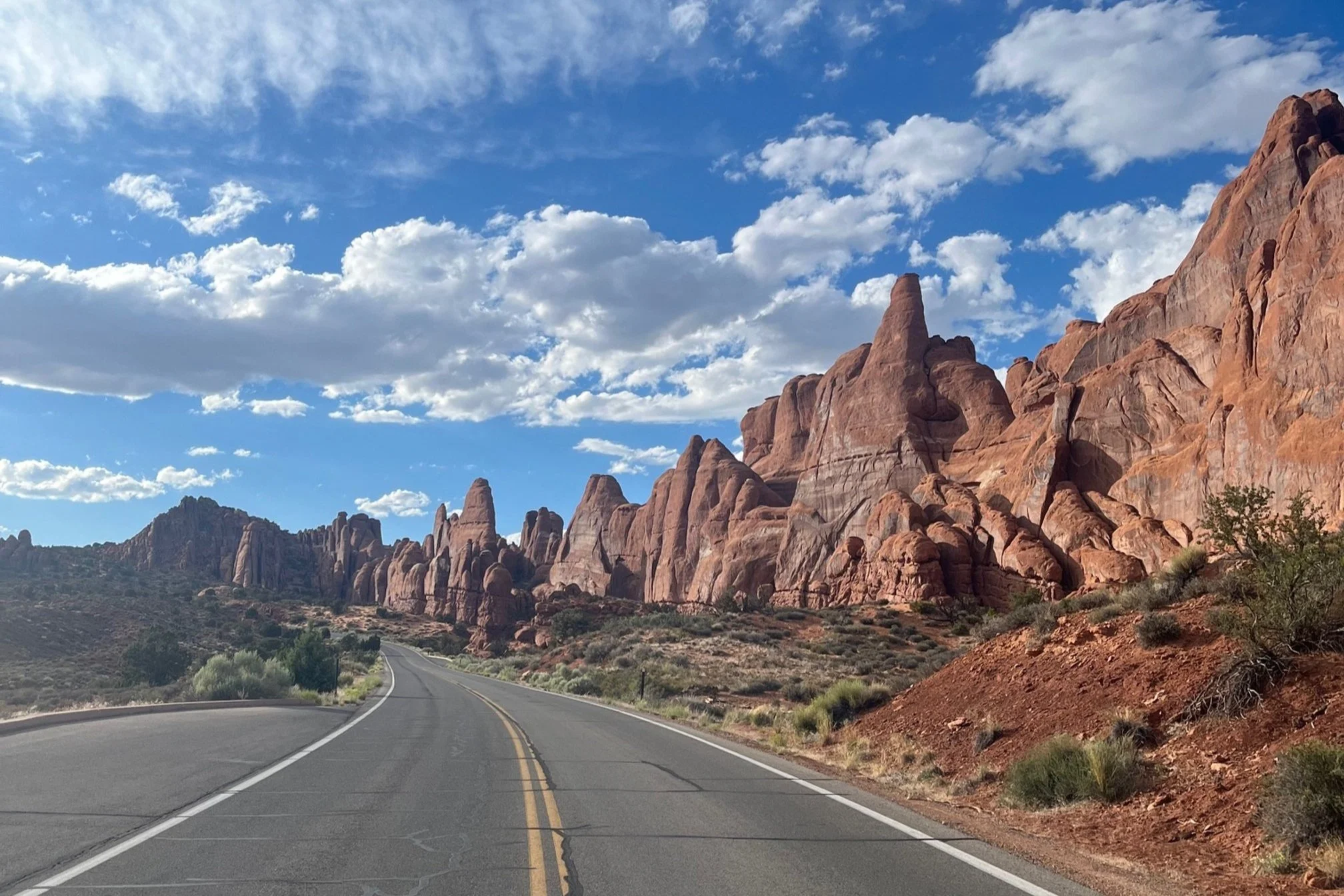
This 19-mile paved road takes you past the park’s most famous natural stone arches. Because of extreme summer popularity, you must secure a timed-entry reservation in advance—do not attempt this drive without one.
It is best for geology lovers who want to see icons like Balanced Rock and The Windows Section. I recommend staying in Moab, which offers a variety of lodges and campgrounds within a short drive of the park gate.
16. Canyonlands Grand View Point Road & White Rim Trail (Utah)
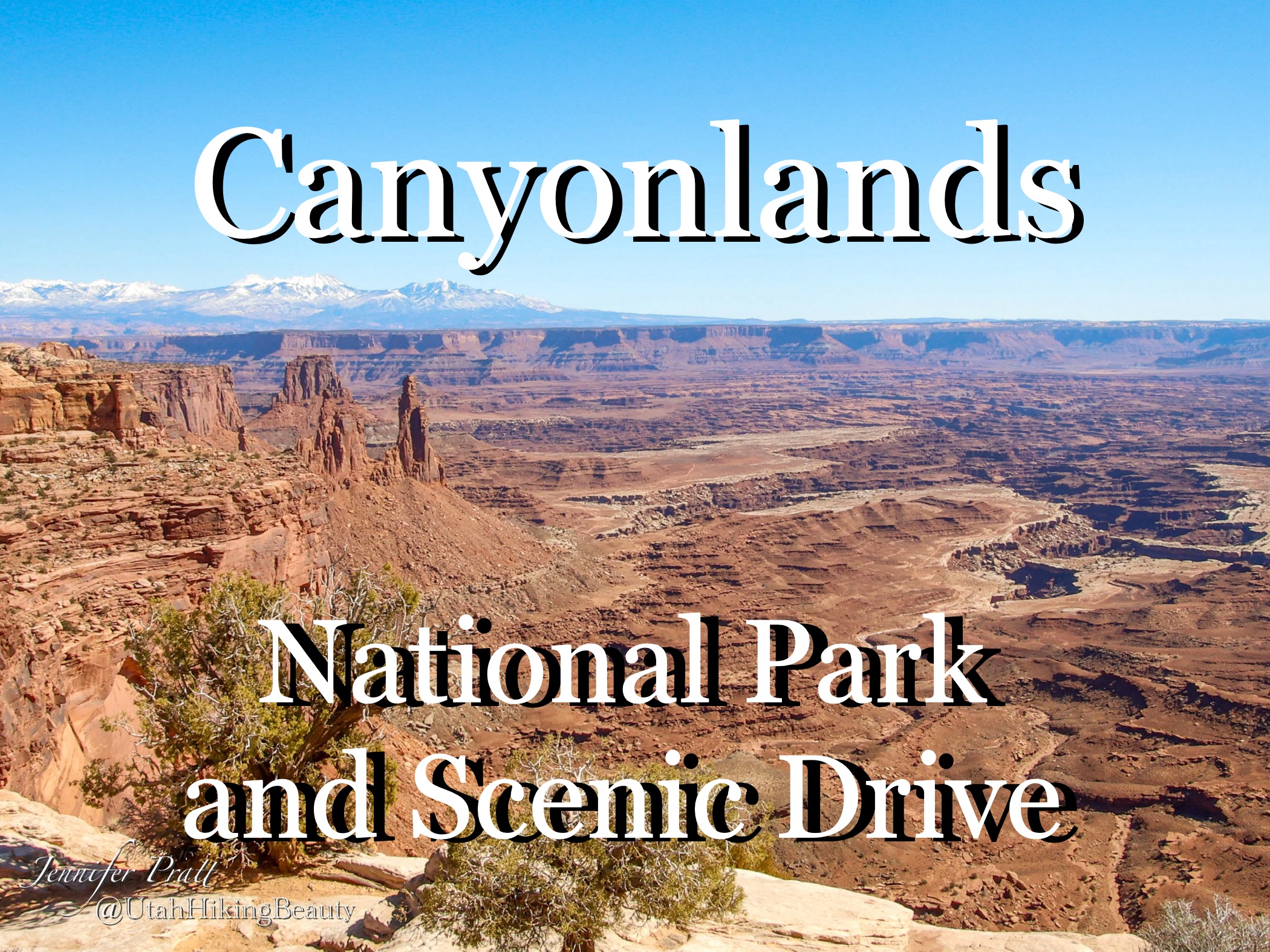
Grand View Point Road is a paved, accessible drive offering panoramic vistas of the Island in the Sky district. For those with a high-clearance 4WD vehicle, the 100-mile White Rim Trail is the ultimate bucket-list challenge.
I recommend the paved road for casual visitors; save the White Rim Trail only for experienced off-roaders with proper supplies and permits. Base your trip in Moab, which serves as the primary hub for all Canyonlands exploration.
Summary: For the best summer experience, prioritize early starts to beat the heat and crowds. If you crave wildlife, choose Yellowstone; if you want dramatic canyon geology, choose Zion or Arches.
Always check the official National Park Service website for current road closures and mandatory reservation requirements before finalizing your itinerary.
How to Safely Drive America’s Most Remote Northern Summer Routes?
Navigating the far-flung corridors of Alaska and the rugged edges of the Great Lakes requires more than just a full tank of gas; it demands a shift in mindset where the journey is defined by unpredictable terrain and sudden weather shifts. Whether you are aiming for the Arctic tundra or the rocky shores of Lake Superior, these routes reward preparation with solitude you simply cannot find on lower-latitude highways.
| Route | Primary Vibe | Best For | Key Challenge |
|---|---|---|---|
| Dalton Highway | Extreme Wilderness | Experienced adventurers | Remote, unpaved sections |
| Richardson Highway | Glacial Landscapes | Mountain scenery lovers | Steep mountain grades |
| North Shore Drive | Lakefront Serenity | Casual road-trippers | Heavy summer traffic |
17. Dalton Highway (Alaska)
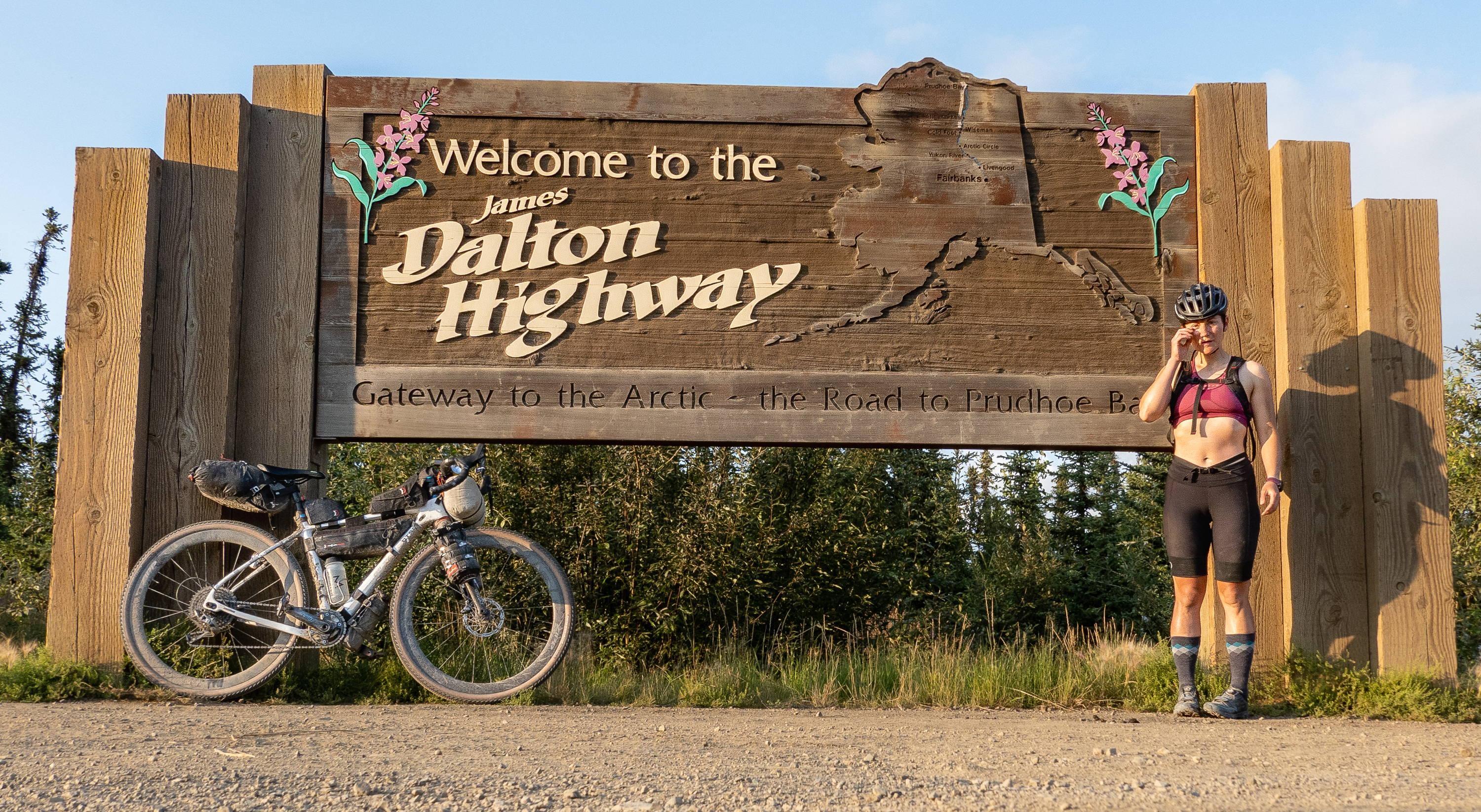
The Dalton Highway is the ultimate test of self-sufficiency, stretching 415 miles from Fairbanks to Deadhorse near the Arctic Ocean. This is not a casual Sunday drive; it is a rugged industrial haul road that follows the Alaska Pipeline.
I recommend tackling this route in September if you want to witness the tundra transition into brilliant shades of red, but summer travelers should prepare for long hours of daylight and potential dust storms.
- Arctic Circle: Stop at the official marker to photograph the surreal, treeless landscape.
- Atigun Pass: As the highest pass in Alaska’s highway system, it offers the most dramatic views of the Brooks Range; keep your eyes on the road as the weather changes here in minutes.
- Coldfoot: This is your essential pit stop. As a former mining camp, it remains one of the few reliable places to secure fuel and food. Do not skip a stop here, as services are non-existent for hundreds of miles.
18. Richardson Highway (Alaska)
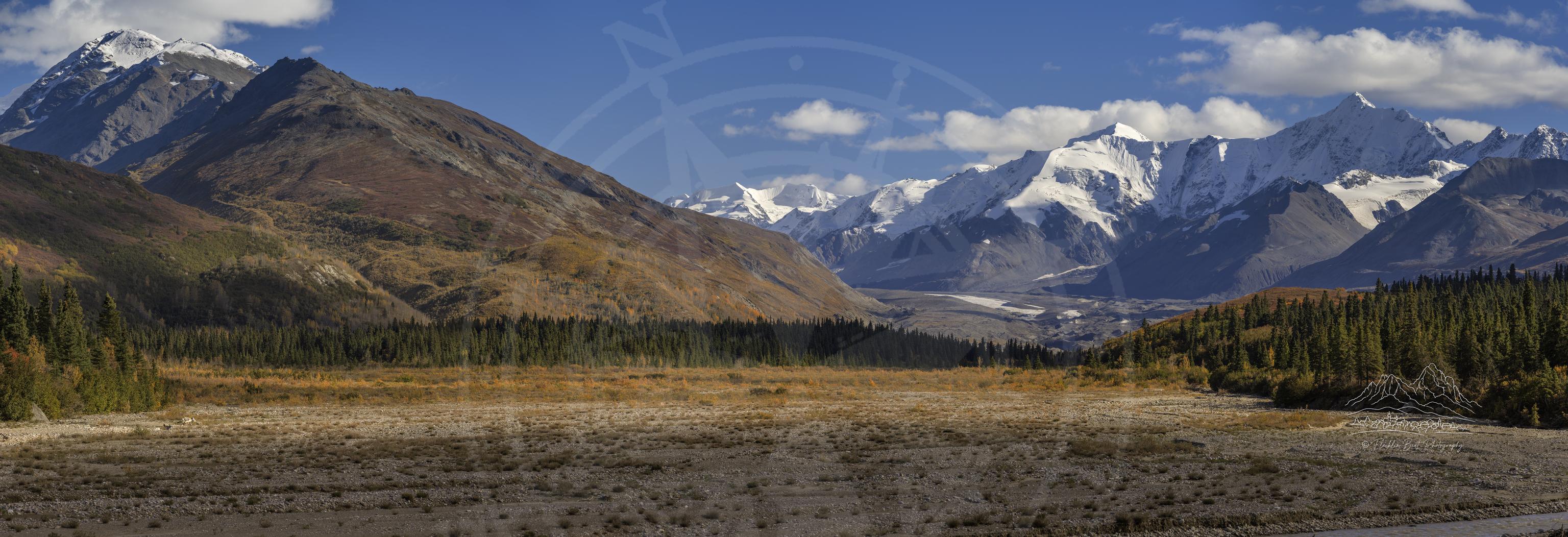
Connecting Valdez to Fairbanks over 366 miles, the Richardson Highway offers a more accessible but equally stunning alternative to the Dalton. Expect roughly $12.25 per vehicle for certain access points, though costs can shift seasonally.
This route is the move for travelers who want to see massive glaciers and deep mountain valleys without the extreme isolation of the Arctic north.
Practical Tip: Base yourself in Valdez for a night to experience the coastal side of the drive before heading inland toward the interior. I prefer the early morning hours on this stretch to avoid the midday tour bus traffic that often congregates near the major scenic pull-offs.
19. North Shore Drive (Minnesota)
The North Shore Drive is the gold standard for a Great Lakes getaway, hugging the rugged coastline of Lake Superior. While the drive itself is a straightforward route, its true value lies in the stops; you will find endless trailheads for coastal hikes on one side of the road and dense, inland forest trails on the other.
It is the perfect choice for a three-day road trip if you are traveling through the upper United States.
Recommendation: Do not rush the drive. The scenery can feel repetitive if you stay behind the wheel for too long, so plan to park the car at least twice a day to explore the inland state parks.
My pick is to base yourself in a lakeside cabin near Grand Marais for easy, next-morning access to the best hiking loops before the afternoon crowds arrive.
Summary for Success: For the Alaskan routes, prioritize vehicle maintenance and carry extra supplies, as help is rarely nearby. For the North Shore, prioritize your hiking schedule over your driving pace.
Always confirm road conditions with local transportation departments before departure, as summer construction and weather-related closures can impact even the most established routes.
Are Desert Drives Like Sedona and Monument Valley Worth It in Summer?
Desert drives are absolutely worth the heat, provided you treat them as sunrise-or-sunset missions rather than midday excursions. The intense summer sun turns the red rock landscapes into a glowing, high-contrast spectacle that you simply cannot experience in the cooler, flatter light of winter.
By planning your drive for the first two hours after dawn, you avoid the worst of the heat and the midday tour bus crowds.
| Drive | Best For | Main Draw | Summer Strategy |
|---|---|---|---|
| Scenic Highway 12 | Landscape photographers | Dramatic, high-desert ridges | Drive early; elevation helps |
| Red Rock Byway | Quick, accessible views | Iconic red rock formations | Sunrise hikes, mid-day shade |
| Monument Valley | Bucket-list photography | The classic desert silhouette | Strictly early morning |
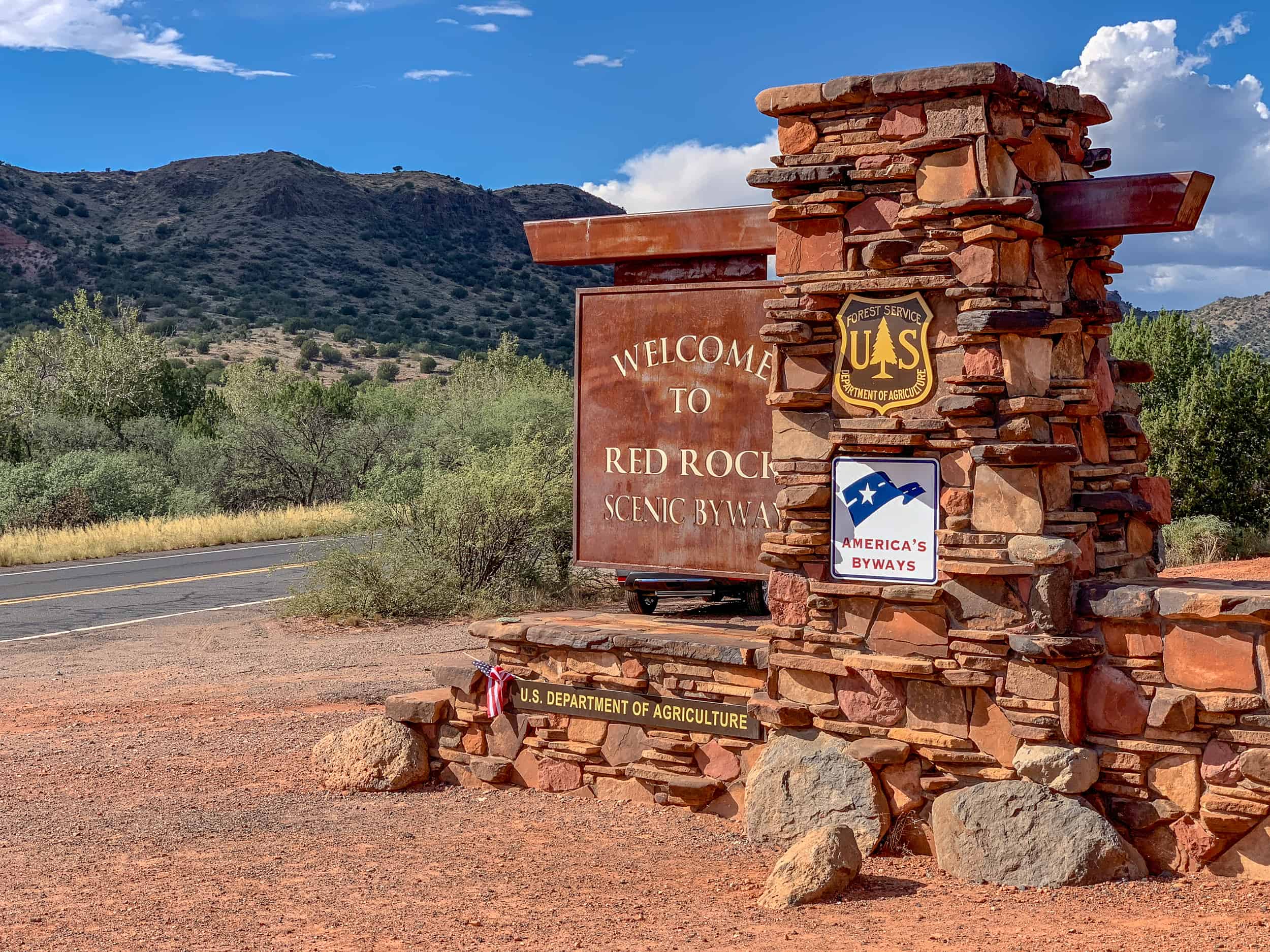
20. Scenic Highway 12 & Burr Trail (Utah)
This route is a masterclass in geological drama, cutting through the Escalante region where the road feels like a knife-edge ridge. I recommend basing yourself in Torrey or Escalante; these gateway towns offer the best cabin and lodge access for an early start.
The Burr Trail is the move if you want to escape the main highway traffic, but ensure your vehicle is capable of handling potential washboard sections. Skip this if you are prone to vertigo, as the drop-offs are significant.
21. Red Rock Scenic Byway & Route 89A (Sedona, Arizona)
The Red Rock Scenic Byway (Highway 179) packs an incredible amount of visual impact into just 7 miles, showcasing Bell Rock, Courthouse Butte, and Cathedral Rock. For a true Sedona experience, I recommend staying in West Sedona; it provides the most convenient access to the trailheads for an early-morning hike before the heat sets in.
You should skip the midday drive along 89A if you are looking for solitude, as it becomes heavily congested with tourist traffic. My pick is to drive the byway at first light and spend the afternoon in the shaded galleries of Tlaquepaque Arts & Shopping Village.
22. Monument Valley Scenic Drive & Route 163 (Utah/Arizona Border)
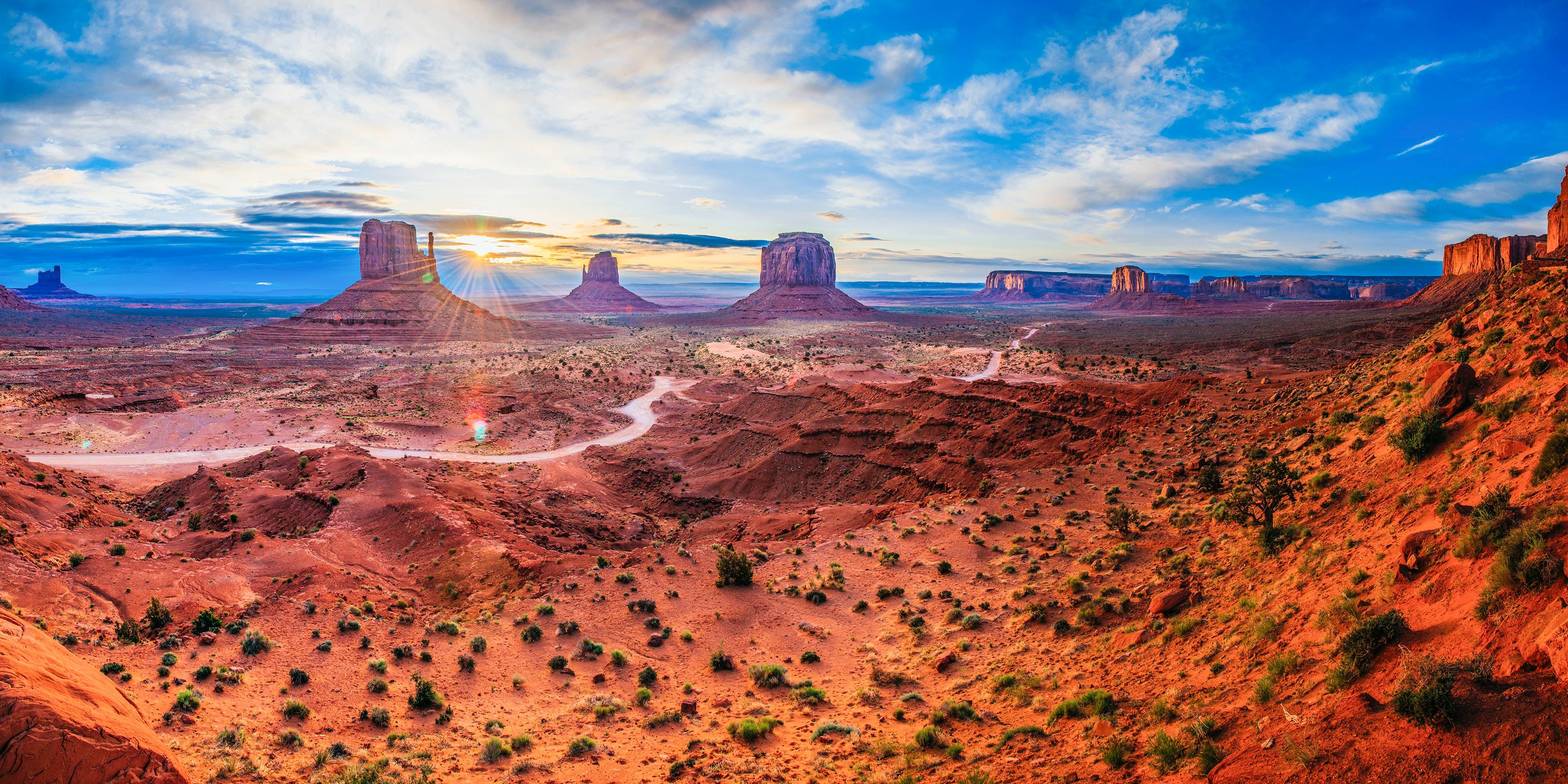
Driving into Monument Valley on Route 163 is the quintessential American West experience, but the real magic happens on the 17-mile loop inside the park. Admission is typically around $8.00 per person, per day, though you should confirm current rates with the Navajo Tribal Park visitor center before arriving.
I recommend staying at The View Hotel; being inside the park allows you to witness the sunrise over the Mittens without driving in from a distant town. This is a must-do for photographers, but skip the loop if you are in a low-clearance vehicle, as the unpaved road can be rough and dusty.
Always check local weather, as summer monsoons can occasionally impact road conditions.
Scenic River and Forest Drives for a Shaded Summer Road Trip
When the summer sun hits its peak, the best strategy is to retreat into the deep shade of mountain forests or follow the cooling breeze along major river corridors. These routes offer a natural temperature drop and a canopy-covered experience that keeps you out of the direct glare of the afternoon heat.
| Drive | Primary Landscape | Best For |
|---|---|---|
| Blue Ridge Parkway | Appalachian Mountains | Slow-paced scenic touring |
| Columbia River Highway | River Gorge & Waterfalls | Waterfall chasers |
| Great River Road | River Valley & Farmland | History and long-haul explorers |
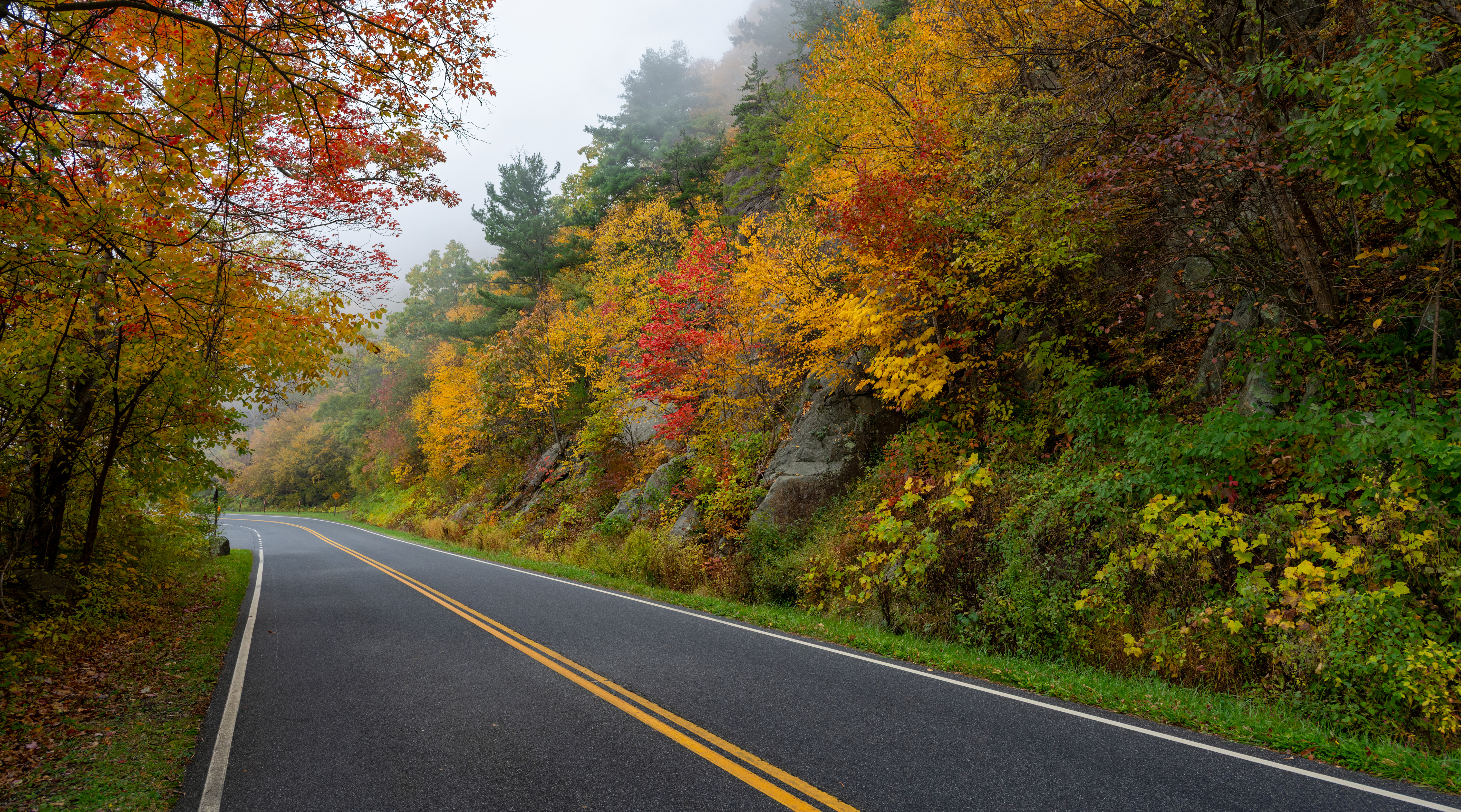
23. Blue Ridge Parkway (Virginia & North Carolina)
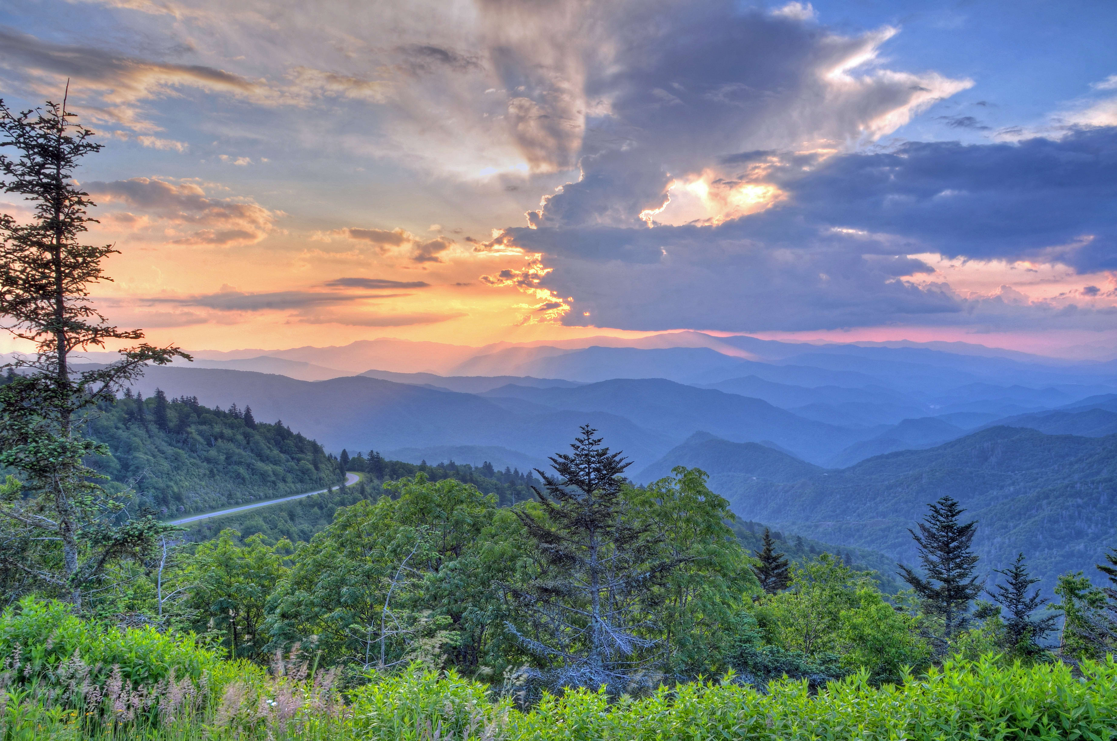
Stretching 469 miles between Shenandoah National Park and the Great Smoky Mountains, this route is the gold standard for Appalachian forest driving. Because this is a long-haul road trip rather than a quick day drive, I recommend breaking it into segments; focus on the Virginia section for rolling pastoral views or the North Carolina stretch for higher elevations and cooler temperatures.
The Move: Prioritize stops at Mabry Mill for the classic historic photo and the Linn Cove Viaduct, which offers a unique perspective of the road hugging the mountain cliffs. For hikers, Craggy Gardens provides a high-altitude escape with stunning mountain vistas that stay significantly cooler than the lowlands.
Insider Tip: Avoid the midday rush by starting your driving segments early in the morning. This is when the mountain mist is most photogenic and the pull-offs are significantly less crowded.
24. Columbia River Highway (Oregon)
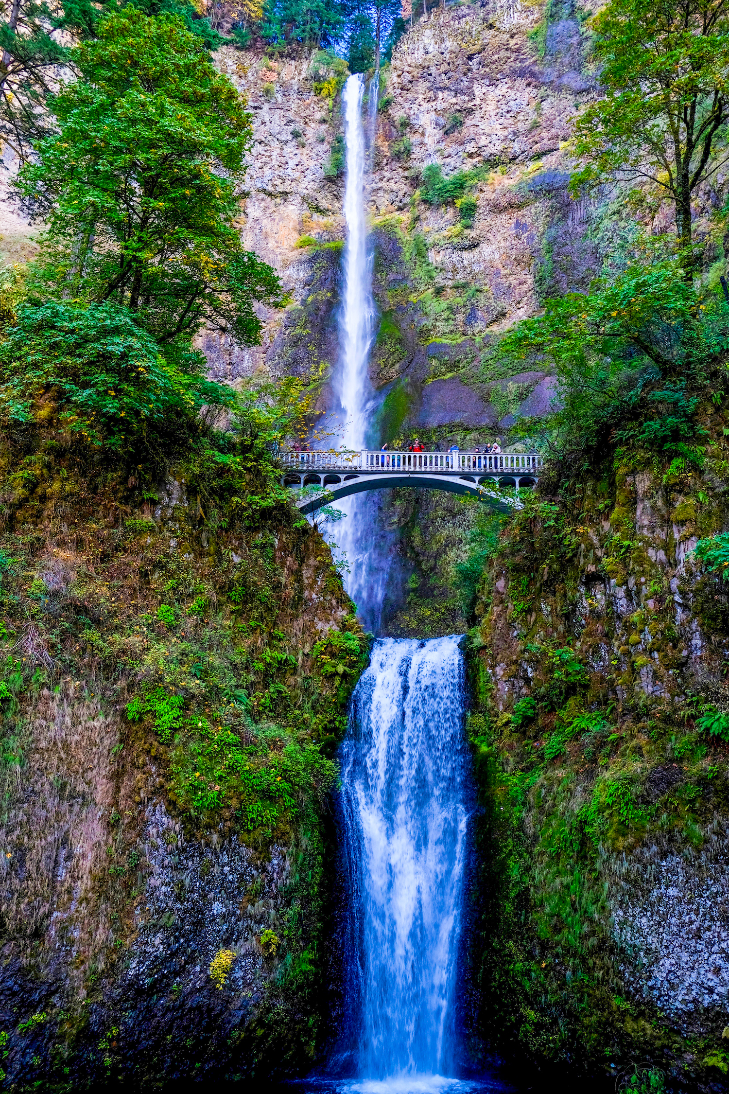
While Interstate 84 is the efficient way to transit the Columbia River Gorge, the Historic Columbia River Highway is the only choice for travelers who want to actually see the landscape. This route winds through dense forest and provides direct access to the iconic Multnomah Falls.
It is the superior option for anyone prioritizing atmosphere over speed.
The Move: Use the town of Hood River as your base. It offers the perfect mix of riverfront lodging and easy access to the highway’s most impressive waterfall trailheads.
Skip the interstate if you have the time—the historic route is specifically designed to showcase the gorge’s geology.
Insider Tip: Parking at major waterfalls like Multnomah is notoriously difficult. Arrive before 9:00 AM to secure a spot, or look for shuttle services if you are visiting during the peak summer months.
25. Great River Road (Minnesota to Iowa)
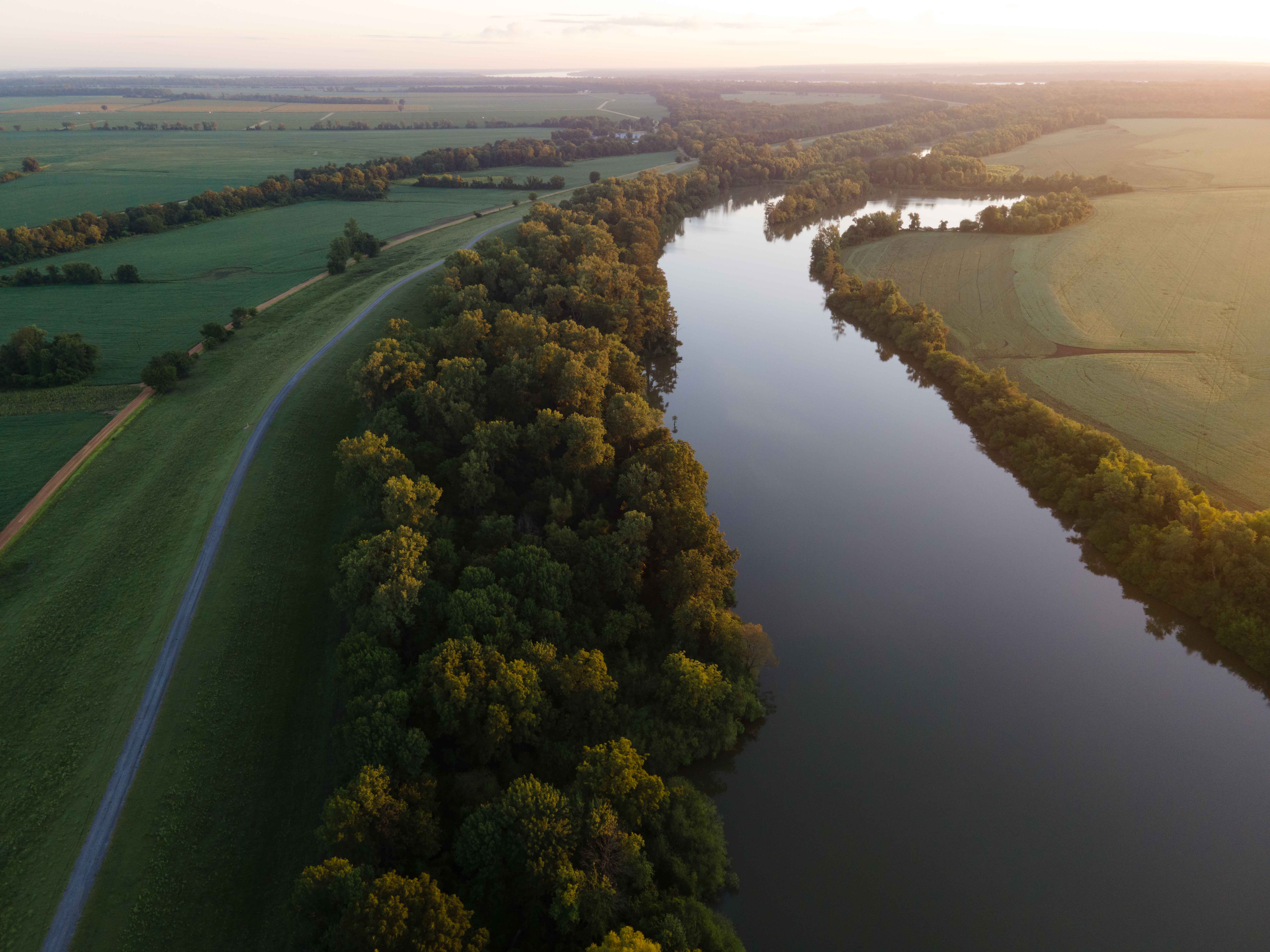
Following the Mississippi River for 2,340 miles from Lake Itasca to the Gulf, the northern segments of this route through Minnesota and Iowa offer a lush, green contrast to the arid western drives. This is best for travelers who prefer slow, meandering roads that hug the riverbanks and pass through historic river towns.
The Move: Focus your trip on the Upper Midwest portion, where the bluffs and river valley provide natural shade and frequent opportunities for riverside picnics. It is a fantastic, free-to-access alternative to mountain driving that feels like a journey through the heart of American history.
Insider Tip: Don’t try to drive the entire length in one go. I recommend picking a 200-mile stretch in the Wisconsin or Iowa river valley region to enjoy the local charm without the fatigue of a multi-state haul.
Summary: Choose the Blue Ridge Parkway if you want mountain elevation and forest canopy; pick the Columbia River Highway if you want waterfalls and dramatic gorge geology; and opt for the Great River Road if you prefer a relaxed, river-adjacent pace through the heart of the Midwest.
Is Driving the Overseas Highway or Road to Hana Better in Summer?
Choosing between the Road to Hana and the Overseas Highway depends entirely on whether you prefer lush, tropical rainforests or endless, turquoise ocean vistas. While both are iconic, they offer vastly different driving experiences: the Road to Hana is a slow, winding journey through dense vegetation and waterfalls, whereas the Overseas Highway is an open-water transit across 42 bridges connecting the Florida Keys.
| Drive | Best For | Primary Vibe | Summer Factor |
|---|---|---|---|
| Road to Hana | Adventure seekers | Tropical/Rainforest | High humidity/Crowds |
| Overseas Highway | Relaxed road trippers | Coastal/Island hopping | Hot/Sunny |
| Smugglers’ Notch | Mountain lovers | Rugged/Forested | Cooler mountain air |
| Finger Lakes Rd 14 | Wine & waterfall fans | Lakeside/Rural | Perfect swimming weather |
26. Road to Hana (Maui, Hawaii)
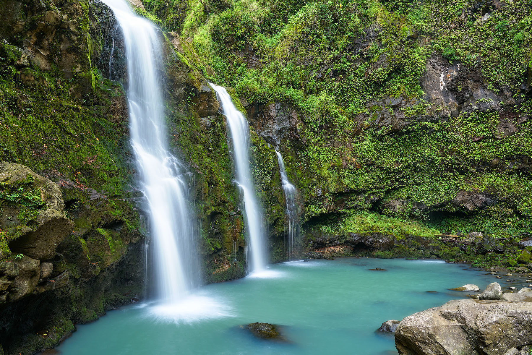
The Road to Hana is a masterclass in patience, featuring over 600 curves and 50 one-lane bridges that demand your full attention. I recommend starting before dawn to beat the tour buses; arriving at the popular stops by 8:00 AM is the only way to avoid the midday congestion.
This drive is best for those who enjoy frequent stops at botanical gardens and hidden swimming holes. If you dislike tight, winding cliffside roads, skip this and opt for a guided van tour instead.
27. Overseas Highway (Florida Keys)
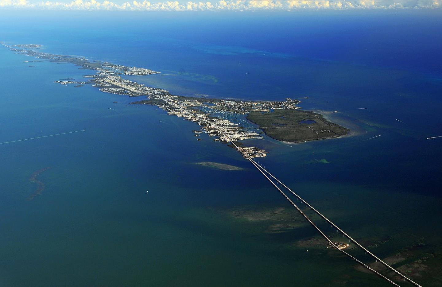
Spanning 113 miles from Key Largo to Key West, this route is the gold standard for ocean-view driving. The highlight is the Seven Mile Bridge, which provides a surreal feeling of driving directly across the open sea.
I prefer staying in boutique waterfront inns in Islamorada for a quieter base compared to the bustle of Key West. This drive is best for those who want a low-stress, flat route with constant beach access.
Avoid this during peak hurricane season months if you are risk-averse, as summer weather can shift rapidly.
28. Smugglers’ Notch Scenic Drive (Vermont)
Smugglers’ Notch (Route 108) is a dramatic, narrow mountain pass that feels worlds away from the flat valleys below. It is best for travelers looking for a quick, high-impact scenic drive through dense forest and massive rock formations.
Note that this road is strictly for passenger vehicles; large RVs and trailers are prohibited due to the tight hairpin turns. For the best experience, base yourself in a mountain inn in Stowe, which provides easy access to the pass and local hiking trails.
29. Road 14 (Finger Lakes, New York)
Road 14 is the definitive route for anyone wanting to combine lake views with world-class waterfall hiking. I recommend prioritizing a stop at Watkins Glen State Park, where the gorge trail offers a spectacular look at 19 waterfalls within a two-mile stretch.
This drive is best for those who want a mix of scenic cruising, winery stops, and outdoor activity. Plan for a full day to allow enough time to hike the gorge, as parking lots fill up quickly by mid-morning during the summer season.
Summary: Choose the Road to Hana if you want an immersive rainforest adventure, the Overseas Highway for stress-free island hopping, Smugglers’ Notch for cool mountain air, or Road 14 for the best waterfall-to-winery ratio in the Northeast.
Frequently Asked Questions
What is the difference between a scenic drive and a road trip?
A scenic drive is typically a shorter, defined route designed to be completed in a single day or less, focusing on a specific geographic feature like a mountain pass or a coastal stretch. In contrast, a road trip—such as Route 66 or the Blue Ridge Parkway—covers massive distances and requires multiple days of travel, overnight stops, and more rigorous logistical planning.
How do I know if my vehicle is suitable for high-altitude mountain passes?
Many of America’s most famous mountain highways, such as the Beartooth Scenic Byway, feature steep grades, tight switchbacks, and narrow lanes that can be challenging for oversized vehicles. If you are traveling in an RV or towing a trailer, check official park or state transportation websites for length and weight restrictions before departing.
I recommend opting for a smaller rental vehicle if your primary goal is to navigate these high-elevation routes comfortably and safely.
Are these scenic drives accessible year-round?
Most high-altitude routes in the Rockies and Cascades are strictly seasonal, typically opening in late spring or early summer once snow is cleared and closing again by the first heavy snowfall in autumn. Always check the Department of Transportation or National Park Service status pages for the specific route you intend to drive, as weather-related closures can occur even during the summer months.
Which base areas do you recommend for multi-day exploration of Utah’s National Parks?
If you are planning to visit both Arches and Canyonlands, Moab is the essential gateway town. It offers the best access to both parks, providing a variety of hotels and base-camp options that allow you to maximize your time on the road.
For the best experience, I recommend staying in downtown Moab for easy access to restaurants and services, or choosing a lodge near the park entrances if you prefer to prioritize early-morning trailhead access.
Is it possible to do a scenic drive as a day trip from a major city?
Yes, many world-class drives are located within an hour or two of major metropolitan hubs. For example, the 50-mile North Shore Drive is an easy day trip from Las Vegas, while various coastal routes are accessible from major California cities.
Always plan to depart early in the morning to avoid peak traffic and ensure you have enough daylight to enjoy the scenery without rushing.
Hit the Road and Make This Summer Unforgettable
Your next step is to choose your terrain, whether that means booking a timed-entry permit for Glacier’s Going-to-the-Sun Road or reserving a cozy cabin along the Oregon Coast. Once your route is locked in, check the local department of transportation website to ensure the seasonal passes are fully open.
There is nothing quite like the freedom of the American open road, especially when summer clears the way to high-alpine vistas and misty coastal cliffs you cannot reach any other time of year.
Grab your map, pack your favorite road trip snacks, and start planning your ultimate summer drive today.
Leave a Reply