
The fog is still clinging to the ridgeline when you pull into Skyland at 3,680 feet, and the Shenandoah Valley unfolds below in stacked layers of blue and green that no photograph ever captures.
Black bears cross Skyline Drive at dawn, deer graze in meadows you have entirely to yourself, and the only noise is your boots on a rocky Appalachian trail.
What makes a three-day Shenandoah itinerary different from any other national park trip is the structure: Skyline Drive is the only road — a single 105-mile ribbon with zero shortcuts — and every trailhead, overlook, and lodge sits directly off it.
You move north to south, and the park itself dictates your pace.
This guide maps out exactly what to hike, where to sleep, and which overlook to park at each day so you never waste a mile.
Expect to spend roughly $15–30 per night camping, $90–160 per night in gateway towns like Luray and Front Royal, or $200–350 per night for in-park cabins and lodges at Skyland and Big Meadows.
Your 3-Day Snapshot at a Glance
- Day 1 (North): Compton Peak summit hike, afternoon detour to Luray Caverns, dinner and overnight at Skyland (mile 41.7)
- Day 2 (Central): Stony Man Summit, Hawksbill Mountain Loop, Big Meadows lunch, Dark Hollow Falls — overnight at Lewis Mountain or Sperryville
- Day 3 (South): Doyles River Falls hike, Blackrock Summit, celebratory craft beer and pizza at Blue Mountain Brewery in Afton
- Best in-park base: Skyland for summit sunrises, Big Meadows Lodge for central-trail convenience
- Best season: Mid-October for peak foliage (book lodging 6–12 months ahead) or late April for waterfall flow with far fewer crowds
- Entrance fee: $30 per vehicle, valid for 7 days — credit card only, no cash accepted at stations
Best Time to Visit Shenandoah National Park
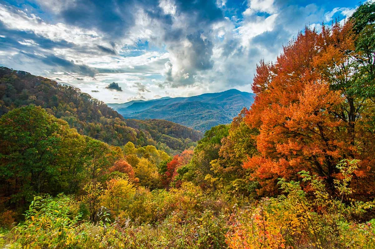
Mid-October turns every overlook on Skyline Drive into a 360-degree canvas of reds, golds, and burnt orange — but you’ll share it with half of Virginia. Here’s how each season actually stacks up so you can pick the tradeoff that fits your trip.
| Season | Crowds | Best For | Watch Out |
|---|---|---|---|
| Spring (April–May) | Low | Waterfalls, wildflowers, solitude | Unpredictable rain, some trail closures |
| Summer (June–Aug) | Moderate–High | Long days, family trips | Humidity, afternoon thunderstorms |
| Fall (Late Sept–Early Nov) | Packed | Foliage photography, scenic drives | Gridlocked Skyline Drive, sold-out lodges |
| Winter (Dec–March) | Minimal | Snow-covered solitude | Skyline Drive closures, limited services |
Spring Waterfalls and Wildflowers
Snowmelt and spring rains mean Shenandoah’s waterfalls hit peak flow between late March and mid-May — this is your window for dramatic cascades at Dark Hollow Falls and Doyles River Falls without summer’s crowds. Trails stay quiet, wildflowers start carpeting forest floors by April, and wildlife is active after winter dormancy.
Average daytime temperatures range from the 50s to low 70s at elevation.
The tradeoff: Virginia spring weather swings hard. Pack layers and a rain shell regardless of the forecast. Some higher-elevation trails may have lingering mud or temporary closures into early April.
Insider pick: Aim for a midweek visit in late April. You’ll get full waterfall flow, emerging wildflowers, and parking at popular trailheads like Stony Man without the weekend scramble.
Summer Escape from Valley Heat
When the Shenandoah Valley bakes in the 90s, the park’s 3,000+ foot elevation averages around 65°F — enough of a difference to make hiking genuinely comfortable. Summer delivers the longest daylight hours, the fullest trail access, and every in-park facility running at full capacity, including lodges like Skyland and Big Meadows plus all campgrounds along Skyline Drive.
Expect afternoon thunderstorms most days from late June through August. Start hikes early, ideally by 8 a.m., and plan to be off exposed summits before 2 p.m. The humidity is real — carry more water than you think you need.
Crowd reality: Summer is moderate but jumps to high on weekends and holidays. If you’re visiting in July or August, weekdays only.
Fall Foliage Peak Season
This is what puts Shenandoah on every bucket list — and what makes Skyline Drive feel like a parking lot in October. Peak color typically hits mid-October, though elevation shifts the timing: higher elevations (above 3,000 feet) turn first in early-to-mid October, while lower elevations hold color into late October and even early November.
The honest truth: fall is crowded to the point that popular overlooks fill up by midmorning on weekends, and the park occasionally implements traffic management at entrance stations. Lodges and campgrounds book out months ahead.
How to win fall without the headache:
- Visit midweek — Tuesday through Thursday are dramatically less congested.
- Start at the southern entrance near Waynesboro, where crowds thin out first.
- Book lodging the moment it opens — park lodges release rooms roughly 12 months out, and fall weekends disappear fast. Gateway towns like Luray and Front Royal are your backup but also fill early.
- Drive south to north if foliage timing matters — you’ll chase peak color down the mountain rather than arriving after it fades.
Winter Snow and Low Crowds
Winter turns Shenandoah into a quiet, snow-dusted ridge with almost no one on the trails — but it demands flexibility. Skyline Drive closes whenever ice or snow makes conditions unsafe, which happens regularly from December through February.
When the drive is closed, you can still enter the park on foot for hiking, but road access to overlooks and trailheads is gone.
Most in-park services shut down in winter. Lodges close, visitor centers operate on reduced hours, and campgrounds are limited. Gateway towns like Luray and Front Royal stay open year-round and are your best bet for dining and lodging.
Winter sweet spot: A clear, cold day after a snowfall delivers the most photogenic views of the entire year — empty overlooks, frost on ridgelines, and bare trees revealing valley panoramas you can’t see in summer. Check Skyline Drive status on the NPS website the morning of your visit before making the drive.
Year-round reminder: Shenandoah charges entrance fees of $30 per vehicle (valid for 7 days) or $15 on foot. Bring a credit card — cash is not accepted at entrance stations.
And cell service is unreliable throughout most of the park, so download your maps and confirm reservations before you arrive.
Where to Stay in Shenandoah National Park
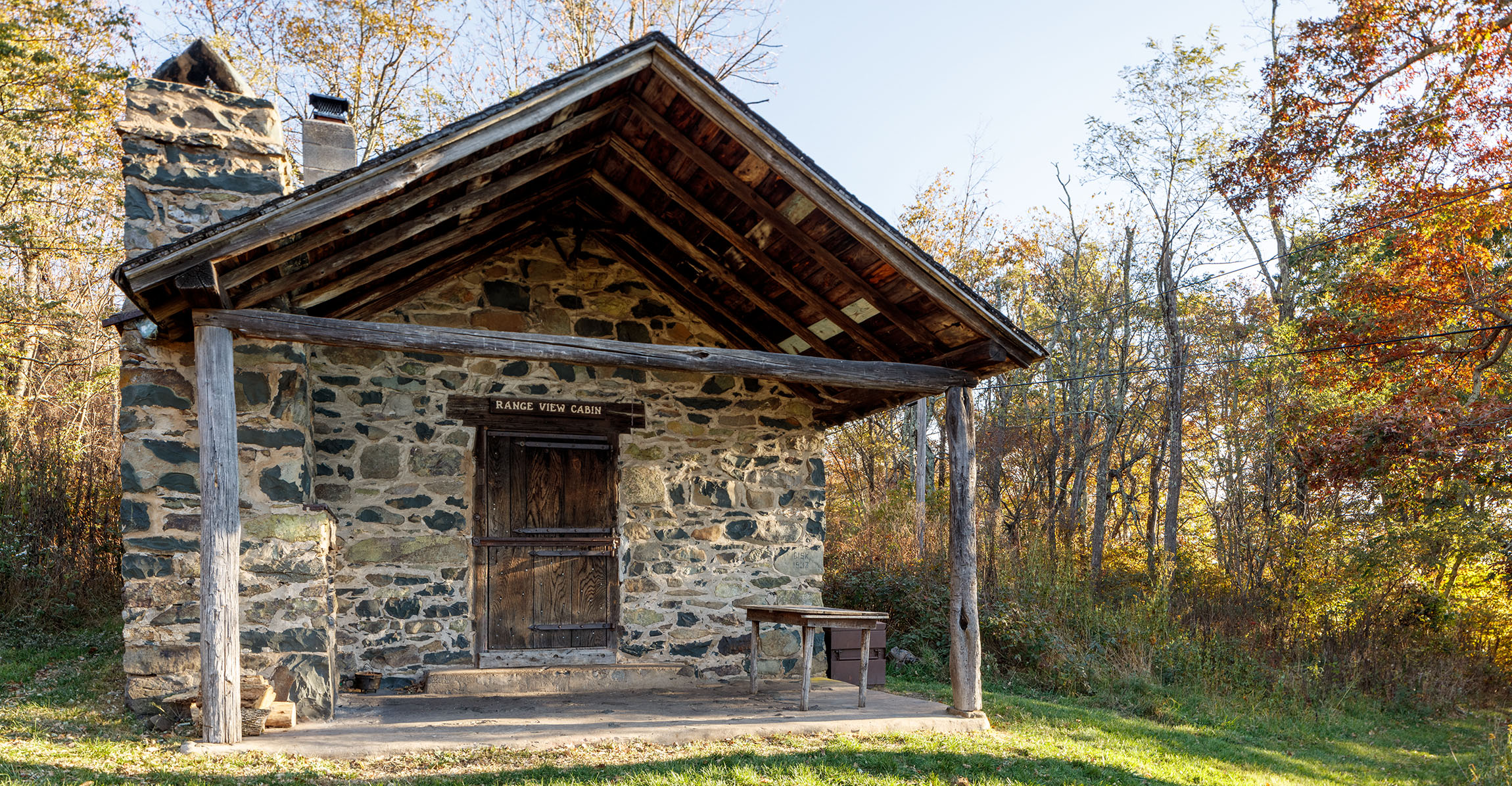
Staying inside the park puts you on Skyline Drive at sunrise and sunset — the two windows when deer, bears, and wild turkey emerge and most day visitors are still an hour away. That alone is worth the tradeoff in room amenities.
In-Park Lodges and Cabins
Shenandoah has two historic lodges operated by the park’s concessioner, plus standalone cabin rentals scattered just outside the boundary. Book early for fall — these sell out months ahead during peak foliage around mid-October.
- Skyland: The highest-elevation option at 3,680 feet on Skyline Drive, with updated premium rooms and detached cabins. Best pick if you want to wake up above the clouds and be steps from the Stony Man Summit trailhead. On-site dining available.
- Big Meadows Lodge: Dead center of the park near Big Meadows, making it the most convenient base for a multi-day itinerary. Main lodge rooms and rustic cabins, plus an on-site dining room. Choose this if you want easy access to the widest variety of mid-park trails without repositioning your car.
- Private Cabins (VRBO): Rental cabins cluster near the Thornton Gap and Swift Run Gap entrance areas. Look for ones with hot tubs and west-facing valley views — the sunset payoff is real. Expect to do your own cooking since these are outside the park’s dining options. Prices typically run $120–250/night depending on season and size.
Campgrounds Along Skyline Drive
Shenandoah operates several campgrounds along Skyline Drive, with Big Meadows Campground being the largest and most centrally located. Sites typically run $15–30/night.
Mathews Arm (north section) and Loft Mountain (south section) offer alternatives if Big Meadows fills up. All campgrounds are seasonal — confirm operating dates before planning a spring or fall trip, as opening and closing depend on weather.
Reservations through Recreation.gov are strongly recommended during weekends and foliage season; walk-up sites are scarce.
Nearby Towns Like Luray and Front Royal
If in-park lodging is booked or your budget needs a break, these gateway towns are your best bets — each offering more dining variety and lower nightly rates than the park lodges.
- Luray (Thornton Gap Entrance): The closest town to the park’s midsection, roughly 10 minutes from the Thornton Gap Entrance Station at Skyline Drive mile 31.5. A solid pick for anyone building a Day 1 itinerary around Dickey Ridge and the northern trails. Downtown Luray has walkable restaurants, and Luray Caverns is worth an hour if you have time.
- Front Royal (North Entrance): The park’s northern gateway at mile 0 of Skyline Drive. Best for travelers entering from the DC metro area or starting a north-to-south drive. Expect roughly $90–160/night at standard chain hotels — a significant savings over in-park rooms. The tradeoff is a 15–20 minute drive to the entrance each morning.
- Charlottesville: The most amenity-rich option, but it’s roughly 30 miles from the nearest entrance. Only choose this if you want upscale dining, wineries, or a university-town vibe paired with your park days — and accept the daily commute.
For a three-day itinerary, basing yourself inside the park for at least one night is the move. You cut drive time, catch the best light, and honestly — hearing nothing but tree frogs from your cabin porch beats any hotel lobby.
How to Get Around Shenandoah National Park
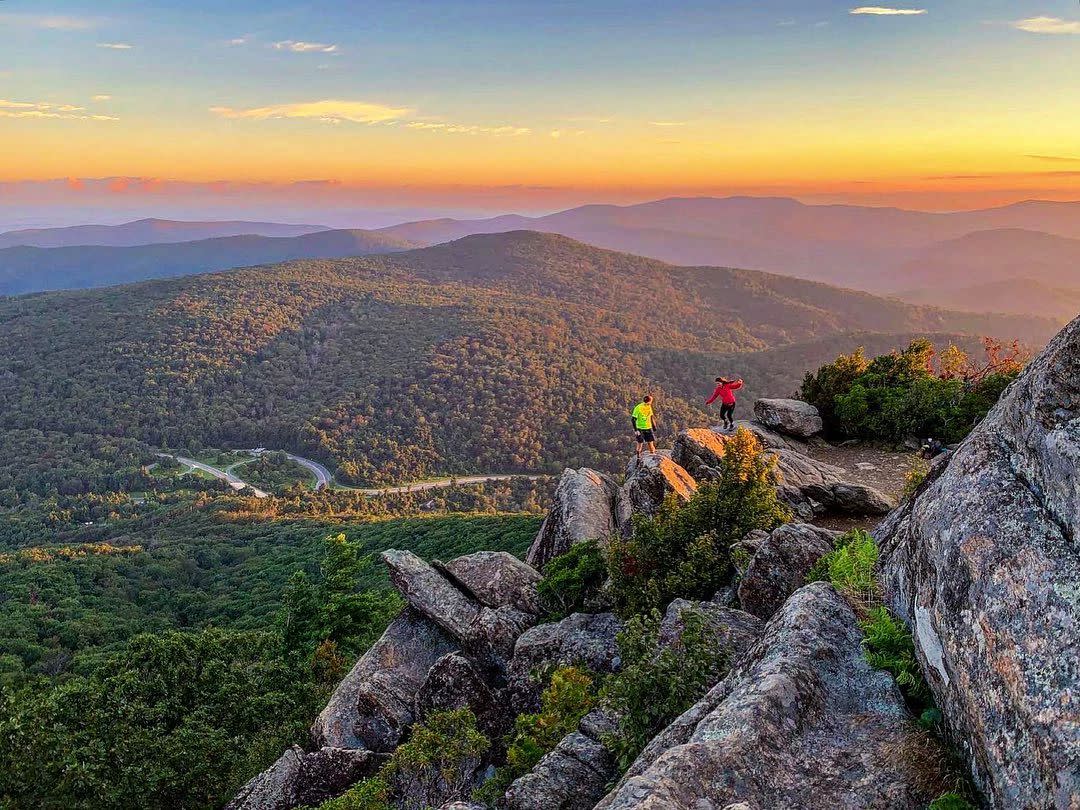
Skyline Drive is the only road through Shenandoah — a single 105-mile ribbon of asphalt cresting the Blue Ridge from Front Royal to Waynesboro. There are no cross-park shortcuts, no parallel routes, and no way to skip ahead.
Every trailhead, overlook, lodge, and visitor center sits directly off this one road, and the park’s entire navigation system revolves around its mile markers.
Driving Skyline Drive North to South
You can drive the full length of Skyline Drive in about three hours without stopping. You will stop — dozens of times — so budget a full half-day minimum for the drive itself.
The speed limit is 35 mph, and it exists for good reason: sharp curves, sudden wildlife crossings, and blind overlook pull-offs make anything faster reckless. Black bears regularly appear along the roadside, especially at dawn and dusk.
Most visitors enter from the north (Front Royal) because it’s closest to Washington, D.C. — roughly 75 miles and a 90-minute drive on a good day. If you’re flying in, Washington Dulles International is your best airport, sitting about two hours from the Front Royal entrance.
Driving north to south is the classic flow for a multi-day itinerary: you hit the least-crowded northern section first and build toward the highest-elevation highlights in the central and southern stretches.
- Best for first-timers: Enter north (Front Royal), exit south (Rockfish Gap near Waynesboro) — the scenery escalates and you save the highest ridgeline views for last.
- Best for return visitors: Start at whichever entrance puts you closest to the trailhead you actually want that morning. The Thorntons Gap and Swift Run Gap entrances near the middle of the park give you the most flexibility to go either direction.
- Weather warning: Skyline Drive closes periodically during ice, snow, and severe weather — even when valley roads are clear. Check the NPS website or call the park before driving up in winter or after storms. You can still enter on foot to hike if the road is gated.
Entrance Stations and Mile Markers
Four entrance stations access Skyline Drive, and every park landmark is referenced by its mile marker — not by name. Learn this system, and you’ll navigate the park like a local.
| Entrance Station | Mile Marker | Nearest Town | Best For |
|---|---|---|---|
| Front Royal (North) | 0 | Front Royal, VA | Coming from D.C. or I-66 |
| Thornton Gap | 31.5 | Luray, VA | Central park access, Luray Caverns |
| Swift Run Gap | 65.5 | Elkton, VA | Old Rag, central-south trails |
| Rockfish Gap (South) | 105 | Waynesboro, VA | Coming from I-64 or Blue Ridge Parkway |
Entrance fees run $30 per vehicle (seven-day pass), $25 for motorcycles, and $15 for visitors on foot or bicycle. An America the Beautiful annual pass ($80) covers Shenandoah and every other national park — worth it if you’re hitting even one more park this year.
Pay by credit card at the entrance station; cash is not accepted. If the station is unstaffed (common early morning or late evening), use the self-pay envelope system at the gate.
Visitor Centers for Maps and Ranger Advice
Grab a free park map at any visitor center the moment you arrive — cell service is unreliable across most of the park, and you will lose signal for long stretches on Skyline Drive. The physical map with mile markers is your real GPS out here.
- Dickey Ridge Visitor Center (Mile 4.6): First stop if you enter from Front Royal. Pick up maps, get ranger advice on current trail conditions, and fill your water bottles. This is also the most reliable spot for cell reception in the northern section.
- Byrd Visitor Center (Mile 51): Located at Big Meadows, right in the center of the park. The largest visitor center with the most comprehensive exhibits. Rangers here know the central trail network best — ask about Hawksbill, Stony Man, and Dark Hollow Falls conditions before committing.
- Dundo Visitor Center (Mile 83.7): Smaller and less crowded; useful if you’re exploring the southern section or coming up from Rockfish Gap.
Insider tip: Visitor centers open seasonally, not year-round. Dickey Ridge and Byrd typically operate spring through fall; hours vary.
If you’re visiting in winter, expect limited or no staffing — download the NPS app and grab maps digitally before you lose signal.
How to Spend Day 1 in Shenandoah National Park

Enter through the Front Royal gate and you’re just 4.6 miles from your first real decision — which trail to tackle before the parking lots fill. Day 1 moves you south along Skyline Drive with a midday detour into Luray, then brings you back into the park for dinner and sunset at the highest point on the entire road.
| Stop | Where | Time Needed | Why It Matters |
|---|---|---|---|
| Dickey Ridge Visitor Center | Mile 4.6 | 20–30 min | Paper maps, ranger intel, trail conditions |
| Compton Peak or Fox Hollow | Mile 10 / Mile 4.6 | 45 min – 2 hrs | First summit views or easy history walk |
| Elkwallow Waystation | Mile 24.1 | 45 min | Only food stop between entrance and Skyland |
| Downtown Luray | Off-drive via Thornton Gap | 1 hr | Walkable Main Street, coffee, antiques |
| Luray Caverns | Luray, VA | 1–1.5 hrs | Largest caverns in the eastern U.S. |
| Skyland Dinner & Overnight | Mile 41.7 | Evening | Sunset from 3,680 feet |
Dickey Ridge Visitor Center Stop
Pull in at mile 4.6 — just minutes past the Front Royal Entrance Station — and do two things before anything else: grab a paper trail map and ask a ranger about current trail closures and weather. Cell service is unreliable through most of the park, so this is your only dependable info hub for the northern section.
The center has exhibits on the park’s natural and cultural history, restrooms, and a bookstore. Budget 20–30 minutes.
If you’re traveling with a pet, confirm here which trails have restrictions — Shenandoah allows dogs on most trails, but a handful are off-limits.
Compton Peak or Fox Hollow Hike
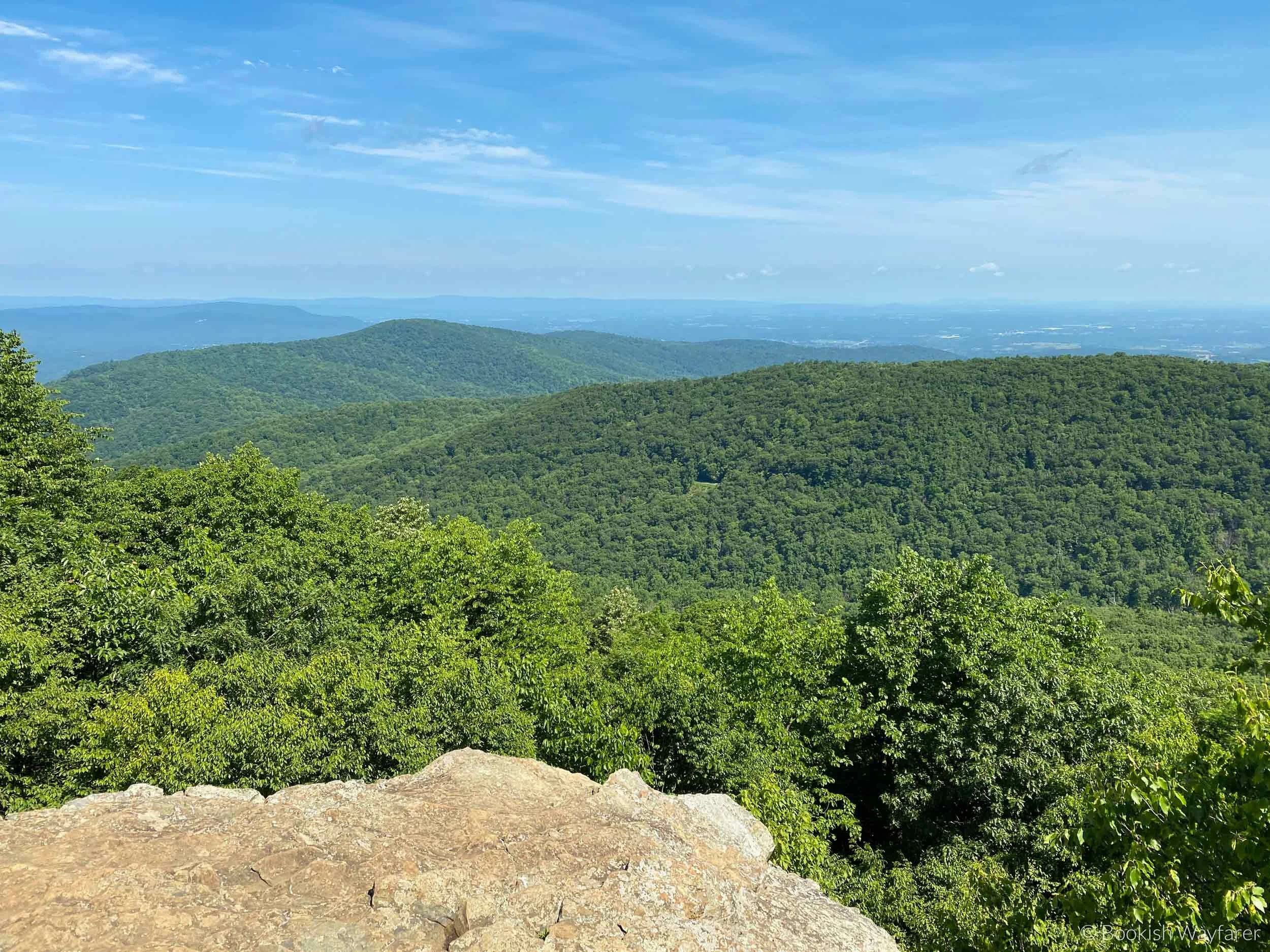
Two trails branch from this northern stretch of Skyline Drive. Pick based on energy and schedule.
- Compton Peak (moderate, ~2.4 miles round trip): The stronger choice for anyone with a couple hours to spare. The summit delivers 360-degree views of the Shenandoah Valley and Massanutten Mountain. The east-facing overlook alone justifies the climb. Allow 1.5–2 hours with photo stops.
- Fox Hollow (easy, ~1.2-mile loop, starts at Dickey Ridge): A flat walk through a historic homestead site — stone walls, old cemetery plots, and forest. The right call for families with young kids or anyone easing into the altitude. About 45 minutes.
Choose Compton Peak unless you’re genuinely short on time or traveling with very young hikers. The elevation gain is steady but manageable, and the summit views beat anything you’ll get from the roadside overlooks.
Elkwallow Waystation Lunch
By mile 24.1 you’ll have earned a meal. Elkwallow Waystation is a seasonal grill and snack bar sitting right on Skyline Drive — the only prepared-food option between the north entrance and Skyland.
It serves burgers, sandwiches, hot dogs, and ice cream. The operating season typically runs spring through fall, but exact opening and closing dates shift yearly — check the NPS website or call ahead if you’re visiting early or late in the shoulder season.
Insider tip: Arrive before 11:30 a.m. or after 1 p.m. The midday window packs in families and tour groups, and seating is limited. If Elkwallow happens to be closed or the line looks rough, picnic areas at overlooks between miles 20 and 30 give you valley views no restaurant can match — pack a cooler.
Downtown Luray Exploration
Exit Skyline Drive at Thornton Gap (mile 31.5) and drive roughly 15 minutes east to Luray. This small Shenandoah Valley town has a compact, walkable Main Street worth a quick spin — antique shops, a few local diners, and the Luray Valley Museum if you want context on the region’s heritage.
One hour is the right amount. Grab a coffee, stretch your legs, and save your appetite for the caverns. Don’t linger too long — you want daylight for the drive back up to Skyland later.
Luray Caverns Visit
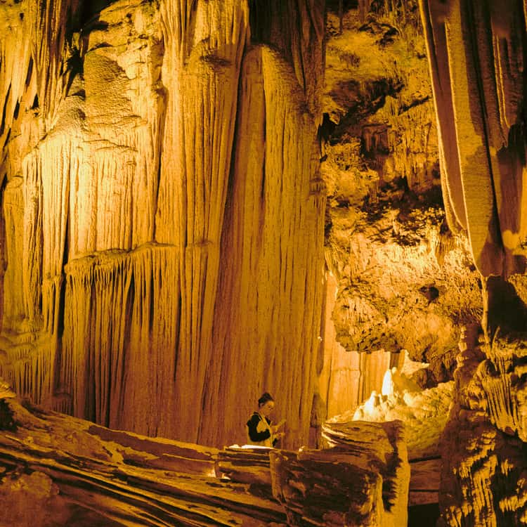
It looks touristy from the parking lot. Go anyway.
Luray Caverns is the largest series of caverns in the eastern United States, and the cathedral-scale chambers dripping with stalactites and stalagmites genuinely earn the admission price. The Great Stalacpipe Organ — a lithophone that strikes actual cave formations with rubber mallets to produce music — exists nowhere else on Earth.
- Tickets: Expect roughly $30–35 for adults, with discounts for children ages 6–12. Kids under 6 enter free.
- Inside time: Budget 1–1.5 hours for the guided cave tour. The cavern holds a steady 54°F year-round, so bring a light layer even in July.
- Booking strategy: Buy tickets online before you arrive. Walk-up lines on weekends and during fall foliage season can burn 30+ minutes just standing at the window.
Your ticket includes the adjacent Car & Carriage Caravan Museum, a toy museum, and a garden maze — worth a quick walk-through if you have time, but not worth rearranging your schedule for.
Skyland Dinner and Overnight
Head back west to Thornton Gap, re-enter the park, and continue south on Skyline Drive about 10 miles to Skyland at mile 41.7. At 3,680 feet elevation, this is the highest accommodation on the entire scenic drive.
The dining room leans Appalachian — local trout, Virginia ham, seasonal sides — and the food is solid, not spectacular. The real reason to eat here is the setting: west-facing windows overlooking the Shenandoah Valley in stacked layers.
Arrive 30 minutes before sunset and request a window table.
Lodging ranges from updated premium rooms in the main building to detached cabins with more privacy. Skyland books out fast during peak fall foliage season and on summer weekends — reserve as early as possible.
For full lodging comparisons, see the Where to Stay section.
How to Spend Day 2 in Shenandoah National Park

Day 2 tackles the park’s two essential summit hikes and its most popular waterfall, all centered around the central hub of Skyland and Big Meadows. This is your high-country day, with the payoff of panoramic views from the park’s highest peak and a classic waterfall descent. Start early; the parking lots for these iconic trails fill by mid-morning.
Stony Man Summit Hike
Begin with this relatively easy 1.6-mile round trip trail from Skyland Resort. It’s the perfect warm-up, delivering a sweeping view of the Shenandoah Valley and the town of Luray below.
The second peak offers slightly better, less obstructed views if you’re willing to add the extra minutes. This is the ideal hike for capturing that quintessential Shenandoah vista without a major time or energy commitment.
Hawksbill Mountain Loop
Drive south to the Hawksbill Gap parking area (Mile 45.6) for the park’s signature summit hike. The 2.9-mile loop to the 4,051-foot summit is the must-do of the day.
For the best experience, take the Appalachian Trail up and the Salamander Trail down. The Byrd’s Nest shelter at the summit is a perfect spot to rest and take in the 360-degree panorama—you’ll see the valley you just looked down at from Stony Man from a much grander scale.
Big Meadows Lunch and Visitor Center
Refuel at Big Meadows Wayside (Mile 51), which serves standard cafeteria fare—burgers, sandwiches, and salads. It’s convenient, not culinary.
For a sit-down meal with more character, the dining room at Big Meadows Lodge is the better choice. While here, stop at the Byrd Visitor Center next door for its excellent exhibits on the park’s human and natural history.
This is your best chance to talk to a ranger about afternoon trail conditions.
Dark Hollow Falls Trail
Just north of Big Meadows (Mile 50.7), this 1.4-mile round trip trail is the park’s shortest hike to a waterfall. It’s also deceptively steep on the return climb.
Go this afternoon to avoid the largest crowds. The falls are lovely, but be warned: the trail is rocky and heavily trafficked.
If your legs are tired from the morning’s summits, you can view the falls from the road overlook instead—it’s not as immersive, but it saves your knees.
Sperryville or Elkton Town Visit
For your evening meal and atmosphere, you have two excellent options that break up the next day’s drive. Head northeast on Skyline Drive to exit at Thornton Gap (Mile 31.5) and descend into Sperryville, a tiny but vibrant arts and food hamlet with standout breweries and farm-to-table restaurants.
Alternatively, exit south at Swift Run Gap (Mile 65) for Elkton, a quieter, more traditional town with solid, no-frills diners. Sperryville wins for foodies and vibe; Elkton wins for a quieter, more direct retreat.
Lewis Mountain Cabins or Campground
For your second night in the park, consider a move south. Lewis Mountain (Mile 57) offers rustic cabins and a small, quieter campground as a less crowded alternative to Big Meadows. It’s perfectly positioned between today’s hikes and tomorrow’s potential exit point.
If you prefer town lodging, book in Sperryville or Elkton to eliminate a morning drive into the park.
Day 2 Snapshot
| Stop | Key Detail | Insider Tip |
|---|---|---|
| Stony Man Summit | 1.6-mile easy hike with valley views. | Do it first thing for morning light on the valley. |
| Hawksbill Mountain Loop | 2.9-mile loop to the park’s highest point. | Hike clockwise (AT up, Salamander down) for best flow. |
| Big Meadows | Lunch, lodge dining, visitor center. | Eat at the Lodge Wayside for more character than the Cafeteria. |
| Dark Hollow Falls | 1.4-mile steep, popular waterfall trail. | Go after 3 PM or accept the crowds. Roadside overlook is a fine compromise. |
| Evening Base | Sperryville for food, Elkton for quiet. | Exit via Thornton Gap for Sperryville; Swift Run Gap for Elkton. |
How to Spend Day 3 in Shenandoah National Park

Your final day packs two contrasting hikes—a waterfall finale and a boulder-top panorama—before rewarding yourself at a brewery in the valley below. This is the day to savor your last views from the crest of the Blue Ridge.
Doyles River Falls Hike
Start early at the Doyles River Trailhead near mile marker 81 on Skyline Drive. This 3.3-mile round trip is the standout waterfall hike in the park, descending through hardwood forest to a dramatic 63-foot cascade into a rocky gorge.
The scramble down to the base involves some rock-hopping, but the payoff is worth it—this spot feels more secluded than the popular Dark Hollow Falls.
- Key Detail: The return climb is steady, so pace yourself. Budget about 2-3 hours round trip.
- Insider Tip: For a longer, more challenging day, continue another 0.8 miles to the second, taller Doyles River Falls (adding about 1.5 miles total).
Blackrock Summit Trail
After catching your breath, drive south to the Blackrock Summit parking area (mile marker 84.4). This 1-mile loop is the perfect, easy cooldown.
The trail leads over a talus slope of large, quartzite boulders to a 360-degree vista overlooking the Shenandoah Valley. It’s less a hike and more a stunning perch to unwind.
- Best For: A final snack break with a view. The summit is expansive, so it rarely feels crowded.
- Timing: Aim to be here by late morning for the clearest skies before afternoon haze builds.
Blue Mountain Brewery Lunch
Exit the park at the southern end (Rockfish Gap entrance) and head down the mountain into the town of Afton. Your reward is Blue Mountain Brewery, a 15-minute drive from the exit.
This is the move for a celebratory final meal—their wood-fired pizzas and flagship ales are legitimately excellent, not just “good for a brewery.”
- Order: A hop-forward IPA or the Kölsch with the “Smokey Blue” pizza (smoked gouda, bacon, caramelized onions).
- Setting: The sprawling patio and lawn offer mountain views, making it ideal for refueling after a hike.
Blue Ridge Parkway Extension Option
If you’re heading south toward Roanoke or beyond, consider swapping the interstate for the first section of the Blue Ridge Parkway. From the Rockfish Gap entrance station, the Parkway begins immediately.
Driving the first 30 miles south to milepost 0 offers gentler curves, more overlooks, and a seamless transition into another iconic scenic drive.
- Decision Factor: Add this only if you have 1-1.5 extra hours and want a leisurely, scenic exit from the mountains. It’s not a must-do, but a beautiful optional coda.
- Note: The Parkway has the same 45 mph speed limit and no commercial vehicles.
Day 3 Snapshot:
| Activity | Time Needed | Why It Fits |
|---|---|---|
| Doyles River Falls | 2-3 hours | The park’s premier waterfall hike, ending your hiking strong. |
| Blackrock Summit | 30-45 minutes | An effortless, rewarding panorama for a final park moment. |
| Blue Mountain Brewery | 1-1.5 hours | A tangible, delicious reward with excellent valley views. |
| Blue Ridge Parkway | 1+ hours (optional) | A scenic southern extension for road-trippers, not a detour. |
Remember: Your park entrance fee (typically $30 per vehicle) is good for 7 days. Cell service is nonexistent along this section of Skyline Drive—download offline maps before you start.
Always check for bear safety protocols and perform a tick check after each hike.
Frequently Asked Questions
How many days do you really need in Shenandoah?
For a satisfying trip that doesn’t feel rushed, three full days is the sweet spot. This gives you enough time for one major summit hike (like Old Rag or Hawksbill), a waterfall loop, a scenic drive segment, and a meal in a gateway town like Luray.
If you only have a day trip from DC, dedicate it entirely to Old Rag—skip trying to combine it with Skyline Drive, as the hike deserves your undivided energy and about five to seven hours.
Can I bring my dog?
Yes, and Shenandoah is notably more pet-friendly than many national parks. Dogs are allowed on most trails, which is a rare perk for a park of this caliber.
However, you must keep them on a leash (6 feet or shorter) at all times, and a few trails are restricted for wildlife protection—check the official NPS pet page before you go. Be prepared with water and waste bags.
What are the biggest safety concerns I should know about?
Two primary things: bears and ticks. Black bears are common, so know proper food storage (use bear-proof trash cans or your car trunk) and what to do during a sighting (back away slowly, never run).
For ticks, which are prevalent, wear long pants tucked into socks on overgrown trails and do a thorough check after every hike—this is non-negotiable in Virginia’s woods. Cell service is also unreliable in most park areas, so download offline maps and tell someone your hiking plan.
Is it worth visiting if I don’t hike?
Absolutely. Skyline Drive itself is a 105-mile scenic experience.
Pull off at frequent overlooks for Blue Ridge panoramas, visit the visitor centers like Dickey Ridge for ranger talks, and pair your drive with a visit to a nearby attraction like Luray Caverns. A relaxed drive with a few short, paved walks and a picnic is a perfect day.
Ready to Hit Skyline Drive
Book your lodging at Skyland or Big Meadows Lodge first — fall foliage rooms release roughly 12 months out and disappear within weeks.
If you’re targeting spring or summer, grab a room in Luray for the most flexibility without the early-commit pressure.
Three days on this single ridgeline road resets your sense of how fast a vacation should actually move, and that unhurried pace is the entire point of coming here.
Download the NPS app with offline maps, pull up Skyline Drive’s real-time road status on the morning you leave, and start driving south from Front Royal — the park handles the rest.
Leave a Reply